
(July 1, 1920-June 25, 1934)
- In 1920, they knew it as: Roads that, despite connecting three consecutive county seats, did not have a unified name (4 counties)
- We know it as: US 59 north of Ida Grove
- Let's get granular:
- Ida Grove, 1920-25 only: 2nd Street in Ida Grove, a vacated extension northwest across the Maple River, IA 175
- Ida Grove to Cherokee: US 59, Hidden Avenue (now dead-ends), 220th Street, US 59, German Avenue/R Avenue, 590th Street, Q Avenue, 580th Street, C44, L56
- That's a long way of saying that between Holstein and IA 10, IA 21 usually could be found a mile east of present 59, save for a part south of Cherokee
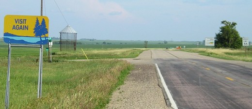
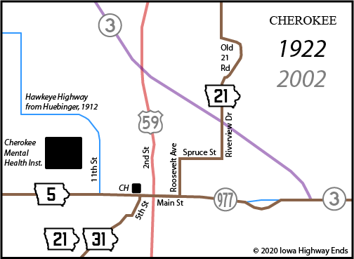
- Cherokee: 5th Street, Main Street, Roosevelt Avenue, Spruce Street, Riverview Drive (see map below)
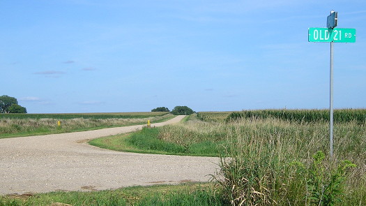
- Cherokee to Primghar: Old 21 Road — possibly the only rural road associated with a number that was extinguished before 1969 if not 1980, 460th Street, Q Avenue, Church Street in Larrabee, C16, R Avenue/Tyler Avenue, US 59
- Going through downtown Calumet would've required two more railroad crossings, and the city limits technically touched present 59.
- Primghar: 1st Street N or S, then McCormack Avenue (estimated) (until June 23, 1924)
- Or some other combination that took the road past the O'Brien County Courthouse and possibly also the school two blocks north. While McCormack is the street that continues out of town, Primghar's east/west street divide is on Green Avenue.
- Primghar to state line: 380th Street, Roosevelt Avenue, US 59
- Related routes:
- IA 110 (I), a spur to Larrabee that was among the first routes created after the realignment of another (21 was moved to Old 21 Road, 455th Street, and R Avenue)
- IA 150 (II), a road that only ever existed in Highway Commission documents, as by the time a road was signed between Ida Grove and Denison it was tagged as an extension of 21
- IA 388, created after 21 became US 59, and the town of Calumet cheated its city limits to get a spur highway
NORTH End: US 59 at Minnesota state line, Osceola County IA/Nobles County MN
Facing south on 21 (6/25/06)
The only difference between IA 21 in 1920 and US 59 in 2020 north of Sanborn is a squared-off corner at the state line with Roosevelt Avenue and 100th Street (going left here), but the original road turned north at the same spot. You can even see the scar of a curve on the right-of-way line half a mile north of the border on aerial/satellite view.
Along the route
Here's a 1920 endpoint: IA 110 east. IA 21's route was tweaked to avoid Larrabee and turn three miles with two railroad crossings into one mile and one spur mile with zero railroad crossings. (8/22/19)
SOUTH End (1): 2nd St. at Main St., Ida Grove, Ida County
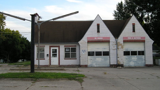
The most logical point for 21 to end inside Ida Grove would have been in the heart of downtown, on 2nd (the east-west street) at Main (north-south). This abandoned gas station at the corner of 2nd and Quimby on the west edge of downtown drops a path clue. (8//22/19)
SOUTH End (2): IA 35, now US 59 at IA 175, Ida County
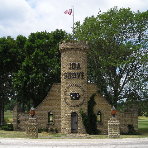
The Great Truncation put 35's end just outside of town, a few hundred feet west of the present 59/175 intersection where this open piece of land is. This photo is not there, but shows the castle theme that is prevalent through Ida Grove. (6/25/06)
Page created 4/22/20