|
April 9-10, 2004 |
 |
I was asked to help moderate a quiz bowl match at the University
of Iowa in April. It gave me a chance to take a little time for
pictures along roads I've been on many times.
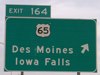
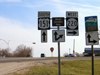
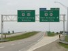
This exit on US 30 has been around since the road was realigned
in 1963, but did not get an exit number until the 2000s, when
another sign for Collins and Zearing was added. And then the
tab was put on the wrong side - it should be on the right, for
a right exit - and remained wrong throughout 2005.
|
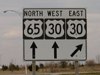 |
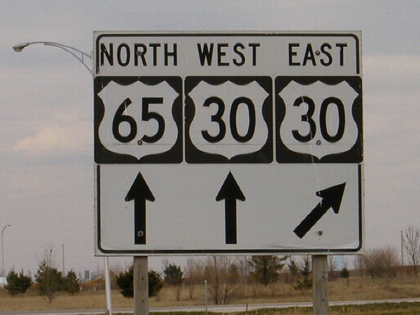
This one-piece sign on northbound 65 actually
has shields for 65 and 30 pasted on. A similar sign on southbound
65 incorporates the shields into the panel. I think the one-panel
thing was tried out in a few places in the 1960s but the standard
three-separate-piece setup won out. |
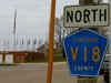 |
Many of the flags displayed in Brooklyn, the
Community of Flags, are near the fire station and what used to
be the south end of IA 398. In 2004, the town tried to sell the
original bridge that carried US 32, later US 6, across the Iowa
River. So yes, the Brooklyn Bridge was for sale. |
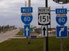 |
This is the first shield heading north on US
151. Half a mile south of this point, the road goes to gravel -
or did until 2005, as the 2006 map and RAGBRAI route now indicate.
I'm not quite sure what's up with the scale here, as either the
numbers are smaller or the interstate shields bigger than usual.
Probably the former since the 151 shield is the same size. |
 |
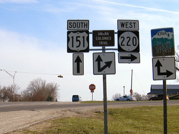
This four-way stop in Amana has been the east
end of IA 220
since 1980. The road used to continue through town
along the main street and then end in East Amana. |
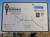 |
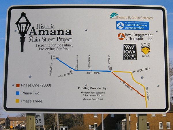
I took a picture of this because I thought it
was interesting that they put up such a sign for a construction
project. The blue line is along 220th Trail, which used to be
IA 220 through Amana. |
|
May 18: North-central Iowa Day
1 |
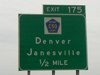 |
When the Denver bypass was built in the early
to mid-1990s, it was the only exit anywhere on US 63 in Iowa.
Apparently this meant that the signs were done by someone who
hadn't seen any recently, because the only way to describe the
BGSs here is "weird". The mileage signs after the interchange
in each direction are equally weird. Southbound, there are two
of them: The first, probably the old one moved from old 63, lists
Waterloo, Hudson, and Oskaloosa; the second subtracts one mile
from Waterloo's mileage and then lists Traer and Ottumwa. |
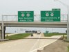 |
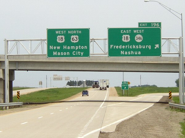
This is a prime example of what signage should
be like in Iowa. Highways are listed with cardinal directions,
the exit tab is attached to the dominant highway despite a lower
number duplexing from this spot, and it isn't Butt-Ugly Kansas-Style
Signage. Unfortunately, the signs along new 63 in 2002 on the New Hampton
bypass, including this one at IA 346,
may be the last good ones put up, as newer signs display the larger
initial letters. |
 |
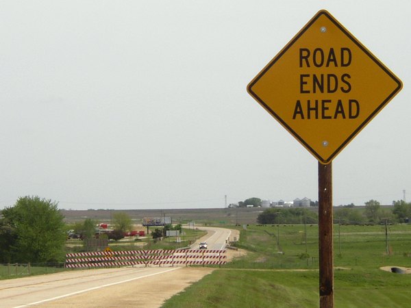
Doesn't this seem like an optical illusion? The
sign says "Road Ends Ahead," and there's a barrier,
yet we can clearly see a road ahead of us. Of course, the position
this photo was taken is on a diagonal piece of 63 left behind
when the New Hampton bypass was built, and now sticks out from
the north-south road built northward from old 63. |
 |
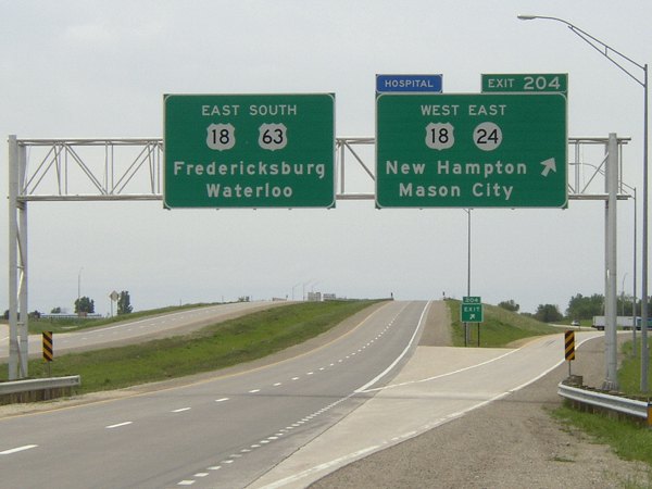
Here's the counterpart to the IA 346 exit picture
above, on the other end of the US 18 duplex and IA
24. I think the DOT
did the right thing here by assigning 63's mile markers to the
exit numbers while using 18's mileage to mark the five-hundredths-mile
poles. |
 |
The four-destination LGS is somewhat rare in
Iowa. Both directions of US 18 have one at IA 150 on the west
side of West Union. Notice the "To 56" in the background;
the original alignment of 56
ended facing north at 18 near downtown while the modern end faces west
at IA 150 on the south side of town. |
 |
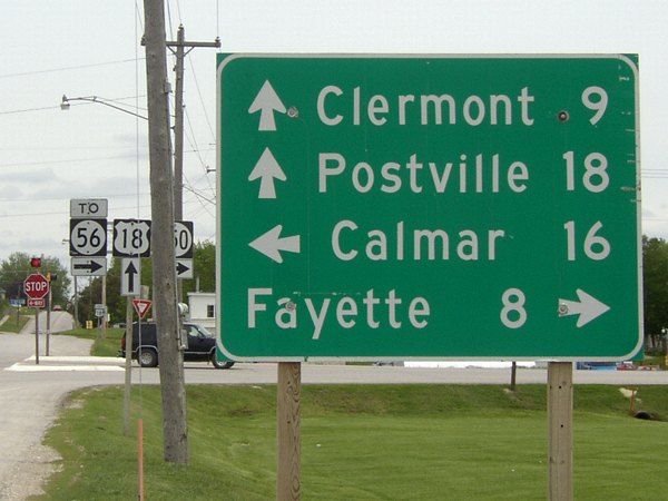
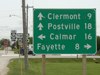
US 18 and 53 stay in Allamakee County just long
enough to get through Postville and serve as IA 51's south end.
US 18 actually enters Clayton County twice, once clipping the
northwest corner after straddling the Fayette/Clayton line and
just before joining US 52, and then re-entering a fraction of
a mile east of this photo's location as the highways leave Postville.
This photo is facing west in Allamakee County, in Postville. |
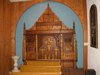 |
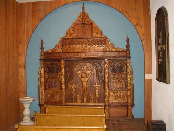
My trip was a combination photo tour and tourist
trip. I stopped at Vesterheim,
the Norwegian museum in Decorah. It had many exhibits, including
this hand-crafted altar by Lars Christenson. Northeast Iowa had
a large contingent of Norwegian immigrants come in the 19th century
- and, as a result, the area has a large contingent of Sven and
Ole jokes today. :-) |
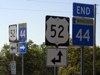 |
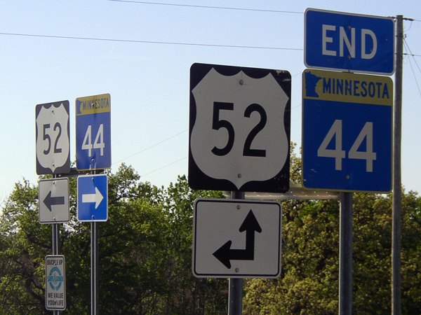
Barely a mile into Minnesota, US 52 meets MN
44. The state highway used to continue west, and joined the northernmost
part of MN 139 before heading west to US 63. The "Welcome
to Minnesota" marker for US 52 is at the southeast corner
of this intersection; this photo is facing west-northwest. |
|
May 19: North-central Iowa Day
2 |
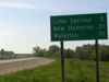 |
Waterloo is the biggest city on US 63 in Iowa,
and the biggest between Rochester and Columbia. This sign serves
as the leaving-town LGS for Chester and the first LGS heading
south in Iowa. We're about 40 miles south of Rochester at this
point, making the halfway point somewhere around County Road
A46 in Howard County. (That means the IA 9 junction is closer
to Rochester than Waterloo, and closer to I-90 than US 20!) This
is also only about 15 miles south of old US 16 but 31 miles north
of US 18. |
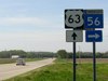 |
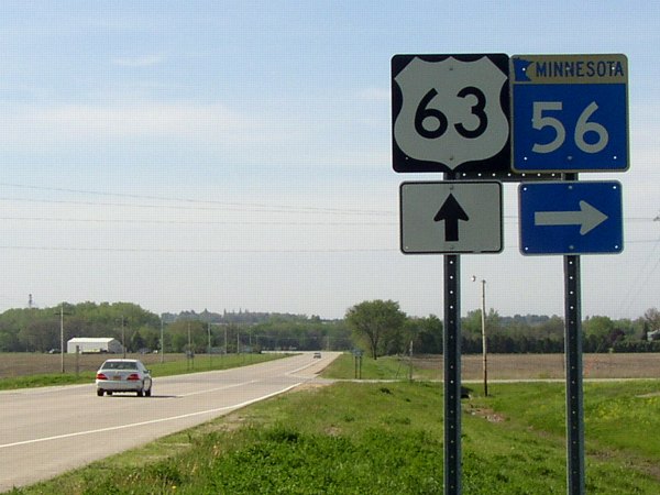
Only half a mile from the state line is 63's
first junction with a Minnesota highway, MN 56. You can see the
curve into Iowa in the background, and Chester's elevator on
the far left. |
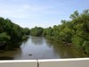 |
The Cedar River starts in Minnesota, and flows
into the Iowa River near Columbus Junction. This is what it looks
like as it crosses the state line. This photo was taken on the
road stradding the state line, looking south. |
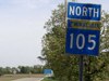 |
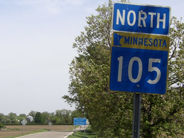
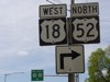
What is the meaning of MN 105's existence? The
question has taxed the minds of prominent Midwestern roads scholars
for some time. It connects to no Iowa route - certainly not old IA
105, an east-west road a few miles south - and parallels US 218
coming south from Austin. |
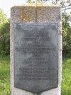 |
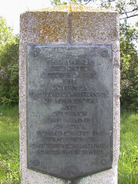
The Jefferson Highway was the Minneapolis-to-New-Orlenas
auto route that later became US 65. The Jefferson met the Lincoln
Highway in Colo, and then went west together to Ames, where they
split and the Jefferson went south to Des Moines. (From US 30
to IA 2, then, the Jefferson originally followed what today is
US 69.) This marker still stands on 65 at the state line to mark
the date that the road was paved or at least blacktopped from
Minneapolis to the Missouri. Since the 65 designation was only
about four years old at the time, referring to it as the Jefferson
would not be out of the question. |
 |
Shields that retain the Minnesota name are posted
at the southernmost Minnesota interchange and only the second
south of Albert Lea. |
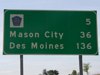 |
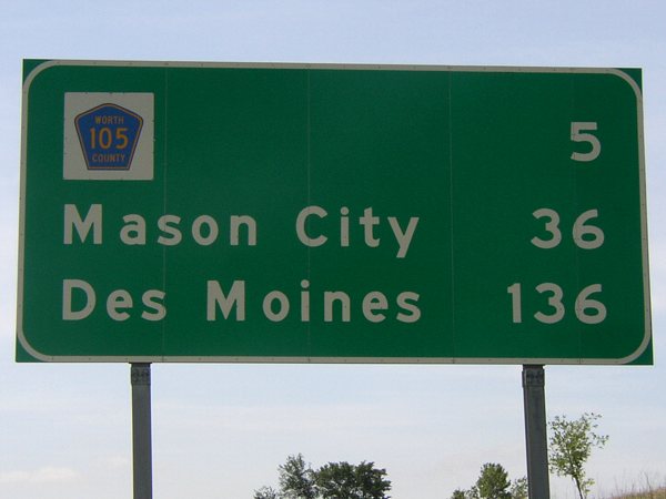
This is the last mileage sign in Minnesota, with a shield for
former IA 105. Based on the mileage on this sign and at former IA 105, the halfway
point between Des Moines and Minneapolis on I-35 (I-35W) is near IA 9. |
 |
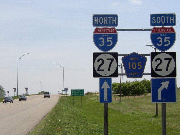
This eastbound setup is a reminder of when IA 105 was here, signed
in the middle. This interchange is now the site of the Top of Iowa Welcome Center
and the Burger King in the Middle of Nowhere. In 2005, as a way to part
Minnesotans from their money increase the county's economic base, Worth
County applied for and got a license for a new casino here. |
 |
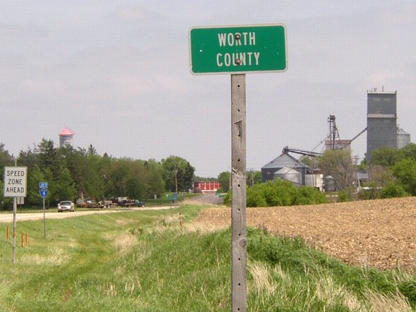
Just before entering Minnesota, US 69 nicks the northwest corner
of Worth County. Ahead is the elevator for Emmons, Minnesota... |
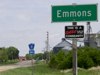 |
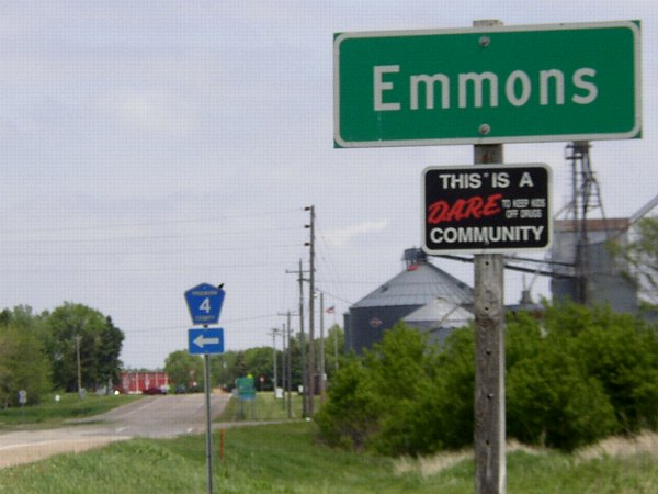
...which, despite being in Minnesota, apparently extends city
limits into Iowa and gets an Iowa DOT sign. The county road running to the left,
whose northbound junction signs are in Iowa, runs on the state line. |
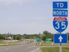 |
The "End" sign that isn't there: US 69 ends abruptly at a county
highway in Albert Lea. This wasn't always the case; the road used to be US 16.
But instead of extending 69 north to I-90, the logical solution, Minnesota just
let 69 end here. Going straight ahead to reach I-35 involves getting onto I-90 first. |
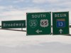 |
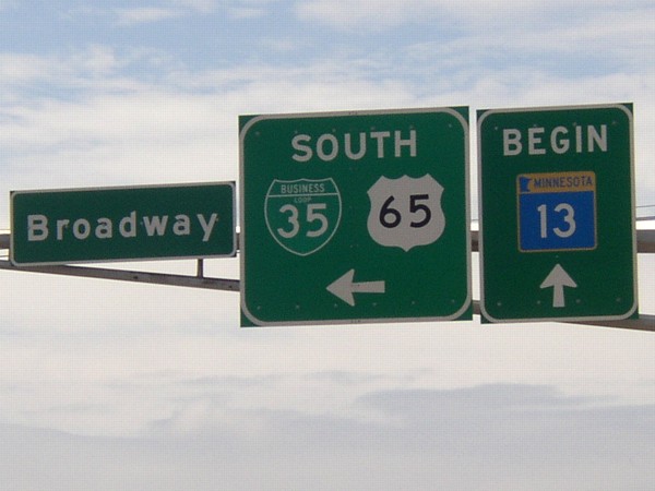
Alternately, Minnesota could have extended 69 eastward to end at US 65.
But that didn't happen either; instead, MN 13 starts here, goes east to US 69, and then
north to I-90. This is facing west, a short distance south of US 65's north end. |
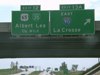 |
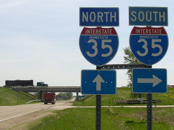
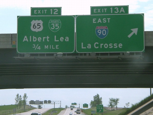
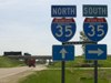
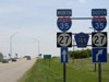
Just south of the I-35/I-90 cloverleaf, whose east-west BGSs are for
La Crosse and Sioux Falls, is the offramp for US 65, a partial interchange. There is no
access from northbound 35 to southbound 65 here, but there is where 65 crosses 35
a bit to the south. |
 |
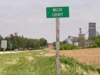
Halfway between Albert Lea and Austin, old US 16 switches from being
on the south side of I-90 to being on the north side. It's now Freeborn County Road 46. |
 |
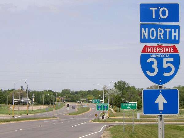
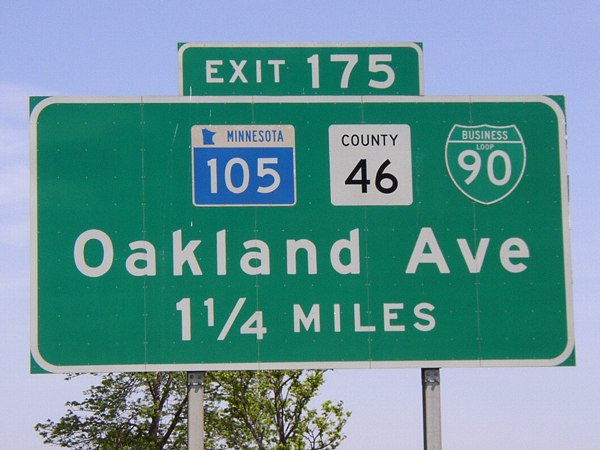
Since the three shields aren't centered, I would guess that the
Business Loop I-90 is a later addition. MN 105 takes part of US 16's route through
Austin but then turns south to serve no purpose whatsoever. |
 |
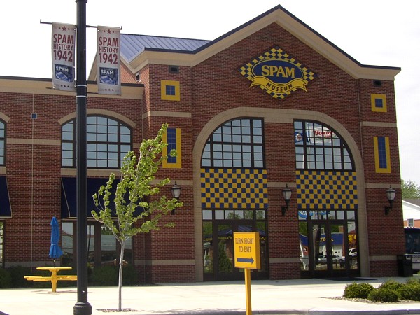
Lovely SPAM, wonderful SPAM...the world-renowned SPAM museum in
Austin MN. Some people go to beaches. I take road trips and stop at museums. |
 |
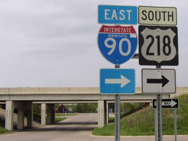
Austin barely beats out Owatonna as the largest Minnesota city on US
218. This is the second of four interstates 218 interacts with, the others being
I-35 (218's north end), I-380, and I-80. |
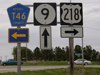 |
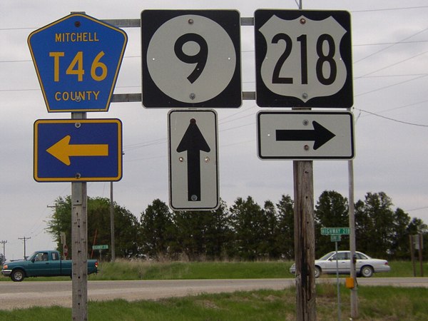
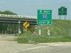
US 218's stairstep alignment in northern Iowa takes another turn
after a duplex with IA 9 in Mitchell County. |
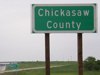 |
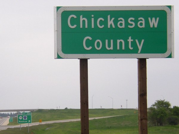
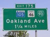
Right about the time that larger county road signs began popping up in random
places in Iowa, the US 218 four-lane and bypass of Nashua opened. Included in
the project, it appears, were larger but mixed-case county signs for 218 on
the Chickasaw/Floyd line and Chickasaw/Bremer lines (218 spends very little
time in Chickasaw County). In the distance is the exit for IA 346, extended
a bit west for the 2nd time in its history but still (barely) contained inside
the county.
|