(July 1, 1920-October 23, 1930)
- In 1920, they knew it as: South of Scranton, the routes were not used as auto trails; in Greene County, overlapping with the Lincoln Highway; from Grand Junction to the Minnesota state line, the Des Moines, Fort Dodge, and Twin City Air Line; duplicated from Harcourt to the Minnesota state line as the Daniel Boone Trail, registered December 22, 1916 (9 counties)
- We know it as: All or parts of N44, IA 148, US 34, IA 25 (although completely different between Greenfield and Guthrie Center), E53, IA 144, IA 175, US 169
- In the 1926 system, the entire route was changed south of Harcourt to what became US 169 in 1930.
- See also: Fort Dodge Highway Chronology
- Let's get granular:
- State line to Corning: N44, State and Main streets in Bedford, IA 148
- There's a half-mile east-west segment on the line.
- A section-line jog at Kirkwood Avenue and 220th Street is near the northeast corner of a surveying offset starting about at Lake of Three Fires and going across the southern half of Taylor, Page, and Fremont counties. From the Iowa Engineering and Land Surveying Examining Board Land Surveying Syllabus and Bibliography (2016): "The west line of Township 68 North, Range 33 West is where the Iowa Base Line offsets one township north/south. This base line was part of James Marsh’s 08/01/1848 contract. Apparently John S. Sheller reran this north/south portion under a 09/06/1851 contract. The section line offsets between Ranges 33 and 34 in Township 68 are about one/half mile, and the north/south dimension of Section 1, Township 68 North, Range 34 West is about one/half mile."
- At the intersection of IA 148 and 200th Street, IA 16 angled northwestward to the vicinity of the corner of 3rd and Jackson streets in Gravity, then back northeast alongside the CB&Q to the straight line. This changed around 1924.
- Corning: Juniper Avenue, Loomis Avenue, 6th Street, IA 148, 4th Street, vacated road forming the west boundary of Happy Hollow Country Club, Kentucky Avenue, Hunter Trail and the extension of abandoned concrete to its east
- Corning to Creston: US 34, with the following stairsteps northeast of Kent: Beechwood Avenue, 220th Street (vacated to west), Clover Avenue, 205th Street
- Creston to Greenfield: IA 25, P27, 150th Street, Eagle Avenue, H24, IA 25; Iowa, 1st, Elm, and 2nd streets in Greenfield
- Greenfield renamed its entire street system sometime after 1930: north-south streets increasing outward from the courthouse, and east-west streets alphabetically from the north side southward.
- Greenfield to Menlo: Monroe Avenue, 200th Street, Pinewood Avenue, P20
- The route moved to run straight north-south on the east side of Greenfield, then use Airport Road and Norfolk Avenue, around 1929. Airport Road now dead-ends at the Iowa Aviation Museum.
- Maybe through Menlo? A route of F65-Sherman Street-335th Street, putting the RRX in town and sending the route through the business district, seems plausible.
- Menlo to Guthrie Center: Ranch Trail, 280th Street, Quail Avenue, 255th Street, Pecan Avenue, 254th Lane (dead end; crossed South Raccoon River), 250th Lane, Noah Avenue, School Street
- From the ghost town of Monteith northwest to Guthrie Center, IA 16 followed a portion of the River to River Road. The R2R, one of the first auto trails in Iowa, was very winding between Adel and Avoca and only parts of it were incorporated into the 1920 system.
- This portion was straightened in 1931.
- Guthrie Center: 7th Street, Ashton Avenue, IA 25, IA 44/Main Street, 1st Street
- Guthrie Center to Grand Junction: F32, Maple Avenue, 215th Road, F32, Kopeck Avenue, 180th Lane, N40, IA 141, Main and Prairie streets in Bayard, IA 25, E53
- The Lincoln Highway overlap through Greene County had a curious bonus: East of Jefferson was Iowa's first wrong-way multiplex. Going east on 6 meant going north on 16 and south on 17. At the time, however, cardinal directions were not signed with the routes.
- The Lincoln Highway through Greene County was IA 16's only concrete before the 1926 system changed the route.
- Grand Junction: Main, 13th, Division, 11th streets, and a vacated connection across the railroad tracks from 1st to the intersection of IA 144 and 215th Street
- Paton area, 1920-22 AND 1925-48: IA 144, E18, T Avenue
- Paton area, 1922-25: IA 144, 150th Street, a vacated road through the middle of Section 29, 140th Street, T Avenue
- This change was requested by the Greene County Board of Supervisors on September 5, 1922 (Jefferson Herald, October 18). It has two more turns but avoids two railroad crossings, one of which was the site of a fatal accident later that very month (Jefferson Bee, September 27). Perhaps surprisingly, this route does not use the now-partially-vacated road going past Paton's wastewater treatment ponds that turns into Main Street.
- The supervisors reversed themselves on May 3, 1925, and the IHC was using the straighter route for plans by July. (Jefferson Bee, June 17) Reasoning for the change of opinion is unknown.
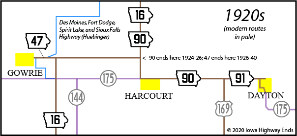
- Webster County: Hayes Avenue, 350th Street, US 169 (see map down page)
- South of Fort Dodge, 1920-22: South River Road, 230th Street, Kansas Avenue, Theater Road and vacated extension, US 169, A Street, Avenue G, C Street, Avenue D, D Street
- South of Fort Dodge, 1922-30: South River Road, Avenue B, K Street
- This route change covers the area from about today's US 20/169 interchange to the Des Moines River.
- Fort Dodge: Avenue C, Bennett Viaduct, 3rd Street, Central Avenue, 12th Street, 2nd Avenue N, 15th Street
- Fort Dodge to Dakota City: P56, C56, Oates Avenue/Ohio Avenue, 260th Street, P56
- The IHC got held up for months at the "Butterworth Corner", now where P56 meets C56, to create a sweeping curve for the route. The curve would stay until the 1970s.
- Dakota City/Humboldt: Main Street/Sumner Avenue, Taft Street, 8th Avenue N
- The straight line on Humboldt's west side, with a bridge over the Des Moines River, came in 1936.
- Humboldt to Algona: US 169
- Just north of B63/130th Street, the route bent around an oxbow of the East Fork Des Moines River; it now cuts through and the cut-off part is algae heaven. Ditto for just north of 160th Street.
- Algona: US 169, State Street, Hall Street, Northpark Drive; OR present US 169, with Jones Street and Park Avenue north of Oak Street
- The 1912 Huebinger map of Kossuth County used 190th Street, Call Park Drive, and Orton Road to come in to Algona from the south to run on Hall Street, and Huebinger's Map and Guide for North Iowa Pike (1912) puts the north-south road on Hall as well, but the state maps don't show this. If IA 16 followed this route, which goes past A.A. Call State Park, it was changed in 1924.
- The Kossuth County Courthouse is at the corner of Hall and State, lending credence to that version, but I just can't tell.
- Algona to state line: US 169 except for:
- 300th Street and 8th Street (with straight northward extension) on the west side of Burt. This would not change until 1964.
- A line running due north from the intersection of US 169 and 360th Street, then 365th Street/Ramsey Street and Portland Street (with straight northward extension) in Bancroft. This was changed with paving in 1928.
- P50, 150th Avenue, Edmunds Street in Ledyard, A30
- Related routes:
- IA 148 south of Corning
- US 34: Overlap from Corning to Creston
- IA 25 north of US 34, but the entire original route between Greenfield and Bayard has changed
- IA 361 (sort of): State connection into Bayard after IA 25 was rerouted/Bayard cheated on its city limits to get a spur route
- US 30, overlap in Greene County on the Lincoln Highway
- IA 144 north of Grand Junction
- IA 397: Spur to Paton created when IA 144 was straightened in 1948
- IA 47 (I): Continuation east of Gowrie when 16 was rerouted in 1926
- IA 413: Segment running north from Fort Dodge when US 169 was relocated, now P56
- IA 320: Spur to Badger, segment running east-west when US 169 was relocated, now C26
- IA 163 (I)/IA 274 (maybe): Spur to A.A. Call State Park, probably not part of original 16, but close
- IA 422: Spur to Burt created when US 169 was rerouted in 1964. It was "decommissioned" but stayed on the map and the part outside of Burt was IA 969 (I) for four years.
- IA 91 (II) — spur to Ledyard created when US 169 was rerouted in 1940
- See also: Fort Dodge Highway Chronology
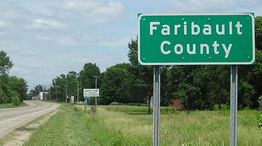
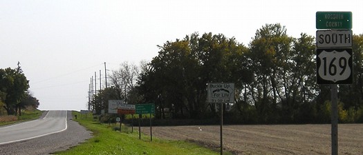
NORTH End: Minnesota state line, now US 169, Elmore MN, Kossuth County IA/Faribault County MN

Facing north on 16 (6/19/15)

Facing south on 16 (6/10/06)
For more pictures, see the US 169 stateline page.
Along the route

SOUTH End: Missouri state line, now N44 at line, Taylor County IA/Nodaway County MO
This is about six miles west of the Iowa-Missouri border marker that marks the beginning of the Sullivan Line and the low point of Iowa's slightly curved southern border.
Page created 5/13/20