(July 1, 1920-October 16, 1926)
- In 1920, they knew it as: Part of the Perry Pike (registered December 22, 1916), but mostly part of the Des Moines and Twin City Short Line (Huebinger); part of the Daniel Boone Trail (registered December 22, 1916) (3 counties)
- We know it as: Part of US 169 (and IA 141 from 169 to Perry)
- Let's get granular:
- Perry to Ogden: Willis Avenue, IA 141, 141st Drive, US 169, P70, E41
- Ogden: 7th, Elm, and 8th streets
- Ogden to present US 20: 210th Street, US 169
- Fort Dodge area, 1920-22: 230th Street, Kansas Avenue, Theater Road and abandoned extension, US 169, A Street, Avenue G, C Street, Avenue D, D Street, Avenue C, Bennett Viaduct, 3rd Street
- Fort Dodge area, 1922-24: South River Road, Avenue B, K Street (or L), Avenue C, Bennett Viaduct, 3rd Street
- See also: Fort Dodge Highway Chronology, 1923 map
NORTH End (1): IA 5, now 3rd St. at Central Ave., Fort Dodge, Webster County
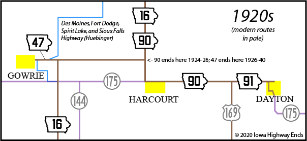
The listed intersection is where IA 16/90 met the Hawkeye Highway. The 90 designation could have been continued with 5/16 on Central to the Webster County Courthouse at 7th Street, until the overlap with 16 was cut to near Harcourt.
NORTH End (2): IA 16, now US 169 at 350th St., Webster County


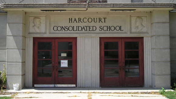
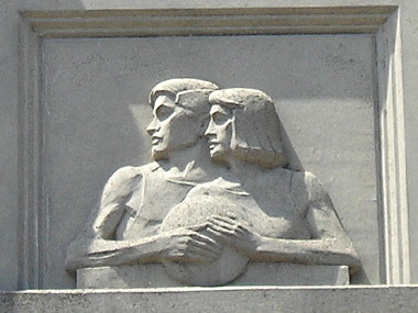
Do I have a photo of the present 169/175 intersection? No. Do I have these two pictures of the 1930s Harcourt gymnasium, featuring a paired detail of Abraham Lincoln and FDR and two basketball players? Yes. (7/26/12)

SOUTH End (2): IA 17, now US 169 at IA 141, Dallas County

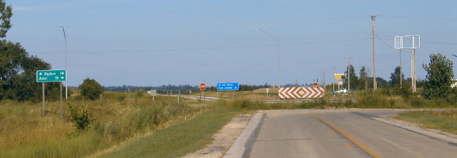
Facing east on old IA 141, but heading south on original IA 17 (8/6/04)
There was a curve in the southwest corner of this intersection behind the camera going to the right, until the early 1960s, for Adel-to-Perry traffic that also followed the original IA 17. The present interchange is just to the north of the intersection, leaving this section. The LGS on the eastbound offramp is at left. A left turn here post-truncation would have put you on 90.
SOUTH End (1): IA 17, now Willis Ave. at IA 144/1st Ave., Perry, Dallas County

Facing west on 90 (8/17/19)
The first end of 90 came over to Perry (because no 1920 non-spur route but one ended at a rural junction), but this wasn't known until it popped up the Great Truncation memo. The intersection of 1st and Willis, where IA 17 turned northward, is in downtown within sight of the Hotel Pattee.
John and Harvey Willis laid out the city in 1869 but Perry "did not grow rapidly until the establishment of the Milwaukee round houses in the city."
As an evidence of the
desirability of Perry as a city of homes, it is claimed by the citizens
that there is not a vacant house in the city. The many schools and
churches, the modern conveniences of all kinds, and the general healthy
nature of the region make Perry essentially a most desirable city in
which to live. ... There are seven churches, five grade schools, a
modern high school, and a commercial and normal school.
— Huebinger's Map and Guide for Des
Moines, Fort Dodge, Spirit Lake, & Sioux Falls Highway (1912)
Page created 4/15/20