
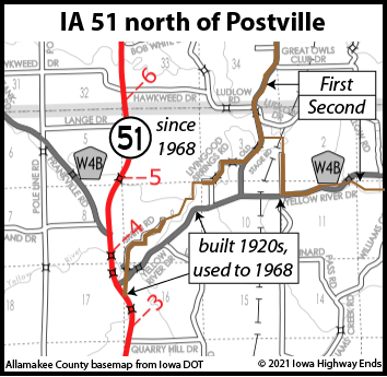
(July 1, 1920-present)
- In 1920, they knew it as: A road from Postville to the Minnesota state line that tried to hit everything in the western half of Allamakee County
- We know it as: Two different bunches of roads in the western half of Allamakee County
- Let's get granular:
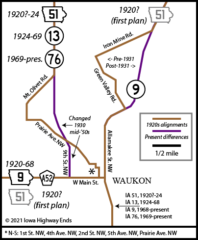
- 1919-20 (as proposed but never signed):
- IA 51 from its present south end to 3 miles north of Postville
- A vacated road near the tree line just east of present 51 north of Quarry Hill Drive, then Smith Road and Livingood Springs Road (they were connected)
- W60, A52 (as IA 9), IA 76 along Main Street in Waukon, IA 9, Green Valley Drive, A44/Iron Mine Drive, IA 9, X20, A26, X6A (gravel, aka Church Road), and IA 76 to the state line
- Including a bridge over the Upper Iowa River, closed but still extant, "technologically significant as one of the last of the pre-ISHC trusses in the state."
- 1920-24:
- IA 51 and the roads in above bullet point #2
- W4B, X16, IA 76, 2nd Street NW and 5th Avenue NW in Waukon, Prairie Avenue NW, Mount Olivet Road, and IA 76 to the state line
- Keep in mind that today's IA 76 north of Waukon is straighter than it was in the 1920s. Isn't the Driftless Area fun?
- 1924-68: IA 51 and old road, W4B (into its current form ca. 1928), and X16
- 1968-present: A nice, quiet, nearly straight line from Postville to IA 9
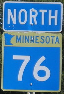
NORTH End (1): Minnesota state line, now IA 76 at line, Allamakee County IA/Houston County MN
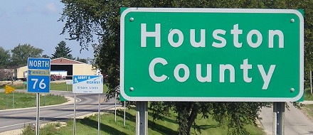
Facing north on 76 (9/2/09)
As you can see, for a route that never got out of one county, its earliest history had some wild gyrations. The 1919 and 1920 state maps show a route different from 1921. On January 30, 1920, the Postville Review was not happy about the southern half of the Allamakee supervisors' recommended relocation of the primary onto the next iteration.
The Highway Commission meeting of July 8, 1920 — mere days before primary route markers were to be painted across the state — radically revised the route of the north-south primary in the county. Because of this, I do not believe the first version was signed. The HC minutes specifically add a primary "to the town of Dorchester", but the road coming down from the border skips Dorchester. This hanging detail was resolved in 1923 with the creation of IA 119 to the unincorporated village.
Along the route
NORTH End (2): IA 13, now X16 at IA 76, Allamakee County
State maps make 51 look like it swerved a lot closer to Rossville, but a 1922 construction plan does not mark a relocation, and the topography of the area does not allow for that line (the Yellow River gets in the way). This connects to the other 1920 mystery in Allamakee County, one I have not resolved: When was the extension of present-day IA 76 from McGregor to Waukon established? It, too, changes between the 1919/20 and 1921 maps.
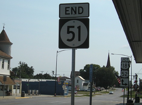
SOUTH End: IA 19/IA 20, now US 18/US 52, Postville, Allamakee County
Facing south on 51 (9/12/17)
Despite all the changes, "End 51" is where it's always been!
Facing north on IA 20, but heading west on IA 19 (9/12/17)
Pictures of IA 51 in its post-1968 form are on its regular Iowa Highway Ends page.
Page created 4/9/20; last updated 2/4/21