
(June 8, 1938-July 1, 2003)
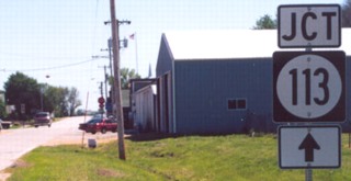
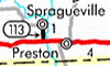
NORTH End: 4-way stop, Main St., Spragueville, Jackson County
Facing north on 113
Photos by Jason Hancock
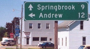
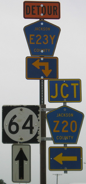
Both towns listed on the LGS are reached only by gravel roads from here. In fact, the road to Springbrook (Z20, also see below) isn't even on the Iowa map, but that became 113's new designation. County Road E23Y - a very rare four-character highway - becomes paved halfway to Andrew at the Maquoketa River has now been paved to Andrew. (See what I mean about pages getting outdated! -Ed.)
Street Atlas and DeLorme seem to indicate that these two streets are the only ones in Spragueville at all. That makes sense when you find out that the 2000 population of Spragueville was 89 - or about 7 and a half people per letter. ;-)
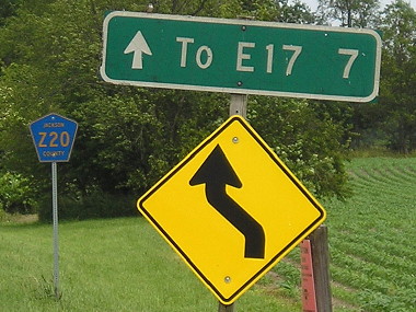
Enlarged version of county road sign
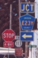
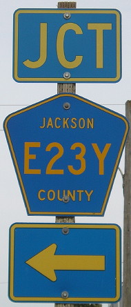
This is a very rare sight in Iowa, the four-character county road shield. I'm not quite sure how these came to be. Diagonals only usually have one numeral in them. E23Y wasn't on the state map until 2001.
Facing south on Z20
Photo by Jason Hancock
Facing north on Z20
Z20 north of Spragueville wasn't on the state map until 2007, although part of it had been paved years before.
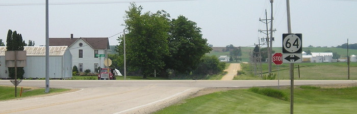
SOUTH End: Stop sign, IA 64, Jackson County
Facing south on 113
Photo by Jason Hancock
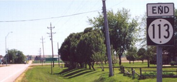
Highway 113 was the easternmost spur in Iowa and the only one replaced with a Z county road.
Facing south on 113

LGS before above picture
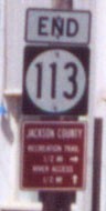
The flash illuminated one of the first retroreflective county mileage signs I've seen, and this was put up at some point after decommissioning. The somewhat unorthodox sign for the detour of E23Y says it goes not only right, but also on the road behind you...
Facing east on 64
...and the sign on IA 64 does the same thing! Although why is the Z20 shield on the right?
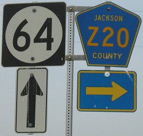
Facing west on 64
Last seen: 2003
Pictures by Jason Hancock: First, second, fourth, and sixth, 5/21/02
Pictures by me: Third and seventh-eleventh, 6/14/11
Page created 7/21/02; last updated 4/4/12