
WEST End: I-35/IA 27 exit 194, Clear Lake, Cerro Gordo County
Facing west on 122 (9/13/14)
Photo by Jason Hancock
The pictures at this interchange have moved to a separate page.
Facing east on 122 (1/1/10)
Photo by Jason Hancock
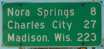
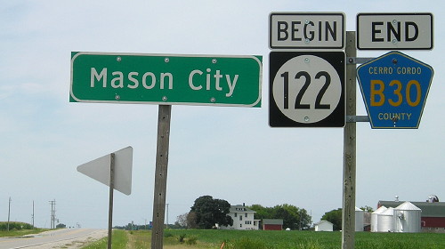
This sign is just east of the Winnebago River, at the edge of Mason City's developed area but still 2½ miles from the city limits and end of 122.
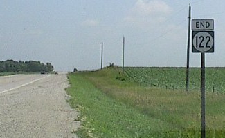
EAST End: City limits of Mason City, Cerro Gordo County
Facing east on 122 (7/2/03 and 7/7/11)
Left photo by Chris Geelhart
Highway 122 has a unique sort of "hanging end". For most other routes that have/had hanging ends - that is, not ending at another signed route or intersection - they ended at the entrance to the city. Instead, 122 goes through the city and then ends at the limits. This end is 4.5 miles from US 65, and about 2.5 miles from any significant development.
Facing west on 122 (8/4/15)
The commission meeting to turn over the relevant parts of 107 and 122 to Cerro Gordo County was Feb. 18, after the county had accepted the routes on Dec. 30, 2002.
Facing east on 122, 1/2 mile from the east end (7/7/11)
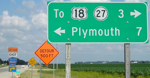
This intersection shows how rural this section of Mason City is. It's also one of the handful of LGSs that have IA 27 on them.
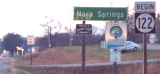
Old EAST End (2001-03): City limits of Nora Springs, Floyd County
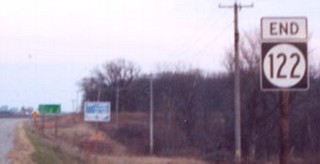
Facing east on 122 (11/17/02 and 8/4/15)
Left photo by Jason Hancock
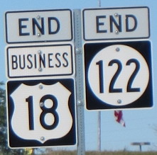
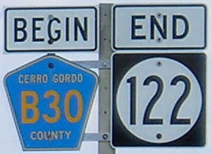
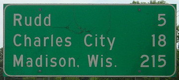
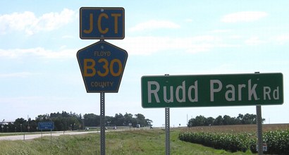
The LGS, obviously, dates back to US 18. Now it's on County Road B30, which is a road that people won't be using to get to Madison.
Facing west on 122 (11/17/02)
Photo by Jason Hancock
Because the west city limits of Nora Springs run right up to the Cerro Gordo line, and the route was only turned over in rural Floyd County, it was logical to just put the east end on the far side. The segment through Nora Springs was turned over on July 1, 2003.
Old EAST End (1999-2001): Stop sign, US 18(/IA 27), Floyd County
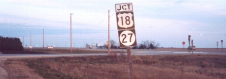
Facing east on 122, now B30 (11/17/02)
Photo by Jason Hancock

Second view of intersection (from right shoulder; pavement is to left of photo, then comes back to center) (8/4/15)
While the 122 designation was given Dec. 6, 1999, the connection to the expressway did not open until summer 2000. (The area had to be reconfigured as 18 deviated from its pre-expressway alignment.) Just off the left side of the picture is the hard right to the road behind the signs.
Highway 122 intersected IA 27 here for less than three months. Jason Hancock reports that in September 2001, as 27 was being signed, 122 was still up, but by the end of the year this portion had become B30.
Facing west on 18/27 (11/17/02)
Photo by Jason Hancock
Compare to the photo below. This was the fourth example on this site where signs have been (re)moved since the pictures were taken (and in the near-decade since, many more have followed).
Facing west on 18 (9/2/00)
Photo by Jason Hancock
Highway 122 used to continue US 18's old route through Nora Springs and Rudd, merging back with 18 near Rudd. This photograph became the first on this site of an end that changed in the 2000s.
Facing east on 18 (7/31/05)
These big street signs now appear before intersections on the expressway part of 18 to increase visibility.
Page last updated 2/24/19