
(September 2, 1924-April 6, 1981)
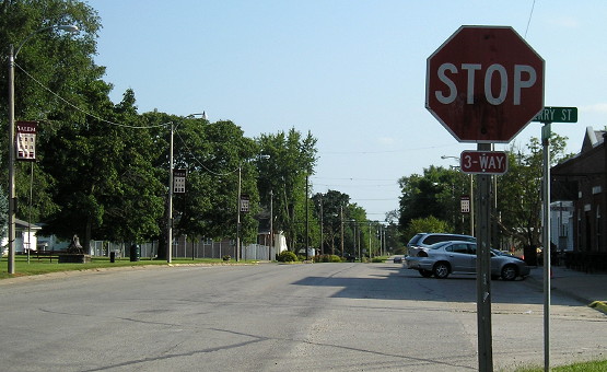
WEST End: Cherry St., Salem, Henry County
Facing northwest, but heading west on 125 (8/12/09)
Without additional records, we believed that the original west end of IA 125 was a four-way stop on the south side of town, where today's J20 intersects W55. It turns out that was wrong, and it went downtown. Additional backing can be found in that the Cherry intersection is a three-way stop, with northbound traffic (on 125) not having a stop sign.
Facing south, but heading east, on 125 (8/12/09)
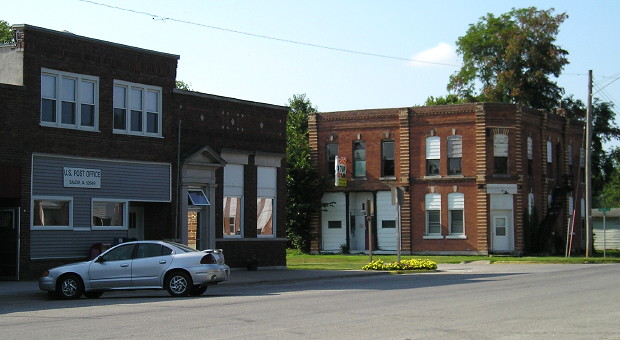
There's a park in the center of town on 125's first block.
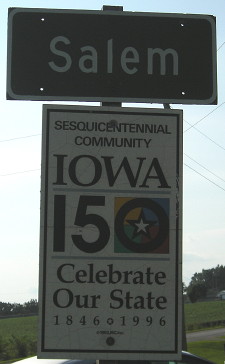
WEST End (August 26, 1980-April 6, 1981): City limits of Salem, Henry County
Facing west on 125 (note: oversaturated for visibility) (8/12/09)
When Jason Hancock visited Salem in 2002, he noted in his caption, "The only other leftover DOT-standard sign on the road is a faded 'Salem' city limit sign." As it turns out, that leftover DOT sign is important because it shows where the city took over seven-tenths of a mile of road a year before the state turned the rest of the road over.
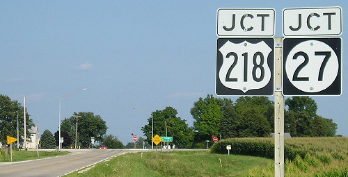
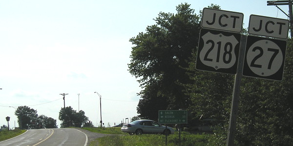
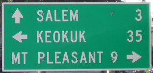
EAST End: Stop sign, US 218 (now US 218/IA 27) and J20, Henry County
Facing east on 125 (8/12/09)
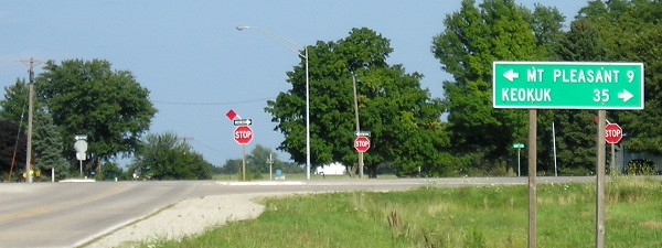
Facing east on 125 (8/12/09)
Obviously, when 125 was here, 27 was not. The LGS is Henry County's.
Facing south on 218 (6/22/02)
Photo by Jason Hancock
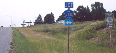
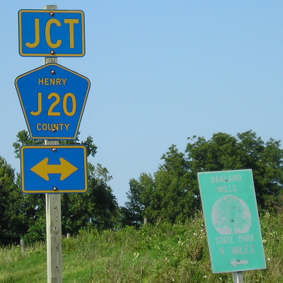
The Phillips 66 is after the intersection. I'm holding on to this picture to show what a beating the Oakland Mills park sign took in seven years:
Facing south on 218 (8/12/09)
Facing south on 218 (8/12/09)
Facing west on J20 (note: oversaturated for visibility) (8/12/09)
Facing west on J20 (8/12/09)
Last seen: 1981
Page created 1/17/03; last updated 1/10/04 5/28/18