
| IA 13 endpoint history | |||
| FROM | TO | NORTH | SOUTH |
| 7/1/20 |
7/8/20* | McGregor ferry landing |
Missouri state line (US 63 at line) |
| 7/8/20* | 12/8/24 | Waukon | |
| 12/8/24 | 10/16/26 | Minnesota state line (IA 76) | US 161 (10th St at 7th Ave, Marion) |
| 10/16/26 | 1961 | US 161, later US 151 | |
| 1961 | 1/1/69 | Mount Vernon Road east of C.R. | |
| 1/1/69 | Present | US 52 | US 30 |
| *Note: IA 13 was extended northward at the first Highway Commission meeting after the primary system took effect. Because poles were not marked until mid-July, it's likely the route was signed through southern Allamakee County at the beginning. | |||
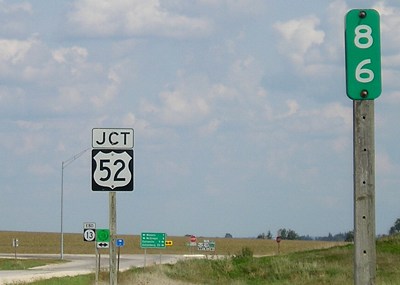
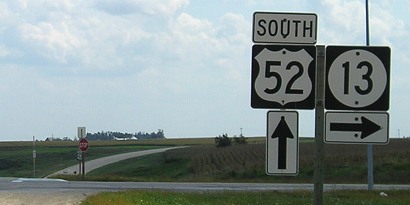
NORTH End: Stop sign/T intersection, US 52, Clayton County
Facing northeast, but heading north, on 13 (9/7/06)
Facing northeast, but heading north, on 13 (9/7/06)
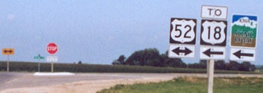
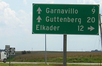
Highway 52 intersects US 18 one mile north of here, where it joins 18 to head to Postville.
Facing northeast, but heading north, on 13 (9/7/06)
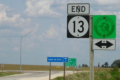
Last signs on 13 (7/28/02)
Photo by Jason Hancock
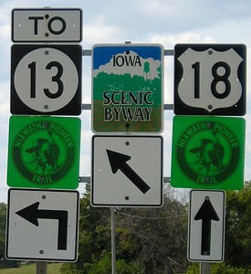
The signage directing travelers to 18 is reciprocated on 18 itself (see below).
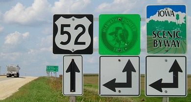
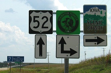
Facing north on 52 (9/7/06)
Facing north on 52 (7/28/02)
Photo by Jason Hancock
The mention of McGregor, since it is not on 52, may be related to 13's pre-1969 route. Old maps indicate 13 went with 52 halfway to US 18 and then turned northeast, forming a triangle with 18 the top side, 52 the left, and 13 the hypotenuse.
Facing north on 52 (9/7/06)
Facing south on 52 (9/7/06)
Facing south on 52 (9/7/06)
Facing south on 52 (9/7/06)
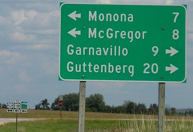
Surrounding area information: East junction US 18-US 52
Facing west on 18 (9/7/06)
Despite the difference in arrow directions, the Pioneer Trail/route to 13 and Iowa Scenic Byway follow the same road.
Facing west on 18 (7/28/02)
Photo by Jason Hancock
From 1924 to 1969, 13 went all the way to Minnesota, following what in 1926 would become US 18 to McGregor and then angling back northwest to Waukon and then into Minnesota. As part of the Great Renumbering of 1969, the standalone route north of McGregor was designated IA 76 and 13 was truncated to its intersection with US 52. This may be why signs for US 18 and IA 13 are at the other's junctions with 52; previously, one route connected Elkader with McGregor.
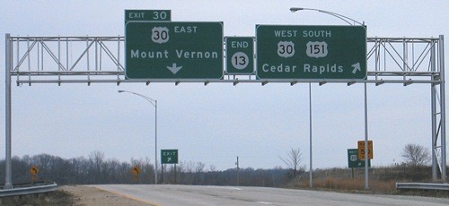
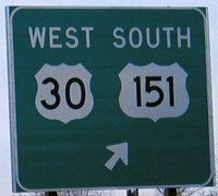
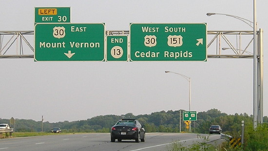
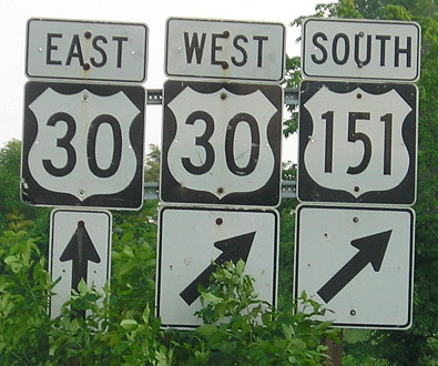
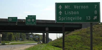
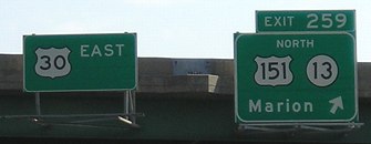
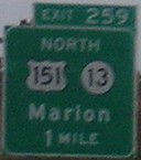
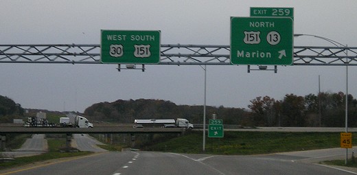
SOUTH End: Interchange, US 30, Linn County
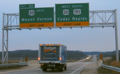
Facing south on 13 (11/28/03)
Jason says the signs only date back from the completion of the last four-lane segment of US 151/IA 13 in mid-2000.
Facing south on 13 (11/28/03)
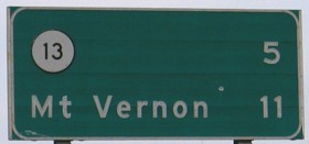
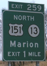
The exit number is that for US 151, but there's a slight problem that only gets worse as you head north. When US 151 was extended south to I-80 in 1985, all the mile markers along the route (I assume) were reset accordingly. However, when 151 was rerouted along 13 and 30 around Marion and Cedar Rapids in 1989, they were not.
The distance between US 30 on the southwest corner of Cedar Rapids and IA 13 northeast of Marion is about 13 miles through the cities, but 19 going around. This exit number is based on going from the pre-1989 numbers at IA 13 and working southward. If you drive 11 miles west with 30, where 151 splits and heads south, the first mile marker you see will be 24 or 25, meaning you only 'traveled' 6 miles on 151. So, since 1989, every mile marker on 151 north of the intersection southwest of C.R. is off about five miles, and with the expressway and bypasses between here and Dubuque it most likely will increase by some amount as you head north.
Sign at lower right corner of above picture (under right sign on gantry) (11/28/03)
Facing south on 13 (6/8/15)
Facing south on 13 (6/8/15)
These regular shields are hiding out near the gantry above.
Facing east on 30 (11/28/03)
Facing east on 30 (9/7/06)
The LGS is dated May 1990, and is interesting because it exists at all. LGSs in the style of regular highways at interchanges are usually only at really old ones - US 65/US 30, for example. Since the interchange has been around since 1981, this may explain the signage, although the information should probably be put on the BGSs at the next replacement.
Facing east on 30 (9/7/06)
The "North" seems in a smaller font that usual (compare to the "East"). The onramp curves around at this trumpet interchange.
Facing west on 30 (10/26/08)
Page created 2/3/02; last updated 10/4/23