
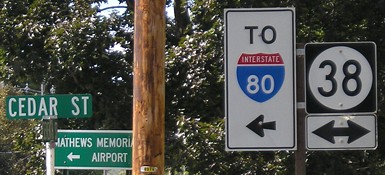
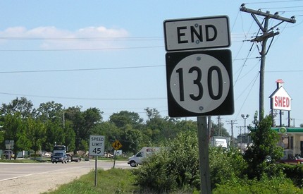
WEST End: Stop sign, IA 38/Cedar St., Tipton, Cedar County
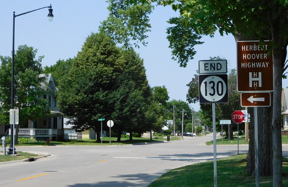
Facing west on 130 (6/13/16)
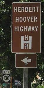
The "End" sign was moved closer to the intersection, and HHH signs replaced with Clearview, compared with the pictures below.
Facing west on 130 (8/31/07)
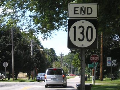
Facing west on 130 (8/31/07)
Facing west on 130 (8/31/07)
Jason Hancock says this intersection has no LGSs, a rare terminus event only seen in a handful of places. Between 1941 and 1969, 130 was the last remaining segment of an IA 150 that went from Davenport through Cedar Rapids and then northwest to meet and become today's IA 150 (which explains why some atlases still treat 130 and IA 38 north of here with greater importance).
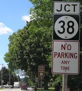
Facing north on 38 (8/31/07)
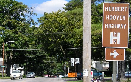
The Herbert Hoover Highway is, in the words of a plaque a few blocks south of here, "a 42-mile series of local, state and county roads that run between the foot of Old Capitol in Iowa City and the Cedar County community of Lowden. The Hoover Highway was designated in 1923 by the Iowa Highway Commission as a tribute to the famine relief efforts of Herbert Hoover." Thus, the highway precedes Hoover's time as president. At the time it was created, most of the route (except for the segment along present-day Y14) was part of IA 74, a secondary Iowa City-to-Davenport route that passed through Tipton.
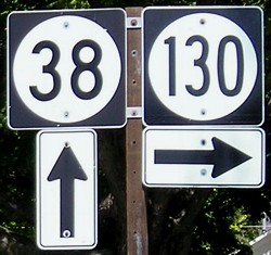
Facing north on 38 (8/31/07)
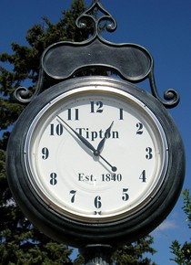
Decorative clock a few blocks south of the intersection (8/31/07)
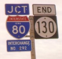
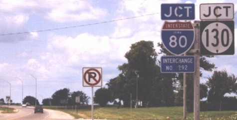
EAST End: I-80 exit 292, Davenport, Scott County
Facing southeast, but heading east, on 130 (8/31/07)
The white-and-red sign on the right is for the Machine Shed restaurant.
Facing southeast, but heading east, on 130
Photo by Jason Hancock
Old photo: Sign was moved to current position in December 2001, on the other side of the freeway.
Facing east on 80 (replaced with Clearview) (8/31/07)

Facing east on 80 (7/18/18)
They covered up the square shield on the Clearview sign with a new MUTCD wide shield.
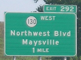
Facing northwest on Northwest Boulevard (natch) (7/25/04)
Photo by Jason Hancock
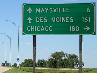
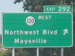
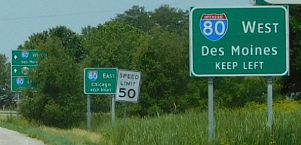
Facing northwest (8/31/07)
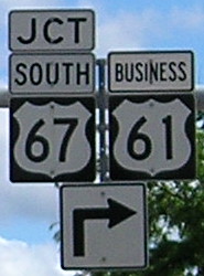
This is was the only state highway with Chicago on a mileage sign. The halfway point between downtown Des Moines and downtown Chicago, as measured in Iowa, is 1½ miles west of the US 67 interchange.
Facing northwest (split view; 80 sign is in median) (8/31/07)
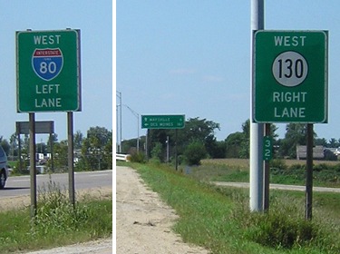
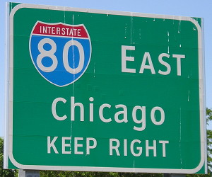
All of these signs are gone, replaced with the Clearview versions below, which have themselves been replaced with versions including US 61.
Facing northwest on Northwest Boulevard (6/13/16)
Closeup of signs in background (6/13/16)
![]()
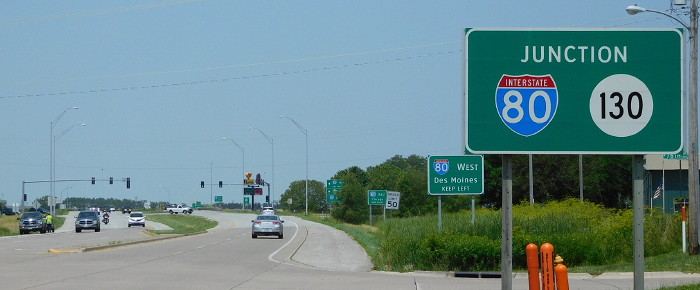
Facing northwest (5/22/12)
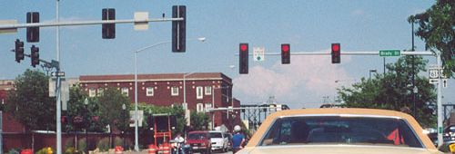
Old EAST End (May 1-December 3, 1984): Stoplight, US 61/Harrison St. (now Business US 61), Davenport, Scott County
Facing south, but heading east, on 130 (6/15/02)
Photo by Jason Hancock
Jason writes, "In 1984 the one-way street pair [of Harrison and Brady] was extended from Lombard Street to a point north of 53rd Street. The IA 130/US 61 multiplex was eliminated and IA 130 ended at the intersection of Harrison Street and the newly-built Welcome Way, which carries southbound US 61 up to this point. This was short-lived, as in 1985, IA 130 was pulled back to its current east end at I-80." Jason doesn't remember any "End" signs at this intersection, which is just south of Kimberly Road (US 6) and north of 35th Street.
Facing south on 61 (6/15/02)
Photo by Jason Hancock
Jason says "The street sign on the pole reads '^ Harrison Street ->.'" meaning Harrison is both to the right and ahead. "Lujack's - the auto mall in the background of these photos - has expanded rapidly during the past 15 years; many of those buildings weren't around when IA 130 was. And despite the exit gore sign, there are no advance BGSs before it." (It's just a little ramp anyway.)
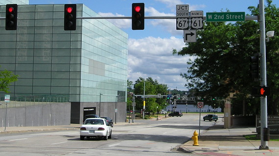
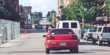
Old EAST End (January 1, 1969-May 1, 1984): Stoplight, US 61/67/River Dr., Davenport, Scott County
Facing south on Harrison / Closeup (6/1/13)
Facing south, but heading east, on 130/61 (6/15/02)
Photo by Jason Hancock
This is on Harrison Street, looking south at River Drive (US 61/67). Highways 130 and 61 met at Lombard Street and went south on Harrison to meet 67. It wasn't a redundant multiplex at first - 130 was a two-way on Harrison, 61 a two-way on Brady - but it became so in 1973. Four blocks to the right, 67 crosses the Centennial Bridge into Illinois.
Facing east, but heading north, on 61/67 (10/13/06)
The warning at right is for the Brady Street companion to Harrison's (in)famous "truck-eating bridge" with 11-foot-8-inch clearance. (The bridge carries the railroad.) Between 1969 and 1973, a left turn would have started you on IA 130 (and IA 150 before 1969).
Facing east on 61/67 (6/15/02)
Photo by Jason Hancock
This is on River Drive at Brady Street, two blocks east of Harrison. While 130's end was at Harrison, its beginning was here, where NB 61 splits from 67. During the Flood of 1993 a picture of this intersection would have had to be taken in a boat.
Facing north on 61, but heading west on 130 (6/15/02)
Photo by Jason Hancock
Prior to 1984, 130 and 61 went north on Brady for 19 blocks before 130 split away at Lombard, just north of St. Ambrose University.
Page created 12/3/01; last updated 1/14/19