
(January 20, 1931-July 1, 2003)
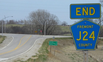
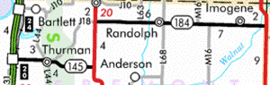
WEST End: I-29 exit 20, Fremont County
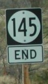
Facing west on 145 (4/19/17)
Facing west on 145 (4/20/02)
Photo by Neil Bratney
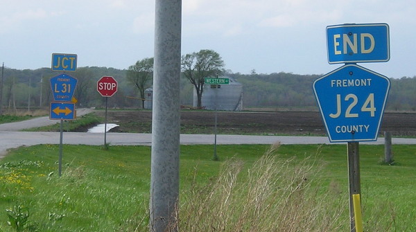
In the four hundred feet west (ahead) of the spot this picture was taken, 145 end(ed), L31 intersects, and the road goes (went) from state highway to dirt. The yellow sign in the far background is one of those "Class B Minimum Maintenance Road - Enter At Your Own Risk" signs. The official end of 145 was the west ramps (SB on/off) for I-29.
Facing west on 145 (4/19/17)
L31 is an interesting county road. Between IA 2 and the Pottawattamie/Mills line, it weaves in and out with I-29 (heading north), crossing it:
- Just south of the J34 intersection south of Percival;
- With J26 at exit 15 (Percival), going from just east of the highway to just west of it;
- 1.65 miles north of this photograph;
- With J10 at exit 24 (Bartlett), going from just east to just west again (J10 only goes east from here);
- Doesn't cross, but comes within 250 feet of I-29 (according to Street Atlas) 1.6 miles north of the Mills/Fremont line - in fact, the Mills PDF map places L31 practically on top of the interstate;
- At the south US 34 interchange (with 978 near Pacific Junction), going from just west to just east, then through Pacific Junction, and stays east of the interstate until it ends east of the IA 370 exit.
- Reader Dan Drackley tells me that IA 370 is only the end of L31 as it's marked on the Iowa map; it actually continues to the north, paralleling I-29 on the east side and then going half a mile east of I-29 on a gravel segment that ends on an old section of South Omaha Bridge Road left behind when the I-29/IA 92 interchange was built; today, Council Bluffs Lewis Central High School is on that road.
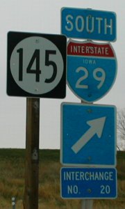
Facing east (4/20/02)
Photo by Neil Bratney
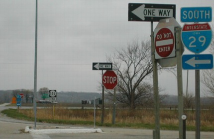
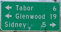
Something to ponder: Who is this sign for? The only way to get here is by coming from the dirt road or L31, which crosses just behind you. How many L31 travelers head to Kansas City? (Well, there are those who live along the road, of course...) The first 145 sign is across from the "End" sign in the top picture.
Facing east on 145, the sign in the above picture (4/20/02)
Photo by Neil Bratney
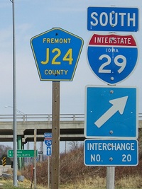
Usually, the bottom sign ("Interchange No.") is with the "Jct" sign, but there wasn't room for one between L31 and the intersection. Neil says, however, that this is not an exception: it's actually the norm for all five interchanges in Fremont County.
Facing east, 2009 equivalents of Neil's photos (4/15/09)
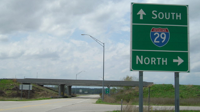
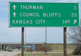
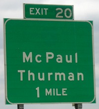
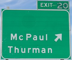
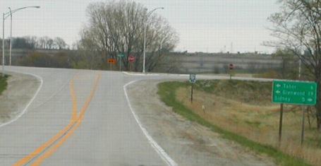
Facing south on 29 (4/20/02)
Photo by Neil Bratney
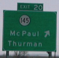
This BGS is the only one in Iowa that lists a town that's not on the Iowa map! Other BGSs list unincorporated places (Honey Creek and Plain View, for example), but McPaul isn't even on the map. Also note the centered exit tab and the lack of an "East" tag. The latter, it would appear, is the norm for I-29. Those wacky western Iowans. ;-)
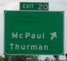
Facing south on 29, post-decommissioning (6/12/06)
The exit tabs, centered as they usually are in southwest Iowa, look older than the BGSs themselves and also don't look like "20" was the original number placed on them - or on the northbound signs, below.
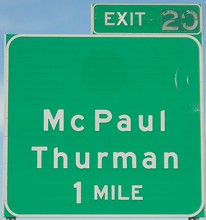
Facing north on 29, post-decommissioning (4/6/08)
Old WEST End: Main St., Thurman, Fremont County
Facing west on 145 (4/19/17)
This is a block before the spur end of 145, at the intersection with L44, but it's the only intersection nearby with signs. Perhaps counterintuitively, Main is the cross street instead of the one carrying 145 through most of town.
Facing west on 145 (4/19/17)
You can see the pavement change where the different jurisdiction eras were. The state didn't take over the segment from Thurman to I-29 until 1980.
Facing east on 145 (4/19/17)
Thurman got something in 2017 that very few Iowa towns do nowadays: A replacement post office. The post office building at the intersection of Main and Filmore was closed for safety concerns; a new post office is planned for the west side.
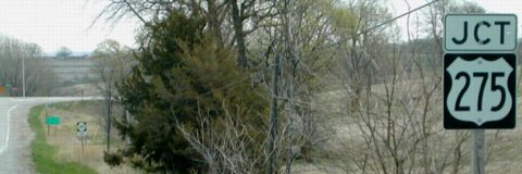
EAST End: Stop sign/T intersection, US 275, Fremont County
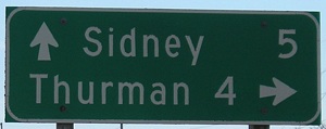
Facing east on 145, leaving Thurman (4/15/09)
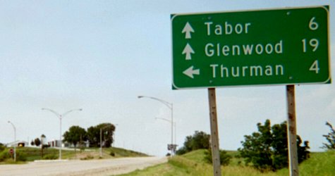
Facing east on 145 (4/20/02)
Photo by Neil Bratney
Facing east on 145 (4/20/02)
Photos by Neil Bratney
Facing east on 145 (4/15/09)
LGS in above pictures (4/15/09)
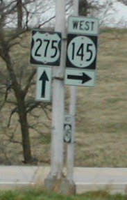
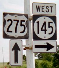
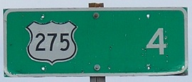
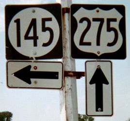
Facing south on 275 / Closeup / Southbound LGS (4/20/02 and 6/16/03 and 4/15/09)
Left photo by Neil Bratney
The first sign heading west can be seen in the left picture.
Facing north on 275 (6/16/03)
Facing north on 275 (6/16/03)
Last seen: 2003
Page created 5/22/02; last updated 12/11/17