
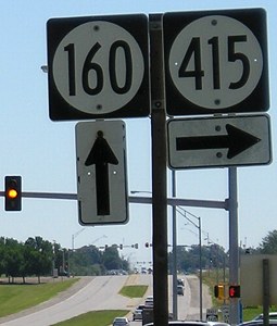
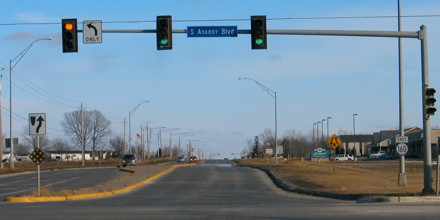
WEST End: Stoplight, IA 415, Ankeny, Polk County
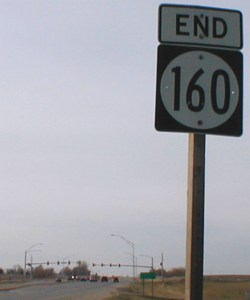
Facing west on 160 (12/21/01 and 12/21/01 and 7/29/09)
As you can see, 160 is just two miles and change. But, as Neil Bratney pointed out, the mileage worked east to west! This Unsolved Mystery of the Iowa highways has since been rectified, and the mile markers placed in their correct positions. Whether this site (or Jason's) had anything to do with it is unknown. But then that sign disappeared, replaced by the Clearview sign at far right.
Facing west on 160 (7/23/08)
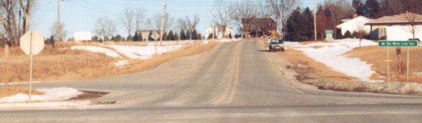
Six and a half years after I originally took pictures at this intersection, my 2001 photos now serve as "before" pictures, as Ankeny continues its rapid development. More photo comparisons follow; check out the southwest corner of the intersection in all of these.
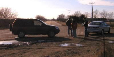
Facing west on 160 (12/21/01)
This area might look like it's in the middle of nowhere (so why's there a light?), surprising due to its prime location. Until 2005, the area north of this intersection was part of the Iowa State University dairy research farm. Iowa State sold the land to Ankeny, which has developed a comprehensive plan for the area, for more than $20 million. The area, which is to be called "Prairie Trail," will have a mix of residential housing styles and retail development. At a projected 1900 housing units, it is the equivalent of building the entire town of Glenwood (1946 housing units, 5358 residents) or Waukon (1909 housing units, 4131 residents) from scratch. Put another way, as its own municipality it would rank in the top 100 in population - but instead, it will be just another part of Ankeny. Seven years later...
Facing west on 160 (7/23/08)
With the completion of new 415 west from Polk City to IA 141, I would renumber 160 and 415 west of this intersection as a new incarnation of IA 46 (two of the three versions of that number have been in the Des Moines area), which would then form a northern beltway (albeit a two-lane one) around the north side of the Des Moines metro area. The north-south portion of IA 415 south of this intersection could be a new IA 87 (another number with a history in Polk County) as part of my plan for a Second Great Renumbering.
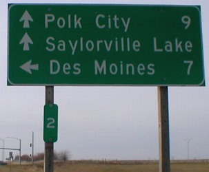
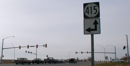
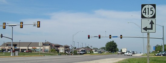
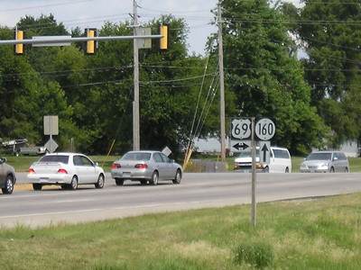
Facing north on 415 (7/23/08)
Compare this LGS to the one on southbound 415 below.

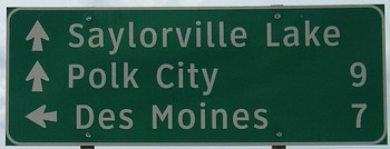
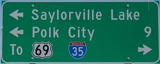
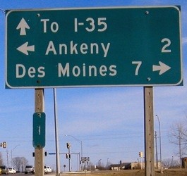
Facing east, but heading south, on 415 (1/18/04)
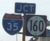
The 69 shield is different, more like an older style, and I-35 is spelled out instead of shown as a shield, which is really weird considering the graphic 69 beside it. In addition, neither LGS shows the mile to 69, nor the two to I-35. This signage is strange, because usually either these two highways would be on different lines on the LGS or posted as regular shields at the intersection. Four and a half years later, notice not only the commercial development on this side of the intersection but also landscaping on the other side.
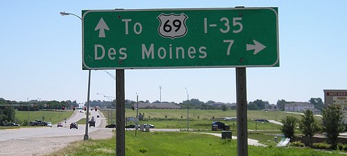
Facing east, but heading south, on 415 (7/23/08)
Facing east, but heading south, on 415 (7/23/08)
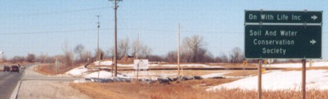
Facing east on 160 (first sign) (12/21/01)
Old WEST End: Y intersection, IA 415, Ankeny, Polk County
Highway 160 started off 1980 as a diagonal connector between IA 415 and US 69. By the end of the year, it had been extended straight east to I-35. In 1986, 160 and 415 were rebuilt to meet at the normal intersection shown above.
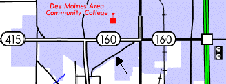
The arrow is pointing to what was 160. That diagonal was all of the pre-1980 route. The north end is now blocked off (see below) and the south reconstructed to stop at an east-west road instead of 415. On the other side, 415 had a corresponding diagonal as evidenced in the city limits border. The layout of the map suggests that before this reconstruction, 415 went north on the road west of the DMACC text and then angled northwest to meet its current alignment again.
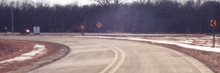
Facing southwest, but heading west, on 160 (February 2003)
Photo by Jason Hancock
The original 160 would have continued straight, meeting 415 in a Y.
Facing north on 415 (February 2003)
Photo by Jason Hancock
Near this point, 415 would have angled left out of the picture.
Facing east (February 2003)
Photo by Jason Hancock
Just beside the intersection, the road shown at left curves back to the 160 diagonal. The northernmost part dead-ends. Straight ahead is the unincorporated town of Carney.
Old EAST End: US 69, Ankeny, Polk County
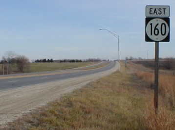
Facing east on 160 (1/18/04)
Notice the new (that is, then-newly placed) MM 1, about .9 mile east of where MM 2 was, and the lack of mileage and graphics on the top line. This view would not have existed when the east end of 160 was at 69 because 160 went southwest from the intersection.
The topographic maps available at ortho.gis.iastate.edu are from the 1950s and revised at some point after 1965, because the interstates are in purple meaning a later revision. Many of the tiny handful of buildings shown in the vicinity of 160's present east end don't exist anymore. (Seriously, nearly the entire state needs new topo maps. These are even older than the 1964-photorevised-1972 variety used for the Waterloo area.)
Facing northeast (1/18/04)
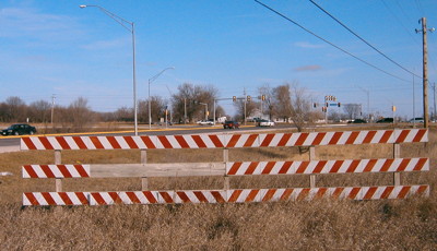
Nearly directly south of the above LGS is this barrier at the end of the old diagonal.
Facing southwest (1/18/04)
This is a view 180 degrees from the above picture. This shot was taken during our January 2004 roadgeek meeting and trip. The pavement ahead of us is a virtual canvas for lane-painting equipment, splotched with white and yellow. This picture shows what not to do in winter: 1) Don't take pictures facing south. 2) Don't take pictures facing west in the afternoon.
Facing northeast, but heading east on 160, as viewed from corner road (7/29/09)
Facing east on 160 (1/18/04)
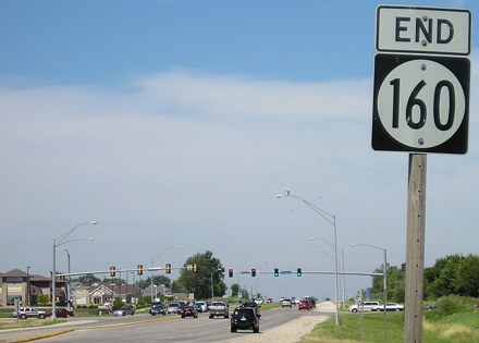
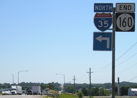
EAST End: I-35 exit 90, Ankeny, Polk County
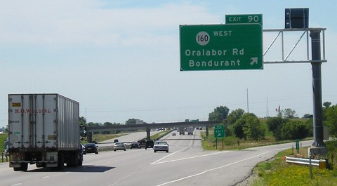
Facing east on 160 (7/19/05)
Facing west on 160 (7/19/05)
Facing west, before interchange / First sign facing west on 160, after interchange (December 2003 and 12/21/01)
Left photo by Jason Hancock
Facing south on 35 (12/21/01 and 7/19/05)
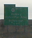
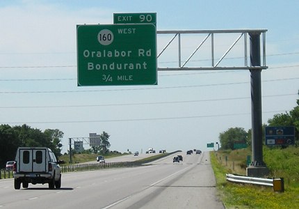
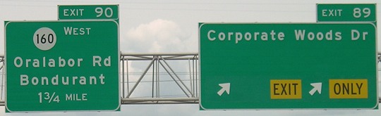
The left sign reads "160 West / Ankeny / Industrial Area / Bondurant / 1/2 mile". There were multiple temporary signs on I-35 during reconstruction. Oralabor was a village that Ankeny has consumed.
Facing south on 35 (7/19/05)
Facing south on 35 (7/19/05)
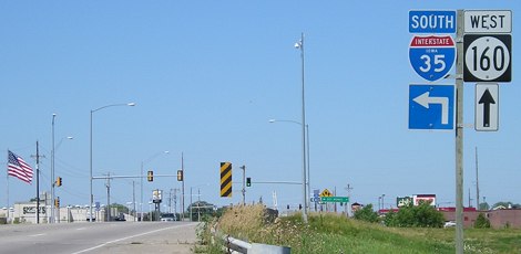
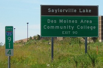
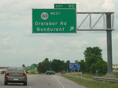
Facing north on 35 (7/29/09)
This is on the "south side" of Ankeny (though recent annexation lines show that the city has appropriated all the land east of I-35 down to the mixmaster). This was the first non-interstate-exit BGS in Iowa to get Butt-Ugly Kansas-Style signage. When the Corporate Woods Drive interchange opened, I figured the space left on the right sign would be used for the new driver's license station when it moved. Turns out they put up a separate sign. So...I got nothing.
Facing north on 35 (7/29/09)
Page created 1/13/02; last updated 5/5/10 1/12/21