
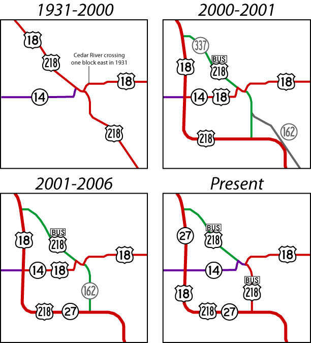
(August 1, 2000-May 1, 2006)
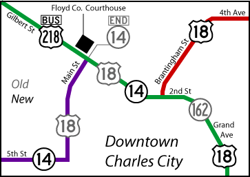
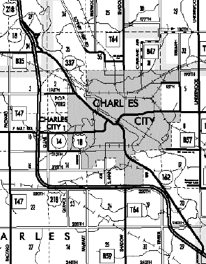
Pictures before 2006 are during the time 162 was an active highway; pictures in 2006 are after US 18 replaced it. For a view of Charles City highways as a whole, see this image. This secret route is one of a tiny handful of state roads in Iowa that were replaced with US routes after the early 1930s, and one of an even tinier handful for which that replacement wasn't part of a route swap.
NORTH End of 162: Stoplight, US 18 E/Brantingham St. and US 18 W/2nd St., Charles City, Floyd County
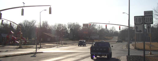
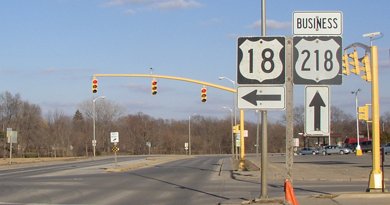
Facing west, but heading north, on 162/Business 218 (3/22/03)
This perspective is now on eastbound US 18, which was rerouted over 162 in the spring of 2006 (signs changed in April, officially taking effect May 1). The "Business 218" marker is likely the same in the above and below pictures.
Facing west, but heading east(!), on 18, same perspective as first picture (8/13/06)
Photo by Jason Hancock
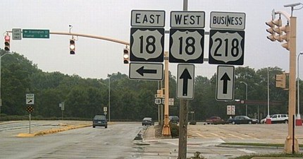
Facing east on 18, but heading south on Business 218 (3/22/03)
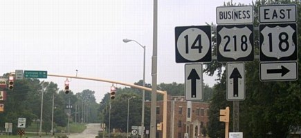
While 18 goes into downtown Charles City on Brantingham Street, to the right is Freeman Street, which runs north-south. Half-hidden behind the stoplight at center is a Business 218 shield with a Hiawatha Pioneer Trail shield still right below it (until 2006, anyway). This view has now become the north end of IA 14, with signs as seen below:
Facing east, but heading north, on 14 (8/13/06)
Photo by Jason Hancock
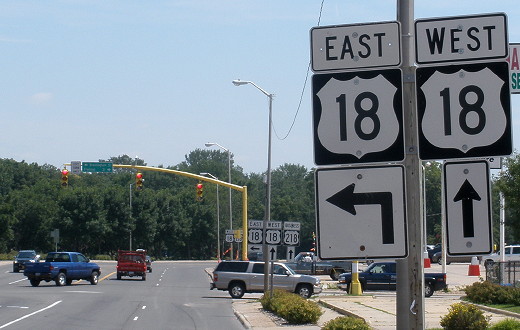
Continuting ahead would have been going south on 162 and Business 218, but is now going west on 18 and south on Business 218. A left turn is to eastbound 18 before and after the change.
Facing east, but heading north, on 14 (7/29/10)
The signs in Jason's picture can be seen in the middle ground. To the right is a used-to-be-Hardee's that became a Chinese buffet that closed in late summer 2019.
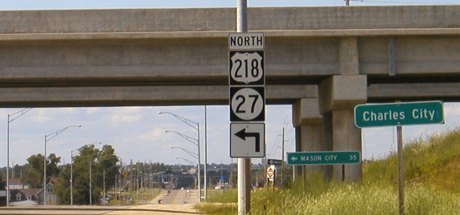
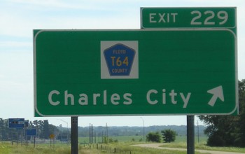
SOUTH End: Interchange, US 218/IA 27 and T64, Charles City, Floyd County
Facing south on Business 218 (6/26/04)
This is before US 18 was rerouted; you can see the 18 shield added below.
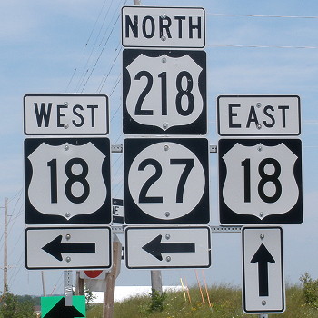
Facing south on Business 218 (8/4/15)
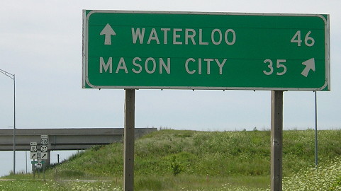
The sign is pointing to Mason City, destination for IA 27 and the four-lane, but not 218, for which Osage would be listed.
Facing south on Business 218 (3/22/03)
Like the north end, there is no signage for the end of the business route. T64 continues south; this was not part of original 218. The original route angled southeast at an intersection north of here.
Facing north on T64 (6/26/04)
Facing north on T64 (6/26/04)
The "Charles City" sign disappeared and the 218/27 shields moved by the time of the photo below.
Facing north on T64 (8/13/06)
Photo by Jason Hancock
Facing north on T64 (7/29/10)
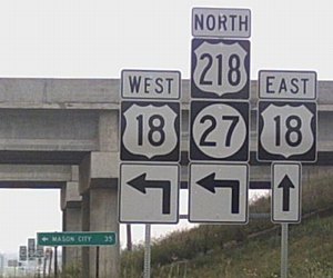
Facing east, but heading south, on 218 (7/31/05)
Facing east, but heading south, on 218 (7/31/05)
Customary of most business routes in Iowa, Business 218 is signed in only one direction. Unfortunately, it's the direction I didn't get pictures for in 2005, before 18 was added to this interchange. See also photos on the Business 218 page.
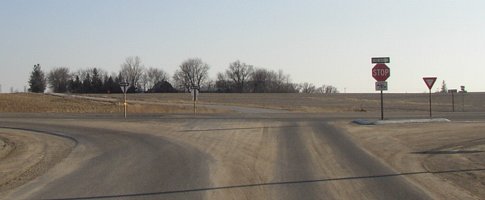
Old SOUTH End: Stop sign, US 218, Floyd County
Facing south on 162 (3/22/03)
The original route for 162 followed the old route for 218, except this intersection has been reconfigured. (The power lines, behind and left of the camera, follow the old route.) A mile and a half northwest of here (see map below), the old and new routes are about 100 yards apart. There is still a sign for Charles City on the diagonal, but the mileage sign has been removed.

Facing north (6/26/04)
Instead of "Old Hwy 218" it's a nondescript "Old Highway Road." The map below shows the original route of 162; now, it goes straight north from the T64 interchange to join the north-south portion of the original route.
Page created 5/4/03; last updated 3/24/20