
The spur that grew up
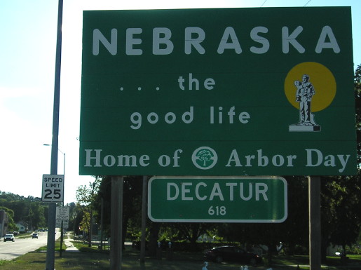
WEST End: Toll bridge, Nebraska state line, Decatur NE (8 miles W of Onawa), Monona County IA/Burt County NE
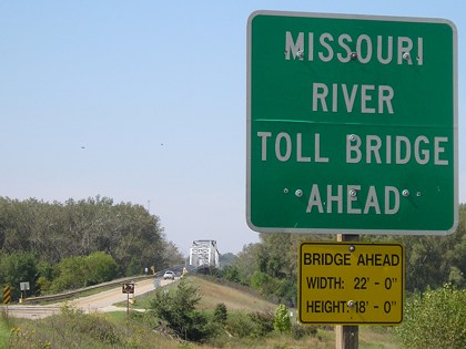
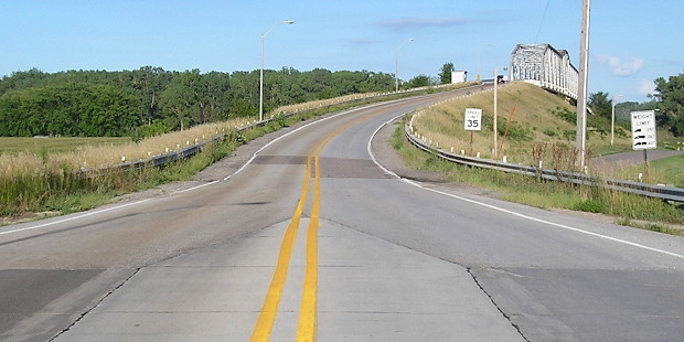
Facing west on 175 (9/17/07)
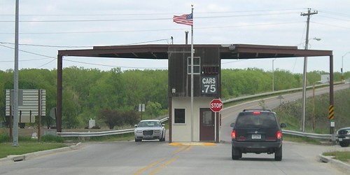
The toll was 50 cents until 1998, then 75 cents until Jan. 1, 2010 to pay for a new iron mesh deck, then $1 until the bridge was transferred to state jurisdiction and the bridge made toll-free Dec. 1, 2013.
Facing west on 175 (5/7/06)
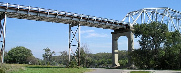
I crossed both this bridge and the US 52/IA 64 bridge in Sabula within a month. Crossing a wide river on a narrow bridge with metal underneath is ... an interesting experience.
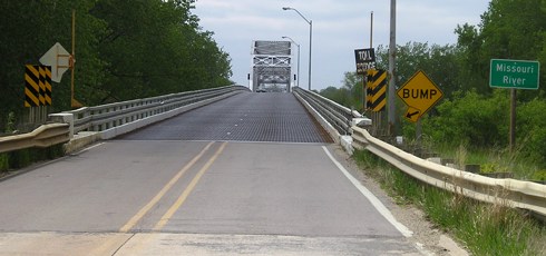
Closeup of bridge deck (2/23/02)
Photo by Neil Bratney
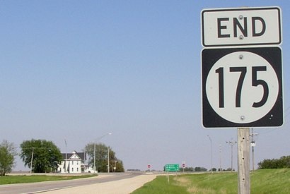
This is as close as you can get to an "End" sign. Neil writes, "Here's the last sign in Iowa, as you climb onto the bridge. No 'End 175.' You can see the iron mesh deck on the bridge." So you could say 175's pavement ends right here.
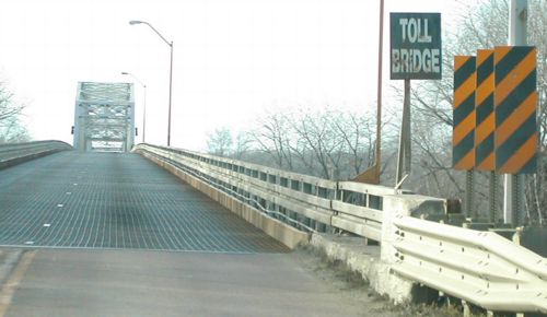
Facing west (5/7/06)
And here it is. Decatur is right on the other side. I suppose it is only fitting that I got a Nebraska quarter as change when I gave a dollar to pay the toll.
Facing west (8/7/16) (brightened for sun reasons)
The next pictures are turning around and coming back into Iowa.
Facing south on 75, in Decatur (5/7/06)
Historically, this would have been US 73; IA 175 met US 75 in Onawa from 1948 to 1984.
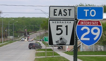
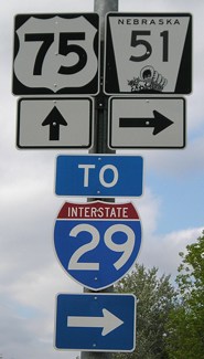
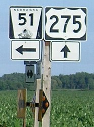
Facing east on 51 (5/7/06)
This is the first and last NE 51 shield between US 75 and the bridge.
Facing east on 51 (5/7/06)
Facing east on 51 (8/7/16)
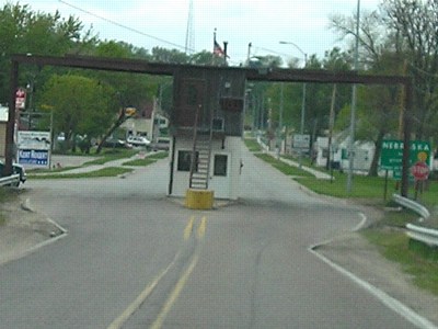
The toll house was demolished in late 2015.

Facing east on 175 (2/23/02)
Photo by Neil Bratney
Welcome to Iowa! Only 221 miles to US 63.
Why, for such a long highway, does it have three digits? Usually, the longer the road, the smaller the number. The answer is very simple: 175 was once your run-of-the-mill spur, 7 miles between Radcliffe and Hubbard. Between 1935 and 1969, 175 was extended west and east, sucking up many other numbers on the way (see below). As the sixth-longest state highway (behind 2, 3, 9, 27, and 92, not in that order), a more suitable designation might be IA 11, a number unused since 1941. As a pipe dream, I'd prefer IA 24, because 175 is exactly where US 24 should be, between 20 and 30.
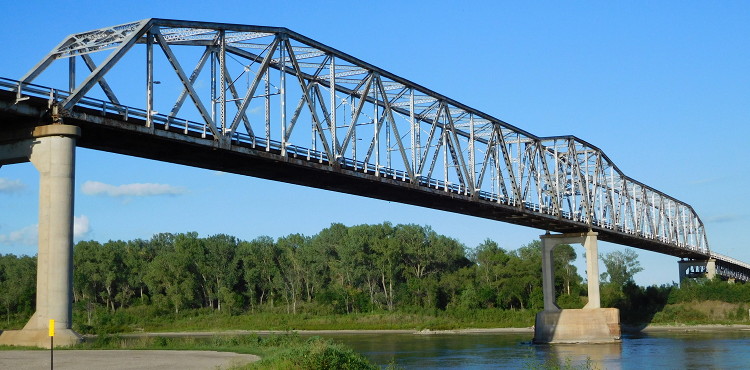
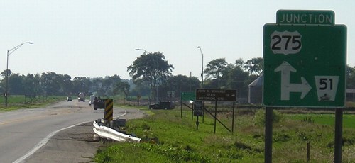
Facing northeast-ish, from the Nebraska side (8/7/16)
While the bridge was being built, the river changed course! According to an Associated Press article that ran in the Oct. 4, 2003 Omaha World-Herald, "The bridge with a 22-foot-wide roadway was completed in 1951, but the corps had no money to carry out its promise of rechanneling the river because federal funds were tied up with the Korean War. So for four years, the bridge wasn't used because it only spanned a stretch of dry land near the river." The river was put back and the bridge finished, and the first car drove across on Dec. 19, 1955. As the only bridge between I-129 and US 30, it is an important link today.
Nebraska side of bridge (9/17/07)
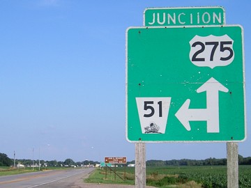
If you keep going west on NE 51, eventually you will end up at another familiar number, US 275:
WEST End of NE 51: Stop sign/T intersection, US 275, near Wisner NE, Cuming County NE
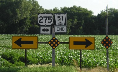
Facing west on 51 (6/26/06)
If the number had stayed the same across the state line, this would be the "far west" end of 175.
Facing southeast on 275 (6/26/06)
The standard junction sign for Nebraska. The word "Junction" at top had nearly completely faded a decade later.
Facing southeast on 275 (6/26/06)
Facing southeast on 275 (6/26/06)
This intersection is on the diagonal between 275's mainly east-west and mainly north-south portions in Nebraska, though the entire route is signed east-west in the state.
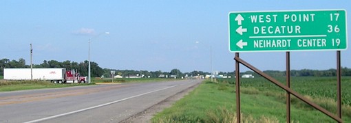
Facing northwest on 275 (6/26/06)
The brown sign is for the John G. Neihardt State Historical Site. We now return you to your regularly scheduled Iowa highway.
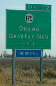
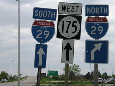
Surrounding area information: I-29 Exit 112
Facing north on 29 (2/23/02)
Photo by Neil Bratney
Highway 175 serves as a terminus for nine four state highways, is duplexed with every US highway it crosses and every state highway that doesn't end at it, and runs through 15 14 school districts (bordering a 13th) including West Monona, Wall Lake View Auburn East Sac, South Hamilton, Hubbard-Radcliffe, Eldora-New Providence South Hardin, and Gladbrook-Reinbeck. (Edits in place to show some of the changes just since 2001.)

Facing east on 175 (9/17/07)
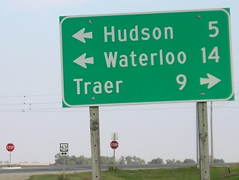
This LGS is posted closer to the I-29 interchange than downtown Onawa, which are about a mile apart. Ahead is a turn for a frontage road serving the businesses beside the interstate (which is in the deep background) and one of the last "West 175" shields in Iowa.
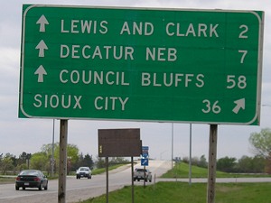
I took both this picture and the LGSs at the east end, three area codes and 2/3 of a state away. As I drove this in 2003 I broke new ground on a state highway I know, a familar number on an unfamiliar road. That all destinations on this sign are for Nebraska calls up the wonder of the open road, going to new places but perhaps staying with a number that goes right back home. OK, I'm done waxing poetic now.
Facing west on 175 (5/7/06)
Facing west on 175 (5/7/06)
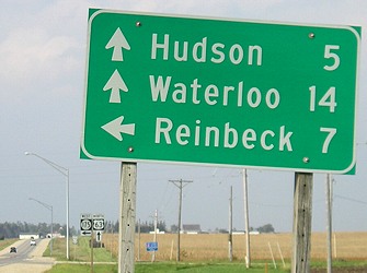
Despite the standard leaving-town sign above, this is farther west and the last multiple-destination sign on 175.
You're going the wrong way
Facing north (9/17/07)
Though their east ends are far apart from each other, IA 141 and IA 175 cross in Mapleton and run together for less than a mile. Just ahead of this picture, the road curves so that eastbound 175 is facing due west for just a bit before it turns northeast.
You will be assimilated...

Above are all the state highways, west to east, that were completely or partially absorbed by 175's extensions in the 20th century, the most recent being IA 57 and 58 in Grundy County in the Great Renumbering.
Facing east on 175 (7/4/05)
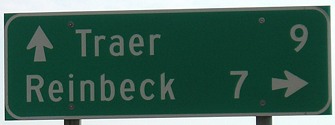
This is the last eastbound mileage sign, by Reinbeck, the counterpart to the sign leaving Onawa above.
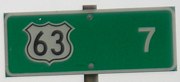
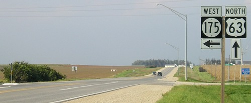
EAST End: Stop sign, US 63, Black Hawk County
Facing east on 175 (5/25/03)
IA 175 is nearly twice as long as US 175 in Texas.
LGS in above picture (9/21/07)
Before about 1970, this intersection was not a regular one like today. As it approached 63, it became a "Y-shaped fork", like US 138's east terminus in Nebraska at US 30 was. In 175's case, one curve went north, one south, and in the triangle in the middle (the area the LGS is sitting in) was the Midway Gas Station.
Facing north on 63 (9/21/07)
Facing north on 63 (9/21/07)
The directional markers are a relatively recent addition to signs at this intersection. It's unknown if this is a trend.
Facing south on 63 (9/21/07)
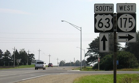
Facing south on 63 (9/21/07)
*Inaugural Highway End*
Page created 11/24/01; last updated 1/16/17