
(June 24, 1931-December 16, 1975; July 1, 1980-May 17, 2018[ish])
The decades-long life of IA 192 followed the one-month life of a highway known only by research: IA 241, running from downtown Council Bluffs south and then east to the Iowa School for the Deaf. For reasons not explained in the archives, the route was renumbered (and #241 recycled as a spur to Readlyn). But the 192 wasn't constant either; from late 1975 to mid-1980 it officially did not exist.
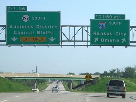
NORTH End: Direct merge into I-29 (exit 56), Council Bluffs, Pottawattamie County
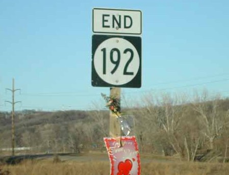
Facing north on 192 (1/18/02)
Photo by Neil Bratney
Neil says this sign is at the onramp to I-29 NB. Someone left a January valentine: "Roses are red / Violets are blue / I love you / Iowa 192!" Sounds like a road geek to me. Update: Someone's heart is broken now.
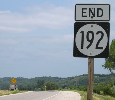
Facing north on 192 (6/12/06)
This second view shows the lane merging with I-29 and the Loess Hills in the background. A fellow roadgeek has suggested that IA 192 would make a perfect Business Loop I-29; I agree.
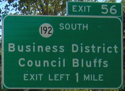
Facing south on 29 (6/9/03)
Whoops...the sign makes sure to tell you to exit left, but the exit tab indicates a right exit.
Facing south on 29 (6/9/03)
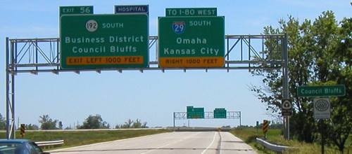
Facing south on 29 (5/13/07)
The exit for 192 is a two-lane left exit. Neil says this was where I-29 stopped between 1958 and 1968: "All traffic had to come on to 16th Street here, while I-29 was built around the west side of CB." Exiting traffic crosses under northbound 29 and runs into a stoplight soon after. The part of I-29 south of here somehow ended up my least-traveled; since you can't turn around until the Honey Creek exit, it kept not making sense to cover the part between 192 and I-480 for any reason, and otherwise I was coming in on I-80.
Temporary NORTH End: Stoplight, US 6/Kanesville Boulevard, Council Bluffs, Pottawattamie County
Facing north on 192/6th Street (6/22/17)
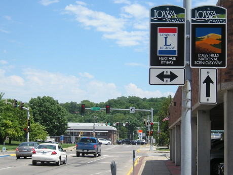
The pickup is stopped on 6th at Broadway, which split/joins Kanesville just to the left, and was the Lincoln Highway. The stoplight in the background is for Kanesville, US 6 1984-2016, and where the Loess Hills Scenic Byway will turn.
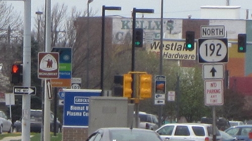
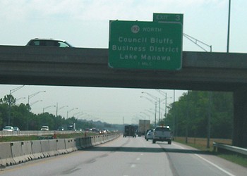
Facing north on 192 (6/22/17)
Paradoxically, highway changes in the present or near-past can be harder to attach timelines to than the far past. In this case, after months of negotiations, the northern segment of IA 192 (and the West Broadway part of US 6) was deleted from the state highway system on May 1, 2016, following a Transportation Commission meeting April 12, but the signs didn't come down until December. That makes three different potential decommissioning dates. Subsequently, the final part of 192 was turned over in a Transportation Commission meeting December 12, 2017, but the signs didn't come down until around five months later.
Facing west on Kanesville Boulevard
Photo by Jason Hancock (4/9/17)
At the time, this was the only indicator 192 went (or, technically, used to go) past this intersection...and it's a stupid wide sign.
Facing west on Broadway (6/22/17)
Some fool who should be pitied worried about not having enough time to walk up to Kanesville and back before the tour bus left, to get that last "South 192" sign, and so did not go.
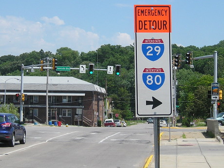
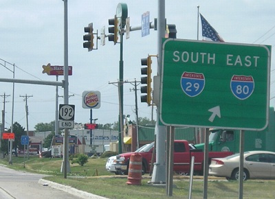
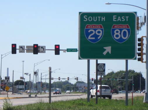
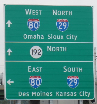
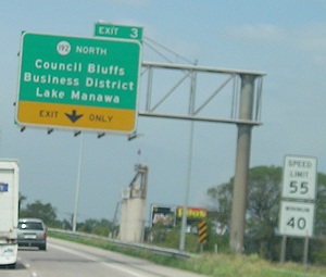
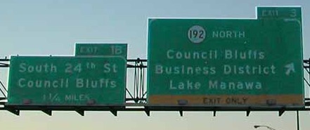
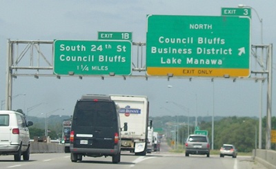
SOUTH End: I-80/I-29 exit 3, Council Bluffs, Pottawattamie County
Facing south on 192 (8/2/16)
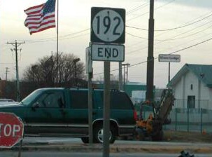
Closeup of "End" sign, with the End at the bottom (1/18/02)
Photo by Neil Bratney
Facing south on 192 (6/12/06)
Facing south on 192 (8/2/15)
Photo by Jason Hancock
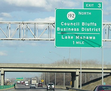
Facing north on South Expressway (which becomes 192) (6/12/06)
Facing north on 192 (first sign) (6/12/06)
Facing north on 192 (6/12/06)
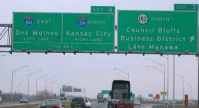
Continuing north on 192, a traveler will go on a viaduct and then be dumped onto a one-way street in downtown. (The 80 shield was fixed in the next six weeks.)
Facing north on 192 (8/1/15)
Photo by Jason Hancock
So now that 192 is gone, what happened to the middle of this sign? Could it at least be greened out with "Downtown" or "S Expressway" instead of blank?
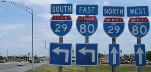
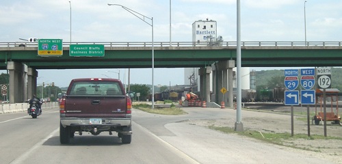
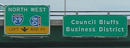
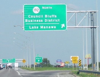
Facing east on 80, but heading south on 29 (6/26/06 and 4/6/08)
Replacement of the 24th Street bridge in 2008 is one of the first visible signs of the Council Bluffs interstate reconstruction project. It's first in part because it will be the detour for US 275/IA 92 while the Missouri River bridge there is finished.
Facing east on 80, but heading south on 29 (1/18/02 and 5/13/07)
Left photo by Neil Bratney
As you can see, this exit is very close to the south 80/29 split. Diagrammatic signs (background) replaced the ones that were on the same gantry. A wider arrow shows more lanes going to 80 than 29.
Facing west on 80, but heading north on 29 (6/12/06)
Facing west on 80, but heading north on 29 (1/18/02)
Photo by Neil Bratney
That's what the sign looks like with a shield attached, but it has since fallen off (below).
Facing west on 80, but heading north on 29 (6/12/06)
The disappearing, reappearing highway
The first routing of 192 ran south from the intersection of Ninth Avenue and Main Street, where US 275 was at the time (it turned from Ninth to Main and 192 went south on Main; see below). Various extensions and reroutings followed, plus that Cleveland Browns-esque time gap, so although the numerical designation remains from 1931, the roadway 192 followed for the last quarter of its life is completely different.
Although it did not go south from I-29/80 after the mid-'70s, a AAA map from 1992 still shows it here. Also notice that on the AAA map, 275 seems to be on two routes at once (the south route is correct).
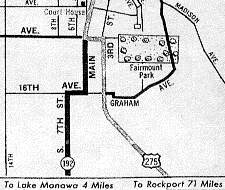
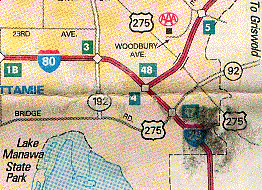
Left: 1937 (ISU Parks Library); Right: 1992 (AAA Omaha map)
Page created 3/31/02; last updated 2/22/19