
(December 1, 1930-July 1, 2003)
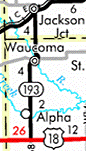
NORTH End: Stop sign, IA 24 and V64, Jackson Junction, Winneshiek County
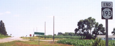
Facing north on 193 (7/25/16)
The LGS is before - quite a ways before - the "End" sign in the below picture. All of Jason's pictures are pre-decommissioning.
Facing north on 193 (7/14/02)
Photo by Jason Hancock
All of 193 in Winneshiek County - approximately 2½ miles - is within the city limits of Jackson Junction, which has incorporated a large amount of land around the town, but in those approximately 6 square miles are only 60 people. Jackson Junction also has the high school for the Turkey Valley school district.
Facing west on 24 (7/14/02)
Photo by Jason Hancock
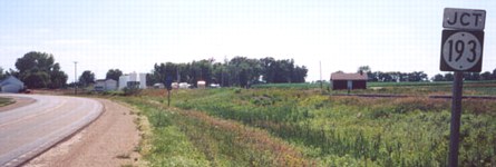
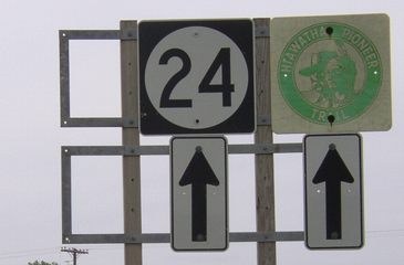
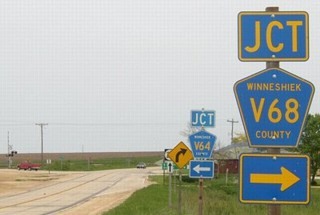
In a strange display of separated signs, "Jct 193" is here...
Facing west on 24 (7/14/02)
Photo by Jason Hancock
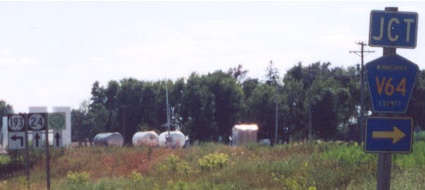
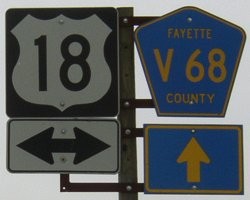
...but "Jct V64" is further down, even though they end at the same intersection. If you look at the map, B33 is the more logical route here out of Jackson Junction, but V64 supplants that route going west from their intersection. Also, 193 has an semi-incorrect "up and ahead" arrow instead of a straight left. The green sign at right on the assembly is for the Hiawatha Pioneer Trail.
Signage in background after decommissioning (5/18/04)

Facing east on 24 (7/25/16)
Facing west on 24 (7/14/02)
Photo by Jason Hancock
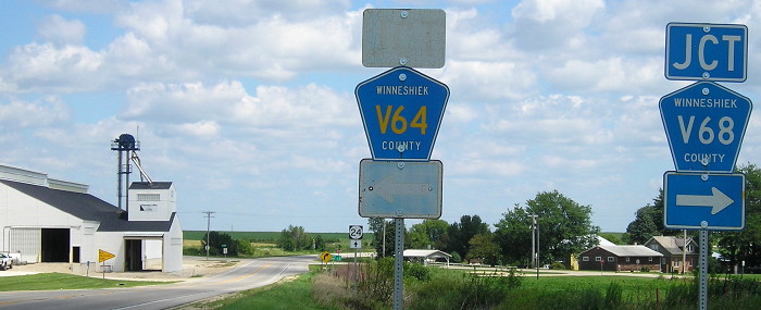
Not only are the junctions separated at the time 193 was around, so are the LGSs.
Facing west on 24 (5/18/04)
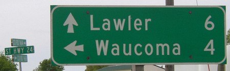
The rural sign is tilted about 90 degrees from where it should be. We should see the V64 and V68 (it is signed as V68) signs head-on instead of the 24 sign.
Facing west on 24 (7/25/16)
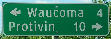
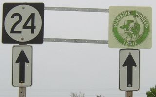
The two LGSs have been combined to exclude Fort Atkinson, since county road intersections only point to destinations on the county road.
Facing east on 24 (5/18/04)
Facing east on 24 (7/25/16)
Facing east on 24 (5/18/04)
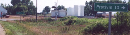
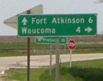
The Protivin sign is separated on the westbound side too.
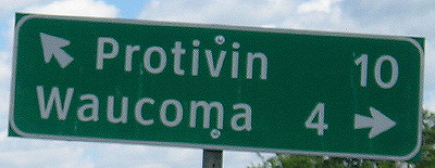
Facing east on 24 (7/25/16)
The two LGSs have been combined in this direction too.
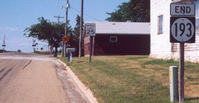
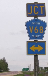
SOUTH End: Stop sign, US 18 and V68, Fayette County
Facing south on 193 (7/14/02)
Photo by Jason Hancock
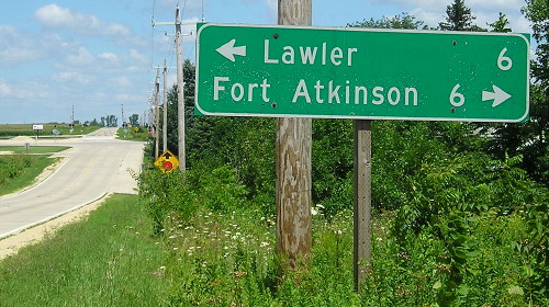
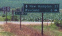
If you look closely you can make out a two-word town on the bottom line of the LGS, New Hampton. Compare that to the county-made sign put up after decommissioning below.
Facing south on 193 (5/18/04)
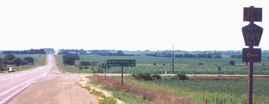
Facing west on 18 (7/14/02)
Photo by Jason Hancock
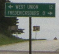
Just like the north end, the junction signs are on separate poles...
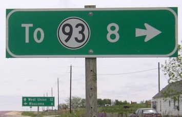
Closeup of signs in above picture (7/14/02)
...and so are the LGSs! The rear one, for V68, says "<- To 93 8".
Facing east on 18 (5/18/04)
As Jason puts it, "Both US 18 and IA 24 have more signage for their intersections with IA 193 than there should be."
The south end of 193 is about 3.3 miles southwest of the confluence of 43 degrees north, 92 degrees west.
Last seen: 2003
Page created 12/18/02; last updated 1/6/17