
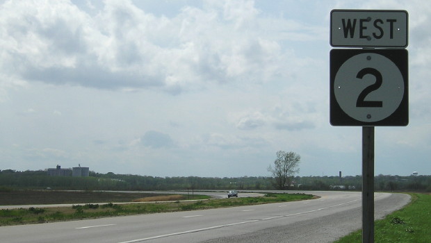
WEST End of NE 2 (EAST segment), Interchange, US 77, Lincoln NE, Lancaster County NE
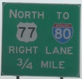
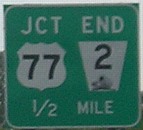
Facing west on 2 (6/4/07)
Facing west on 2 (6/4/07)
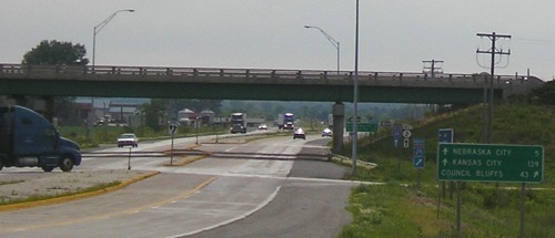
With the completion of Interstate 80, NE 2 was cut in half instead of keeping its long multiplexes from Grand Island to Lincoln via US 34, NE 15, and US 6. The western segment now runs from I-80 southeast of Grand Island northwest past Alliance, where it heads north on a now-redundant multiplex with NE 71 to become SD 71. Even so, four of the five largest cities on the combined segments are in Nebraska: Lincoln, Grand Island, Alliance, and Nebraska City (Fort Madison is No. 3).
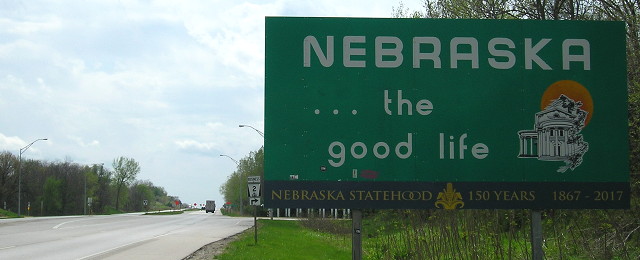
Nebraska City
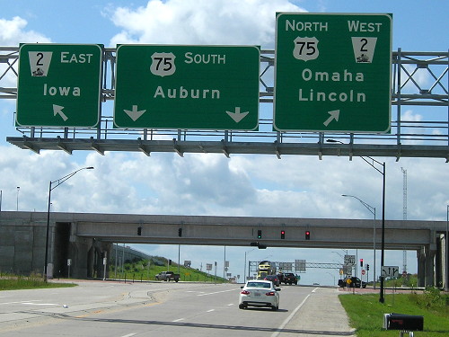
Facing south on 75 (7/24/19)
This intersection of US 75, NE 2, and Business 75 was turned into a SPUI (single-point urban interchange) in the late 2010s.
WEST End: Nebraska state line, Nebraska City NE, Fremont County IA/Otoe County NE
Facing west on 2 (4/19/17)
Facing west on 2 (6/4/07)
West of I-29, IA 2 is a four-lane road, primarily because using NE 2 shaves 40 miles off the trip to Lincoln or Kansas City for those on 29, instead of going through Omaha. This bridge, done in tandem with a bypass of Nebraska City, is farther south than the original route. The switch happened in 1986.
Facing west on 2 (4/19/17)
After crossing the bridge we meet the intersection with Business NE 2, following the original route through Nebraska City. To the left is the Lewis and Clark Interpretive Center with exhibits of the 1803-06 expedition and a keelboat replica.
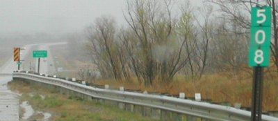
Facing east on 2 (4/20/02)
Photo by Neil Bratney
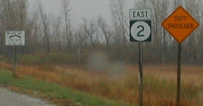
Neil says that 2 is Nebraska's longest highway and Iowa's shortest cross-state highway. (However, the westernmost 58 miles of NE 2 are redundantly multiplexed and north-south on what is mainly a northwest-southeast highway.) The small green sign reads "MISSOURI RIVER". The first part of 2 in Iowa can be seen in the background.
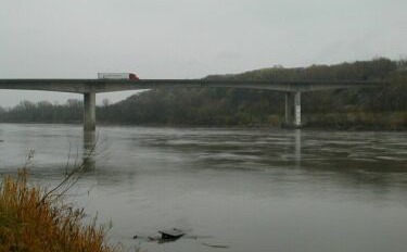
Photo by Neil Bratney (4/20/02)
The bridge is high enough to let commercial river traffic under it.

Facing east on 2 (6/12/06)
Facing east on 2, first sign after bridge (4/20/02)
Photo by Neil Bratney
Old WEST End: Nebraska state line, Nebraska City NE, Fremont County IA/Otoe County NE
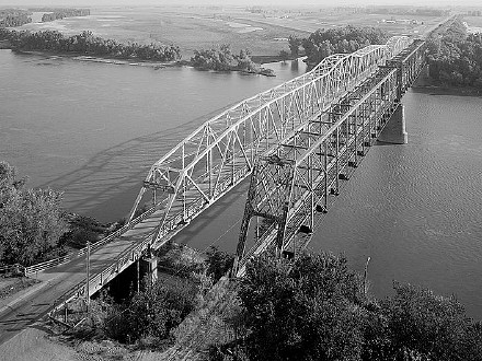
Facing east from Nebraska; highway bridge is on left
Library of Congress photo (August 1984)
The original bridge for what today is IA 2 opened with great fanfare on October 17, 1930, as a toll bridge at the west end of IA 3. Prior to that, the two nearest bridges on either side were the toll bridge at Plattsmouth and US 36 at St. Joseph. (What is now the US 136 bridge didn't open until the late 1930s, and the US 159 bridge didn't open until November 1939.) Fifty-six years later, give or take a month, the present bridge opened. The bridge in the opposite corner of the state, IA 9 at Lansing, opened exactly eight months later.
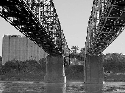
Facing west, underside of railroad bridge (left) and highway bridge (right)
Library of Congress photo (August 1984)
The photo below was taken in approximately the same spot, as you can see by the silos:
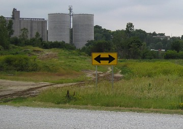
Facing southwest, but heading west, on 2 (6/12/06)
This view is not accessible now. After major flooding in 2011, a levee system was built (below).
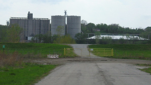
Facing southwest, but heading west, on 2 (4/19/17)
Facing east on 2 (6/12/06)
The old pavement for 2 remains on the Iowa side, along with a building that was a truck stop/gas station. This is about where the levee is now, maybe a little west.
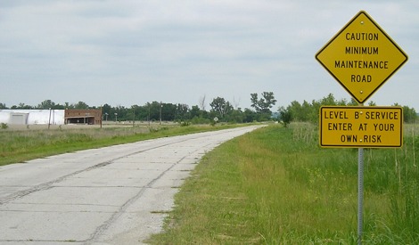
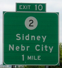
Surrounding area information: I-29 exit 10
Facing west on 2 (6/12/06)
In addition to the Burger King in the Middle of Nowhere (old IA 105 at I-35), and the Arby's in the Middle of Nowhere (IA 14 at US 20), add the Wendy's in the Middle of Nowhere, part of the small cluster of traveler service businesses (and Iowa Welcome Center) in the northwest corner of the interchange.
Facing west on 2 (6/12/06)
The expressway begins right at the interchange. The stretch west of 29 is the only standalone portion of 2 that is four lanes.
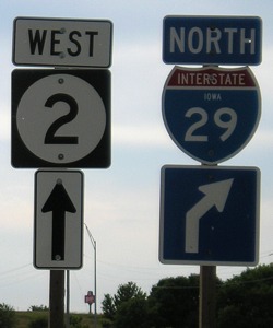
Facing north on 29 (6/12/06)
This BGS has (another) different style of signing a city across the Missouri River from I-29 than other exits. At IA 370, it's "Bellevue" without a state identifier; at US 30, it's "Blair Nebraska" spelled out; at IA 175, it's "Decatur Neb"; here, though "Nebraska City" is the city's name, it's abbreviated.
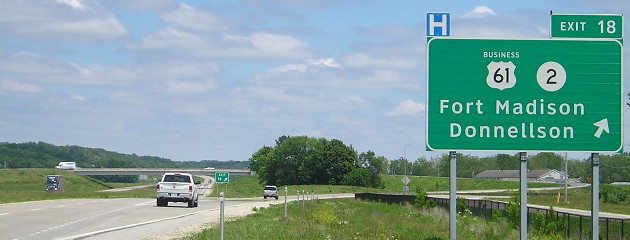
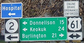
EAST End: Interchange, US 61, (but technically city limits of) Fort Madison, Lee County
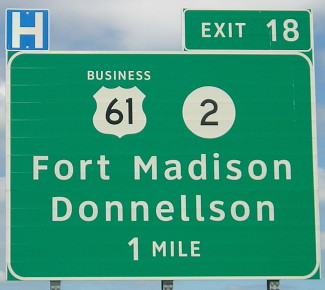
Facing southeast, but heading east, on 2 (6/1/15)
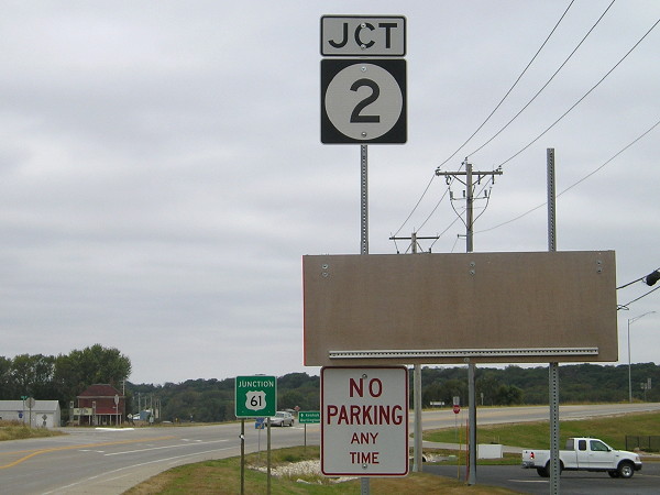
The Fort Madison bypass, which opened in late 2011, was the first non-interstate freeway segment in Iowa to get generic interchange signage. Because of that, there are no signs for Business 61 or IA 2 on the cross road at the exit.
Facing southeast-ish on 2, but heading north on Business 61 (6/1/15)
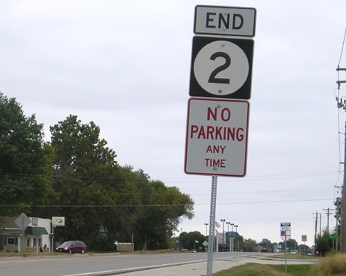
This sign set just past the northbound 61 off/on ramps is the only indication that IA 2 does not end at the exit itself, but continues a few hundred feet.
Facing east on 2 (10/4/15)
If you do not count the changes to IA 9 signage at the Black Hawk bridge, because that's kind of a weird situation, the truncation of IA 2 to the west end of the Fort Madison bypass is the first change to the endpoint of a cross-state route since IA 3's east end was moved in Dubuque in 1993.
Facing west on 2 (10/4/15)
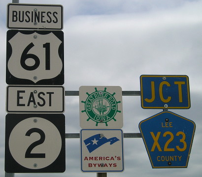
This is the first sign on 2 after the segment inside Fort Madison was turned over to the city. This shows you how close the location is to the interchange. The red brick building in the left background is on a short piece of old 61, approximately where 61 and 2 used to split. That's now incorporated into X23, which is very old 61, now 263rd Avenue. But functionally, 2 ends at 61.
Facing north on 61 (6/1/15)
The BGS doesn't include a "West" above the IA 2 shield.
Facing north on 61 (6/1/15)
At right is old 61 and a partly new frontage road.
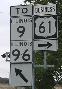
Old EAST End: Toll bridge, Illinois state line, Fort Madison, Lee County IA/Hancock County IL
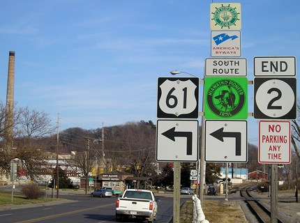
Facing east on 2, but heading north on 61 (12/18/06 and 10/4/15)
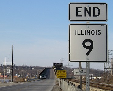
Although the "End 2" sign is before the foot of the Iowa side of the bridge, the DOT considered the bridge part of 2. By comparison, the "End" sign for IA 9 is right at the foot of the bridge into Wisconsin. (Or it was, until the early 2010s.)
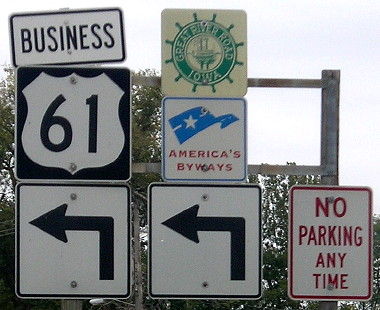
The updated assembly, at right, adds the business route designation and removes both the Hiawatha Pioneer Trail and IA 2.
Sign assembly in background of above picture / Closeups (3/31/02 and 12/18/06)
Left photo by Jason Hancock
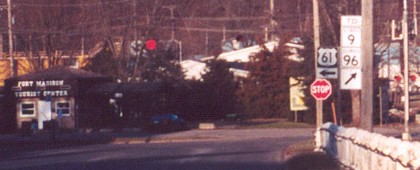
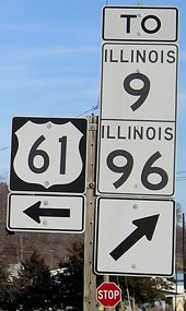
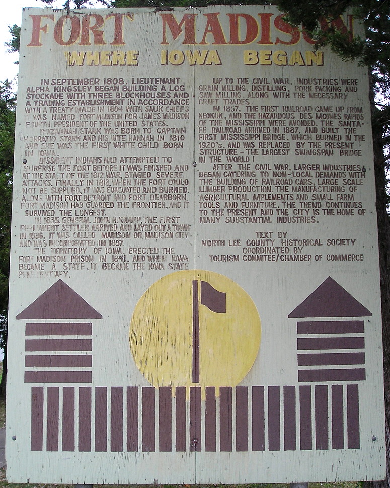
Although the DOT does an excellent job of directing to the highways on the Illinois side, it could have put up a shield for 2 with a diagonal right arrow to send it to the bridge. At left is a local welcome center. Here is a large photo of the sign partially visible near the stop sign, "Fort Madison: Where Iowa Began".
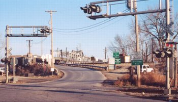
Photo by Jason Hancock (3/31/02)
It would have been more accurate - or at least closer to accurate - for the "End 2" to go on that telephone pole.
In 1977, of Iowa's 12 non-interstate bridges across the Mississippi River, all but three (IA 9, US 18, and US 20) were toll. Today, this is the only bridge that still charges passage, because it is owned by the BNSF Railroad.
Another view of the bridge entry (10/21/05)
The place where IA 2 crosses the state line is about where the Sullivan Line, which forms Iowa's southern border west of the Des Moines River, meets the Iowa-Illinois line in the Mississippi River.
Facing northwest (12/18/06)
This signs for bridge travelers is across the street.
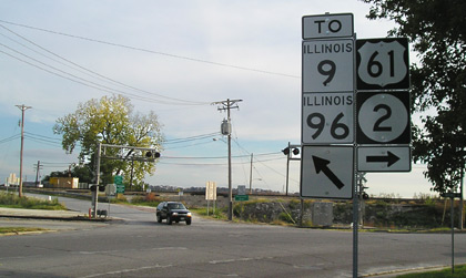
Facing south on 61 (10/21/05 and 10/4/15)
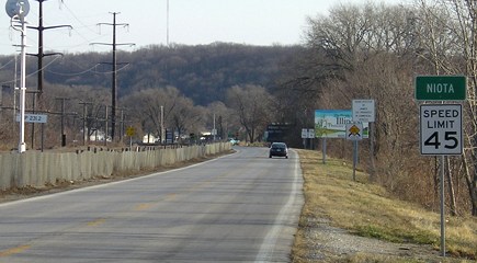
The black SUV has just entered Iowa on IL 9/IA 2. In 2002, these signs were on a wooden pole. After paying the toll and crossing the bridge, you start on IL 9.
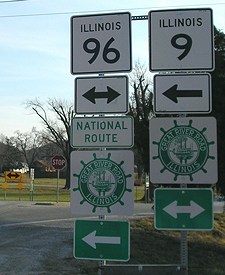
Facing west on 9 (12/18/06 through to the bottom)
Like IA 9, IL 9 goes border to border with a river crossing on one end just after it intersects another state highway. (Though in IA 9's case, the intersection is much closer.)
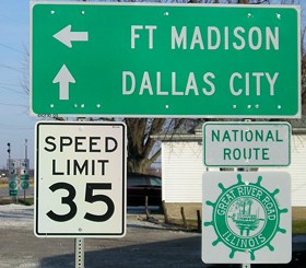
Facing east on 9
In the background is the junction with IL 96.
Facing east on 9
Notice how the "9" on the right has a very extended oval. It could be in Series E font.
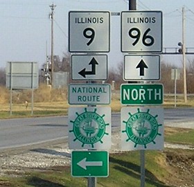
Facing north on 96
Page created 5/8/02; last updated 4/8/20