
Facing north on 151, coming from I-80 (6/3/15)
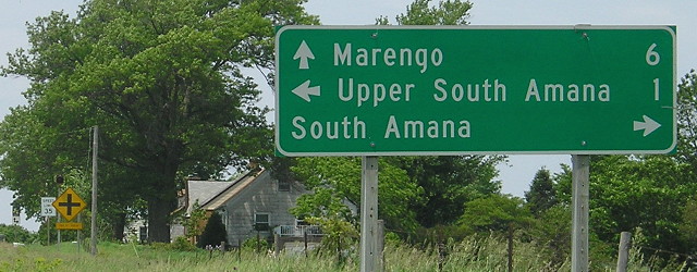
Old WEST End: Upper South Amana, Iowa County

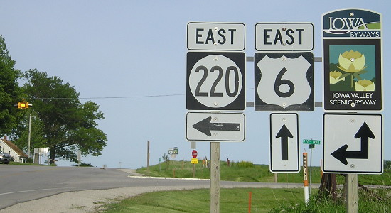
Facing south, but heading west, on 220 (10/23/19)
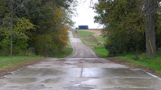
Pavement goes for about 3/4 mile south of 220's current end at US 6 to Upper South Amana (which, seemingly contrary to logic, is south of South Amana proper). Upper South, which would be the end of 220 for 45 years, is not marked on either state or county maps. Up to 1976, South was depicted on maps as being south of US 6, not migrating to the north of the intersection until 1977. The 1972 map, for example, clearly shows 6 bisecting 220 with South being a mile (mile-ish) south of the intersection. Perhaps there was confusion/amalgamation of South and Upper South because 220 extended south of 6, but the extension was lopped off in 1980.
Facing south, but heading west, on 220 (10/23/19)
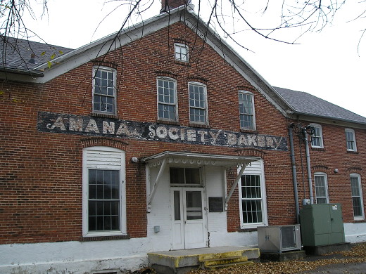
"In 1885, the Upper South General Store was constructed as the biggest and best of the village stores. Upper South was a busy rail center. The store also provided a second floor residence. The west side of the building was a furniture shop which sold casegoods to visitors. In 1943, the building became the home of the Amana Society Bakery. In 1987, the interior of the bakery was remodeled extensively." — Plaque to side of door
The Amana Society Bakery closed in early 2013.
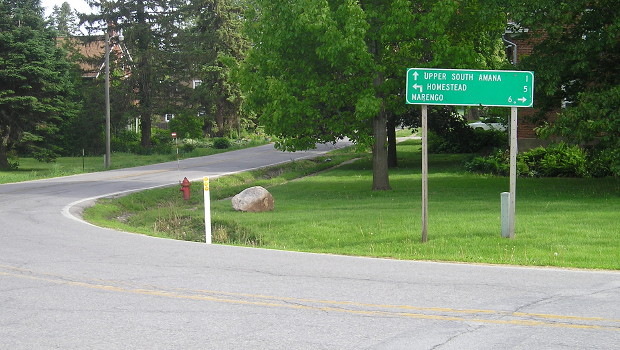
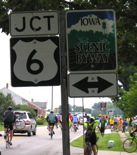
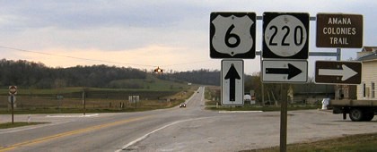
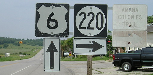
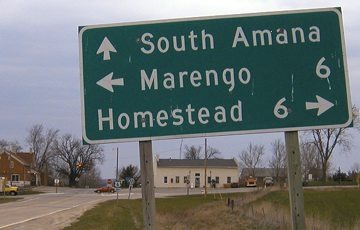
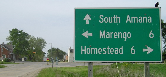
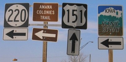
WEST End: Stop sign, US 6 and W16, South Amana, Iowa County
Facing south (5/19/15)
Two blocks before its south end (in the background), 220 makes a sharp set of turns. The turns are so sharp that the LGS for the road runs parallel to it! As evidenced by the yellow lines in the bottom of the picture (which was taken off the road in a parking lot), when cars pass the LGS they are heading east yet the LGS is for traffic heading south.

Closeup of LGS (4/9/04)
This isn't a DOT sign (strange, given that 220's been around quite a while), and the ahead-and-left arrow for Homestead while not doing the same for Marengo makes it even stranger.
Facing south, but heading west, on 220 (7/24/08)
RAGBRAI came through West and South Amana in 2008.
Facing south, but heading west, on 220 (7/24/08)
Facing east on 6 (5/19/15)
Facing west on 6 (6/3/15)
Facing west on 6 (4/10/04)
Facing west on 6 (6/3/15)
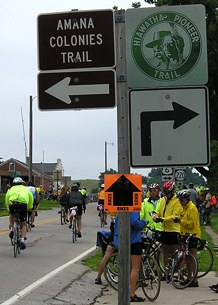
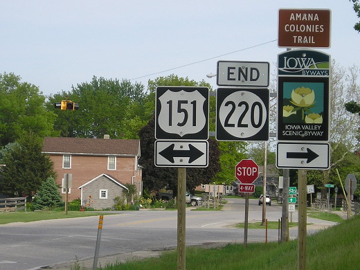
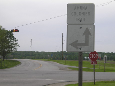
The 220 shield was replaced, but the "Amana Colonies Trail" wasn't and is illegible at speed.
Facing north on W16 (4/10/04)
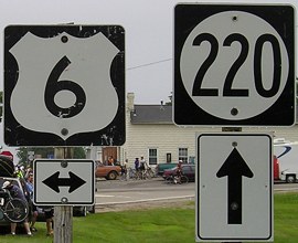
This LGS, to me, did not appear to be following state guidelines, but it could merely have been a very old one, given its replacement:
Facing north on W16 (5/19/15)
Facing north on W16 (7/24/08)
These signs were replaced between 2004 and 2008. By the way, only the county map marks this road as W16, since it's short and doesn't connect to anything.
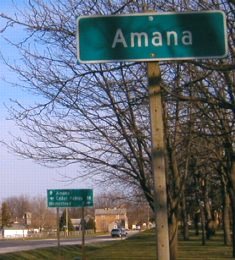
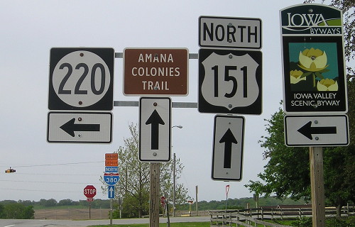
EAST End: 4-way stop, US 151 and F20, Amana, Iowa County
Facing east on 220 (December 2001)
Photo by Jason Hancock
From this point, the end of the road is not able to be seen. It curves around to the left side of this photo, following the tree line. Update: The "End" has moved to the intersection; see below.
Facing east on 220 (LGS at bottom left is in right picture) (4/9/04)
The city limits sign shows up right before the LGS, yet the latter still includes the town.
Replacement Clearview signage (5/19/15)
Facing east on 220 (4/9/04)
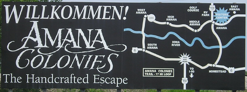
The bulk of main Amana is straight ahead. While some like to poke fun at Iowa's ethnic enclaves and festivals (see, for example, the 1998 movie I'll Be Home for Christmas), Iowans take pride in remembering their heritage, in this case Germans. The Amana Colonies were a communal society set up by followers of a German religious sect.
Facing east on 220 (5/19/15)
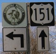
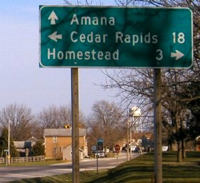
Facing north on 151 (4/9/04)
Facing north on 151 (5/19/15)
This is the Clearview replacement for the LGS in the above right picture. Not shown is the Casey's that took over the HandiMart.
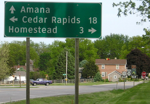
Facing north on 151 (4/9/04)
Facing north on 151 (5/19/15)
This Amana Colonies Trail sign got replaced but the arrow should be pointing left.

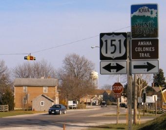
Facing south on 151 (5/19/15)
Homestead is 151's last town before the US route ends at I-80. The town of Homestead was originally purchased by the Amana Society (the colonies' governing body in the 19th century) to serve as a railroad station for the colonies - hence why it doesn't have "Amana" in the name. Today, the "Little Amana" collection of businesses 14 miles south of here at I-80 exit 225 acts much the way Homestead did in introducing travelers to the Amanas. (However, until 1985, going from that exit to the Amanas required traveling a gravel road!!)
Facing south on 151 (4/9/04 and 5/19/15)
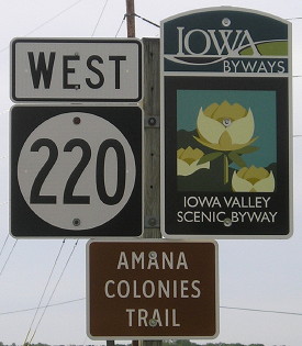
If you follow that Iowa Scenic Byway, it makes a loop around the Amana Colonies and F15 east of Marengo and then continues on US 6, IA 212, and IA 21 in Iowa and Benton counties and E66, a tiny piece of the original Lincoln Highway, V18, E64, US 63, E49, and T47 in Tama County, ending at US 30 north of Montour.
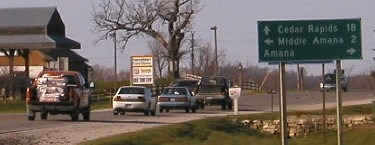
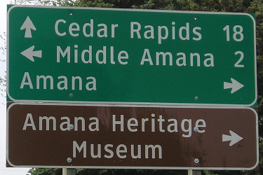
Facing west on F20 (5/19/15)
The small stretch of 220 east of 151 connecting Amana and East Amana (including the road here) was demoted in 1980. Middle Amana, though unincorporated, is the site of both the Amana appliance manufacturing plant (now a part of Maytag Whirlpool) and Amana Elementary. Middle Amana also had Clear Creek-Amana Middle School until explosive growth in the eastern part of the district resulted in new facilities opening in Tiffin in 2009. Part of the school was used for a few years by the Old Creamery Theatre but then that moved elsewhere.
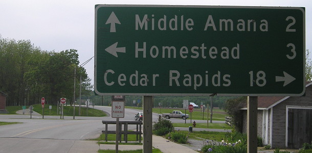
This sign appears to be the same one I photographed in 2004 (the fasteners on the "M" and "n" in "Middle Amana" are in the exact same places), but the first "a" in "Cedar Rapids" is a replacement for what had appeared to be a partially-peeled-off capital letter.
Facing west at intersection, then first sign on 220 (5/19/15)
Old EAST End: East Amana, Iowa County
Facing southwest, but heading west, on 220 (5/19/15)
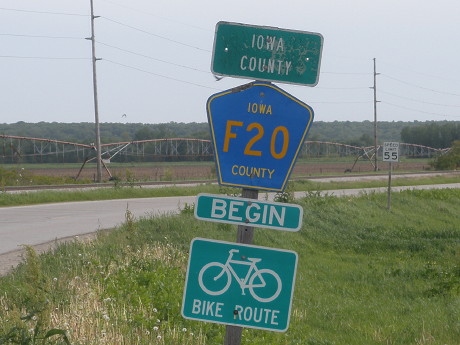
This "Iowa County" marker is a mystery. Yes, until 1980, this was where 220 began, and the pavement ends a few hundred feet behind this picture. However, this is a mile inside the county line, and the gravel F20 follows the Iowa River east to Old US 218 - not exactly a major thoroughfare.
Page created 12/11/01; last updated 3/24/20