
(January 7, 1931-August 21, 1994)
For additional history of roads in this area, including a proposed but never-enacted plan to get rid of the highway running south from State Center, see these maps.
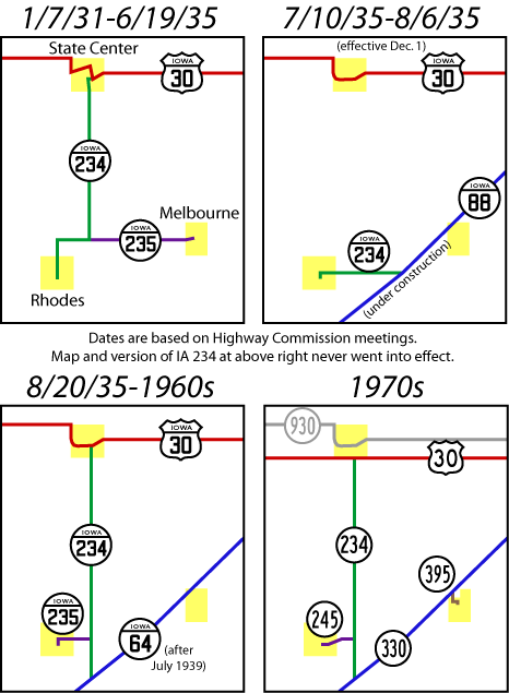
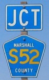
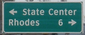
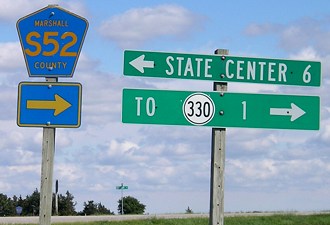
NORTH End: Stop sign, US 30, State Center, Marshall County
Facing north on 234
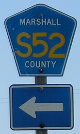
Iowa 234 had the distinction of living into the 1990s while all but about the southernmost mile was still gravel. Today the unpaved portion is unmarked while S52 covers the paved portion (see below) and then parallels old 234 one mile to the west. This certainly is a rare sight: signage on a gravel road. On the south end of the gravel, an LGS is still up. (See below.)
In fall 1962, the school districts in Clemons, State Center, and Melbourne joined to form West Marshall. In part because of this, State Center lobbied hard to the Iowa Highway Commission to pave 234. At the same time, the Highway Commission was lobbying equally as hard for Marshall County to take the route. As you can see, both were about equally as successful, though eventually the state won as the county took the unpaved road decades later.
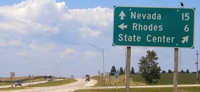
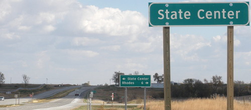
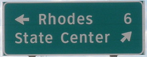
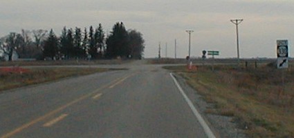
Facing east on 30
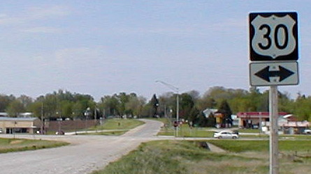
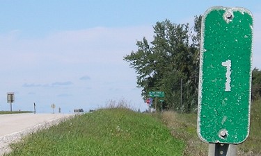
Here on the south side of State Center, from the early 1960s through the first decade of the 21st century, 30 was four lanes very briefly, not even as long as the 2001 and 2002 maps showed it. A mile back, S52 joined 30, and now heads north from it. Although Rhodes was on the LGS for S52 south, 1 mile behind us, it shows up again on this LGS, even though going south here means gravel.
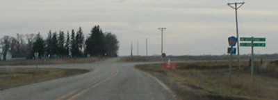
Facing west on 30
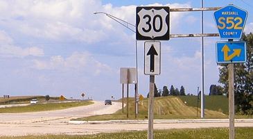
Facing west on 30
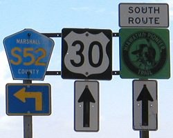
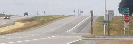
This set has a space for a 234 shield, with the 30 in the middle. There is a small diagonal to get on S52, which stayed after construction of the four-lane.
Post-construction
Facing east on 30
Facing west on 30
Facing west on 30
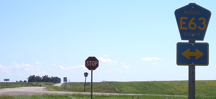
SOUTH End (1989-95): Stop sign, E63/Old IA 245, near Rhodes, Marshall County
Facing south on 234
This sign on a gravel road is a leftover from 234's days as a state highway. It is probably the only DOT-standard mileage sign on a gravel road that isn't approaching an interchange.
Facing south on 234
For about six years, the gravel road ending here was a state highway, but the paved segments ahead and to the right were former state highways turned county roads.
Facing north on 234
The 1-mile markers for both 234 and 245 are visible from the intersection.
Facing north on 234
Facing east on 245
The day after Christmas 1989, Marshall County and the DOT swapped some roads. Marshall County got the paved parts of IA 234 and 245, plus Lincoln Way into Marshalltown, while the DOT took over S75 south of Albion and made it part of IA 330.
Facing east on 245
SOUTH End (1931-89): Stop sign, IA 330, Marshall County
Facing south on 234 (December 2001)
This picture and the one below show the intersection as it was during nearly all of 234's existence. This intersection was reconfigured in 2002 to end perpendicularly (see below).
Closer to the intersection
The LGS is for Melbourne and Des Moines, but I can't recall the numbers, and the sign's gone now; see below.
Facing south on 234 (December 2002)
Because this picture was taken in the ditch, you may not be able to see the new end, reconstructed to end at 330 perpendicularly. The stop sign is now in front of the semi's cab. Signage today is more like that of a state highway, with separate "Jct" and arrows, which are now straight and not diagonal like the top picture.
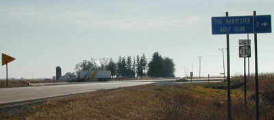
The blue sign points to the Harvester Golf Club, or as I call it, The Golf Course in the Middle of Nowhere.
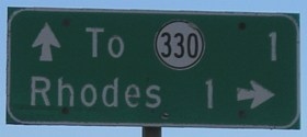
Facing northeast, but heading north, on 330
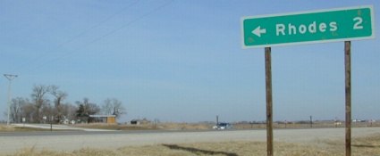
This is a large LGS for Rhodes, more like a freeway sign. The LGS is about where the old road intersected 330.
Last seen: 1989 and 1994 (1991, 1995 maps)
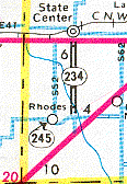
In previous maps, 234 and 245 are shown with solid black lines (indicating they were paved), but the 1991 map (left) showed those portions decommissioned. The part of IA 245 inside Rhodes was turned over a year after the part outside the city, likely too late to have it removed from the 1991 map.
Highway 234 was the middle of a trio of spurs assigned to Marshall County in January 1931: 233, 234, and 235. (Oddly, these three numbers were assigned one day before a significant batch of lower numbers.) Since then, 233 has been superseded by 330, 234 is gone, and 235 became 245 when the interstate system needed the number.
All pictures by me: First, 5/10/02; second-sixth, 7/16/04; seventh-tenth, 10/27/11; 11th-16th, 9/3/06; 17th and 18th, 12/21/01; 19th and 21st, 12/14/02; 20th, 7/15/07
Page created 1/21/02; last updated 3/17/17