
(August 5, 1931-November 17, 1980)
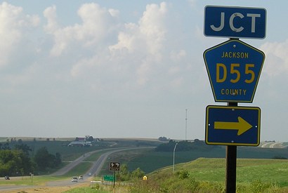
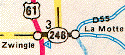
WEST End: Stop sign, US 61, Zwingle, Dubuque/Jackson county line
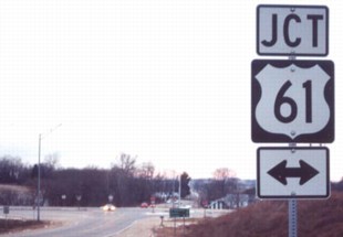
Facing west on 246
Photo by Jason Hancock
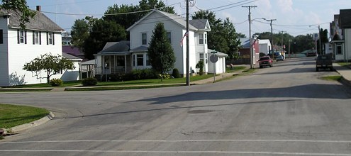
Although 246 always ended at US 61, that end was not always in the same place. Between its commissioning in 1931 and 1947, its end was north of Zwingle at what is now the intersection of D53 and 61, entering La Motte on a diagonal now named 230th Avenue in Jackson County.
Facing west on 246
Photo by Jason Hancock
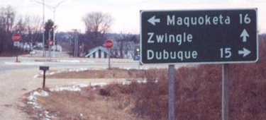
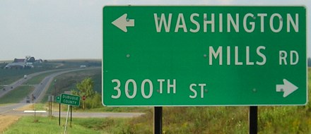
Between 1947 and 1967, 246 ended at an old alignment of 61, beyond the yield sign in the background (between the stop signs). That year, 61 between Zwingle and Maquoketa was straightened; if you look at a Jackson County map today you will see pieces of paved roads on either side of present 61.
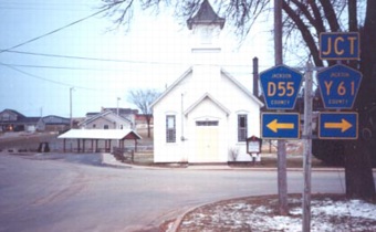
Facing south on 61
Photo by Jason Hancock
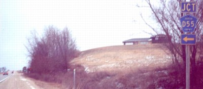
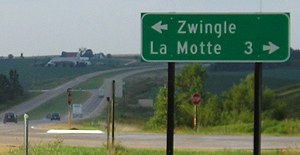
From 1967 until 1980, when 246 was decommissioned, it ended at this intersection. (See the 1980/81 note at the end of this page.) There is a signage error here, though, because D55 also runs west of 61 through Zwingle. This has not been fixed.
Facing south on 61
Photo by Jason Hancock
Facing north on 61
Facing north on 61
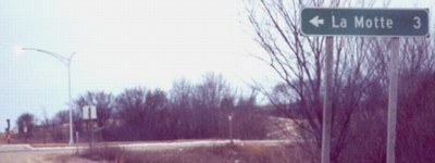
Notice that the Dubuque County sign comes before the intersection, as if the intersection itself was NOT on the dividing line.
Facing north on 61

The day after Labor Day 2008, I completed the alphabetical span of Iowa: from Ackley to Zwingle.
EAST End: Somewhere in La Motte, Jackson County
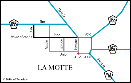
Even as small as La Motte is, finding the end of 246 was not easy or final. In fact, the route of the county road into town may be different from that of 246, too. The 1980 route log includes Spruce Street as a waypoint, a street that doesn't intersect the county road coming in.
Documentation released in 2016 offers a concrete routing: In 1960, the route was specified as Elm, Main, Pleasant, and Union, ending at Main, the dot for photos 3 and 4 below. Weirdly, later entries are directional-only, saying only "easterly, southeasterly, southerly and easterly to Main Street." If you follow that order, it's the same streets. Now we can disregard the question-marked black route in the map, although it doesn't explain the Spruce Street line in the route log.
Pleasant at Union
Yeah, not much there. (#1)
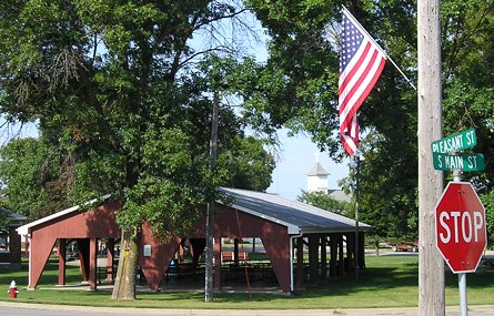
But turning around, facing northeast, there is this nice park shelter. (#2)
The street sign says Main and Pleasant, but it's the southwest corner of the square. The street on the east side is Main Street or Park Avenue depending on where you look.
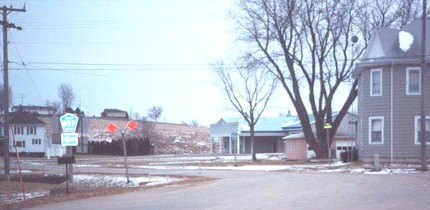
Facing south (#3)
Photo by Jason Hancock
This is another candidate for the end, at the southeast corner of the square. After leaving Zwingle, D57 becomes gravel, and Y61 leaves on the diagonal.
Facing north (#4)
This is on the reverse of Jason's picture (the sign reflected in the flash).
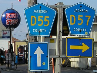
Facing east (#5)
Photo by Jason Hancock
This is at the northeast corner of that square. Jason says, "To the left, facing north, there's an assembly for D55 with a 'Bellevue 15 ->' LGS on the side of the road." Wait, FIFteen? That's not what it showed six years later:
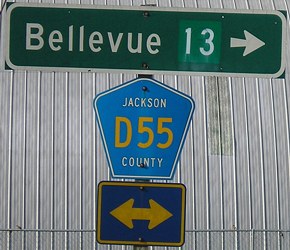
Facing north
Hmm... interesting.
Last seen: 1980 (1981 map)
La Motte didn't want the road, but the State Functional Classification Review Board made it take it about two months after Jackson County had taken it. Since that was over the winter (November 17, 1980, and then January 12, 1981), the route made it onto the 1981 map.
Pictures by Jason Hancock: First-fourth, eleventh, and thirteenth, 12/25/02
Pictures by me: Fifth-tenth, twelfth, and fourteenth, 9/2/08
Page created 2/22/03; last updated 3/17/17