
(January 16, 1934-July 1, 2003)
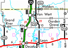
WEST End: Stop sign, US 69, Clarke/Decatur county line
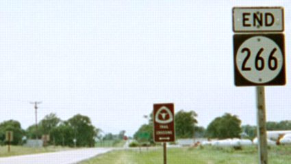
Facing west on 266 (6/15/03)
At the end of its existence, IA 266 was marked on state maps as a bituminous road. J.D. Adams told Jason Hancock that the road's surface is a "glorified seal coating." The 2002 official construction history at the DOT indicates that the road received 2 inches of "Type B Asphalt Cement Concrete" in 1995, with the only other date listed being a bituminous seal coat in 1938.
The brown sign indicates the Mormon Trail crossed here.
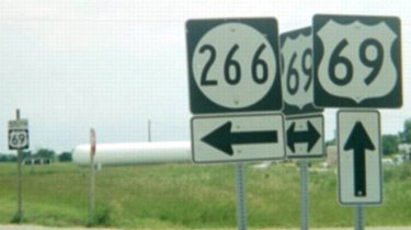
Facing south on 69 (6/15/03)
The rural sign by the right post lists "Clarke-Decatur Road." The line runs across the centerline of the east-west road.
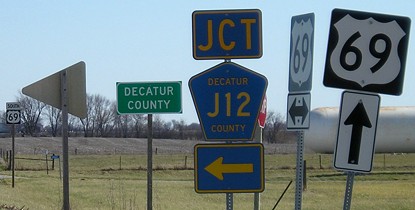
Facing south on 69 (6/15/03)
...but the Decatur County sign is strangely absent. You can see where it is supposed to be on the left.
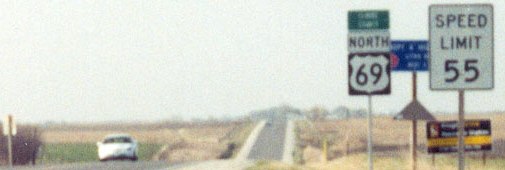
In 2003 I wrote: "The shields here scream 'temporary,' possibly explained by recent asphalting that was done on 69." Well, scratch that - they're still there.
Facing south on 69 (4/16/07)
The Decatur County sign was put up by August 1, 2003, one of the first large county signs in the state.
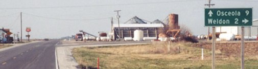
Facing north on 69 (4/14/03)
Photo by Jason Hancock
Facing north on 69 (4/14/03)
Photo by Jason Hancock
There IS a shield for Clarke County, though. The pole at far left is the southbound "Jct 266."
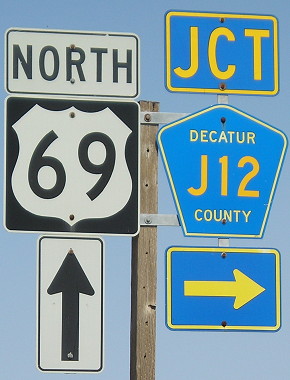
Facing north on 69 (4/16/07)
EAST End: 3rd St., Weldon, Clarke/Decatur county line
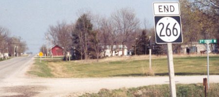
Facing east on 266 (4/14/03)
Photo by Jason Hancock
I once read a collection of "small town" lines that included "You know you're in a small town when Third Street is on the edge of town." Perhaps the author had visited Weldon. The city is only on the south side of the road, fully on the Decatur County side.
Old EAST End (pre-1980): 2nd Ave., Weldon, Decatur County
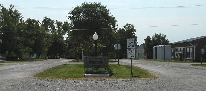
Facing south, but heading east, on 266 (9/13/11)
"Welcome to Weldon - Always Home", but no one was home on a gravel Main Street during the noon hour on a Tuesday. The east end, which was a block ahead of this photo (behind the gazebo mostly hidden by the tree), was dropped from the state system in October 1980.
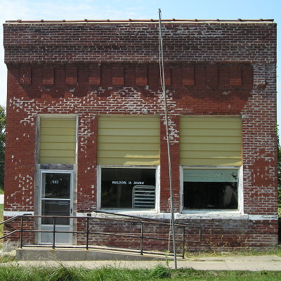
This building in downtown, deep background of the above photo, used to house the post office, until it moved north to the blacktop. That cookie-cutter post office, in turn, was on the list of anticipated closures. (9/13/11)
Last seen: 2003
Page created 7/27/03; last updated 7/31/07 5/28/18