
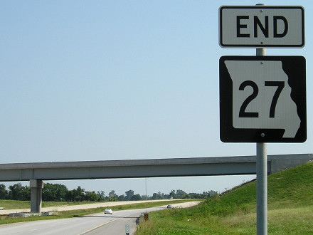
NORTH End: Minnesota state line, on I-35, Worth County IA/Freeborn County MN
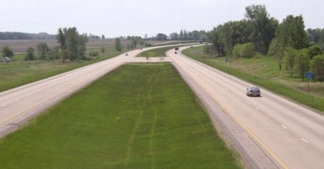
Facing north on 35 (3/19/07)
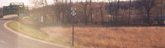
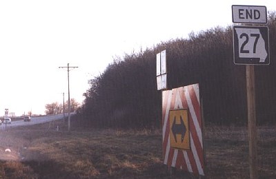
There is no specific "End 27" sign; the last northbound one is four miles south at County Road 105.
View of same from southbound lanes (7/26/16)
From this point, it is about 260 miles to I-35's north end in Duluth - and more than 320 miles to Kansas City.
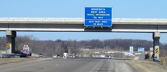
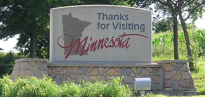
Closeup of first signs in Minnesota (3/19/07)
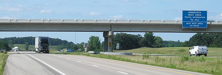
Facing north on 35 (5/17/04)
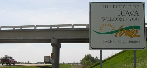
This view of Minnesota is from the bridge on State Line Road. The "Welcome to Iowa" side is actually on this, the north side, of the bridge, to the left of the No U-Turn sign (see below).
Facing south on 35 (5/17/04)
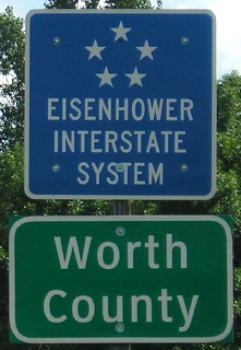
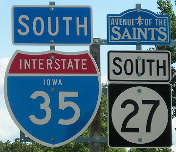
Turn around on the bridge and you see the interstate's entry into Iowa. At far right are the Eisenhower Interstate System and Worth County signs. At center right are the first shields in Iowa.
Facing south on 35 (7/26/16)
Facing south on 35, Minnesota side of the bridge (5/17/04)
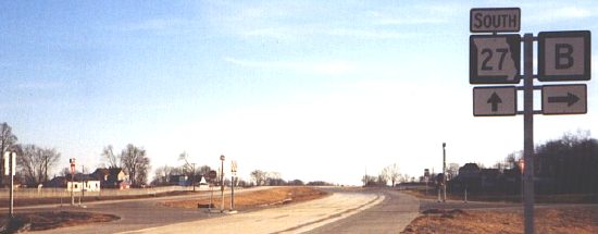
Facing south on 35/27 (7/26/16)
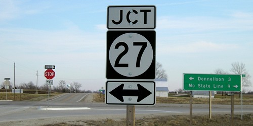
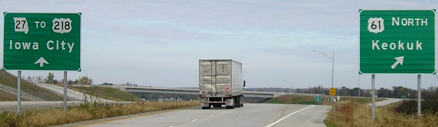
In summer 2001, the Iowa DOT began to mark the route of the Avenue of the Saints as IA 27, since the avenue follows different highways - IA 394, US 218, I-380, US 20, IA 58, US 218 (again), US 18, and I-35. About 272 miles after seeing the shields above, southbound IA 27 drivers will encounter the following:
Split with US 218
Facing south on 218/27 (10/25/08)
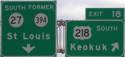
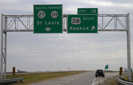
Ten miles north of the Missouri line, US 218 and IA 27 join/split for the first/last time. In an Iowa highway first, "Former 394" was added to signs at the interchange near 394's old north end. This sign is a bit misleading, because while 27 is the mainline, numbering for 218 should take precedence. As it is, 218 is exiting from itself with its own exit number.
Facing south on 218/27 (10/5/08)
"Former 394" has since been taken off. The left BGS now has a blank space at the top and "South" is beside the "27".
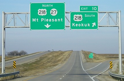
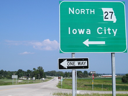
Facing north on 27 (12/18/06)
Here's a good view of the opposite direction. Notice the difference in exit numbers, and the right-aligned exit tab in the background. Additional pictures of this area throughout the decade, including the current view of this interchange from the cross road, can be seen on the IA 394 North page.
Facing east on J62 (12/18/06)
Here's a rare sight: A "Jct 27" without another shield beside it. This is about two miles south of the interchange with 218. Right behind the camera is the old IA 394 two-lane; the four-lane deviates from it north (left) of here and also at Argyle.
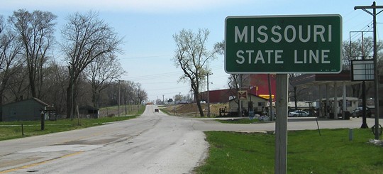
SOUTH End: Missouri state line, St. Francisville MO, Lee County IA/Clark County MO
Facing south on 27 (12/24/04)
Photo by Jason Hancock
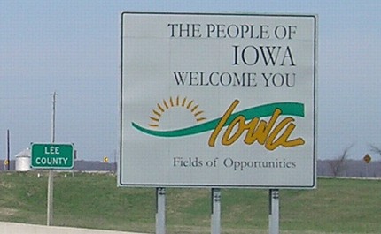
It didn't take long for a welcome sign to appear in the Fireworks State:
Facing south on 27 (10/25/08)
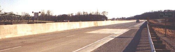
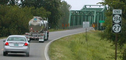
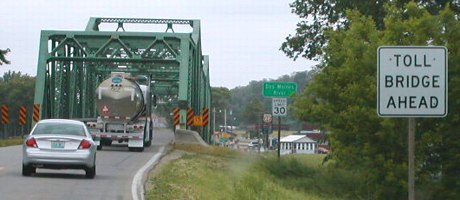
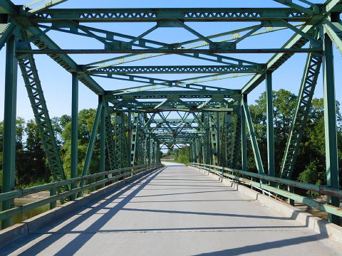
Old bridge visible from the new (4/20/08)
Facing south on MO 27 (12/24/04)
Photo by Jason Hancock
The first MO 27 sign is at the junction with Route B, which was realigned to the west of St. Francisville (instead of going through town and ending at the toll bridge). There is one interchange with US 136 at Wayland, and then 27 ends at US 61.
Facing north on 27, Missouri side (12/24/04)
Photo by Jason Hancock
Facing north on 27 (12/24/04)
Photo by Jason Hancock
Facing north on 27 (12/24/04)
Photo by Jason Hancock
At the end of 2004, the four-lane ended half a mile north of the state line. The next summer, the gap south of Donnellson was closed, and within 18 months, the entire Avenue of the Saints was completed in Iowa.
Facing north on 27 (4/20/08)
Old SOUTH End: Toll bridge, Missouri state line, St. Francisville MO, Lee County IA/Clark County MO
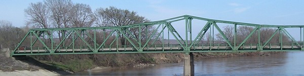
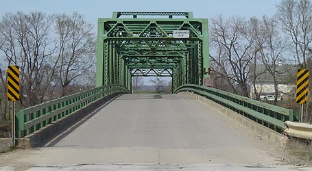
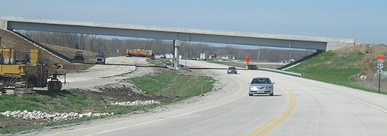
On May 23, 2006, the entire route of IA 27 opened to four lanes. Originally, IA 27 ended as a two-lane road with IA 394 at an old toll bridge into Missouri. Ironically, on April 14, 1937, the Iowa Highway Commission said it did not "see its way clear to request" a federal-aid road running due south from US 161 (now 218) to St. Francisville; 70 years later, it's part of a major four-lane corridor.
Facing south on 27/394 (6/5/02)
Photos by Neil Bratney
To my recollection, the End sign was not posted in March 2002. Jason Hancock's visit in April 2004 confirmed the disappearance of 394 as a signed route.
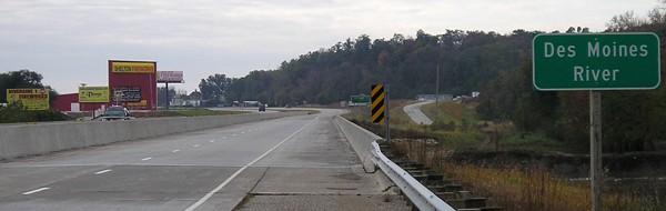
Facing south on 27 with new bridge visible at far right (4/4/04)
Photo by Jason Hancock
As planned for the freeway, 27 became the only number on what was 394, and 218 itself will go down to its current two-lane diagonal to its end at US 136 in Keokuk - creating a very visible gap in Iowa's expressway system with two north-south four-lanes having no similar connection between them at their closest point.
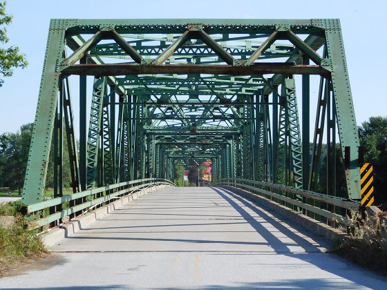
Facing south on 27/394 (7/12/16)
On September 6, 2016, the old bridge was closed after MoDOT bridge inspectors raised concerns about the support piers.
Facing south (4/20/08)
Facing north (12/24/04)
Photo by Jason Hancock
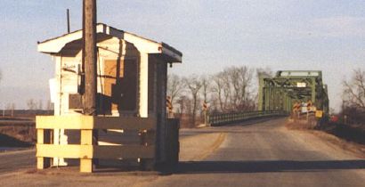
At the end of 2004, the toll booth in Missouri was closed because the four-lane bridge had opened, but the toll bridge itself was still driveable.
Facing north (4/20/08)
Facing north (7/12/16)
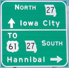
SOUTH End of MO 27: Interchange, US 61, Clark County MO
Facing east on 136 (8/12/09)
US 136 is the only highway MO 27 intersects before ending at US 61.
Facing south on 27 (10/25/08)
Facing south on 27 (8/12/09)
Facing south on 27 (8/12/09 and 10/18/16)
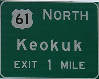
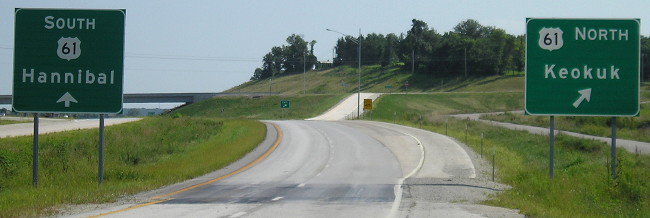
Facing north on 61 (10/25/08)
Facing north on 61 (4/20/08)
At the time this picture was taken, Missouri had not completed four-laning US 61 in the northeast corrner of the state. US 61 was detoured on 27 and 136 to finish the interchange here.
Facing north on 61 (10/25/08)
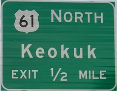
Finally, finally, Iowa City and Keokuk get named on BGSs in Missouri. With the completion of the Fort Madison bypass, US 61 has only a 12½ mile two-lane gap between the St. Louis area and far southwest Wisconsin, although parts in Burlington and Dubuque are urban arterials with stoplights.
Facing east, but heading north, on 61 (8/12/09)
Facing east, but heading north, on 61, after 61 leaves the four-lane (10/25/08)
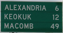
This tri-state mileage sign gives a distance to Macomb, Illinois. Before MO 27 was designated and the Avenue upgraded to four lanes, Missouri signed a pseudo-duplex of 136 with 61 from their split at the state line to Spur US 136 south of Wayland (see the IA 394 South page).
Old SOUTH End of MO 27: Intersection, US 61, Clark County MO
Facing south on 27 (12/24/04)
Photo by Jason Hancock
Jason writes, "The four-lane MO 27 ends about a mile north of its south end, and 27 joins the alignment of the former US 136 spur." The location of the interchange and former intersection are virtually the same.
Facing south on 27 (12/24/04)
Photo by Jason Hancock
After being in Missouri for about 7½ miles, you can go right back into Iowa.
Facing south on 27 (12/24/04)
Photo by Jason Hancock
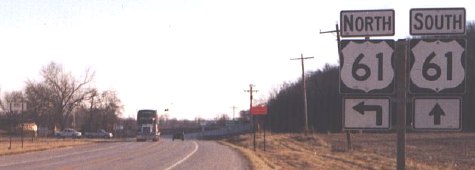
This is the north end of the intersection with US 61; there is a dominant NB-EB curve. (If the curve is the hypotenuse, this intersection is the right angle.) The 27 designation ends as it hits the Avenue of the Saints' last route (unlike a certain other state's...) as the connection continues south on 61.
Facing north on 61 (4/4/04)
Photo by Jason Hancock
In December 2001, the shield at left was IA 394. My picture of the same assembly at that time is on the IA 394 South page. More photos of the area are on Jason's Avenue of the Saints page.
Same assembly (12/24/04)
Photo by Jason Hancock
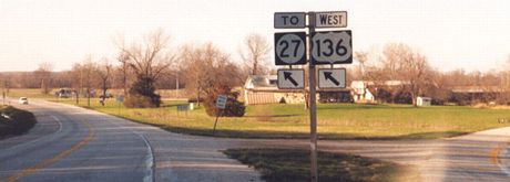
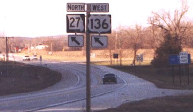
Despite the break in the former spur, and despite the fact that this road has its own number now, this sign tries to insist that 136 and 27 share the road. In reality, a "To" needs to be on top of or in place of the "West".
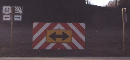
Facing west on "61" (short access road to 27) (12/24/04)
Photo by Jason Hancock
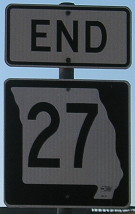
"End 27" is at far right.
Page created 5/31/02; last updated 4/15/07 3/5/17
Jason Hancock's Avenue of the Saints photo galleries: North / South