
WEST End: South Dakota state line, 2 miles west of Westfield, Plymouth County IA/Union County SD
Facing west (7/20/12)
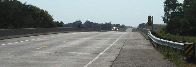
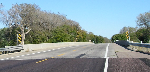
A new bridge across the Big Sioux opened May 24, 2010, replacing one built in 1957 and visible in Neil's photos below.
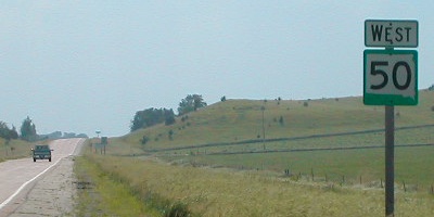
Facing west on SD 50 (7/20/12 and 6/18/02)
Right photo by Neil Bratney
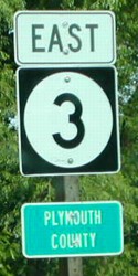
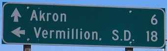
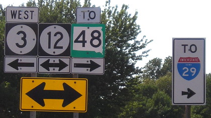
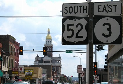
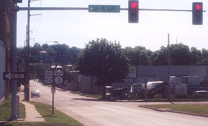
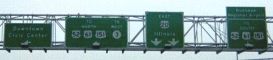
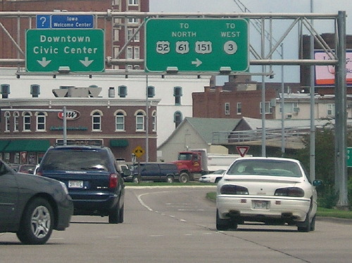
This, obviously, is on the South Dakota side of the Big Sioux River. Highway 3 ends at the bridge (see below) and joins IA 12 just over a mile to the east. South Dakota actually has somewhat of a system for its major highways: East-west roads start with SD 10 in the north and work down to SD 50 in the southeasternmost part of the state, west of Plymouth County. North-south roads start with odd numbers below 20 (11, 13, 15) on the east side and work over to SD 79 and 89 in the northwest and southwest parts, respectively. (In South Dakota's numbering scheme, US 12 and 85 are in the right places there too!) Notice the Butt-Ugly Kansas-Style signage, which is spreading through Iowa like the plague.
Facing west on SD 50 (9/30/15)
Facing east on SD 50 (9/30/15)
Facing east on 3 (6/18/02)
Photos by Neil Bratney
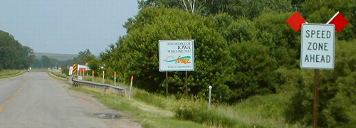
Entering Iowa, the speed limit goes from 65 to 55 (whether anyone pays attention is a different story). The fun technical tidbit here is that the "Speed Zone Ahead" doesn't appear until you've entered Iowa, so in that short distance to the "Speed Limit 55" you can make the argument that the speed limit is 65, at least eastbound.
Surrounding area information: South junction IA 12, just north of Westfield
Facing east on 3 (7/20/12)
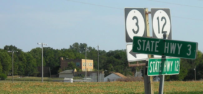
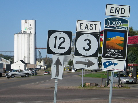
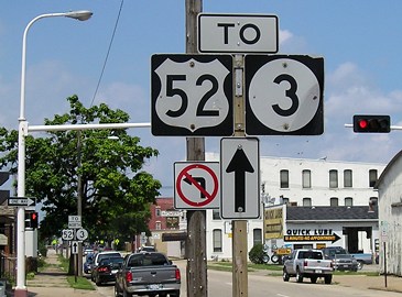
This is the westernmost intersection of state highways in Iowa. It's roughly on line with 84th Street in Lincoln, Nebraska.
Facing north on 12 (6/14/04)
This intersection is about 1¼ miles east of 3's entrance into Iowa.
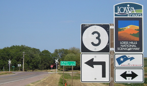
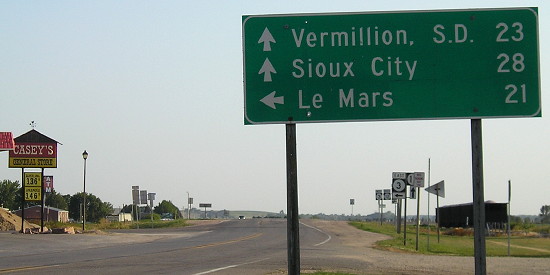
On the Iowa side, it would appear more logical for 3 to leave Akron and cross into South Dakota there, instead of a 5-mile duplex with IA 12. (It also helps make IA 3 the longest state highway.) Looking at the South Dakota side, though, it makes a bit more sense because SD 50 is four lanes west of I-29, and goes to Vermillion and Yankton. From this intersection, Vermillion is 5 miles closer than Sioux City. That also means the Akron-Westfield football team would be much closer to home playing in the Dakota Dome (less than 20 miles from here) instead of the UNI-Dome.
Facing north on 12, south of the intersection with 3 (6/14/04)
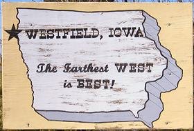
Westfield, pop. 189, is so far west the star here looks like it's off the map. It is the westernmost town in Iowa; in comparison northwest Sioux City is 6 miles east of this location.
The lights are off and no one's home at the abandoned Westfield school, visible from the intersection. (7/20/12)
Surrounding area information: North junction IA 12, just south of Akron
Facing south on 12 (7/20/12)
That "East 3 <-" with no indication of westbound 3 continuing ahead used to be a correct left-and-ahead arrow set. Also pictured(ish): the westernmost Casey's in Iowa, now replaced by a new one across the street.
In approximately 1948, the approach of the east-west road to Akron was changed to its present status. Before then, the route (first as IA 5, then as IA 5 and 3) entered Akron from the southeast and went through town to end at IA 12 on Reed Street, where there used to be a bridge into South Dakota. IA 12, which at creation ended in Akron, remained gravel until the 1950s.
A proposal to have IA 3 bypass Akron entirely, and instead junction IA 12 due west from its current east-west segment nearby, was scrapped in the late 2000s.
Facing west on 3 (7/20/12)
I-29 is 13½ miles from here via SD 48 - but in South Dakota, not Iowa, despite what the small text says.
Facing north on 12, but heading east on 3 (9/30/15)
Future EAST End: City limits of Dubuque, Dubuque County
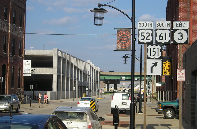
The Southwest Arterial has been a long-desired connector in Dubuque, running from US 20 to US 61 in some manner, but money and topography have been its enemies. In 2013, Dubuque made a significant offer to the DOT: Complete the arterial and the city would take over IA 32 and also the surface one-ways of US 52/IA 3 north of downtown. The DOT agreed. When the plan is executed, which at this point is years in the future, IA 3 east of Luxemburg will become a really long spur or. Its east end will be in the vicinity of the present IA 32 intersection.US 52, meanwhile, will be routed over IA 136, US 20, and the Southwest Arterial onto a wrong-way north-south multiplex with US 61/151. US 52 will touch the south side of Dubuque, from the new Seippel Road interchange along the connector then north to its current stoplight with 61/151, where it will go south again.
Unofficial EAST End (June 22, 1945-August 21, 1982): Stoplight, old US 61/151/20th St., Dubuque, Dubuque County
Previously, based on sufficiency logs and some educated guesses, I believed that IA 3 had four different endpoints since its creation in 1945. The mid-2010s online publication of primary route descriptions, however, indicated that either I was very wrong OR there was a glaring decades-long discrepancy between IA 3's end in the primary road sufficiency logs and its legal end. Without photos of the time it is impossible to tell to which intersection IA 3 was signed, US 61/151 (at either intersection) or US 20.
Although you couldn't tell from the state maps, IA 3 legally extended all the way down to US 20 since at least 1948. However, every route log until 1982 ended at 20th Street, which was where US 61/151 came to/from Wisconsin via the Eagle Point Bridge. Then there is an extension to the 9th/11th street pair, where 61/151 split to go to the new bridge. So, we have five points to look at: The two places where the sufficiency logs stop, the place where the primary route description ends, a temporary endpoint while the final link in the US 61/151 freeway was constructed, and the endpoint that exists until 52/3 inside Dubuque is turned over. Finally, a sixth point, outside the time scope of this website, is nonetheless the most important intersection in modern-day Dubuque.

This series of maps details the history of highways in Dubuque. The points below work southward, ending at the presumably earliest end.
Facing southeast, but heading east, on 3 (8/7/10)
A map book detailing every highway route in the state in the late
1930s clearly and unambiguously shows the end of IA 10 at the
intersection of Central and 20th. But no later than 1948, which is the
first available entry in the online
route description, IA 3 was extended down to Dodge Street.
In 1957, 3's east
endpoint moved a block west, from Locust Street at Dodge Street to
Bluff Street at Dodge, when Dubuque implemented a one-way street system
downtown.
Unofficial EAST End (August 21, 1982-January 28, 1991): Stoplight, US 61/151/11th Street, Dubuque, Dubuque County
1983 Primary Road Sufficiency Log
Facing southeast, but heading east, on 3 (8/9/07)
In 1982, the new 61/151 bridge to Wisconsin opened, and IA 3 once again ended (or "ended"?) at the junction with those highways. Ahead would have been southbound 52/61/151.
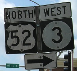
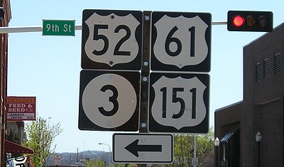
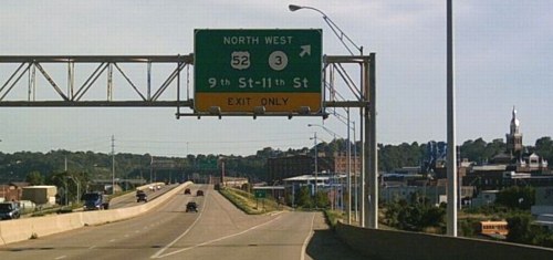
Facing northwest on White at 9th (8/9/07)
IA 3's west beginning was considered to be White at 9th, where northbound 61/151 took a right turn.
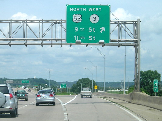
Facing northwest on White at 9th (9/16/15)
The direction situation was clarified greatly years after the above picture was taken, likely because of the conversion to two-ways.
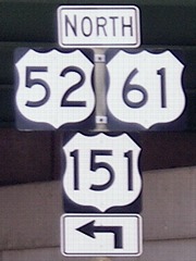
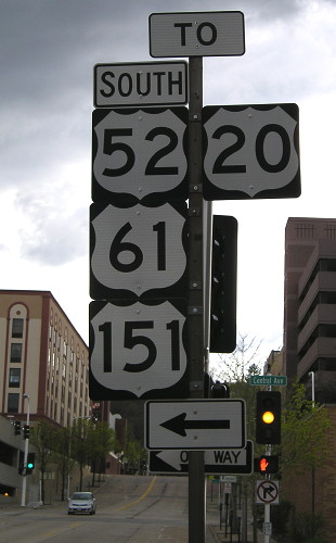
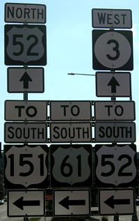
Facing northwest on White at 11th (8/9/07)
The "To" signs are on top because 52/3 does did not get on White until after 11th. (Now, however, since you can travel west on 9th, White between 9th and 11th carries northbound 52 if you are following the route uninterrupted.)
Facing southwest on 11th at White (8/9/07)
Old EAST End (January 28, 1991-August 19, 1993): Partial interchange, US 61/151 and 4th Street, Dubuque, Dubuque County
Facing northeast on 4th (8/9/07)
If you continued down Central between early 1991 and mid-1993, you would have joined the new expressway at its 4th Street beginning. Today, this sign is visible on eastbound 4th - notable because it has Series D numbers like Wisconsin, and a squat arrow like Wisconsin. Based on route logs, this point was never an end of 3, but based on the primary route description, it absolutely was:
Beginning on Central Avenue at the north corporation line; thence southeasterly on Central Avenue to 21st Street (begin one‑way southbound); thence continuing southeasterly on Central Avenue to 4th Street (end one‑way southbound). —1996 description of 1991 realignment
Facing south-southeastish on Central, but heading east on 3 (8/9/07)
This is where the surface street merges with the short at-grade segment of 51/61/151 that opened in 1991.
Facing north on 52/61/151 (6/18/15)
For a year and a half all traffic exited here, then proceeded to White Street, which would have been the beginning of 3.
Facing west on 5th at Central (5/4/13)
This is one block north of where that temporary end of 3 would have been. After one block to the left, Central becomes an onramp.
Future EAST End: Interchange, US 61 and 151, Dubuque, Dubuque County
Completion of the Southwest Arterial was contingent upon Dubuque taking over the surface streets for 52/3.
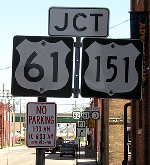
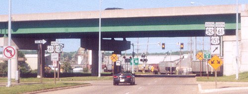
Old but still signed EAST End: Interchange, US 61 and 151, Dubuque, Dubuque County
Facing southeast on 52/3 (4/18/06)
Why yes, that IS a feed store in the middle of Dubuque, Iowa, and that IS a horizontal stoplight. This is was a one-way to one-way turn, and I feel sorry for the semis that have to make it. There should be a "To" on the right side.
Facing northeast on 52/3 (4/18/06)
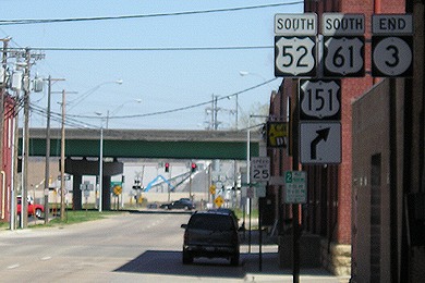
Facing northeast on 52/3 (4/18/06)
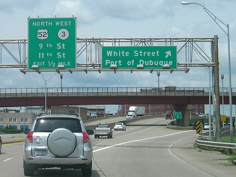
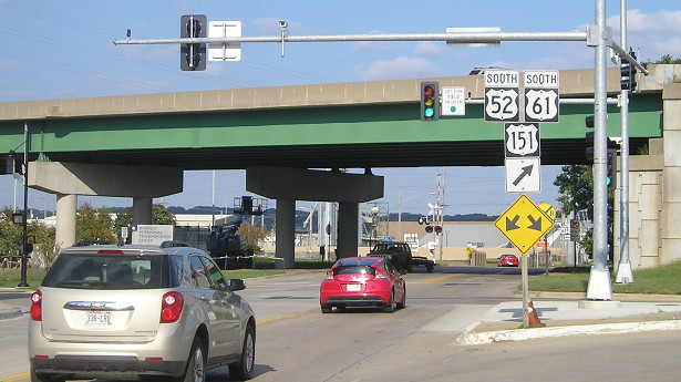
This picture is just before 52 joins the 61/151 freeway, north of their intersection with US 20. In August 2014, 9th and 11th streets were converted from one-ways to two-ways but 52/3 remain unchanged and the official directions for northbound 52/westbound 3 changed, but only if you were exiting from northbound 52/61/151.
Facing northeast on 52/3 (9/16/15)
Parking meters? Old manufacturing buildings stripped to the bricks and turned into housing? Fancy lighting in a "district"? This area of Dubuque has been invaded by hipsters! (On the plus side, new parking garage.)
Because this street is a two-way street now, this is also the official start of westbound 3. The highways then turn north from 9th to White, making White between 9th and 11th a carrier for northbound 52/westbound 3 that it wasn't before.
Facing northeast on 9th Street (5/26/02)
Photo by Jason Hancock
The orientation of Dubuque's streets is skewed to the river downtown, so this picture is actually a bit northeast of the above picture. This is right at the onramp. The black car is at (or very near) the official end of 3.
Facing northeast on 9th Street (9/16/15)
What to see in comparison with the 2002 picture: There's no stoplight on the other side of the bridges, nor a medium green sign pointing to 61/151 north. Instead, the stoplight is in the foreground, with "Left Turn Yield On Green" showing that you can turn left vs. the "No Left Turn" in 2002.
Facing west, but heading south, on 61/151 (4/18/06)
The first exit in Iowa from Wisconsin is on an island. When coming in on the bridge, Illinois is only about 3000 feet to the south, though to get there you would've had to take the previous exit (WI 35). The offramp in the picture above meets Kerper Boulevard only after becoming 16th Street and crossing the Mississippi on the west side of City Island. The sign for northbound traffic is for the rest area in Wisconsin (see below).
Facing south on 61/151 (7/31/05)
Photo by Jason Hancock
That's the Dubuque County Courthouse at right.
As of mid-2014, if you take this exit, one lane of westbound 11th Street remains, officially, a connector from southbound 61 to northbound 52.
Facing north on 61/151 (6/18/15)
In the all-one-way configuration, eastbound 3 ended on 9th Street, but westbound 3 began on 11th. The mile marker is US 52's since it is the lowest-numbered route between this point and its split on the south side of Dubuque, though I think US 61 would have been better for continuity purposes. (The exits aren't numbered, so it doesn't matter as much.)
Photo by Jason Hancock (5/26/02)
Jason says this is where the off-ramp intersects 9th Street, the (now-former) one-way running northeastward. Obviously, it's a lot harder to change the exit/entrance ramp configuration that it is to repaint surface streets, so the exit itself remains split.
Facing southwest, but heading west, on 11th Street at Elm Street (8/23/20)
These signs, along with all the others for 52/3 in downtown Dubuque, remained after the opening of the Southwest Arterial. Removal of the signs was delayed because sign crews were otherwise preoccupied after the August 2020 derecho.
Facing (south)west on 11th Street (5/26/02)
Photo by Jason Hancock
Three blocks from here, 52 and 3 turn onto White Street. This sign pair was out after 11th was converted to two-way.
Old EAST End (October 2, 1957-January 28, 1991): US 20/Dodge St., Dubuque, Dubuque County
Facing south on Bluff Street (7/31/05)
Photo by Jason Hancock
Previously written: The route log dated Jan. 1, 1991, doubles 3's length inside Dubuque and adds a mess of one-way streets, but its length is reduced again the next year, indicating that 3 only ended at 20 for a few months. Jason writes, "After US 20 was reconstructed west of downtown Dubuque in 1996, this intersection was changed so that Bluff Street merges into eastbound US 20. This is a 'wayfinding' sign on Bluff just before the merge."
But, given the issues in the route logs detailed above, who knows?
Because of the layout of Dubuque's streets, this old east end is farther west than its current east end, but during that time it was not the easternmost point of IA 3 - that point, geographically, would have been the intersection of 4th and White, about 1000 feet farther east than this intersection.
Facing south on Bluff Street (7/31/05)
Photo by Jason Hancock
If southbound Bluff merges into US 20, where does that northbound lane come from? Behind the camera, if you take the last left turn, that road will loop around, paralleling Locust and 20 before coming back here.
Facing east on 20 (5/4/13)
Facing east on 20 (1/31/03)
This is the signage at Locust Street, which is an at-grade intersection used to connect 52/61/151 to 20. The mainline 52/61/151 does not have a direct connection. A left turn would put you on Locust and the beginning of IA 3. Having the documented end of the route be at 20 would have given clearance for IA 3 to be signed here, and then "To 3" later on.
Facing north on 946/Locust (8/10/07)
The beginning of IA 3 would have been straight ahead from here, just east of Bluff.
Facing north on 946/Locust (8/9/07)
This picture, taken from the south side of the intersection, shows the BGSs on the north side. The lane with the blue van becomes Locust Street north, the official start of IA 3 before the expressway was built; the right lane turns to intersect 52/61/151 at a stoplight, where a driver goes north to see exits for White Street and then 9th Street.
Points of interest
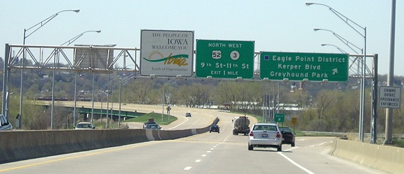
After junction with US 71, Buena Vista County (3/21/03)
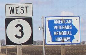
Iowa 3 is known as the "American Veterans Memorial Highway", a designation it received in the mid-1990s. Signs are posted sporadically across the state.
Strange but true: Although IA 3 between Cherokee and Pocahontas is a part of one of the straightest stretches of road in Iowa - the official "longest straight" stretch begins just east of the Cherokee/Pocahontas line and goes to US 69 east of Clarion, I believe - as late as the late 1930s there wasn't a road connecting the two county seats! A new highway, 221, was finally built between the two and then in 1945 the present IA 3 was commissioned across the state.
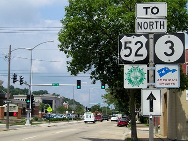
Until completion of the Southwest Arterial, I saw no real reason for 3 to continue past Luxemburg, other than to make it a full "cross-state" route. In Luxemburg, 52 changes from a southerly direction to an easterly one, and although it's in 3's direction, there's really no reason for 3 to come along. Past that intersection with US 52 and IA 136, 3 never gets its own route again.
However, it WAS the primary route along that road for just under four years, between December 1963 and October 1967, when the road's condition was so bad US 52 was routed through Dyersville on IA 136 and US 20. The businesses in northern Dubuque were peeved (to put it mildly), demanding and getting an Alternate 52 designation until the original route was restored.
Page created 12/16/01; last updated 10/29/20