 NORTH
and
NORTH
and  SOUTH at
  and
and 
NORTH End of 32 (September 13, 2002-present)/
SOUTH End of 386 (September 13, 2002-July 1, 2003):
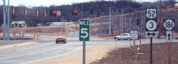
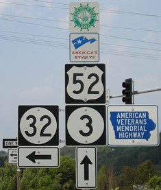
Stoplight, US 52/IA 3, Sageville, Dubuque County
Odd.
That about expresses my thoughts when Jason Hancock sent me these pictures. Although all were put up at (near?) the same time, there are quite a few differences between similar signs and everything just seems...a bit off. See if you think the same, and then compare the 2002 sign sets to the 2008 assemblies. Clockwise from about 7 o'clock:
End 32
Facing northeast, but heading north, on 32 (12/24/02 and 9/2/08)
Left photo by Jason Hancock
Here, the numbers are uniform, but small. The green sign didn't have the normal sign font.
Facing northeast, but heading north, on 32 (9/2/08)
Facing northeast, but heading north, on 32 (12/24/02)
Photo by Jason Hancock
Since IA 32 is a four-lane highway for its entire length, it has freeway-style mile markers.
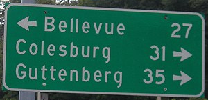
Facing northeast, but heading north, on 32 (9/2/08)
Notice that Bellevue is listed instead of Dubuque, even though we are not in Dubuque yet.
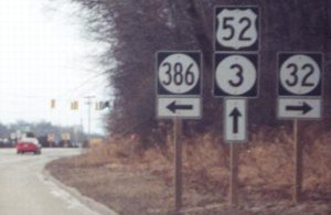
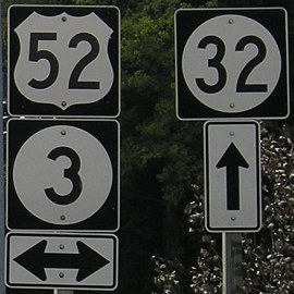
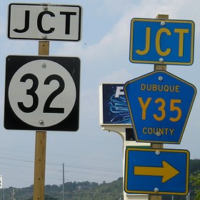
52/3 South/East
Facing southeast on 52/3 (12/24/02 and 9/2/08)
Left photo by Jason Hancock
Compare this sign to the one on US 65 NB at 330 and 117. Here, missing black borders around shields notwithstanding, the "Junction" seems too small, and the differing font sizes are weird. The white "Jct" in the right photo looks off too.
Facing southeast on 52/3 (9/2/08 and 12/24/02)
Right photo by Jason Hancock
Small arrows, a different-style US shield, and is there a bracket shortage?
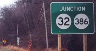
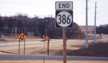
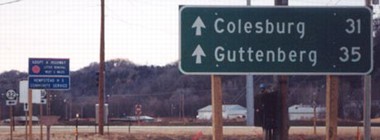
End 386
Facing southwest on 386 (12/24/02)
Photo by Jason Hancock
Back to all little numbers again.
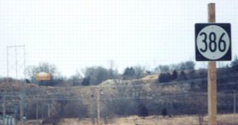
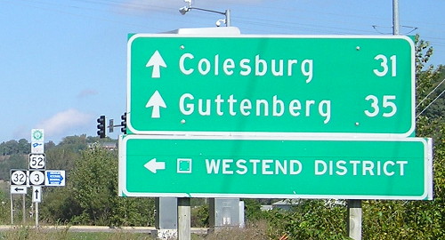
Closer view (9/28/15)
Facing southwest on 386 (12/24/02)
Photo by Jason Hancock
Can you spot the sign goof in this picture?*
Facing southwest on 386 (9/2/08)
Facing northeast on 386 (12/24/02)
Photo by Jason Hancock
Turn around from the above picture and you will see this. Although it appears someone intended a directional marker to be placed, there wasn't one, which left 386, as Jason says, "with a grand total of zero directional markers on the entire route." This is due to the fact that 386's "north" end was southwest of its northernmost point, and in fact both ends faced southwest.
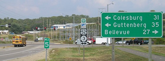
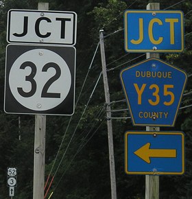
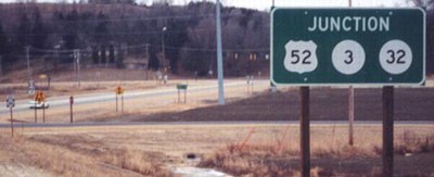
52/3 North/West
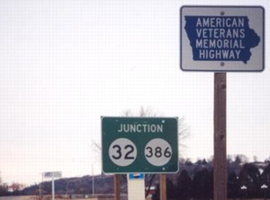
Facing northwest on 52/3 (12/24/02 and 9/2/08)
Photo by Jason Hancock
The American Veterans Memorial Highway designation is for 3. Just like southbound, there's a size difference on the "Junction" sign.
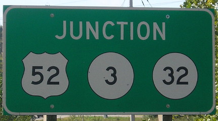
Facing northwest on 52/3 (12/24/02)
Photo by Jason Hancock
Perhaps it's an illusion, but there seems to be more space between letters and around the outside than usual.
Facing northwest on 52/3 (9/28/15)

Facing northwest on 52/3 (12/24/02 and 9/2/08)
Left photo by Jason Hancock
...for a grand total of one bracket (previously zero), and 100% small single-direction arrows, at this intersection.
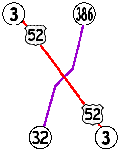
To the IA 32 South End / To the IA 386 North and former South End
Page created 2/27/03; last updated 4/9/09 4/7/20
*The yellow sign says "Divided Highway Ends" while the division is actually beginning; notice the "Keep Right" sign.