
(June 4, 1935-July 1, 2003)
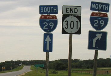
WEST End: I-29 exit 95, Harrison County
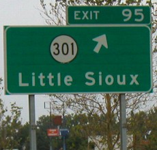
Facing west on 301, pre-decommissioning
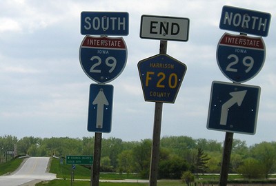
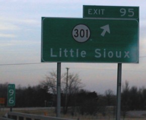
Facing west on 301, post-decommissioning
This interchange is closer to Council Bluffs than Sioux City, but the next one north is closer to Sioux City than Council Bluffs. The ten miles between this interchange and the next one, E60 (the Blencoe exit), is the longest distance between interchanges in Iowa. Oddly enough, one segment tied for second place is on I-35, US 30 to IA 210, between Ames and Des Moines. (The official halfway point between Sioux City and Council Bluffs is Mile 101, near the Monona/Harrison line.)
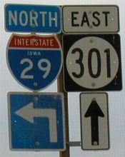
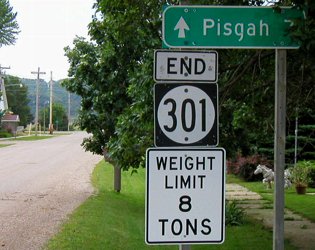
Facing east on 301 (first sign eastbound)
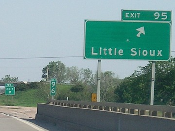
Facing north on 29
The remains of a Stuckey's are in the background of the right picture. The road to the west ends right after the interchange.
Facing south on 29
Photo by Neil Bratney
The interchange is at the northernmost part of the 95th mile.
Facing south on 29, post-decommissioning
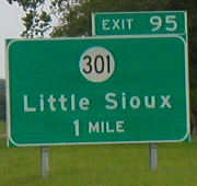
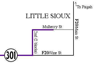
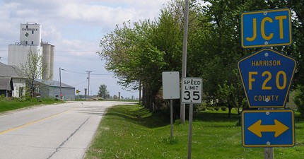
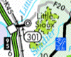
EAST End: Between 3rd and 4th streets, Little Sioux, Harrison County
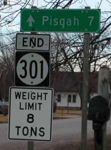
Facing east on 301: February 2002 (with mailbox, sans foliage) / June 2003 (sans mailbox, with foliage)
Left photo by Neil Bratney
Neil writes, "IA 301 eastbound does a quick left turn and right turn inside Little Sioux." Mile marker 2 is on the pole with the second turn, but neither of my turn pictures were in focus. Today, that pole is gone. Prior to decommissioning, the junction of F20 was not signed in town; that has changed, at least for southbound Second Street approaching Vine.

Secret IA 986 was a piece of US 75 that, for whatever reason, stayed on the state rolls long after the surrounding roads were turned over to the counties. Elsewhere, old 75 north of Mondamin was peeled off going northward - the segment north of Onawa to the Woodbury County line was gone in 1980, and it was nearly completely gone (save for a few hundred yards) by 1996. The north end was at the county line:
Facing south at beginning of 986
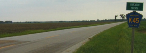
This Harrison County marker (without a corresponding Monona) is the only signal this was a state-maintained road at one time - that, and the perhaps original pavement.
Facing south at end of 986 (June 2003)
This is the only state sign on the route, here at the south end at the intersection with 301 (hence it being on this page). Because it was 75, the traffic for 301 stops at a county road.
Facing south on 986 (May 2006)
Three years later, the sign in the above picture has completely washed out. There was no "Jct 301" here earlier.
Last seen: 1985 (986) (1981 map) / 2003 (301)

Pictures by Neil Bratney: Sixth and seventh, 2/23/02
Pictures by me: First, third-fifth, and ninth-eleventh, 6/1/03; second and twelfth, 5/7/06; eighth, 5/13/07; map, 7/10/06
Page created 4/11/02; last updated 1/20/08