
(June 4, 1935-April 16, 2003)
Facing southeast (10/3/16)
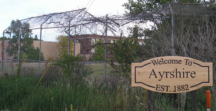
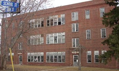
I'm going to skip ahead to the end here: Coming across the Ayrshire school on my first big Iowa road trip was an awakening of sorts. It made me realize that there were far more towns in Iowa with old schools than I was aware of. It also made me think that someone needs to be taking photos of them for history, and I could be that person, or at least one of them.
The combination in this photo of a town welcome sign and an abandoned-for-decades baseball diamond with an old school in the background is haunting in a way. On the one hand, it's putting on your best welcoming face; on the other, it's an inescapable sign of a better past. Ayrshire lost its school exactly a century after it was founded.
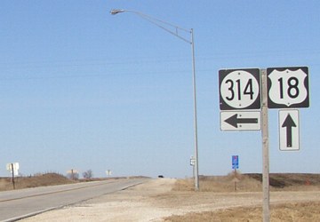
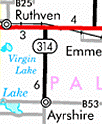
NORTH End: Stop sign, US 18, Palo Alto County
Within a month of taking these pictures, the signs came down on the date above. Palo Alto County orginally accepted the road Dec. 3, 2002, and Ayrshire on Dec. 13; the highway commission voted to transfer it Jan. 14, 2003.
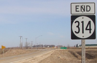
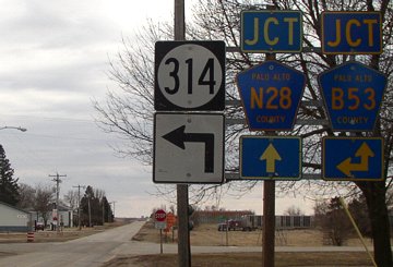
Facing north on 314 (all north end 3/22/03)
Facing north on 314
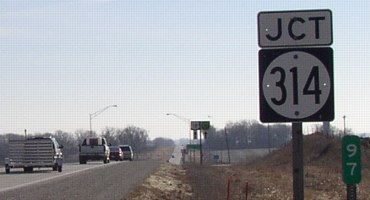
This will probably be the first mileage sign the county replaces.
And in the background, a photogenic representation of a hog lot. :-|
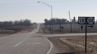
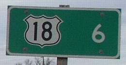
Facing west on 18
Notice the Hiawatha Pioneer Trail sign with 18 in the background.
Facing west on 18
Facing east on 18
Facing east on 18
Facing east on 18
Ready for its closeup...
The 1999 film The Straight Story is based on a true story about a man who drove his lawn mower from Laurens to Mt. Zion, Wisconsin, to see his brother. At least one draft of the screenplay puts some scenes as taking place on "Iowa County Highway 314" and then "Iowa Hwy 314 at Grotto sign". Unfortunately, films being notorious for direction and sign errors, 314 isn't on the way from Laurens to the Grotto of the Redemption near West Bend. (Later the screenplay mentions Highway 18.)
SOUTH End: Old C&NW railroad tracks, Ayrshire, Palo Alto County
Photos with 314 shields and brown ground taken 3/21/03; later photos taken 10/3/16.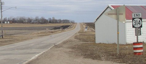
Facing east, but heading south, on 314
Before getting to its end, 314 took a turn to go through Ayrshire's business district and it ends where railroad tracks used to be, not unlike other highways in the area. The two concrete strips on the road in the foreground have to be where railroad tracks were. The white building is right on the tracks. A shield for B53 is in the middle background.
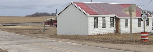
Facing southeast
This picture gives a different view, showing the concrete strips running at an angle through the road and into the white building. When the shields were removed, the entire barrel was probably taken out.
Facing west, but heading north, on 314
Facing west, but heading north, on 314
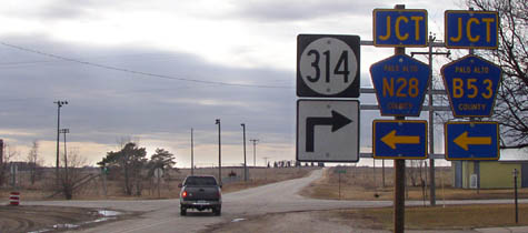
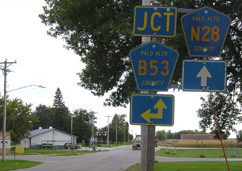
In this direction, B53 is marked as starting here instead of secretly duplexed with 314, as it is in the other directions. Ahead is a paved road for three miles. Under the 314 arrow you can see a green sign; it says "Highway to Heaven", and someone at the newsgroup misc.transport.road informed me it leads to a cemetery (and also skirts the north end of Silver Lake).
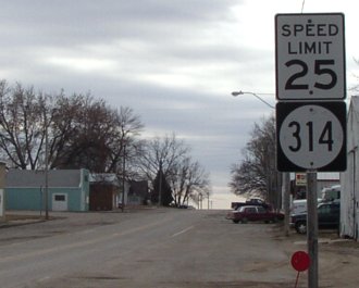
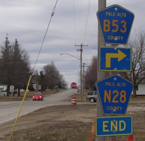
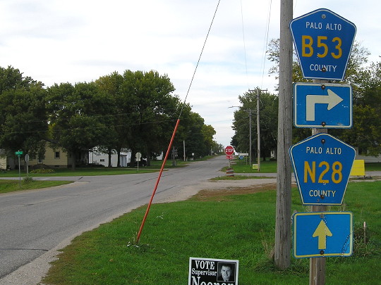
Facing south on 314
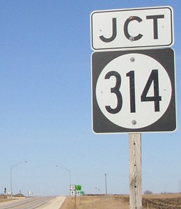
The white sign under the stop sign says "Traffic from left does not stop." That traffic is 314 northbound, the previous picture; the pickup did not have to stop. B53 continues south with N28 for a mile before heading west again. Notice this direction includes B53 going east. Now it definitely does; also, the post-April version of this assembly should have the "Jct" above N28 removed. (The signs are all on one pole; the one behind 314 is not holding it.)
Facing south on 314, post-decommissioning (photo has been lightened)
Facing north on N28
N28 doesn't end anymore; it took over the north-south portion (the rest) of 314's route.
Facing north on N28, post-decommissioning
Now the intersection is an all-way stop.
Facing north on 314
Like most spurs, the mileage sign heading out of town has only the destination highway shield.
Surrounding area information: Ayrshire school(s)
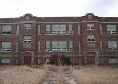
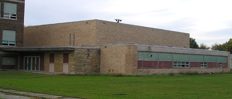
This school is just south of the 314 turn. Ayrshire is part of the Ruthven-Ayrshire school district, and its regal old buildings have fallen by the wayside. This double entrance was interesting; above both doors the lighter-colored stone says "Silver Lake Township". This building was constructed in 1920.
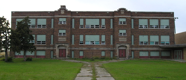
When I returned 13 years — coincidentally, one education cycle — later, there was a huge difference in appearance: Someone mowed the lawn. All the growth around the building was removed (see below). It made a world of difference and gave me the impression that if you didn't look too hard at the broken windows, the building could be ready for use that fall.

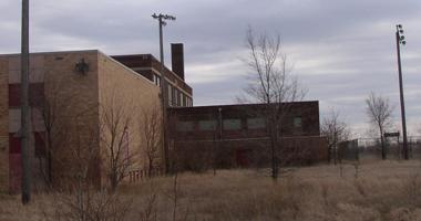
The addition on the north side (to the right of the top picture) was of decidedly different vintage. Judging from the architecture, I estimated it to be late 1950s or early 1960s. All the doors were padlocked shut.
Research in 2016 revealed that the Ayrshire school building closed a year before the Ayrshire school district came to an end; students were tuitioned out to Ruthven and a consolidation vote took place in summer 1982. If my guess on the addition is close to correct, by the second time I came to Ayrshire, the addition has been abandoned longer than it was in use. This is likely to become more common across the state.
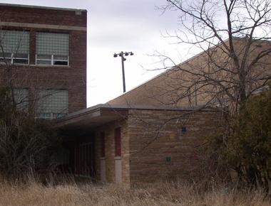
Another view of the addition, facing west
Another view of the addition, facing west
In the hour or so before I reached Ayrshire in 2016, this time from the west, the sky clouded up. Time-of-day-wise, I appeared about 80 minutes later than I did in 2003. That meant I was taking pictures in late afternoon under a cloudy sky, just like the first time.
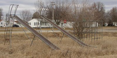
You don't see nice big slides like these anymore. Too dangerous, they say.
Facing south
There were still lights surrounding what once was a baseball diamond. This would be looking from the third-base line.
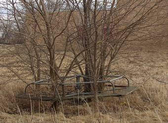
Judging from the trees growing through the old merry-go-round, the place had been unused for a long time.
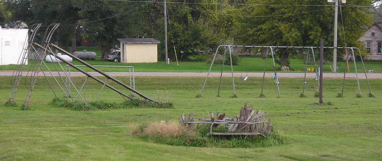
Looking at the playground a decade-plus later, all of it's still there, but looking marginally better. But no one can use the swings.
To the north of 314's turn is this building. It had no discernible date, lots of open windows, and a "No Trespassing" sign. If you drove east along School Street, you'd run right into it. This was torn down between mid-2007 and mid-2008.
Last seen: 2003
Page created 12/18/02; last updated 3/6/17