
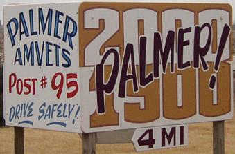
(June 4, 1935-April 2003)
Within a month of taking these pictures, the signs came down. Pocahontas County orginally accepted the road Dec. 17, 2002.
WEST End: Stop sign, IA 4 and C56, Pocahontas County
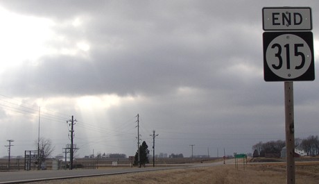
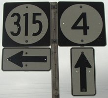
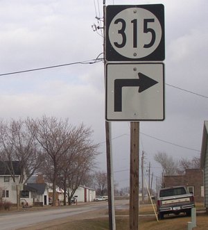
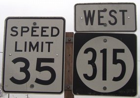
Facing west on 315 (3/20/03)
Unfortunately for historical purposes, the record of this highway is under overcast skies. The sun did peek out on this picture, though.
Facing west on 315 (3/20/03)
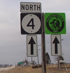
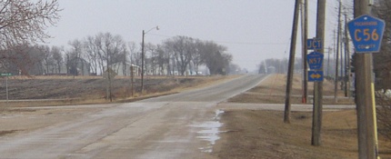
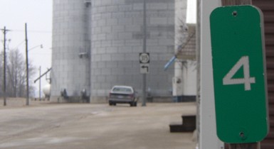
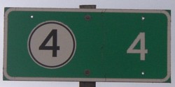
Facing north on 4 (3/20/03)
Facing north on 4 (3/20/03)
Facing south on 4 (3/20/03)
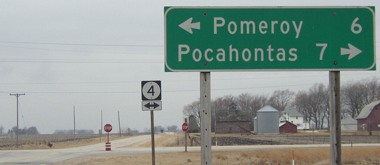
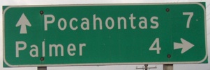
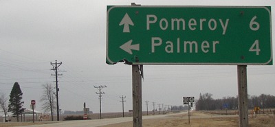
The sign in this direction displays both schools of the Pomeroy-Palmer school district. Pomeroy is at about the halfway point of the duplex of highways 4 and 7.
Facing south on 4 (3/20/03)
Facing south on 4, post-decommissioning (9/8/06)
There's a little roadside park with a shelter at the southeast corner of the intersection. This sign was removed/changed between 2008 and 2015. (3/20/03)
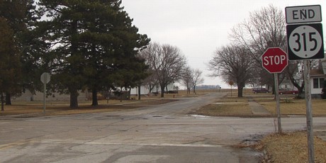
EAST End: Stop sign, N57/Henrietta St., Palmer, Pocahontas County
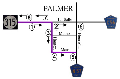
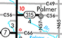
Like IA 359, 315 dips south to go through the business district. The numbers correspond to the pictures below. (Map 4/26/03)
1) Facing east on 315 (3/20/03)
Facing east just past the turn (3/20/03)
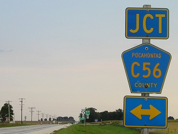
2) The road is (was) first marked as C56 right before the intersection with N57.
Facing south, but heading east, on 315 (3/20/03)
3) The last mile marker is on a stop sign. Had 315 continued due east, it would have been exactly four miles long. Mile marker still there in 2018.
Facing southeast-ish (3/20/03)
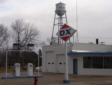
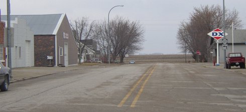
3a) This restored DX station is across the street from the mile marker. There wasn't anything in it, though.
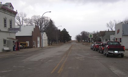
Facing east on 315 (3/20/03)
4) The Palmer House, the white building on the left, was built in 1900. There are no 315 shields coming this direction on this street.
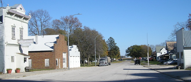
Facing east on 315 (10/20/18)
The gas station sign is gone. The vending machines ouside Palmer House are gone. The bar at far right lost a sign but still operates.
Facing east on 315 (3/20/03)
5) After stopping at N57, the street itself goes for one more block before ending. Looking left (north) you see the Stop Ahead sign for N57 at C56 (which, incidentally, has a double arrow for its junction). There were no signs for 315 on N57.
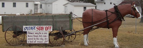
6) This was placed on the southeast corner of the C56/N57 intersection, two blocks north of the above picture. Behind me in this picture is a map of Pocahontas County sites, placed for the Iowa Sesquicentennial in 1996. A large image of the sign with readable text can be seen here. (3/20/03)
The horse is gone (between 2009 and 2013 according to Street View), but the sesquicentennial map isn't. (10/20/18)
The Palmer school, on the south side of town, closed in 1999. The building was something in 2009, but I can't tell from the low-res Street View. By 2013 whatever it was had closed and the chimney had collapsed, taking a small corner of the roof with it.
Facing north in nearly the same place as picture 4 (3/20/03)
On the sign at left is the 315 with up-and-left arrow. In both directions there is not a follow-up arrow. At right near the DX sign is the first westbound 315 sign; there was not one right away on Main Street.
Facing west on 315 (3/20/03)
7) This is the second sign westbound, but the first sign westbound that a) is on an east-west road and b) has a direction attached.
8) Facing west on 315 (3/20/03)
A nice symmetry here, don't you think?
Last seen: 2003
All pictures by me: All except eighth, 3/20/03; eighth, 9/8/06; graphic, 4/26/03
Page created 4/26/03; last updated 12/11/06 3/22/19