
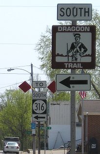
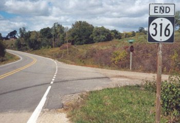
Old NORTH End: Stop sign, IA 163 and S27, Polk County
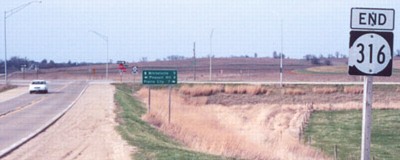
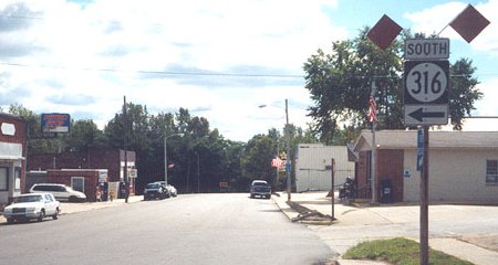
Facing north on 316 (4/14/02)
Photo by Jason Hancock
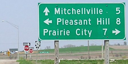
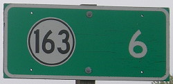
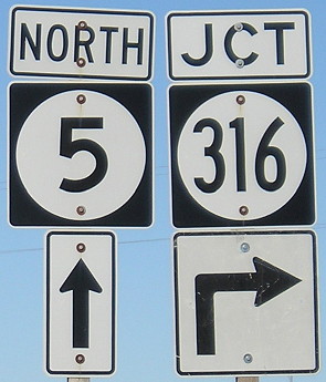
Closeup of signs in above picture (4/17/05)
County roads are not signed in Polk County.
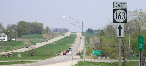
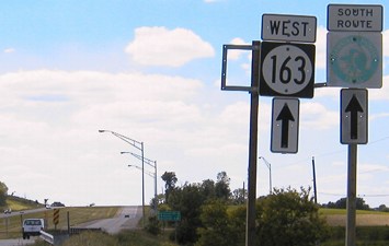
Facing east on 163 (4/17/05)
This is the only remaining IA 163 sign before the intersection.
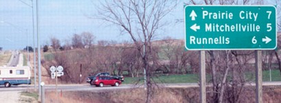
Facing east on 163 (4/14/02)
Photo by Jason Hancock
The shields have (had) two ones, two threes, and two sixes, in different order.
On 163 between US 65 and IA 117, which includes this intersection, the eastbound and westbound lanes often follow different contours. One set may go up while the other goes down, or one may change altitude while the other is level. This is obviously a result of both sets not being built at the same time. A similar situation happens on US 63 north of Denver.
Facing west on 163 (6/3/04)
Facing south on S27 (6/3/04)
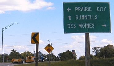
Facing north on 316/S27 at Runnells (9/30/14)
Old SOUTH End: Hancock St., Runnells, Polk County
A Des Moines Register article in early August 2002 had a sidebar stating that 316 inside Runnells had been turned over to the city. This segment is less than a mile, but there is a turn involved in the downtown. That turn is still signed.
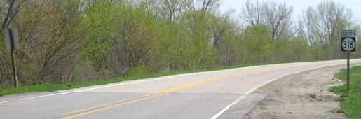
Facing south on 316 (9/28/03 and 4/17/05)
Left photo by Jason Hancock
In 2003, separate from the forced turnover, Polk County agreed to take charge of most of 316 outside of Runnells. (Highways 931, 945, and part of 415 were turned over in the same deal.) This means that while the 1935-80 alignment of 316 went from 163 to Runnells, the 2003 alignment goes south from near Runnells to 5; its new north end is farther south than its first south end. Just like IA 160, it's completely off its original alignment yet has never been decommissioned.
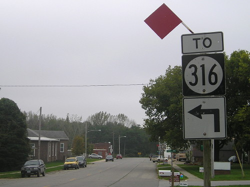
Facing south on old 316 (9/30/14)
Facing south on old 316 (9/30/14)
Notice that the buildings in the southeast corner of the intersection (left) is gone, and that the "To" is still sticking out like an afterthought (which it was, since the sign is from before decommissioning).
Ahead, at the double arrow, is where 316 ended as a spur coming south from IA 163. When the route was extended, Runnells took the southernmost block.
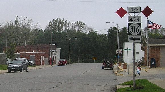
NORTH End: City limits of Runnells, Polk County
Facing west, but heading north, on 316 (9/30/14)
Jason Hancock says that by mid-2012, the north end of IA 316 or at least the sign itself had migrated from an intersection just north of the Des Moines River bridge (see below) to the city limits of Runnells, which may have been where it was supposed to be in the first place.
Old NORTH End (2003-2012?): East of Runnells, Polk County
The below pictures are about a mile to the east of downtown Runnells.
Facing north on 316 (9/28/03)
Photo by Jason Hancock
This gravel road is the first one on the north side of the Des Moines River - and it eventually dead ends to the east. In fact, only a very small part is accessible before being blocked off as part of the Red Rock wildlife area. If the east part of the Polk/Warren line followed the section line instead of the Des Moines River, this would be the county line; the Jasper/Marion corner is a half-mile to the east (albeit inaccessible by car).
This creates an interesting situation: While every spur except one was decommissioned in 2003, 316 was turned into a spur. The Department of Transportation told me that 316 and IA 98, the one living spur, were classified as "access routes." My speculation is that 316 is still under state control because of its bridge over the Des Moines River, which is the only one between US 65 and IA 14. The same applies to IA 98, the only state-maintained bridge across the Des Moines between Ottumwa and Keosauqua. It would not be without precedent; IA 411 across the Iowa River at Marengo (now V66) was likely created for the same reason.
Facing south on 316 (4/17/05)
Everything that got turned over was re-asphalted. North of Runnells, Polk County has placed many large stop signs at intersecting roads, in part because the removal of one in 2004 caused a fatal accident. In addition, the road is finding itself stradding a line between suburban and rural, with more and more non-farm houses springing up.
Stop sign at intersection (4/17/05)
Uh...say what?
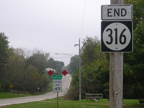
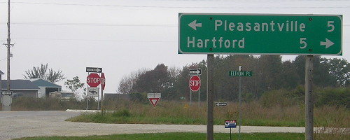
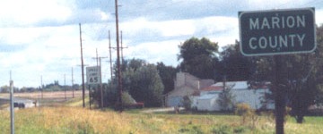
SOUTH End: Stop sign, IA 5, Warren/Marion county line
Facing south (4/17/05)
This is east of the present intersection. This is approximately where the road for 316 would be as it intersected IA 5 prior to 5 being four-laned in the area. In the center is the Warren County sign; the corresponding Marion County sign is in the background of center right.
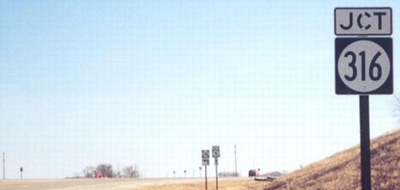
Facing south on 316 (12/14/02)
Photo by Jason Hancock
While 316 appears to straddle the county line, the current end is ever so slightly on the Warren County side. A bridge over railroad tracks is entirely in Marion County. The south end of 316 was closed for construction of the IA 5 expressway until December 20; this may have been a five-way intersection before then. When Jason Hancock took the picture above and the "Jct 316" below no LGSs had been put up, but they had by mid-March 2003.
Same view, much later (10/15/10)
Facing south on 316 (9/30/14)
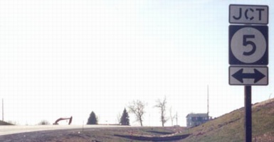
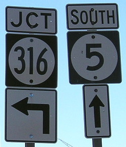
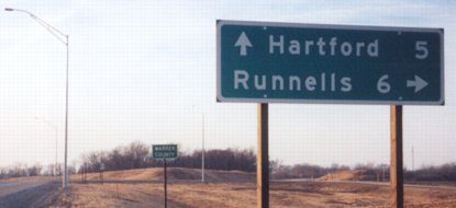
Facing southeast, but heading south, on 5 (12/14/02)
Photo by Jason Hancock
Just like the north end, there are extra 316 shields around (not visible in Jason's pictures). The one down here is in the background, which has an up-and-left arrow, is a set not usually at non-multiplex intersections, but these have been showing up at other ends (e.g. 415 North [1980-2003]).
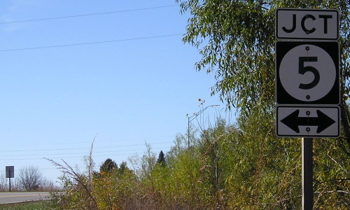
Facing southeast, but heading south, on 5 (10/15/10)
Facing southeast, but heading south, on 5 (10/8/04 and 10/15/10)
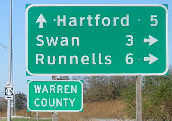
The LGSs on 5, like those on the IA 330 expressway, are a larger size, between the standard LGS and an interstate BGS, presumably to increase visibility. (The sign on two-lane 316 retains the smaller size.) Later on, a Clearview version included the tiny town of Swan, which is just off 316.
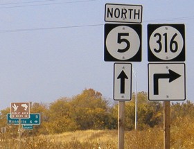
Facing northwest, but heading north, on 5 (10/8/04 and 10/15/10)
Normally I would note this incident of an up-and-right arrow as wrong, but it might be an attempt at creating a greater 'warning' distance for drivers on the four-lane (viz. how the same thing happens on cross roads at interchanges).
Facing west, but heading north, on 5 (right: 10/15/10)
Left and below photos by Jason Hancock (3/16/03)
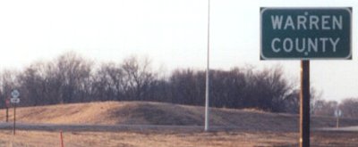
This was new in the early 21st century - a county sign that, in Jason Hancock's words, "is legible for a change." More will be showing up after this change in DOT standards. The fact that both signs are just east of the intersection means 316's south end is entirely in Warren County - which is due to realignment so 316 ends at 5 perpendicularly.
Facing southeast, but heading south, on 5 (9/28/03)
Photo by Jason Hancock
Thanks to J.D. Adams for asking the DOT about the Decatur County sign.
Page created 1/17/03; last updated 12/11/17