
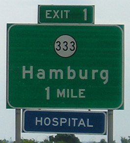
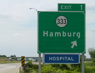
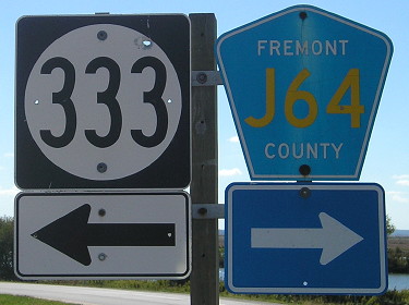
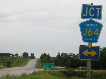
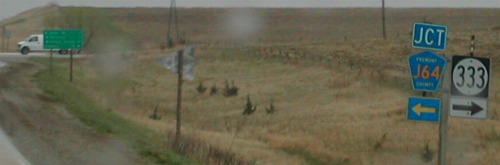
WEST End: I-29 exit 1 and J64, near Hamburg, Fremont County
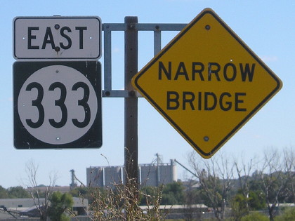
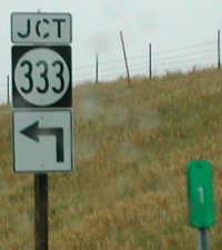
Facing west on 333 (10/2/15)
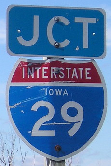
At left is one of Iowa's last free-standing interstate shields that's on a side road. It escaped being taken down somehow; there's a new-style "Junction 29" after crossing the railroad tracks.
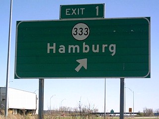
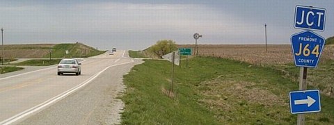
Facing west on 333 / Facing east on J64 (6/12/06 and 4/20/02)
Right photo by Neil Bratney
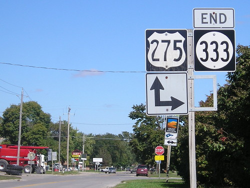
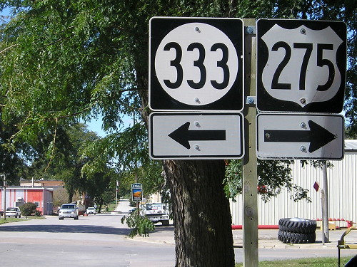
Highway 333's west end is the southwesternmost terminus in Iowa, 3.75 miles east of Nebraska and 1.15 miles north of Missouri. Just east of here, 333 enters Hamburg, intersecting US 275 1.4 miles east of its west end, meaning that on the current map, the dot for Hamburg covers up 333's entire route. (Fremont County puts the "Interchange No." signs with the on-ramp signs.)
Facing west on 333 (10/16/20)
As of October 2015, and still in 2020, there is no "End 333" sign at the west end.
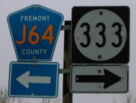
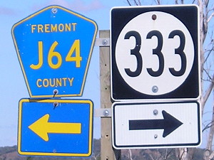
Facing east on J64 (10/2/15)
Facing west on 333, on the other side of the interstate from the top pictures (6/12/06)
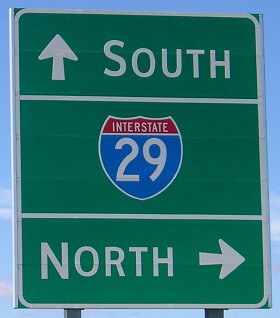
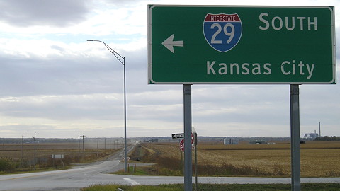
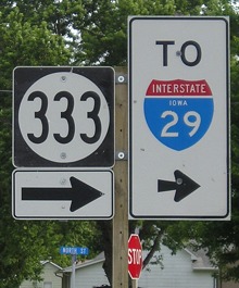
Facing northwest, but heading north, on 29 (6/12/06)
This sign is by I-29's bridges over a local road, which about a thousand feet to the camera's left becomes Route V after crossing the Missouri line, and to the camera's right becomes Main Street in Hamburg.
Facing northwest, but heading north, on 29 (6/12/06)
Facing southeast, but heading south, on 29 (4/1/07)
Photo by Jason Hancock
Jason writes, "I have a feeling the top line had a spelled-out "County Road J64" when the sign was put up before the text was stripped off and IA 333 was added. However, I didn't notice any 'label scars' on the sign. After getting the photo I looked on the back to see if an erection date was present on the sign, and there was a '7-73' written on the back, implying that it's an original sign from July 1973."
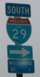
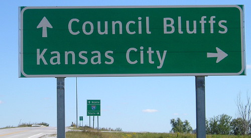
Facing north on the 29 northbound offramp (4/20/02 and 10/2/15)
Left photo by Neil Bratney
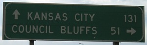
Facing south on the 29 southbound off-ramp (10/2/15)
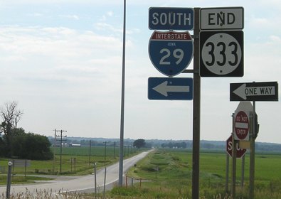
As of 2020, this was one of maybe three remaining shields that was square and not wide.
Facing east on 333 (10/2/15)
Highway 333 is one of five four 300s still in existence; the others are 316, 330, 346, and 370.
Facing east on 333, North Street at Main Street (10/16/20)
I have been to Hamburg and Lansing three times each. Can anyone else say that?
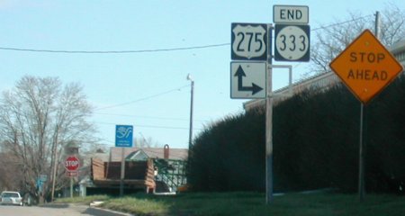
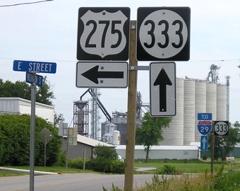
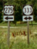
EAST End: Stop sign, US 275 S/E Street and US 275 N/Washington Street, Hamburg, Fremont County
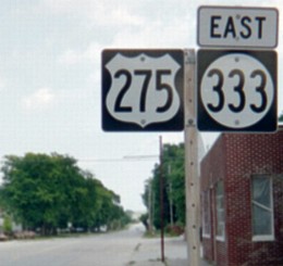
Facing north, but heading east, on 333 (3/28/04)
Photo by Neil Bratney
Highway 333 did not die in the Second Great Decommissioning, it just lost about 9/10 of its entire route. Only the connection between I-29 and US 275 was retained, meaning its closest sibling in function today is IA 152. (IA 244 had a similar role.)
From December 19, 1980, when 333 was extended west to I-29, to December 7, 1984, 333 approached this intersection from the west, using Main and E streets.
Facing north, but heading east, on 333 (10/2/15)
I believe this is the same 275 shield as in Neil's picture but with another decade of wear on it.
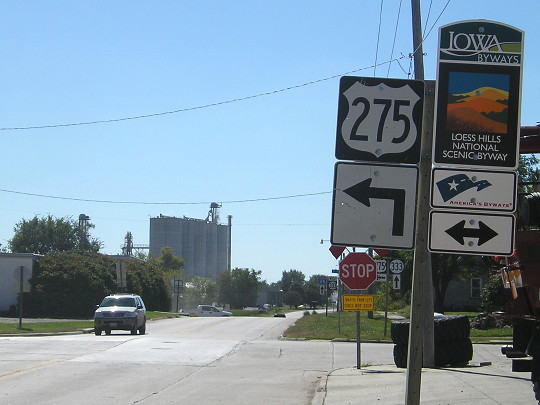
Facing north on 275, 2 blocks north of the intersection (10/2/15)
This is the white rectangle in the deep center background of the above picture. By 2020 this had been replaced with an LED sign/message board.

Facing west, but heading north, on 275 (3/28/04)
Photo by Neil Bratney
Facing west, but heading north, on 275 (10/2/15)
In 1981-84, 333 went straight ahead.
Facing south on 275 (6/12/06)
Facing south on 275 (10/2/15)
Facing southwest, but heading west, on 333 (6/12/06)
Five blocks south of its end with 275, 333 turns to go slightly west-northwest and then west to 29. If Missouri ever decided it didn't want to have US 275 anymore due to its proximity to I-29, 275 could easily be extended along 333 to end at I-29's first Iowa exit.
Surrounding area information: Duplex with US 275 (1980-2003)
WEST end of duplex: Facing east on 333, but heading south on 275 / EAST end: Facing north on 275 (6/16/03)
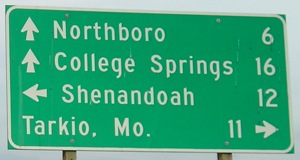
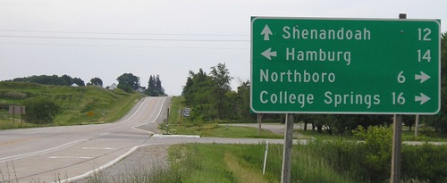
The south end of US 275 is only about 19 miles south of here; 333 is the first route and was the first duplex it meets heading north. Today, J64 goes east of 275, parallelling the Missouri border about 1 1/4 mile north of the line for about 32 miles to US 71, all covering stretches of road that at one point or another were labeled as IA 333.
Facing north on 275 (10/2/15)
According to the DOT's official records, the 333 designation still extends to this intersection:
Beginning again on the East Corporation Line of the City of Hamburg connecting with E Street; thence southeasterly through Section 22‑T67N‑R42W to a point near the SE Corner said Section 22 (east junction US 275).
There is no need for that line if 333 truly ends in Hamburg, as it's signed. It could be a clerical oversight, given that there's an error in the US 275 description as well (it says F Street instead of E Street).
Until 1995, this was a T intersection with the north-south road being the through route; 333 stopped and went with 275 northwest and west into Hamburg. Then a new road and bridge across the Nishnabotna River were built and the east-west road became dominant and northbound traffic stops.
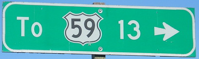
Old EAST End: Stop sign, US 59, Fremont County
Facing east on 333 (4/20/02)
Photo by Neil Bratney
Until 1980 this was the west end of 333, but moving it east and west across Fremont and Page counties involves more than that. Originally, in 1935, it started here and went six miles east to Northboro. Between 1945 and 1964, it was extended both east and west, running from US 275 to US 71, but then in 1964 it was cut back to ending at 59 again. In 1980, 333 went through a complete swap, switching from between 59 and 71 to between I-29 and 59, and then nearly killed off 23 years later. Notice what's peeking out from behind the LGS.
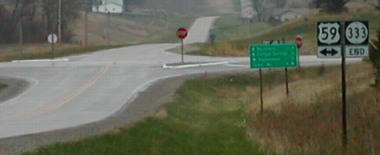
Facing east on 333, behind the LGS (this picture looks more SE) (6/16/03)
This assembly comes to you courtesy of the Department of Redundancy Department. At right is the last southbound 59 shield in Iowa.
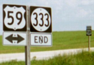
Facing west on 333 (LGS from two pictures up) (6/12/06)
Facing north on 59, before and after truncation (4/20/02 and 6/12/06)
Left photo by Neil Bratney
Along this line, 333 is just over a mile from the border.
Facing north on 59 (6/12/06)
For much of the mid-20th century, Page County found itself talking to a brick wall: On April 16, 1940, a delegation from the area asked the Highway Commission to blacktop the road (333 at the time) from US 59 eastward to US 71. On February 4, 1958, a delegation from the area asked the Highway Commission to pave the road between US 59 and US 71. In the late 1970s, delegations asked the Iowa Department of Transportation to pave IA 333 from one mile east of US 59 to US 71. It was finally done in 1980, under the condition that the county take charge of the road when paving was completed. (The DOT then got embroiled in a fight over who should maintain the road between US 59 and US 275, which is another story in itself.)
Facing south on 59 (4/20/02)
Photo by Neil Bratney
Facing south on 59 (4/23/06)
Photo by Jason Hancock
Unlike the northbound sign, the arrow only points in one direction here though the bracket has been removed.
Facing south on 59 (4/23/06 and 10/2/15)
Left photo by Jason Hancock
Page created 5/22/02; last updated 10/30/20