
(February 1, 1938-November 25, 1981)
WEST End: Stop sign, Rembrandt, Buena Vista County
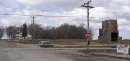
Facing west on Main at Railroad
A man I talked to in Rembrandt in 2003 said the supervisors and the state once argued about paving the last block of 351, otherwise it would have ended a block behind this picture. (The business district and 71 are behind me.) Sign at right is for raising funds for the fire station, which was up the second time I visited the town six years later (below).
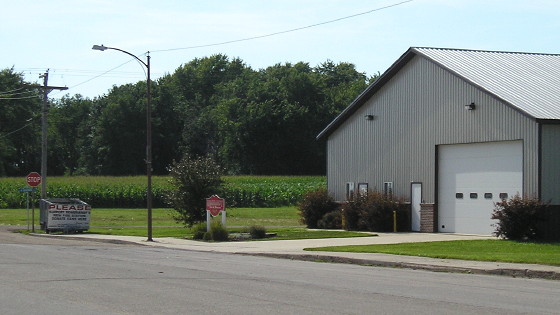
Facing west (7/23/09)
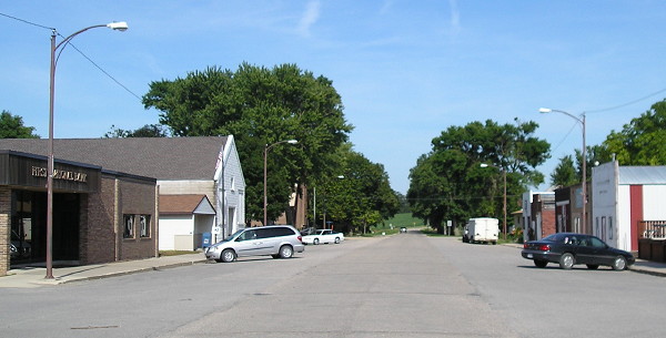
Facing east on 351 (7/23/09)
This photo is in the same spot as the above picture, in the other direction. You can see all the way out of town in this picture. The posted end would have been on the light pole at left.
Temporary WEST End (August 11, 1980-November 25, 1981): City limits of Rembrandt, Buena Vista County
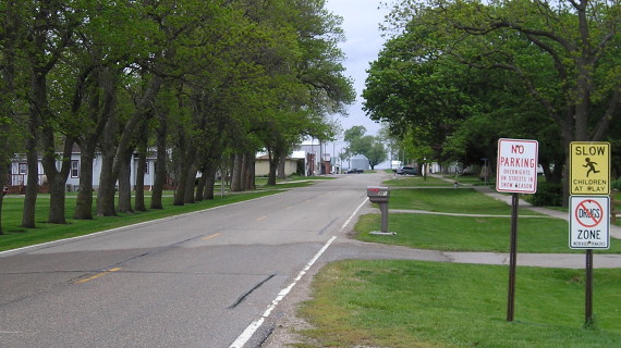
Facing west on 351 (5/10/10)
The city limits are roughly here, or a bit behind the camera.
The route was only eight-tenths of a mile at its longest extent, and about three-tenths of that was turned over to the city a year before the county took over the rest. Because 351 remained in the county longer, it was signed on the 1981 map.
EAST End: Stop sign, US 71, Buena Vista County
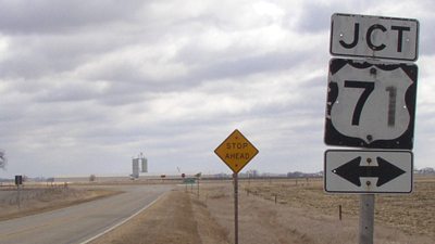
Facing east on 351 (3/21/03)
Could this forlorn-looking shield set (minus the double arrow) be from its days as a spur?
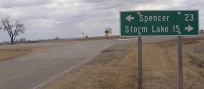
Facing east on 351 (3/21/03)
Given the font and newness of the sign this has to be county-erected.
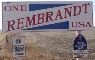
Facing south on 71 (3/21/03)
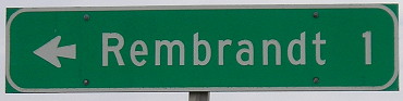
What? Because it's the only Rembrandt in the entire country, that's what.
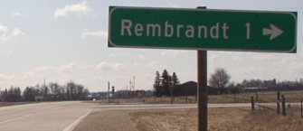
Facing south on 71 (3/21/03)
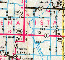
In the background is the junction with C25. While old 352 is in the rural road system as "Hwy 352", and old 390 is "Hwy 390", old 351 is 477th St. Go figure. (UPDATE: This is no longer true.)
Facing north on 71 (5/10/10)
Last seen: 1981
All pictures by me: 6/21/03
Page created 4/1/04; last updated 3/28/17