
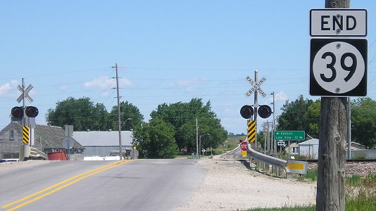
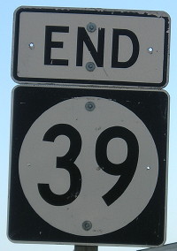
NORTH End: Stop sign, IA 175/Market St. and M43/Des Moines St., Odebolt, Sac County
Facing north on 39 (9/20/02)
Photo by Neil Bratney
The route connecting Denison and Storm Lake used to be the same number, the original IA 4, which ran from border to border, Hamburg to Spirit Lake. After being superseded by US 59 south of Denison, US 71 north of Early, and then IA 110 north of Schaller (its realignment after 71 was commissioned), 4 lost even more mileage when US 71 was rerouted to go straight south of Early. At that time, the main road between Schaller and Odebolt, most of which is today's M43, was decommissioned as it had become too close to another major route. The massively truncated alignment of IA 4, which only ran between Odebolt and Denison by 1940, later had its entire alignment in Sac County shifted east about two miles, giving IA 39 the route it has today in the Great Renumbering.

Facing north on 39 (6/24/17)
Facing north on 39 (6/24/17)
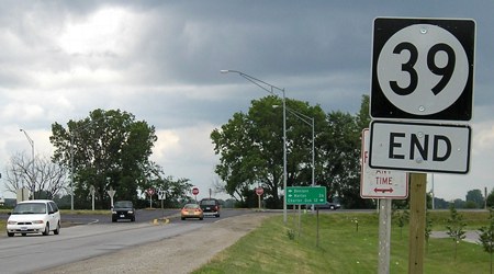
A decade earlier, "End 39" had its own post to the right, instead of being mounted on the utility pole.
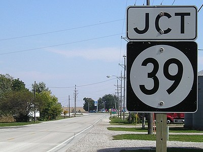
Facing north on 39 (9/17/07)
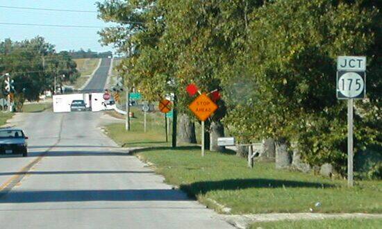
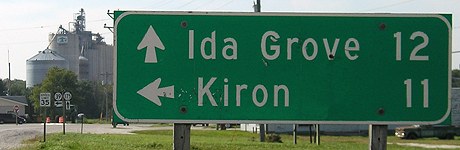
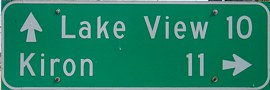
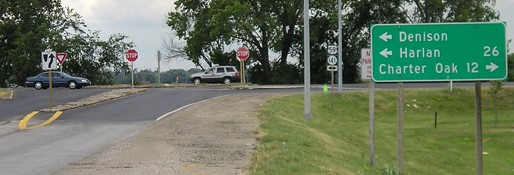
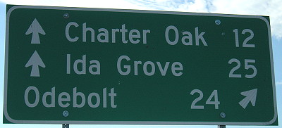
Odebolt is on the LGS despite 39 running along the town's east side. Better options would be "<- Ida Grove 12" (see below) or "^ US 20 12".
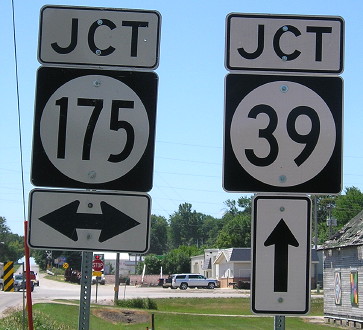
Facing west on 175 (9/17/07)
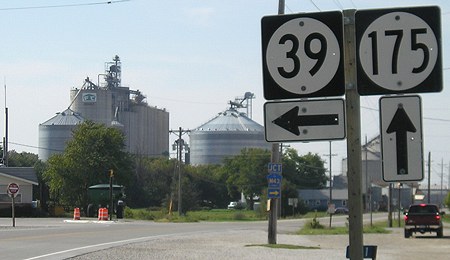
Facing west on 175 (9/17/07)
Facing east on 175 (9/17/07)
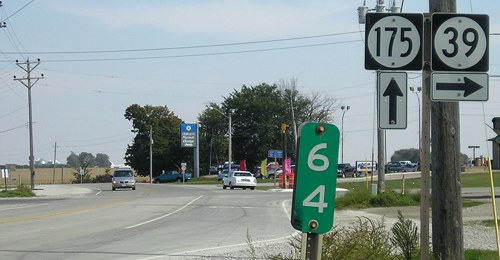
Facing east on 175 (9/17/07)
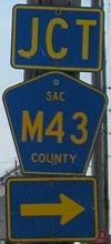
Facing south on M43 (6/24/17)
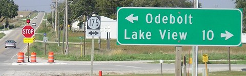
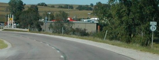
For a change, the county road approaching a state highway's end marks the road going ahead.
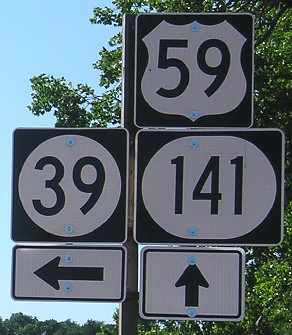
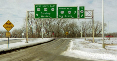
SOUTH End: T intersection/"2½-way" stop, US 59/IA 141, Denison, Crawford County
Facing south on 39 (6/25/06 and 6/21/17)
This intersection is set up somewhat strangely. IA 39 stops, which is a given. All traffic on northbound US 59/westbound IA 141 does, too. But for southbound 59/eastbound 141, through traffic does NOT stop while traffic that wants to turn left, onto 39, gets in a lane that curves toward 39 and then has a stop sign before crossing the northbound lanes.
Facing south on 39 (6/25/06)
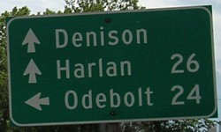
The mileage sign is pointing to Denison despite being on the northwest side of town and already having passed the major intersection leading to the business district (Avenue C, old 59).
Facing north on 59/141 (9/20/02)
Photo by Neil Bratney
Facing north on 59/141 (9/20/02 and 6/21/17)
Left photo by Neil Bratney
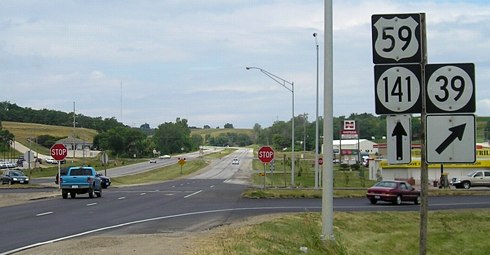
Facing north on 59/141 (6/25/06)
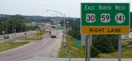
Neil writes, "There's a Pizza Hut, McDonald's, No Frills Supermarket, and a strip mall at this intersection (probably because access is limited at the US 30 intersection)." The No Frills closed in 2015, the start of a huge contraction for the chain. Although a four-lane, 59/141 straddles the line between expressway and fancy arterial, with some access controlled but some not, as seen below with US 30. This sort-of-controlled road structure was common in the 1950s and early 1960s, but today the development and left turns involved would likely require an entirely different alignment, farther to the west, to bring it up to even current expressway standards.
Facing south on 59/141 (6/25/06)
Facing south on 59/141 (6/25/06 and 6/24/17)
Surrounding area information: Junctions with US 30
Facing north on 59/141, approaching 30 (6/25/06)
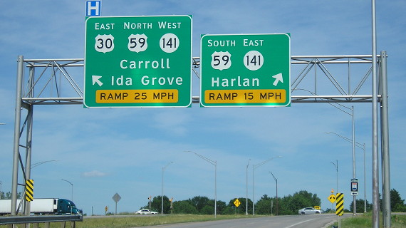
This view, about a mile south of 39, shows the slightly convoluted nature of the at-grade south intersection with US 30. To go west on 30 from here, one must turn left, stop, and then cross the southbound lanes (which have a stop sign) while at the same time, eastbound 30 is coming up to the intersection and merging into a new left lane for northbound traffic. Northbound 59 doesn't stop.
The old Lincoln Highway would be northwest of this point, crossing the present road between the bridges and the north junction in the deep background.
Facing east on 30 (6/20/17)
The new alignment of 30 on the west side of Denison opened in December 1962. The changes effectively obliterated the Lincoln Highway alignment around the Boyer River. The 1929 pavement of US 30, though, is just to the south (behind photo to the right). The old curve connecting eastbound 30 to southbound 59, immediately right of this photo, remains today as Chamberlin Drive. The present-day US 30 from the end of the four-lane to the northeast corner of Dow City uses a two-lane road built parallel to an alignment from 1925 that technically counts as Lincoln Highway. The original lanes were removed around 1983.
The construction for US 59 north of the north intersection (shown below), including the south end of IA 39, was not finished until 1967.
Facing north on 59, but heading east on 30 AND west on 141 (9/20/02)
Photo by Neil Bratney
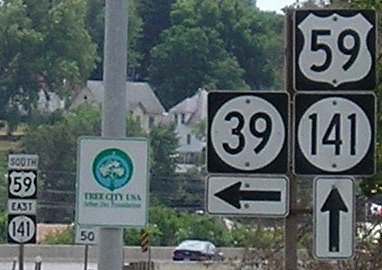
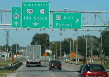
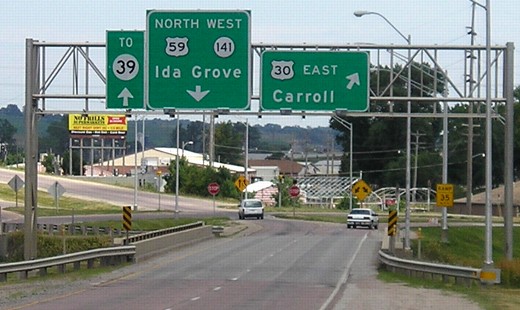
Up, down, and angled arrows on this BGS gantry make for an interesting intersection, which is actually an at-grade with small ramps. That might not be as confusing as the fact that the driver here is going both east and west (while facing north!) at the same time, following a short wrong-way multiplex with US 30 and IA 141. (West of US 59, straight east-west roads are rarer than diagonals in both directions. Just look at the state map.) The "To 39" is possibly a later addition, seeing as though there's really no reason not to have "North 59 West 141 To 39" on the one BGS. Below is a slightly different view of the same gantry with the "To 39" replaced:
Facing north on 59, but heading east on 30 AND west on 141 (6/25/06)
Facing west on 30 (1/19/03)
A possible explanation for the "To 39" signage is its relative proximity and how perhaps some people reading small maps expect to run into 39 from 30. The leftmost sign here makes you look at either side to catch the wrong-way multiplex.
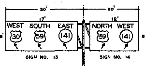
Iowa DOT archive, 1964
Original sign sets at both intersections had all signs coming out of the poles set up in the islands inside of the intersection (the yellow sign above, with the arrows on it). This strategy was changed around the end of the decade, based on other less-complicated intersections that had overhead gantries erected at that time. According to the Denison Bulletin of Aug. 6, 1964, the sign project cost $50,745.
Page created 5/2/04; last updated 5/19/24