
(August 22, 1953-December 28, 1998)
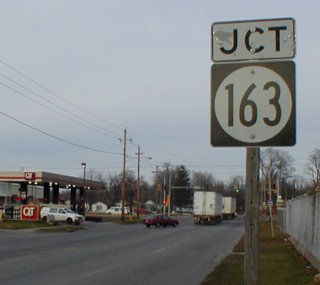
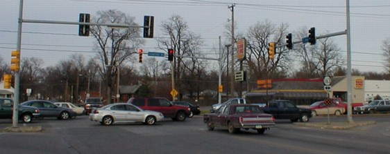
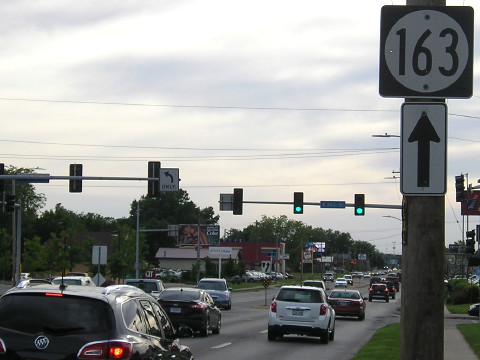
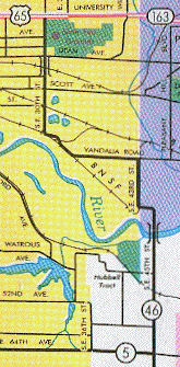
NORTH End: Stoplight, IA 163/E. University Ave., Des Moines, Polk County
Facing north on 46 (12/21/01)
Like many discontinued highways, many shields with other numbers still stand.
Facing north on 46 (12/21/01)
The maroon car is at the end of 46. Notice 163 shield with double arrow.

Facing north on 46, about same view (5/31/17)
Facing south on 46 (12/21/01)
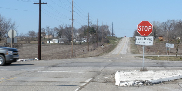
Look familiar? It's the Grandstand of the Iowa State Fair! The intersection of 163 and 46 (East University and Southeast 30th) is at the northwest corner of the fairgrounds, and is usually given as the fairgrounds' address. A better location would be East 33rd and Grand, which is in the fairgrounds near the Agriculture Building, or East 33rd and University, the fairgrounds' main entrance.
Highway 46 runs down the west side of the fairgrounds; between University and Grand the road was used for US 63 from 1926 to 1933. South of Grand, the route was (after 1931) IA 60, a secondary north-south route in Iowa. Most of its route outside Polk County is IA 17 to the north and IA 5 to the south. Inside the county, 60 used what became IA 415 and 46, until it was rerouted twice in the 1950s along the west and south sides via IA 141, I-35, and Army Post Road.
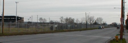
After crossing Dean Avenue (the south side of the fairgrounds), 46 runs through an industrial sector of Des Moines, full of frequently turning trucks and the dust that follows them.
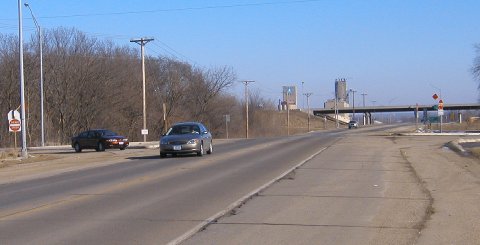
Facing east on 163 (12/21/01)
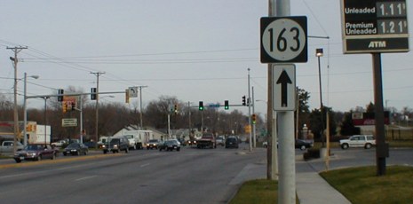
Remember $1.11-a-gallon gas?
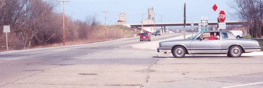
Facing west on 163 (5/31/17)
For a short time, there were also US 65 shields on this stretch of 163. This photo replaces an identical view from 2001.
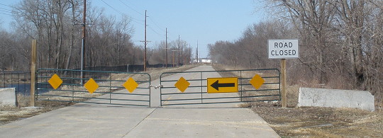
The DOT signs remaining on IA 46 in the middle of the decade north of the river could be easily counted: The 163 shields here, a Des Moines city sign, two park signs (one each way), mile marker 3, and a Pleasant Hill city sign. The last is right before today's road is blocked off to public access, right after the curve from Carlisle Road to SE 45th Street.
Facing north on 46 (3/25/10)
This is on the south side of the Des Moines River at Evergreen Street. The road continues about another third of a mile to a cul-de-sac.
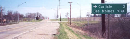
SOUTH End: Intersection, Old IA 5 N/SE 64th Ave. and Old IA 5 S/SE 45th St., Polk County
Facing south on 46 (4/14/02)
Photo by Jason Hancock
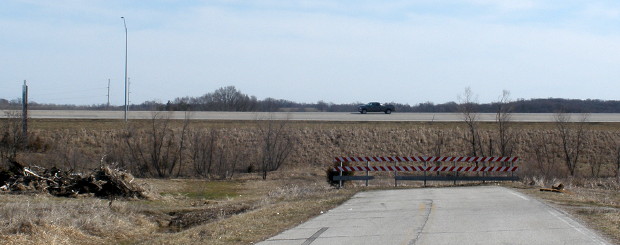
Before the bypass, there was an up arrow by Carlisle. Allegedly, a village of Avon is near this intersection; there is a small collection of streets to the northeast of this intersection, but other than that you can't tell there was a town here. Also allegedly, there is an even smaller village of Levey between here and the Des Moines River; this is not true. The streets that some atlases and phone book maps say exist north of SE 44th Avenue aren't only not there, but the road to them is "closed". From the intersection of SE 44th Avenue and SE 45th Street (which was 46) you can see the pavement stop shortly thereafter. The spot for Levey in the Iowa Atlas and Gazeteer is no longer publicly accessible, and if aerial photos (which, in 1990, had the streets already on their way to becoming barely visible scars) don't convince you that Levey is decidely gone, the warning signs in the area will.
Facing north on 5 (4/14/02)
Photo by Jason Hancock
A combination of bypass construction and condition of the bridge over the Des Moines River led to decomissioning of 46 and destruction of its bridge across the Des Moines River. So even though the LGS still indicates Pleasant Hill is ahead, you can't get there from here. (This sign has been removed.) The state map no longer shows this road south of the intersection, making you think the road with the Carlisle LGS would end at a T. However, the 2002 Qwest phone book map, which showed the completed bypass (but still has IA 401 - go figure), indicated the road in this picture continues behind us south to a T at 72nd Avenue. It also marks the portion south of 64th (the cross road above) as South Schrier Drive.
Because there is no bridge, the only way across the river east of 14th Street (US 69) is the new bypass, which is why there is not a minimum speed limit on that part of the freeway. The needed access for slow traffic, then, doesn't put the bypass at interstate conditions. Otherwise, perhaps I-435 or I-880 might have shown up.
Facing north, but heading west, on 5 (3/25/10)
Facing east on 5, now SE 64th Avenue (2/3/05)
Technically, the road running one mile north of the Polk-Warren county line is Army Post Road only inside the Des Moines and West Des Moines city limits. Though the part running through the previously unincorporated southwest part of the county was known as Army Post anyway, in the southeast part it is officially SE 64th Avenue. (SE 80th is County Line Road.) Thus, when the bypass was constructed, the original BGS was simply "SE 64th Avenue." IMO, this was shortsighted, as a supplemental "To Army Post Rd" sign was added later. (Another note on shortsighted bypass signage: "5 South Carlisle" now has Knoxville on another sign, another expense that should have been saved by putting it on the sign in the first place.)
There used to be paint marking a right-turn lane, whose edge is marked by the dark line, but now it's just a wide shoulder. The red car is turning from the end of 46 onto northbound 5. It's probable that north-south traffic did not stop while Army Post traffic did, especially since the north-south road through the intersection had been IA 60 at one point.
Facing east on 5, now SE 64th Avenue (4/14/02)
Photo by Jason Hancock
The gray car is northbound on old 5. If it continued straight ahead, it would be heading north on 46. The red van would not be on any highway, just SE 64th. A sign for IA 5 can be seen on one of the poles in the background, right above the gray car's windshield; it says "South 5," an error because 5 now joins the bypass a mile south. It remains from when traffic using Army Post was directed onto the new segment. There is also a separate sign for Carlisle at the interchange.
Surrounding area information: Old IA 5
Facing south on 5 (3/25/10)
South of SE 72nd Avenue, the rest of IA 5 dead-ends just after beginning the curve southeast to Carlisle. The BGS on the freeway is the exit sign on SB 65 for SB 5. East of here, 5 and 65 are on a wrong-way mutliplex, a result of 65's realignment near what was an east-west 5.
Last seen: 1998 (1997 map)

The road is blocked on the north side just after it makes its last turn south, and on the south side at the road that intersects 46 at the "4" in "SE 45th St."
And now for something completely different...
This message is for Rand McNally (2007 atlas), Google Maps/NAVTEQ, and WHO-TV (which, in 2004, got satellite maps dated to the mid-'90s): This highway is no more! It has ceased to be! It's expired and gone to meet its maker! This is a late highway! Bereft of life, it rests in peace! It's run down the curtain and joined the choir invisible! THIS IS AN EX-HIGHWAY!!
Update: Rand McNally fixed it by 2010...sort of. The line is now gray instead of pink but still crosses the river.
Page created 2/28/02; last updated 12/6/17