

(July 1, 1920-July 1, 2003)
- In 1920, they knew it as: Melrose's consolation prize for being removed from the Blue Grass Road mainline
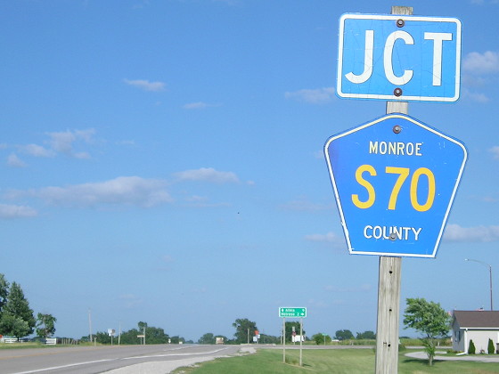
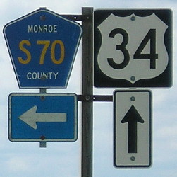
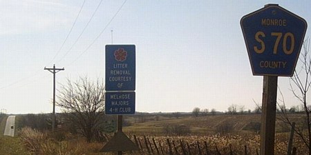
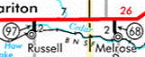
- We know it as: County Road S70, which becomes Shamrock Street in Melrose
- Let's get granular: It is possible that the original route followed Kells Avenue, 220th Street, and 535th Avenue, but I think this is unlikely.
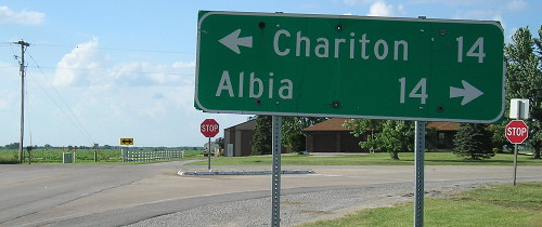
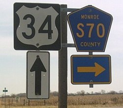
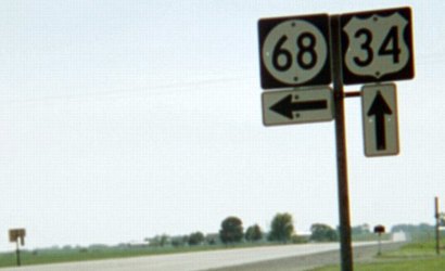
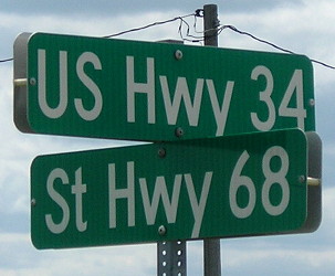
NORTH End: Stop sign/T intersection, US 34, originally IA 8, Monroe County
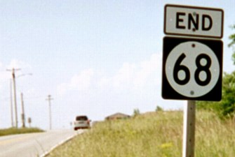
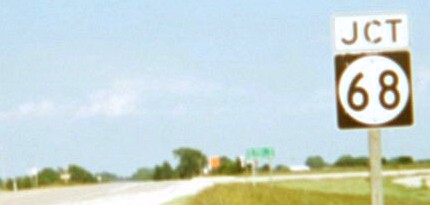
Facing north on 68 (6/15/03)
In 1920, the intersecting road was IA 8.
Facing north on 68 (1/20/02 and 6/18/18)
Left photo by Neil Bratney
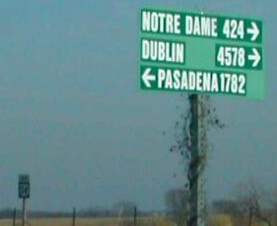
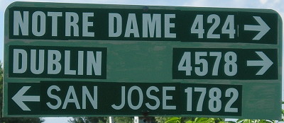
I seriously doubt the distances to Pasadena and San Jose are identical from this point. I am guessing that the sign owner seasonally swapped Pasadena, home of the Rose Bowl, for the location of the 2018 college football national championship game (it ended in Santa Clara, which is next door to San Jose).
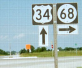
The real mileage sign, with 34/double arrow at left (6/15/03)
Same sign, with another 15 years on it (6/18/18)
Facing east on 34 (6/15/03)
Facing east on 34 (6/18/18)
Facing east on 34 (11/22/06 and 6/18/18)
Left photo by Jason Hancock
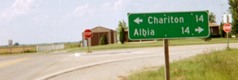
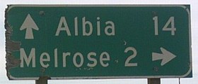
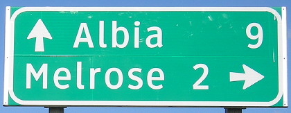
Wait, what? How did the distance to Albia get chopped from 14 to 9? Downtown Albia remains 14 miles away; 9 miles only gets you to an intersection of 34 and old 34 just east of the BNSF railroad tracks.
Facing east on 34 (6/15/03 and 11/22/06)
Right photo by Jason Hancock
Facing west on 68 (8/24/19)
Facing west on 34 (6/15/03 and 8/24/19)
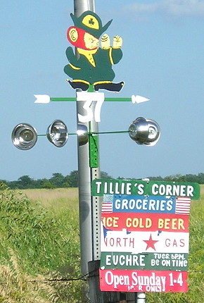
Euchre, Tuesday, 6 PM, be on time! (6/18/18)
Facing south on 68 (11/22/06)
Photo by Jason Hancock
Right under the Adopt-A-Highway sign is a small green marker, shown larger below.
Facing south on 68 (6/18/18 and 8/24/19)
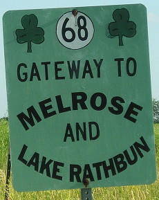
Melrose's slogan is "Iowa's Little Ireland." I first saw the sign on the left in 2003 and it was still there in 2018. In addition, Monroe County has not changed its rural street signs.
*Original Number, Original End*
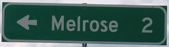
SOUTH End: Melrose, Monroe County
Facing south on 68 (6/16/03)
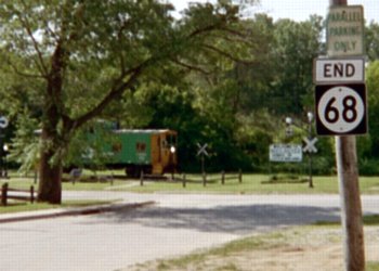
The city limits of Melrose (1920 pop. 450, 2010 pop. 112) are about a mile north. The final end of IA 68 was S70 at Erin Avenue. (6/15/03)
The south end of 68 is almost exactly 3 miles southwest of the confluence of 42 degrees north, 93 degrees west, near the confluence(!) of sections 25, 26, 35, and 36 of Wayne Township (T72N-R19W).
If you turn around, a shamrock is painted on the road right at the beginning of 68. The highway itself is Shamrock Street.
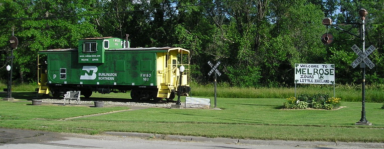
Closeup of railroad car and sign in above picture (6/18/18)
Point of interest
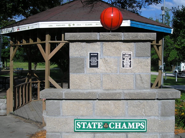
At the end of 68 is the Melrose veterans memorial and also a monument to the 1937 Melrose boys' basketball team, "Voted best high school basketball team in the first 100 yrs. of high school basketball." (6/18/18)
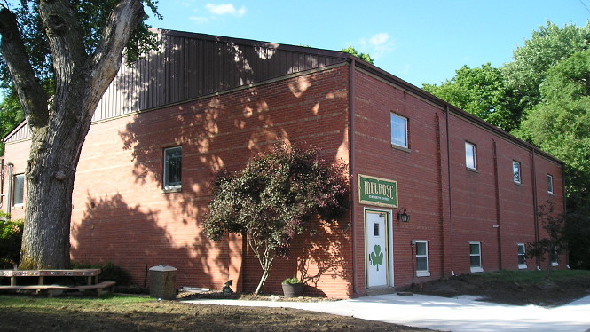
"The second floor of the rear section will have a spacious stage overlooking the main floor of the auditorium. The basketball playing floor will be one of the finest in a town of Melrose's population anywhere in Iowa. ... The Melrose community hall is being built with the aid of a $7,500 grant from the Public Works Administration. The PWA grant covers 45 percent of the cost of the structure, which is expectted to total $16,880." — Albia Union-Republican, April 27, 1939 (photo: 6/18/18)
Melrose, which became part of the Albia school district in 1959, lost its school in 1999. The process to close the elementary buildings in Melrose and Lovilia became so heated that the Union-Republican had to issue a defense of both its news coverage and its balance of pro/con letters. "[W]e can't help it if we print information regarding meetings that people don't like or don't want to hear. Spearing the messenger is a practice that dates back to ancient times when kings would put to death the bearer of bad news." (March 11, 1999)
*Original Number, Original End*
Last seen: 2003
Page created 3/22/02; last updated 3/26/07 3/22/20