

(July 1, 1920-July 1, 2003)
- In 1920, they knew it as: A road to Blairstown (1920 pop. 540, 2010 pop. 692) that locals would attempt more than once to get extended to Marengo. It never worked.
- We know it as: County Road V66
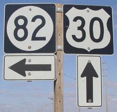
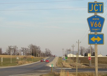
NORTH End: Stop sign, US 30 and V66, originally IA 6, Benton County
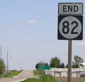
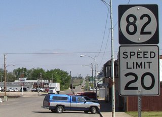
Facing north on 82 (5/20/03)
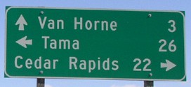
According to Jason's website, 82 was designated ten years (1920) before the other highways in Benton County, which would explain the smaller number and its non-relation to the others. This LGS has the closest-to-equal Cedar Rapids and Tama mileage.
Facing north on 82 (5/16/17)
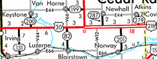
Let's talk about the Lincoln Highway, the road at 82's north end, designated IA 6 in 1920. There is only one significant stretch in Iowa where the Lincoln did not closely parallel the Chicago and North Western Railroad: from the corner east of Belle Plaine to Mount Vernon. The Linn County deviation can be explained by the Lincoln looping through the then-county seat of Marion. But as the Lincoln Highway headed west out of Cedar Rapids, it could have followed one of two other routes.
One, rejoining the C&NW, would have passed through Fairfax, Norway, Watkins, Blairstown, and Luzerne. However, this alignment would have stairstepped down to Fairfax and had many more turns plus four railroad crossings. (Perhaps not unrelatedly, it took a surprisingly long time to get a good road between Norway and Blairstown.)
The second, following the Chicago, Milwaukee, and St. Paul Railroad, likely would have headed out of Cedar Rapids on E Avenue then north a mile to Atkins. Then it would have passed through Newhall, Van Horne, (just north of) Keystone, and Elberon, with one railroad crossing at Newhall and two in Tama County. A 1912 Tama County map in fact refers to a road between Elberon and Toledo (now W Avenue and 320th Street) as "Cedar Rapids Road" but it has the drawback of winding through the Bohemian Alps.
The earliest reference to a transcontinental road for cars in the Belle Plaine Union was June 10, 1910: "The good road committee reported through Dr. Blanche, and he outlined plans for grading up and dragging the river road south of Belle Plaine, a road north, and an east and west highway, this last to be the official route of the transcontinental automobile route across Iowa."
The Transcontinental Route became Iowa's portion of the Lincoln Highway in 1913. In eastern Tama County, it stuck to the C&NW and the Iowa River bottoms. In Benton County, splitting the difference between the railroads meant that all those towns listed in the preceding paragraphs were a maximum of four miles away from it. It also created a perfectly straight 26-mile road in eastern Iowa, great for travel, but not necessarily great for autos of the time. Standalone service stations sprung up along the route. According to Cedar Rapids Gazette columnist Dave Rasdal in 1994, the last station between Tama and Cedar Rapids, at the Luzerne corner, closed soon after being robbed three times in 1989.
Today, US 30 in Benton County and western Linn County has a characteristic not typical of highways in Iowa: various businesses out on the road by their lonesome. Those include Youngville Cafe, the most famous of those gas stations in the middle of nowhere, saved from the wrecking ball in the 1990s and now a seasonal cafe, preserved as a four-lane road finally goes by.
Facing west on 30 (5/20/03)
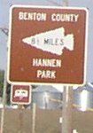
Hannen Park is on the Benton-Iowa line.
Facing west on 30 (5/20/03)
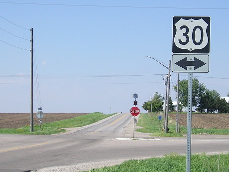
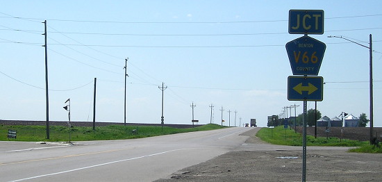
As with all Benton County spur termini, county roads were unsigned. Today, all the last poles in each direction on 30, like this one, have "Jct [route] [arrow]" as seen below.
Facing west on 30 (5/16/17)
Facing east on 30, post-decommissioning (11/26/08)
*Original Number, Original End*
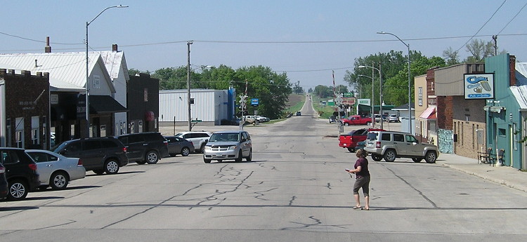
SOUTH End: Benton St., Blairstown, Benton County
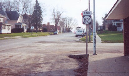
Facing south on 82 (12/2/01)
Photo by Jason Hancock
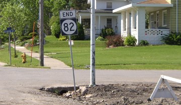
Facing south on 82 (5/20/03)
The building at right was torn down for construction of a new city hall/community center/library.
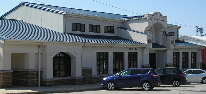
The completed city hall/community center (5/16/17)
A Highway Commission listing from 1936 put the end of 82 a block south at Prospect Street; it was truncated to Benton on January 1, 1961.
Facing north on 82 (5/20/03)
IA 82 was not marked as paved on the state map until 1999, which seems patently ridiculous. But when WAS it paved? Well, it depends on what the definition of "paved" is. It was marked as a bituminous road (commonly known as "blacktopped", a dustless route that has ill-defined shoulders and typically no pavement markings) in both the 1945 and 1997 county maps. The event that likely precipitated the change on the map was a three-layer asphalt resurfacing project in 1997. The road's status is curious in that it was "officially" paved far later than the entire state system despite being an original route, one of only two spurs in Benton County, and after 1980 one of only two (IA 201 the other) that didn't end at city limits.
Facing north on 82 (5/16/17)
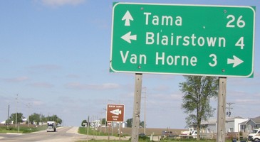
Another view of downtown Blairstown.

Facing north on 82 (5/20/03)
Last seen: 2003
Page created 2/23/02; last updated 3/15/20