
| IA 83 endpoint history | |||
| FROM | TO | WEST | EAST |
| 7/1/20 | 6/4/35 | IA 7, later IA 64 (High at Elm, Avoca) | Walnut |
| 6/4/35 | 7/31/37 | US 6 in Atlantic | |
| 7/31/37 | 8/12/59 | ||
| 8/12/59 | 3/7/73 | IA 64 (IA 191) | |
| 3/7/73 | 7/1/03 | IA 148 in Anita | |
| 7/1/03 | Present | US 59 (High at Walnut, Avoca) | |
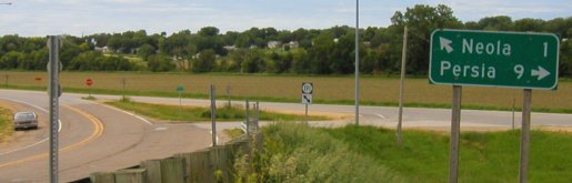
Old WEST End: Stop sign, IA 191, Pottawattamie County
Facing west on 83 (6/9/03)
Facing west on 83 (6/9/03)
Notice the rare double diagonal arrow (which also used to make appearances at intersections with IA 330). The double arrow became a straight one after decommissioning with a G8L shield above it.
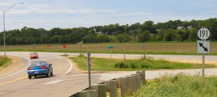
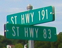
Facing north on 191 (6/9/03)
After July 1 the right sign's bracket was blank.
Facing north on 191 (1/18/02 and 6/4/07)
Left photo by Neil Bratney
Facing north on 191 (6/9/03)
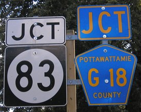
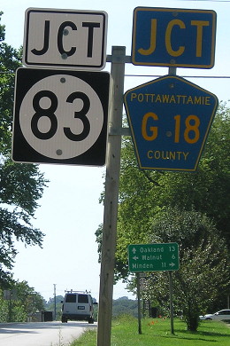
Turning from 191 to 83 here used to mean continuing on the same road. Between 1939 and 1969 both segments were part of IA 64, a cross-state route that involved a lot of duplexing. Today, this entire intersection has been dumped into Pottawattamie County's jurisdiction, a far cry from when this was an important intersection.
Facing north on 191 (7/24/19)
There are arrows there. You might have to squint.
Facing east on 83 (6/9/03)
Bridges figure prominently in the old first mile of 83. This one, just past the first sign, is over Burlington Northern railroad tracks, and then I-80 goes over it half a mile to the east (with no direct access).
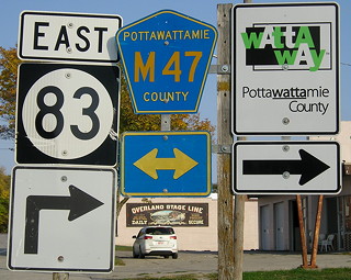
Alternate names were given to the portions of 191 and 83 turned over to the county after July 1, 2003. (6/9/03)
Facing south on 191 (6/4/07)

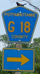
1920 WEST End: IA 7, now G18/High St. at Elm St., Avoca, Pottawattamie County
The evolution of highways in Avoca was not as straightforward as I thought it was. IA 7, which took over the River-to-River Road west of Des Moines, broke from the north-south road north of downtown. It passed by the building that was the not-quite-Eastern-Pottawattamie County Courthouse, aka "Avoca Courthouse," whose history is covered in this Council Bluffs Nonpareil story, and went through the northern part of downtown Avoca.
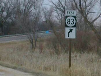
Facing west on 83 (8/23/19)
Notice the decorative brick here at the center of the business district. IA 7 went ahead and right.
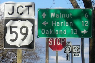
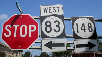
WEST End: Stop sign, US 59/Walnut St. and G18/Old IA 83/High St., Avoca, Pottawattamie County
Counterclockwise from 3 o'clock:
Facing west on 83 (8/23/19)
This is probably about as close as mileage can get. This is heading uphill, before the "Jct 59" sign...
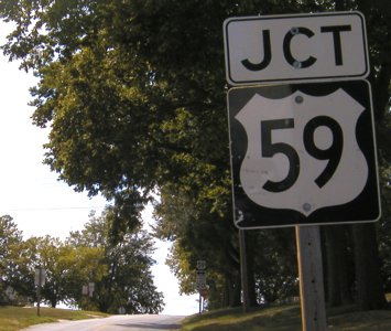
Facing west on 83 (8/11/03)
...which apparently never had an "83 ^" and as of August 2003 did not have an "End 83". It does now (below).
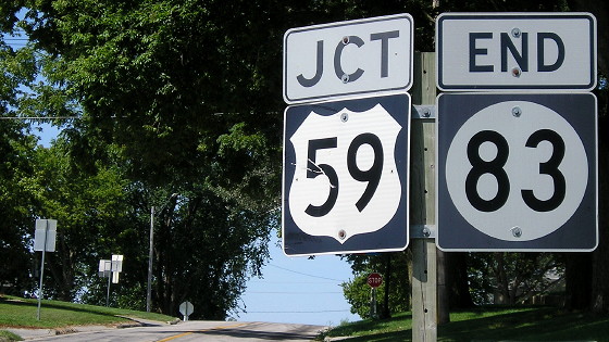
Facing west on 83 (8/23/19)
Facing north on 59 (6/12/06)
Facing north on 59 (8/11/03)
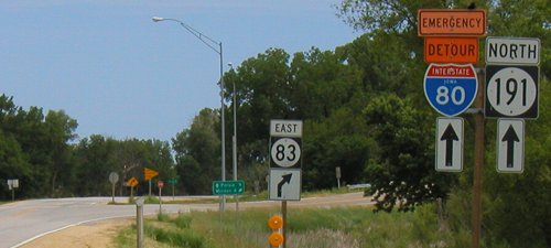
Note the sign assembly from the background of the above picture at right and the "To 80" sign in the background here.
Facing east on 83 (4/6/08)
The "East 83 ^" in the background is now the first shield eastbound and it's on the other side of the intersection (see below).
Facing south on 59 (8/11/03)
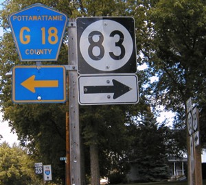
The designation for 83 west of 59 is now G18. Given the massive truncations in Pottawattamie County, I was almost surprised 83 was not extended a mile and a half north of Walnut to I-80 and truncated an additional six and a half miles - but then found out that to do that, 83 would end up on brick streets in downtown Walnut.
Facing south on 59, more recent view / Closeup (8/23/19)
Facing south on 59 (8/23/19)
Downtown Avoca is at the base of a bluff/rise that grows to the northeast all the way to I-80.
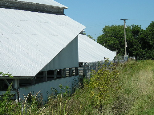
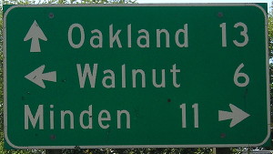
US 59 on Walnut Street is a block west of the straight north-south road, Chestnut Street. The highway was moved to Chestnut in 1937, when a railroad overpass was built. According to the Walnut Bureau (get it?), the overpass was dedicated July 31, 1937.
What does that have to do with this picture? These are animal barns for the Pottawattamie County Fairgrounds, on the south side of town, that have had their corners shaved off exactly along the right-of-way line for 59. (8/23/19)
1920 EAST End: Walnut, Pottawattamie County
- In 1920, they knew it as: Walnut's consolation prize for where the primary system significantly deviated from the River-to-River Road
- We know it as: IA 83
- Let's get granular: IA 83, a now-vacated road southeast and east from Ballard Creek, Tailor Avenue, 480th Street, IA 83, Westgate Road, IA 83. Downtown Walnut is the block running north of where 83 turns southward today.
- Point of interest: The 1910 River-to-River Road between Exira and Avoca went through Atlantic and Marne. However, the primary system favored straighter roads via Harlan, and that's where IA 7 went. Eventually, though, the left-behind segment all became IA 83.
- Related routes: IA 271 (I), a spur to Marne that lasted eight months; and IA 973, the route of US 6 between US 71 and Anita that remained when 6 was moved onto I-80 and it took the state a year to extend 83.
Facing east on 83 (10/8/20)
To the left is downtown Walnut, with a brick street. The "Watta Way" is a promotional tour from Pottawattamie County tourism.
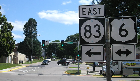
Old EAST End: Stoplight, US 6/7th St., Atlantic, Cass County
Facing south, but heading east, on 83 (7/24/19)
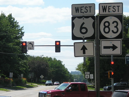
Facing west on 6 (7/24/19)
Facing east on 6 (7/24/19)
Facing southeast (10/22/14)
It took me three trips to Atlantic before photographing this intersection as an endpoint, because it predates 1980. It was extended east to Anita, creating a triplex with US 71, in March 1973, after a brief period with the road through Wiota as an unmarked primary.
I have plenty of pictures of the courthouse, though. (10/22/14)

SQUIRREL! (10/22/14)
Civil War monument in park across from courthouse (10/22/14)
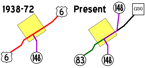
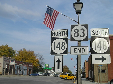
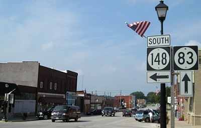
EAST End: Intersection, IA 148/Michigan Ave., Anita, Cass County
Two maps of Anita from when 6 went through town and today are here.
Facing northeast, but heading east, on 83 (8/11/03)
Until 1973, 83 ended at US 6 in Atlantic. After 6 was duplexed with US 71 up to I-80 and then east on 80, 83 was extended along 6's old route to Anita, creating a 2-mile triplex east of Atlantic with 6 and 71. When this was still 6, this was 148's north end. Soon after this intersection, 148 turns north again to end at I-80.
Facing northeast, but heading east, on 83 (10/22/14)
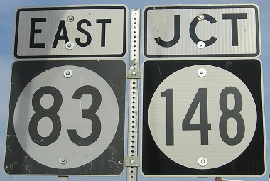
For some reason, there's now a reassurance shield for 83 less than a block from its end.
Facing northeast, but heading east, on 83 (10/22/14)
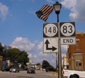
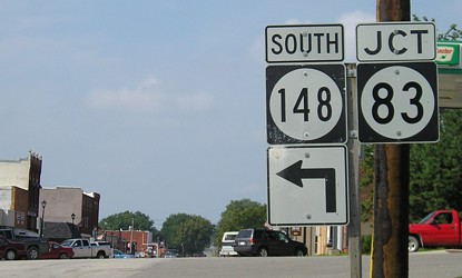
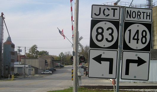
Compared to the 2003 setup two pictures up, this is strange. I don't know why the directions for 148 were split, and we still have "83 End".
Facing north on 148 (8/21/06)
Until 6's realignment this would have read "End 148 / 6 <->". In the late 1960s and early 1970s, I-80 existed a few miles to the north, but 148 south of here was still gravel to IA 92. By 2014, the 148 shield was replaced, and the metal strip anchoring the arrows had been moved down, creating a gap between the shields and the arrows.
Facing southwest, but heading south, on 148 (8/21/06)
Facing southwest, but heading south, on 148 (8/31/13)
Photo by Jason Hancock
Facing southwest, but heading south, on 148 (8/21/06)
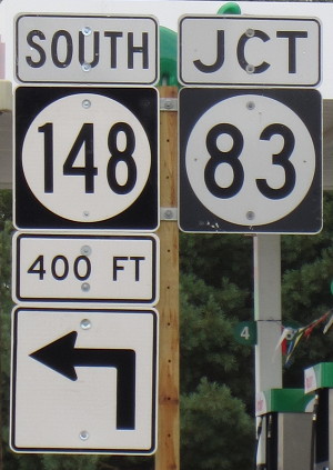
Facing north on 148 (10/22/14)
The inclusion of the arrow with the "Jct" is due to the railroad tracks and lack of space closer to the intersection.
Page created 3/22/02; last updated 10/30/20