
(November 12, 1975-February 18, 2003)
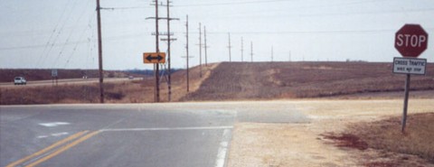
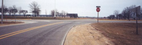
NORTH End [NORTH segment]: Stop sign, US 61, Clinton County
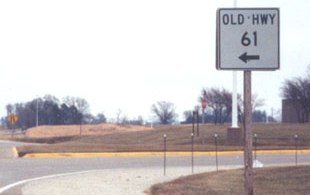
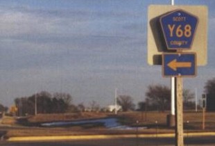
One of the more prominent yet unsigned secret highways in Iowa fell just before the Second Great Decommssioning of July 1, 2003. Within a matter of days in December 2002, all three entities involved with the road agreed to take over jurisdiction of their respective portions of the route - Clinton County (for $841,000), Scott County ($1.7 million), and the town of Eldridge ($695,000). (The bridge over the Wapsipinicon River, articles indicate, is entirely owned by Scott County now.) The route is now signed as Y68.
Facing northwest on 956
Photo by Jason Hancock
Today's maps seem to indicate that 956 ended in what appeared to be a direct merge at US 61, but this is not the case.
Facing west
Photo by Jason Hancock
This picture was taken near the same spot as the one above. The east-west road is 210th Street, which 956 used a tiny piece of to get to 61. There is no county road signage on 61, even though Y62 and E73 both come near here.
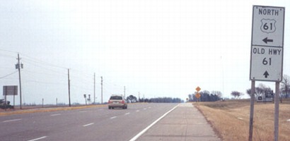
Facing south on 61
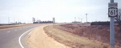
Facing south on 61
Photo by Jason Hancock
You can see 956 along the power lines. The minimum speed limit of 40 indicates that the freeway actually starts here, instead of at US 30. Jason Hancock adds this sidebar about the status of 956's north end: "IA 956 originally ended at a half-diamond interchange with US 61 after the freeway opened. It was close to the house and trees in the background of the third photo. This half-interchange, made with the old "Freeway 561" plans in mind, was removed around 1995, when grading for the four-lane segment began and US 61 was curved to the northwest to run closer to its old alignment." Indeed, all maps between and including 1977 and 1996 show a partial interchange here.
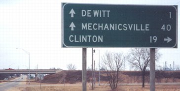
SOUTH End [NORTH segment]: City limits of De Witt, Clinton County
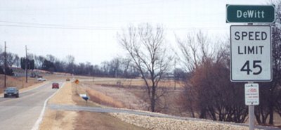
Facing south on 956
Photo by Jason Hancock
The portion of old 61 through De Witt was turned over at some point in the past, same as old 30 (IA 948 between 1975 and 1992). The segment between US 61 and the north city limits of De Witt is 1.93 miles.
Facing north on 956
Photo by Jason Hancock
LGS in background of above picture
Photo by Jason Hancock
This is the only remaining LGS on 956. The south one may have been removed after construction of the 61 freeway south of 30.
Old SOUTH End: Interchange, US 30, Clinton County
NORTH End [SOUTH segment]: City limits of De Witt, Clinton County
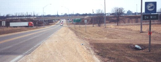
Facing north on 956
Photo by Jason Hancock
Prior to 1982, the four-lane construction of US 61 had not gone south of US 30. Between 1982 (or whenever the segment through De Witt was turned over) and 2002/3, the beginning of the big piece of 956 was here. This picture encompasses both of them; the pavement change at lower left marks the switch. Just to the right of the sign in the foreground is "Jct 30". From here it is 2.99 miles to Scott County's portion.
Facing north on 956
Photo by Jason Hancock
Facing east on 30
The BGSs did not include anything about 956, but...
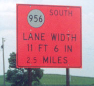
Photo by Jason Hancock
This orange construction sign in spring 2002 has probably one of four or so (eight?) 956 shields ever made.
Facing west on 30
Photo by Jason Hancock
This trumpet interchange is a mile west of 956. While the exit tab on the left is OK, the one on the right means that US 30 is exiting from itself. At all BGSs at the two interchanges involved, the tabs not on 61 by itself use 30's exit numbers, meaning 30 exits from itself twice. It would be more logical, even though it goes against the rule of using the lower-numbered highway, to treat 61 as the dominant highway and use its exit numbers, only including 30's on 30 proper and not when it's exiting from itself.
SOUTH End [SOUTH segment]: Stop sign, F55, Scott County
Facing south on 956
Photo by Jason Hancock
This is actually not a part of old 61, even though the picture below indicates otherwise. Construction of the freeway was such that part of old 61 is west of the new, and this part, now the southernmost half-mile of 956, was built to connect F55 with old 61 east of the freeway. The road ahead is the entrance to the John Deere Davenport Works.
Facing east on F55 (December 2002 / December 2003)
Photos by Jason Hancock
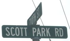
Photo by Jason Hancock
Throughout Scott County 956 is Scott Park Road.
Facing east on F55
Photo by Jason Hancock
This indicates that "Old 61" (956) is straight ahead, and then it's followed up in the picture above.
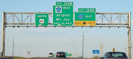
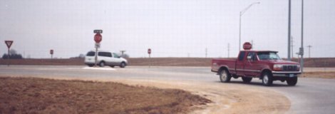
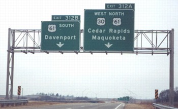
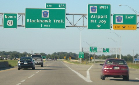
Facing north on 61 (2006)
This is most likely the best-signed exit with a county road in Iowa, and that's partially due to its setup and history. Jason Hancock writes, "The interchange was probably made with Deere and the old Caterpillar plant in mind; traffic heading from the Quad Cities toward Cat would use the F55 west loop ramp, merging into F55 without a stop sign or light, and traffic heading toward Deere would use the F55 east ramp. Cat closed its Davenport plant in 1988." Still, there are quite a few interchanges along I-80 that completely ignore county roads, so this gantry with directions included is a rarity. These signs on US 61, and the ones closer to the exit, have now been replaced.
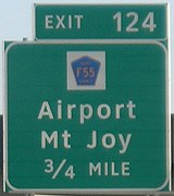
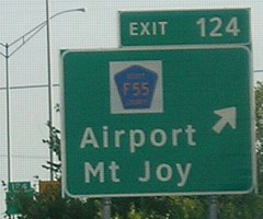
Facing north on 61 (2007)
Facing north on 61 (2002)
Photo by Jason Hancock
Facing north on 61 (2007)
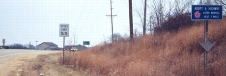
Facing south on 61
The southbound signage is much less elaborate.
Surrounding area information: Old US 61
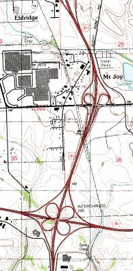
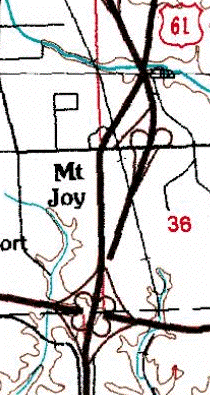
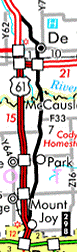
USGS topographic maps (different scales) from ortho.gis.iastate.edu
The road in question here is the one that double-dead-ends on the left map. You can see that the entire road north of I-80 was rebuilt to cross itself. The road running past "Mt Joy" on the left map is IA 960 (a separate designation from 956).
Facing southwest
Photo by Jason Hancock
This is the northernmost part of old 61 west of the freeway, taken from the freeway's shoulder.
Facing west on F55
Photo by Jason Hancock
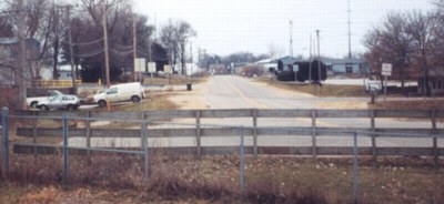
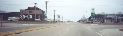
Old 61 runs between the tavern on the left and BP (former Amoco) on the right. Notice that the former Amoco has been 'fully assimilated' into a BP, a trend that happened first in larger cities. The other side of this intersection was the east end of IA 387, which went to the airport.
Facing south
Photo by Jason Hancock
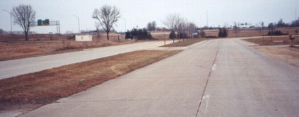
The evidence of 61's past is evident in these bypassed four lanes. Jason writes, "From 1982 to about 1997 the old US 61 segment dead-ended at the point where the grassy median ended. Before the freeway was built the four lanes ran due southward to the I-80 cloverleaf, where you can see some of the BGS gantries in the background. Around 1997 the city of Davenport extended this stub around the I-80/US 61 interchange as part of a new business park." By the end of 2003 one tenant, Swiss Valley Farms, had moved in.
Facing west
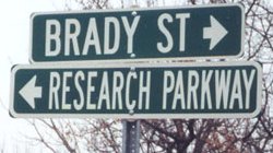
Photo by Jason Hancock
This sign marks the change from the old road (Brady St.) to the new extension (Research Pkwy.).
Last seen: 2003
Pictures by Jason Hancock: First, second, fourth-tenth, twelfth-fourteenth, 16th, 17th, 20th, and 23rd-26th, 12/25/02; eleventh, spring 2002; 15th, December 2003
Pictures by me: Third, 21st, and 22nd, 9/2/08; 18th, 10/13/06; 19th and 21st, 8/31/07
Page created 3/3/03; last updated 12/31/08