 and
and  BUSINESS
(976: November 26, 1996-July 1, 2003)
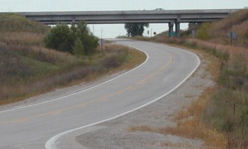
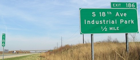
WEST End: Direct merge into US 30, Marshall County
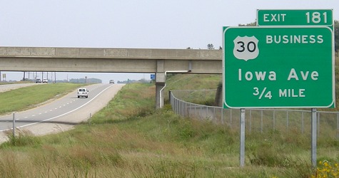
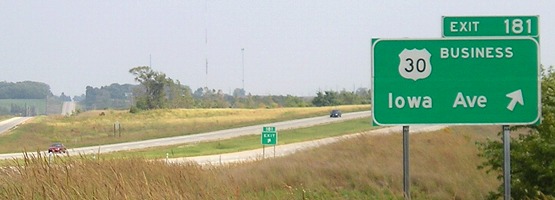
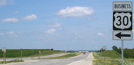
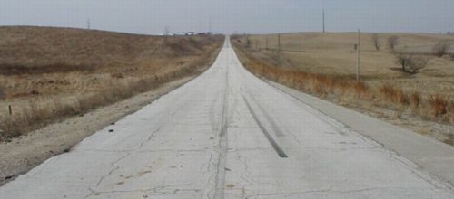
Facing east on 30 (9/21/07)
The bridge is for County Road S75, which goes gravel south of 30; this was an at-grade intersection before the four-lane was constructed.
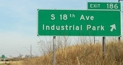
Facing east on 30 (9/21/07)
A note: I wrote the below when I originally created this page. A decade later, the circumstances have changed somewhat. US 30 is finally an expressway/freeway all the way from Ogden to Tama. With all those changes, the bypass makes more sense. However, I have left the text below intact. Is any of it still applicable? Your mileage may vary.
<rant>
A funny thing happened on the way to the future - the roads got longer. In the early days of roads, they detoured off the straight path to enter business districts. Later, they were rerouted to be made straighter, an era that seems to have ended in the late 1980s. Today, in the name of progress and four-laning, highways are detoured around cities and towns, away from the straight route, to make it "faster". US 30 is a prime example. After a rerouting away from the Lincoln Highway routes, 30 was more or less a nice straight highway from I-35 to Toledo, with a slight angle to the southeast in that last portion. Today, 30 runs parallel to the old route in Marshalltown - which itself was a straightening from the original downtown Lincoln route — by mere hundreds of feet, curving southeast from the old road and then curving back northeast to meet it. All that, so travelers would not have to slow down for the businesses along the old route, and so they would not risk actually having to — gasp! — stop at a stoplight! Since late 2004, between the east city limits of Carroll and the west city limits of Clinton, a traveler on 30 is required to stop precisely three, and perhaps four, times — a stop sign at IA 4 north of Jefferson, a stop sign at R27 south of Boone, a stoplight (formerly a stop sign) at US 63 in Toledo (ed: not anymore), and a stop sign at IA 1 in Mount Vernon.
Now, back to Marshall County. The perfectly straight road of as late as 1995 takes two swings off the path. In addition to the Marshalltown bypass, a bypass goes around the north side of Le Grand (see the IA 146 North page). It is with a slight touch of irony that a route designated in the '50s through Le Grand, which was part of the Lincoln but not the first 30, that made the road straight between Marshalltown and Toledo, is being superseded by a semicircle around the town. And in 2011, fifteen years after the opening of the Marshalltown bypass, 30 still won't be four lanes to Ames.
</rant>
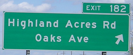
Originally, IA 976 was the designation of the entire business route. It appears the 976 designation at decommissioning in 2003 only applied to the small piece of road between a newly-paved piece of road just east of this picture that has a partial interchange with 30, and the end of the onramp, approximately at the location of the car without headlights on the left side. As with many business routes, the route is only signed in one direction at each end; the westbound signage is at the 18th Street exit. Eastbound traffic gets off, and westbound traffic gets on, at this partial interchange; the other half of the equation uses the Highland Acres Road/Oaks Ave. partial interchange about half a mile ahead.
Facing west on 976 (9/21/02)
This is the end of an extended onramp, an alignment that used to carry all of US 30 but now has westbound traffic only. Eastbound 976 exits from 30 and dips under the freeway before meeting up near the end as seen below.
EAST End of 976: Just past west US 30 interchange, Marshall County
Facing west (9/21/02)
The vehicle coming towards us marks where eastbound and westbound 976 join up. The vehicle leaving is approaching the area in the extended onramp picture above. The arrow at lower right marks a pavement change, the likely east end of 976.
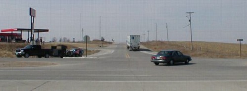
Facing south (9/21/02)
This is looking south from Business 30, east of 976, at a road paved to serve as the other half of the west interchange. The partial interchange has a WB offramp and EB onramp. To the west are the other halves, which make up 976. Oaks Avenue is the rural name for this street, Highland Acres Road the city one.
Facing west on 30 (4/17/16)
Facing south on Oaks Avenue (4/17/16)
This is about 1 mile northeast of the confluence of 42 degrees north, 93 degrees west, which is nearly on the gravel road that S75 becomes south of 30.
At the very end of 2003, Marshall County apparently gave back (PDF) this small remainder of IA 976 to the DOT, saying the ramps were "inadvertently transferred to Marshall County under [Senate File] 451." However, PDF maps since then do not show a 976 marker, leaving the official designation unknown.
Surrounding area information: Junction IA 14
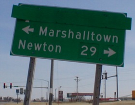
Facing west on Business 30 / Facing east on Business 30 (3/23/02)
Since these pictures were taken, the poles for the old westbound sign are gone and the left third of the "^ Toledo 17" strip is gone. The distance and arrow for Newton looked like there were two or three layers underneath. You can tell they are stickers if you look closely.
Signs in above pictures: Westbound / Eastbound (3/23/02)
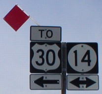
As for facing south on 14, there is no "Jct" sign, but rather a "To 30" with a straight arrow on the north side of the intersection. It's probably because the bypass is so close.
Facing south on 14 (3/23/02)
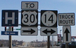
How close? That close. The top is looking south at the intersection. While a Super 8 and Best Western sit between old and new 30, old mom-and-pop hotels from the 1950s line old 30 to the west of here.
On the left picture, the sign at left is 14 with a straight arrow, and an LGS is on the right. On the right picture, notice the text difference in the directions. They are bolder than the normal ones, and show up occasionally on mid-1990s assemblies.
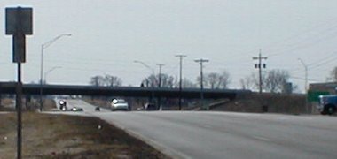
EAST End of Business 30: Interchange, US 30, Marshalltown, Marshall County
Facing south, but heading east, on Business 30 (7/15/07)
The west end of Business 30 is just south of where the original route was, because of the curve.
Closeup of LGS in above picture (7/15/07)
Facing north, but heading west, on Business 30 (7/15/07)
Facing north, but heading west, on Business 30 (7/15/07)
Straight ahead is 18th Street, a four-lane road along the east side that really doesn't pass by much until Main Street and the Lennox plant. To the right is the old - and seemingly abandoned - part of 30, pictures of which are below.
Facing west on 30 (7/17/07 and 6/20/17)
Facing west on 30 (7/17/07)
Facing east on 30 (7/17/07)
Like a lot of business routes, Business 30 is only signed one way each way.
Facing east on 30 (7/17/07)
Surrounding area information: Abandoned(?) US 30

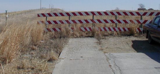
Facing east, at the beginning of the abandoned segment (3/23/02)
I say "abandoned" with a question mark because it seems in good condition for a decade off the beaten path.
Facing east (3/23/02)
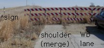
Right at the very end, the pavement on the side expands a bit. I'm pretty sure that this was a paved part of the shoulder for traffic from Tiffin Avenue to turn on the highway. The street sign for Tiffin and 30 (240th St.) is on the left. The car is straddling the center line. The key below helps figure out what is what:
Facing west from end (3/23/02)

Facing west, near where side pavement ends (November 2002)
The shoulders appeared to have been mowed in 2002, but five years later no such maintenance was occurring.
Facing west (3/23/02)
As you can see, the white line on the side of the north-south road does not break on this side of the intersection.
Page created 5/26/02; last updated 1/12/18