
(1952-July 1, 2003)
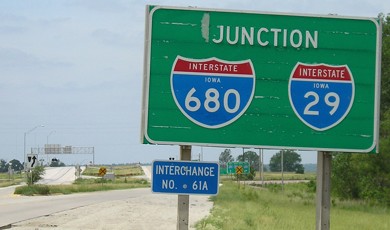
WEST End: I-29 exit 61A/I-680 exit 3B, Pottawattamie County
Facing west on 988 (6/12/06)
Facing west on 988 (6/12/06)
There's no "End" sign because 988 was (mostly) unsigned. Like 928 in Hamilton County, the only shields were on BGSs (see below).
Facing west on 988 (6/12/06)
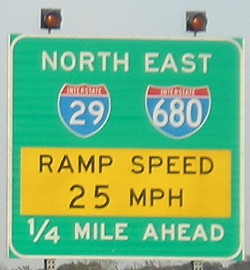
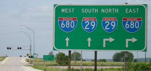
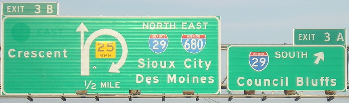
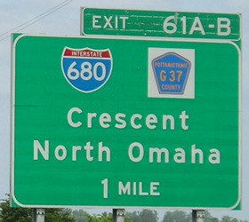
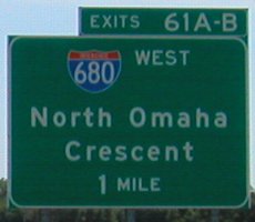
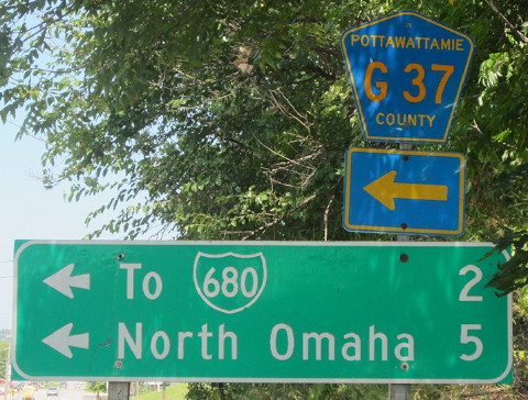
Facing east on 680 (10/9/10)
The picture at far right is the one by the "EXIT" gore sign in the photo underneath.
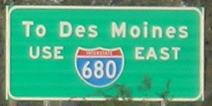
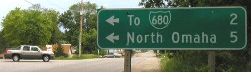
Facing east on 680 (6/1/03)
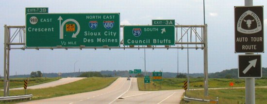
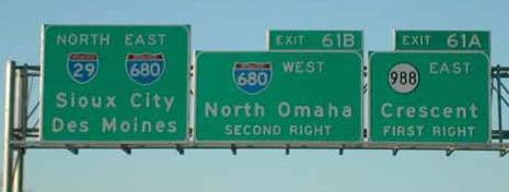
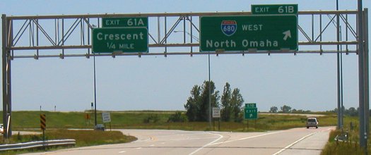
After decommissioning the shield and the "East" were peeled off the Crescent signs. The ground-mounted BGSs have 29 and 680 shields warning of the turn.
Facing east on 680 (4/9/17)
Photo by Jason Hancock
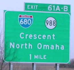
I am not a fan of putting a space, especially a giant one like this, between a number and A/B on an exit.
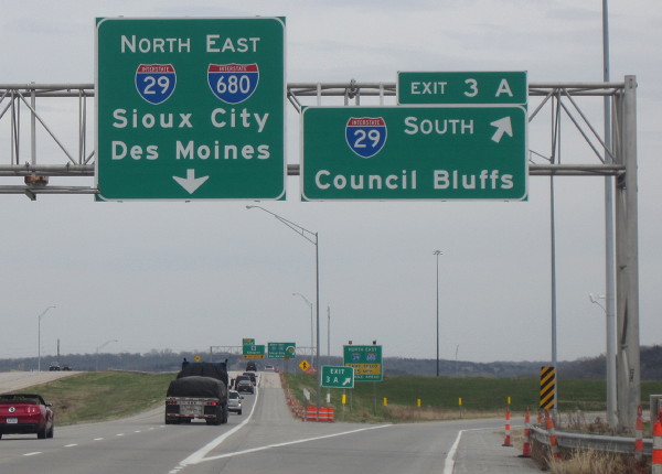
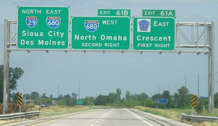
Facing east on 680, post-decommissioning (10/9/10)
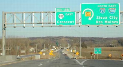
This picture at dusk shows the ghost of the "988 EAST" marker and awkwardly spaced Clearview exit tabs.
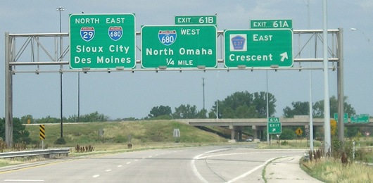
Facing east on 680 (6/1/03)
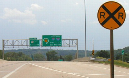
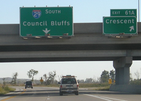
How often do you see an "RRX" sign on an interstate?
Facing east on 680, barely (1/15/02)
Photo by Neil Bratney
I-680 traffic takes the ramp on the right, while traffic in the other two lanes a) goes to one lane immediately, and b) crosses railroad tracks almost as immediately. Nice and abrupt.
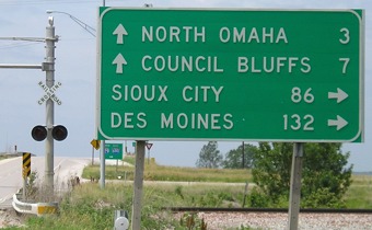
Facing north on 29 (1/15/02 and 6/12/06)
Left photo by Neil Bratney
Hello, secret-highway-that's-not-secret. Only northbound 29 BGSs had 988 shields.
Facing north on 29 (1/15/02)
Photo by Neil Bratney
Facing north on 29 (6/12/06)
Facing north on 29 (6/12/06)
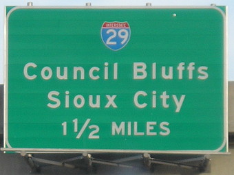
Facing south on 29 (6/1/03)
Facing south on 29 (6/1/03)
Facing south on 29 (10/1/15)
On the route
There are only two intersections on 988's route, meaning only two signs had to be replaced. (6/1/03)
EAST End: Stop sign/T intersection, IA 183, Crescent, Pottawattamie County
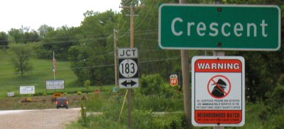
Facing east on 988 (6/1/03)
Again, no "End" sign. The "Jct 183" now has "G37 End". I think G36 would have been more appropriate, since a G36 does head east just north of here and the route is really a continuation of (pre-680) NE 36.
Facing east on 988 (6/1/03)
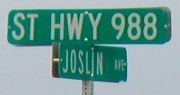
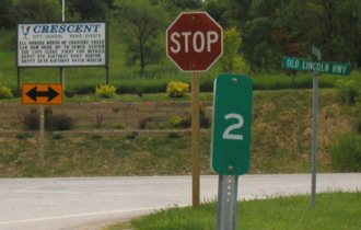
Street sign in above picture (1/15/02)
Photo by Neil Bratney
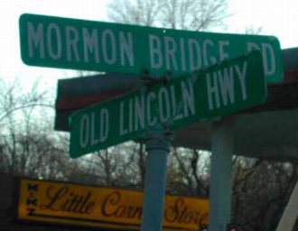
"Old Lincoln Highway" is 183, from the original route. US 30, then 30A, then IA 183, and finally L20 were subsequent numbers for this road, going from transcontinental route to lowly county road in exactly 90 years. The connector between Crescent and I-680 is the "Mormon Bridge Road" in tribute to the Mormon pioneers who spent winter in the Omaha area in 1846. Neil writes, "IA 988 was simply the 'Mormon Bridge Road' (unnumbered) from Crescent to North Omaha in 1959 when the Mormon Bridge was opened. In 1977, I-680 was built across the river using the original as well as a duplicated Mormon Bridge." (Street Atlas, incidentally, calls it "Norman Bridge Road". Go figure.) This sign, like at 982, is another example of old roads never dying, just living on in street signs.
Note: These became the names of the roads in rural Pottawattamie County when 183 and 988 were decommissioned.
Facing south on 183 (1/15/02)
Photo by Neil Bratney
Facing north on 183 (6/1/03)
There wasn't any other signage at this intersection save for the 183 shields after it.
Facing north on 183 (8/2/15)
Photo by Jason Hancock
Page created 4/7/02; last updated 2/23/19