 EAST
(1980-2003*) and
EAST
(1980-2003*) and  SOUTH (1926-present) at
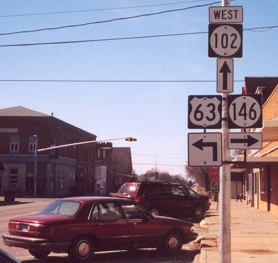
EAST End of 102 (1980-86) and WEST End of unsigned 102 (2003-present): City limits of New Sharon, Mahaska County
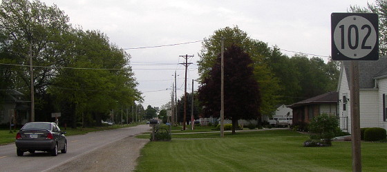
Facing east on 102 (5/13/03)
While the state took charge of the stairstep county road that was designated IA 102 in the summer of 1980, it did not sign an agreement with New Sharon until July 22, 1986 — which I didn't know until legal descriptions were released online, although the 1986 county map had a tiny giveaway by not listing the mileage inside the city. Now, the route could have been signed at the intersection downtown, but Market Street wasn't technically the state's yet.
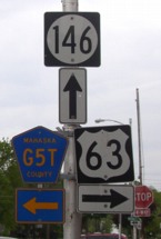
On May 13, 2003, there were precisely two IA 102 signs still standing: The "End" sign, and this one, facing east on the west end of town. Strangely, this outer sign seemed to be on a new pole, directly across from the second G5T sign - the first is right where it should be, replacing the first sign for 102 west. I called the New Sharon City Hall later in the month, and they told me the entire route was turned over...
But wait!
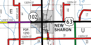
More than a decade later, county surface maps show all state-maintained routes in black and city maps in red. This 2013 Mahaska County map and current New Sharon map clearly show IA 102 still existing within New Sharon's city limits. Post-2003, IA 102 and IA 965 are Schroedinger's highways — they are both alive and dead. Because this half-mile of 102 remains under state control, it is the last remaining of the 11 signed highways created in 1980.
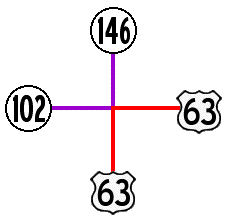
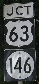
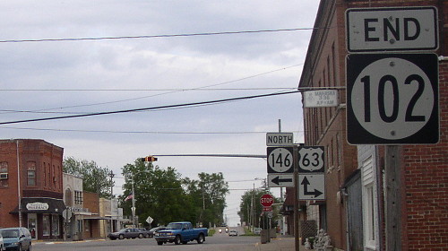
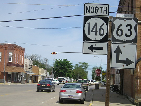
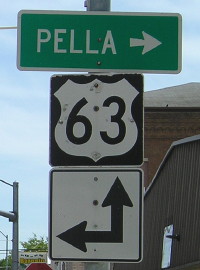
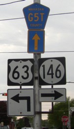
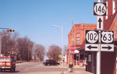
SOUTH End of 146/EAST End of 102: 4-way stop, US 63, New Sharon, Mahaska County
Clockwise from nine o'clock, showing before (early 2002) and after (May 2003/May 2015) pictures:
End 102
Facing east on 102 (5/19/15 and 5/13/03)
Facing east on 102 (5/19/15)
End 146
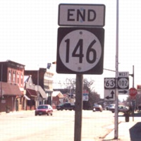
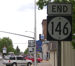
Facing south on 146 (4/14/02 and 5/13/03 and 5/19/15)
Left photo by Jason Hancock
63 South
Facing west, but heading south, on 63 (5/19/15)
Facing west, but heading south, on 63 (4/14/02 and 5/13/03)
Left photo by Jason Hancock
63 North
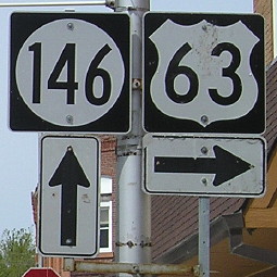
Facing north on 63 (4/14/02 and 5/13/03 and 5/19/15)
Left photo by Jason Hancock
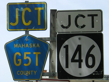
Why did the G5T signs disappear?
To the IA 102 West end / To the IA 146 North end
Page created 5/24/02; last updated 3/28/17