

NORTH Iowa line: Big Sioux River, Sioux City IA/North Sioux City SD, Woodbury County IA/Union County SD
Facing west, but heading north, on 29
The signs at left include a preliminary sign for US 77. The segment of I-29 between what is now IA 12 and the east Business US 20 exit is the oldest segment of Iowa's interstate highway system outside of central Iowa, and part (probably) pre-dates the interstate signage. The first interstate interchange was opened on December 15, 1957, at the bridge into Nebraska. For about a year, this carried US 77 between Hamilton Boulevard and the bridge, though it might not have been signed as I-29 at the time. (US 77 had been moved to an alignment near the river in the 1940s.) Then, on October 1, 1958, the segment between 12 and 20 opened as an official part of I-29.
Facing west, but heading north, on 29
This is the last exit in Iowa, and shortly after it drivers approach the bridge. For comparison, I-35's Exit 151 is C70 in southeast Wright County. For three years, traffic had to exit here and travel north to the Military Road bridge.
Facing west, but heading north, on 29
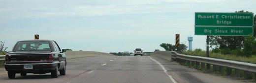
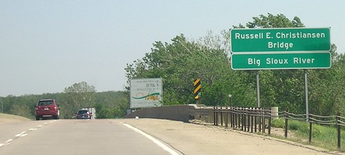
The short connection between IA 12 and the Big Sioux waited until South Dakota was done, but four months after it opened the span you see here collapsed and had to be rebuilt.
Facing east, but heading south, on 29
Photo by David Morrison
Facing east, but heading south, on 29
Photo by David Morrison
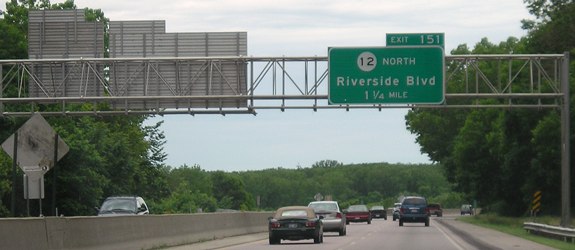
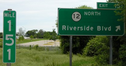
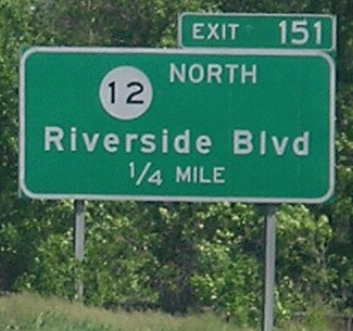
The IA 12 interchange is close enough to the state line that only a 1/4-mile advance sign is put up. This is the only non-interstate interchange on I-29 besides IA 192 that gives a direction with a highway shield.
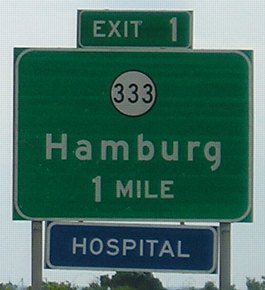
SOUTH Iowa line: 1 mile S of Hamburg, Fremont County IA/Atchison County MO
Facing north on 29
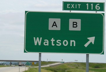
This picture is 10 miles south of the line, but isn't it fitting that the last (or first) exit in Missouri is for A and B?
Facing south on 29
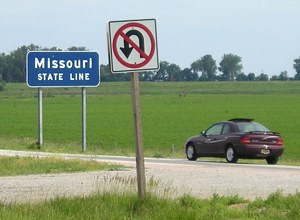
The presence of a state-line sign with state DOT standard signage is somewhat rare, since usually states put up their own special signs. But even rarer is someone (besides me!) who stops and gets out to take a picture of a state-line sign, as the people in this purple car were doing.
Facing north on 29
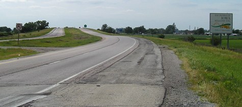
Notice the immediate change in the shoulder crossing the line.
Facing north on 29
In the background of the above picture you can see this 1-mile sign for IA 333.
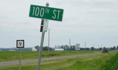
Surrounding area information: The southwesternmost point in Iowa
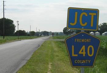
Facing west on J64
If you took the IA 333 exit and turned west, you would be on a "blacktop" bituminous road, J64. This junction with L40 is the southwesternmost signed county road junction in Iowa.
Facing south
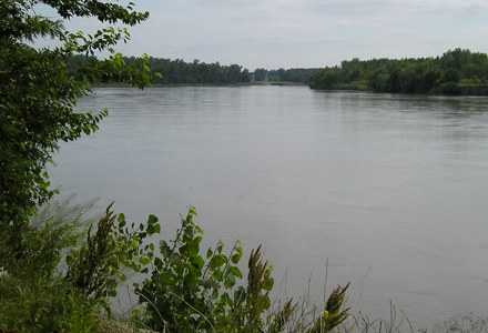
Here it is - Iowa's southwesternmost point accessible by vehicle. Well, it's probably the second-southwesternmost, because I reached this by taking a gravel road a mile and a quarter north of the state line and there was a narrow road by the line but I didn't want to take the car on it.
Fremont County rural sign in the corner
Facing south from the state line
This road is entirely unconnected to any other paved road in Missouri; if you follow it, you will eventually turn back northward into Iowa and enter Hamburg on the road that goes under the I-29 bridge at the "IA 333 1 mile" sign. Taking Route V and then turning off it leads to our second geographic oddity of the area, a piece of Nebraska entirely east of the Missouri River.
Surrounding area information: McKissick Island and the Missouri-Nebraska border
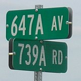
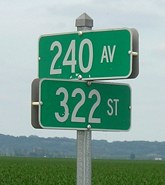
This rural sign at a one-house intersection is the only indication - besides the improvement in the gravel road's quality - that you are actually in Nemaha County NE instead of Atchison County MO. The "A"s indicate that the roads are on the half-mile of section lines, in this case the middle of Section 25 of the township.
This is in the center of "McKissick Island," which really isn't an island at all. According to the Supreme Court case Missouri v. Nebraska (196 U.S. 23, 1904), the Missouri River changed course on July 5, 1867 - less than five months after Nebraska officially became a state - and soon after, the old riverbed dried up. Monuments were placed to mark the boundary after the court case, but by the end of the 20th century they were a foot or more below ground. It wasn't until 1999 that the states passed a compact to establish the boundary along the course of the river except for this area. DeLorme's 2001 Iowa Atlas and Gazetteer shows this island and also marks the Nebraska-Missouri border a mile east of where US 136 crosses the Missouri River; this anomaly would have been rectified with the 1999 agreement.
Pictures by me: First-third, 6/12/05; sixth-fourteenth, 6/12/06
Pictures taken by David Morrison: Fourth and fifth, 5/13/07
Page created 9/17/06; last updated 8/27/07