

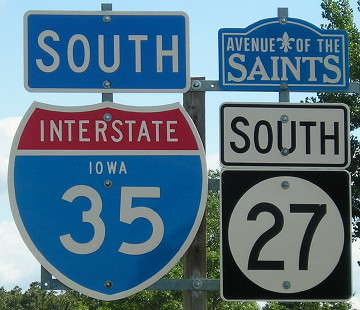
NORTH Iowa line: 8 miles NW of Northwood, Worth County IA/Freeborn County MN
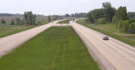
Facing north on 35 (3/19/07)
There is no specific "End 27" sign; the last northbound one is four miles south at County Road 105.
View of same from southbound lanes (7/26/16)
From this point, it is about 260 miles to I-35's north end in Duluth - and more than 320 miles to Kansas City.
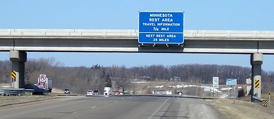
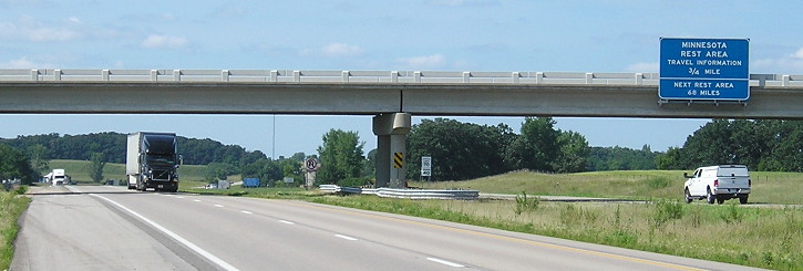
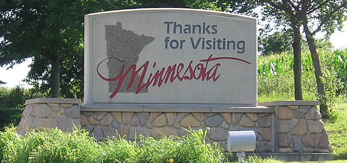
Closeup of first signs in Minnesota (3/19/07)
Facing north on 35 (5/17/04)
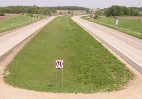
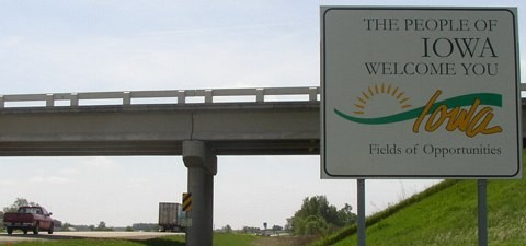
This view of Minnesota is from the bridge on State Line Road. The "Welcome to Iowa" side is actually on this, the north side, of the bridge, to the left of the No U-Turn sign (see below).
Facing south on 35 (5/17/04)
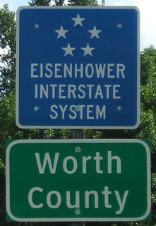
Turn around on the bridge and you see the interstate's entry into Iowa. At far right are the Eisenhower Interstate System and Worth County signs. At center right are the first shields in Iowa.
Facing south on 35 (7/26/16)
Facing south on 35, Minnesota side of the bridge (5/17/04)
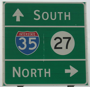
Facing south on 35/27 (7/26/16)
Surrounding area information: A halfway point
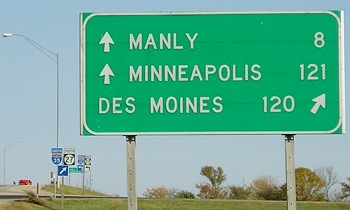
Facing east on IA 9 (10/6/06 and 10/4/16)
As this sign indicates, nearly all of Worth County is closer to downtown Minneapolis than downtown Des Moines. The halfway point is in the southernmost two miles of the county, south of the IA 9 interchange (Exit 203). But the genericization of signage (right) has killed off this marker.
With the town of Fertile about 18 miles west of Manly, this area is also the home of the (most likely apocryphal) newspaper headline "Manly Man Marries Fertile Woman."
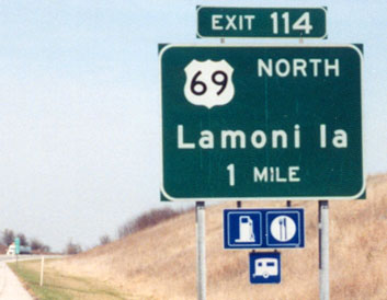
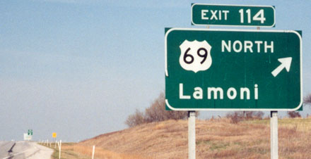
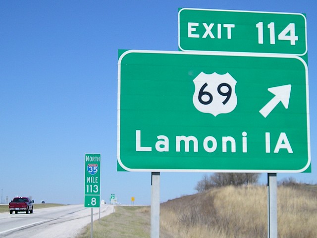
SOUTH Iowa line: 4 miles S of Lamoni, Decatur County IA/Harrison County MO
I-35 and US 69 hit the Missouri line at about the same place and have an interchange that straddles the line. Order of photos: Southbound 35, northbound 35, facing east, facing west. Some additional photos are on the US 69 page. Click on the thumbnails below for larger images.

|
Facing south on 35 (4/16/07 and 7/13/03) Right photo by Jason Hancock Look at how faded the (possibly original) right sign got in five years, below. |

|
Facing south on 35 (4/6/08) MoDOT invades Iowa by putting this construction sign north of the border. Every project in Missouri has such a sign, and when completed has a strip placed across at a diagonal. Missouri resurfaced I-35 from Bethany north to the state line and built an actual welcome center on I-35 just to the south of here. It's a very nice one. Within two weeks of taking this picture, the US 69 exit BGS was replaced. |
 |
 Facing south on 35 (5/5/09)
 |

|
Facing south (4/16/07) This is the I-35 sign for Missouri, just on the south side of the bridge, as seen from US 69. Another state-line sign in a highway font is on I-29 entering Missouri, although these have largely been dropped and replaced with special "Welcome To" state-line signs (see Iowa's below). |
 |
Facing north on 35 (8/9/10) At Missouri I-35 MM 85, Des Moines is 100 miles; at MM 100, Des Moines is 85 miles. Then the countdown stops. |
 |
Facing north on 35 (8/9/10) The LGS north of the Eagleville exit gives the distance to the state line but not Des Moines - perhaps because if it did, it would display a lower number than the first sign in Iowa. |
|
Facing north on 35 (7/13/03) Photo by Jason Hancock This sign was replaced between April and October 2007. Southbound 69 is an option, but it is unlikely to be taken. |
|
Facing north on 35 (7/13/03) Photo by Jason Hancock |
|
Facing north on 35 (4/16/07) The later sign at this interchange has a larger exit tab, the addition of "IA" (compare to "Ia" above), and is right by a tenth-mile marker like those placed on all interstates in Missouri. This sign was replaced by that October, without "IA". |
 |
Facing north on 35 (5/23/10) The most recent 1-mile sign also omits "IA". |

|
Facing north on 35 (4/16/07) This is on the south side of the bridge, possibly technically in Missouri. You can see a large "Decatur County" sign to the left and one of the westbound shield assemblies on the right. |
|
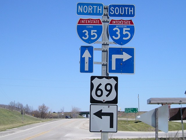
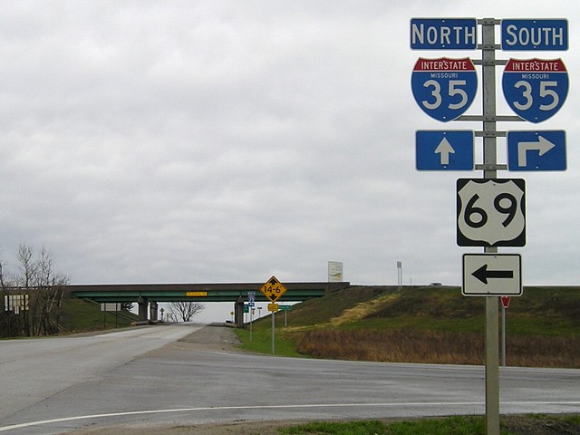
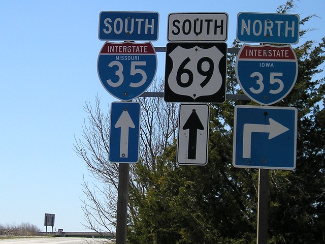
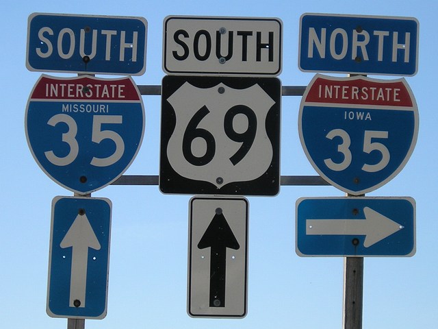
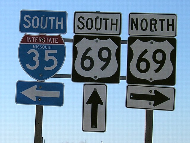
Facing east, but heading north, on 69 (4/16/07) The metal pole these shields are on is typical of those used in Missouri, but the 69 shield and arrow are definitely Iowa standard (Missouri almost always uses the wider Series D for numbers). It's possible the only Missouri parts of this assembly are the pole and the "Missouri 35" shield. |
 |
Facing east, but heading north, on 69 (4/18/08) About a year after I extensively photographed this interchange, MoDOT went through and replaced everything on the south side. This means that all the Iowa stuff is gone eastbound, including the "Iowa 35" shield that used to be here. |
|
Facing east, but heading north, on 69 (4/16/07) This mileage sign is in button copy, which Missouri used longer than Iowa did, and could be original from 1972. It would be up to MoDOT to replace it. Around a year after this picture was taken, they did. |
|
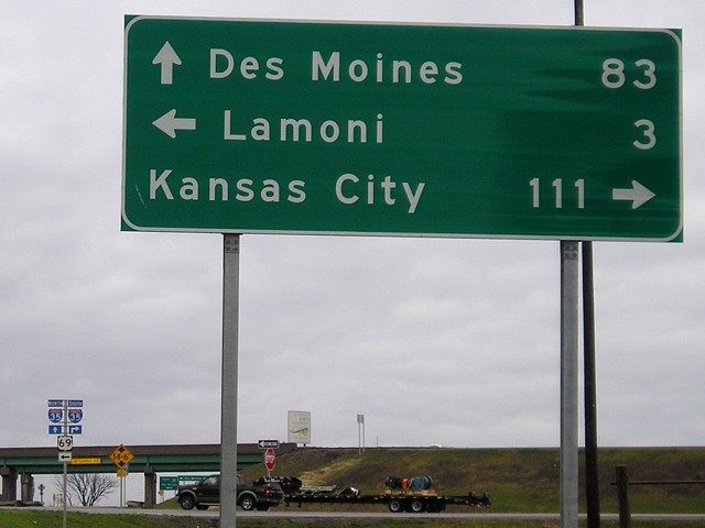
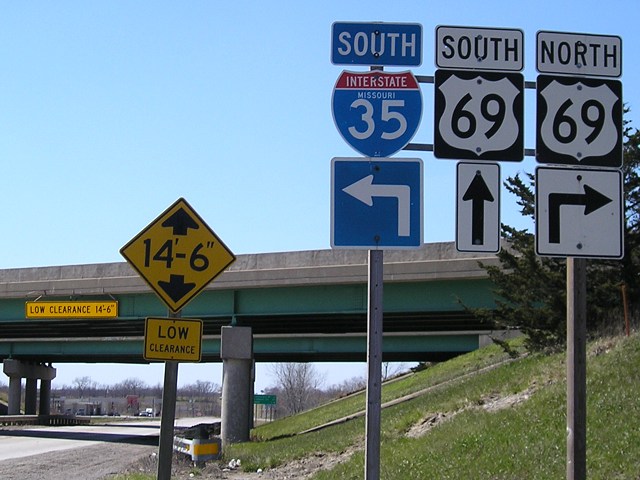
Facing east, but heading north, on 69 (4/18/08) Wait a second, how did Kansas City get 4 miles farther away? Now Missouri and Iowa disagree on the distance to both Kansas City and Des Moines. |

|
Facing east, but heading north, on 69 (4/16/07) Last signs before 69 turns north. The road ahead is paved to the east-side (NB 35) ramps. |
|
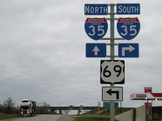
Facing east, but heading north, on 69 (4/18/08) As with the previous assembly, all these shields on the Missouri side of the interchange are now Missouri standard. |
  |
Facing east, but heading north, on 69 (4/16/07 and
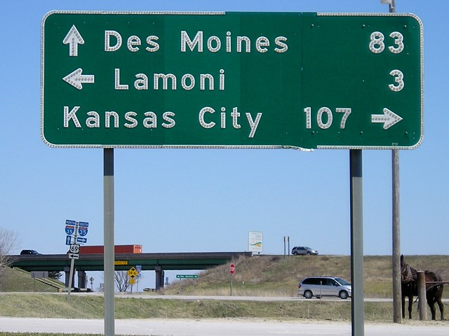
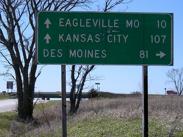
1/10/12) Notice that the two Missouri signs give the distance to Des Moines as 83 miles, but the Iowa signs (see two pictures down) give the distance as 81 miles. But even that distance doesn't match Missouri's numbers. Near mile marker 100, a sign gives the distance as 85 miles (photo farther up), which adds up to about mile 71 in Iowa, barely into West Des Moines. That's the last distance given on 35 until 1 mile north of this exit, which gives the distance as a more accurate 80 miles. (So in a distance of 15 miles, you lose 5.) |
|
Facing east (4/18/08) Missouri added this sign at the far eastern side of the interchange, following the state's new standard for signing the "far side" of the interchange in either direction. (In Missouri, its counterpart would be facing west at the southbound ramp.) Surprisingly, Des Moines is used sparingly on these signs; Bethany and Cameron often appear instead for the northbound destination. |
|
Facing west (4/16/07) No signs on the Iowa side had changed as of April 2008, and they appeared to be the same (if replacemtn versions) in October 2015. |
|
Facing west (4/16/07) Someone has been using this Iowa-standard mileage sign for target practice. |
|
Facing west (4/16/07) |
|
Facing west (4/16/07) Whether by design or circumstance, these signs escaped the interchange genericization of the early 2010s, perhaps because the setup is a little more complicated with 69 intersecting the ramps. |
|
Facing west (4/16/07) |
 |
Facing west (1/10/12) Same shields, better light. |
Page created 1/8/07; last updated 1/16/17