
Old WEST End: Main St. at US 30/US 75/Broadway, Council Bluffs, Pottawattamie County
For photos of this location, which was 34's west end for about nine years, see Dale Sanderson's Council Bluffs page.
US 34 could have died...
In the fall of 1930, Chief Engineer Fred White received a letter from the Cleveland-Chicago Pike Association encouraging him to lobby for a new highway number to cross the state. The association wanted US 6 to continue westward from Union City PA, using various state and federal highways in the Midwest, including US 34 in Iowa and US 38 in Nebraska. At the time, 34 still went north to Council Bluffs. This routing was later changed, however, and 6 ended up absorbing US 32 through Iowa and Illinois before using US 38. One can only wonder what impact would have been made on Iowa's and Nebraska's highway history if this original plan had been followed through.
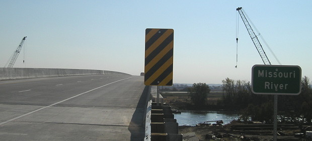
WEST Iowa line: Missouri River, Mills County IA/Sarpy County NE
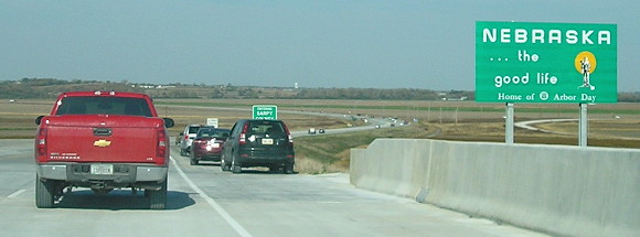
Facing west on 34 (all new entrance pictures taken 10/22/14)
A caravan from the opening ceremony at a farm implement dealer near the I-29/US 34 interchange was the first sanctioned passenger traffic over new 34, a few hours before it opened.
Facing west on 34
For now, new 34 meets US 75 at a T intersection but eventually that will become an interchange.
Facing east on 34
The guardrail and warning marker on this side of the bridge are Nebraska-standard.
Facing east on 34
Facing east on 34
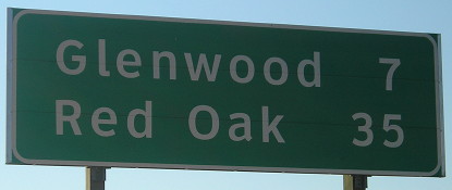
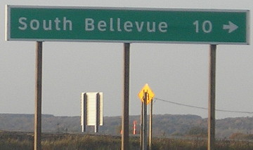
Having a mileage sign at the state line is not typical Iowa practice.
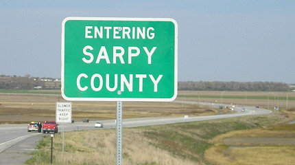
Surrounding area information: I-29 exit 35
Facing east on 34
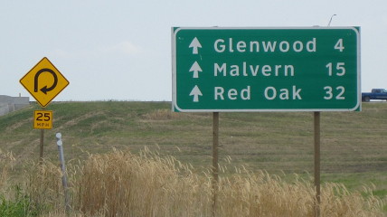
The kerning and spacing on these signs bug me.
Facing south on 29
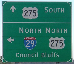
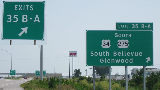
This early-morning photo shows the advance BGS before "East" was greened out that day. There is one ramp from southbound 29, which then has a split for westbound 34 and then goes under the bridge and loops around to 34/275. This BGS's replacement is shown below.
Facing south on offramp
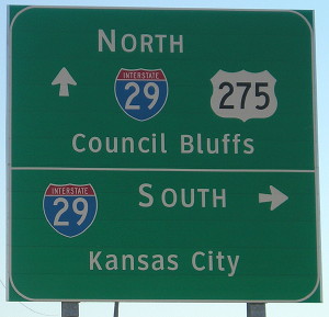
"South Bellevue" isn't a city, but now it appears on Iowa signs along with "North Omaha" and "South Omaha" elsewhere.
Facing south on 29 (7/5/15)
Photo by Jason Hancock
Facing south on 29 (7/5/15)
Photo by Jason Hancock
This is on the ramp from I-29 from which traffic then splits for westbound/eastbound 34.
Facing south on 29 (7/5/15)
Photo by Jason Hancock
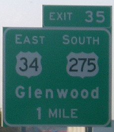
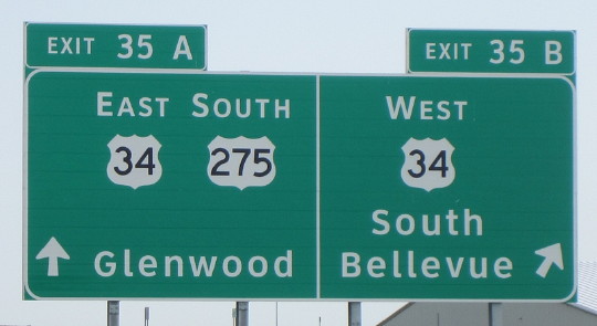
The destinations on eastbound 34 are "ahead" because there is not a return ramp to I-29.
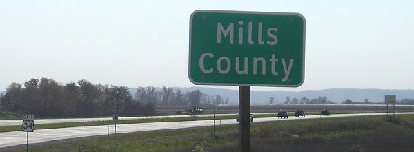
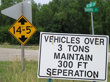
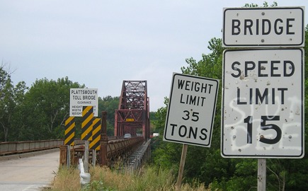
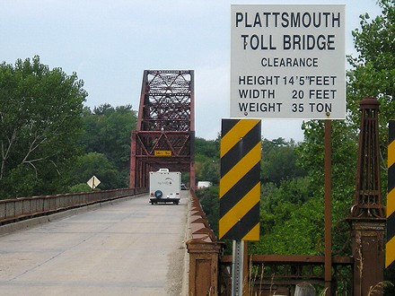
WEST Iowa line: Missouri River (toll bridge), Plattsmouth NE, Mills County IA/Cass County NE
Facing west (7/29/07)
Spell-check? We don't need no stinking spell-check.
Facing west on 34 (7/29/07)
Facing west on 34 (7/29/07)
Here you can see the ornate ironwork on the bridge approach. The bridge looks like it may have been painted red at one point, but is now somewhere between red and rust.
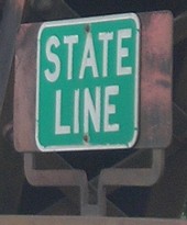
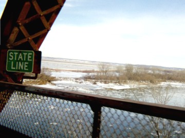
State-line sign on north side of bridge (hard to see because it's parallel to the roadway) (7/29/07)
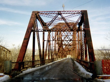
Facing east on 34 (1/19/03)
This bridge is the oldest currently in use on Iowa's part of the Missouri River; in fact, it was the fourth non-railroad bridge to be built. It was constructed in 1929, though it didn't open until February 1, 1930, and US 34 was not routed onto this bridge until the first weekend of September 1935. About 3 miles east of this point, 34 joins a four-lane interstate and then gets its own 1970s-era four-lane road.
Facing east (1/19/03)
Just getting to this bridge on the Nebraska side means following some winding roads that recall the earliest days of the US highway system. Lack of funding and some dispute over the route between I-29 and US 75 have meant the continued use of this bridge.
Facing east on 34 (7/29/07)
Old EAST Iowa line: Mississippi River (MacArthur Bridge), Burlington IA/Gulfport IL, Des Moines County IA/Henderson County IL
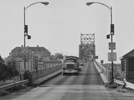
While in western Iowa, a 1970s four-lane eventually gives way to a Depression-era bridge, in eastern Iowa, for nearly two decades a 1970s four-lane was routed right onto a World War I-era bridge!
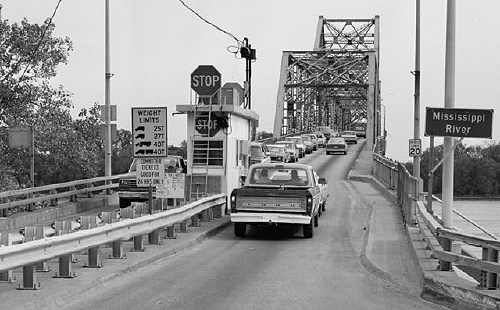
Facing east on 34 (October 1987)
Library of Congress photo
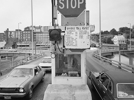
While this picture shows two lanes of traffic on the bridge at the same time, the below picture from the Illinois side indicates this may not have been the case at all times.
Facing west on 34 (October 1987)
Library of Congress photo
Facing west on 34
Library of Congress photo (October 1987)
In the reverse angle of the shot two photos up, cars that pay the toll can immediately take a ramp to IA 99.
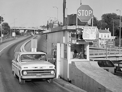
Facing west on 34 (October 1987)
Library of Congress photo
This shot shows the freeway behind this bridge, built in 1917. Eventually, this entire area would have to be reworked to make way for the new bridge in the same area.
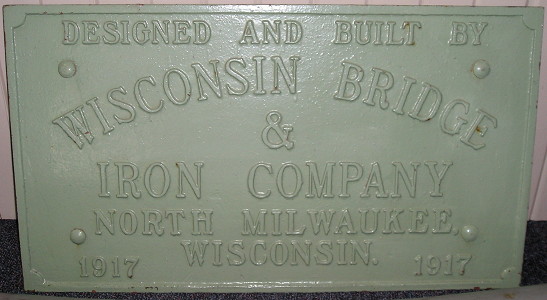
The plaque from the bridge is in the Burlington Welcome Center in the old train depot near the first exit. (5/26/12)
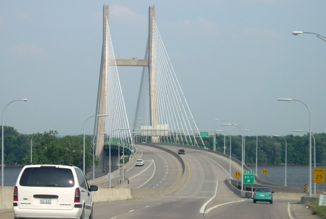
EAST Iowa line: Mississippi River (Great River Bridge), Burlington IA/Gulfport IL, Des Moines County IA/Henderson County IL
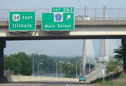
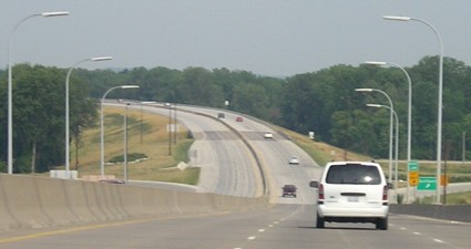
Facing east on 34 (6/16/06 and 5/26/12)
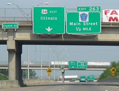
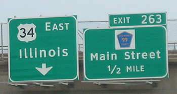
"Toll Bridge" used to be under "Illinois" until the sign was replaced; the 1970s freeway through Burlington fed into the old bridge for 20 years. The BGSs in 2012 still said County Road 99 instead of the newer designation X99 for the former IA 99.
Facing east on 34 (6/16/06)
Facing east on 34 (6/16/06)
The exit is right at the west bank of the bridge. Two lanes of the new bridge across the river opened in August 1993, the other lanes opened Oct. 4, and the bridge was formally dedicated on Aug. 14, 1994. (The use of "1993" and "river" in the same sentence may conjure up waterlogged memories for Iowans who lived through the Flood of 1993.)
Facing east on 34 (5/26/12)
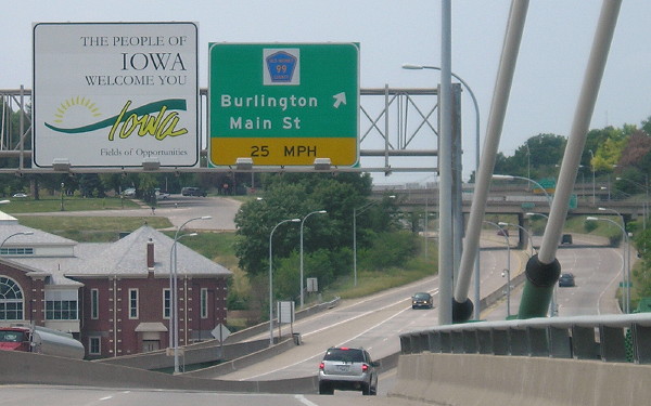
Facing east on 34, entering Illinois (6/16/06 and 5/26/12)
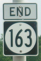
The left picture is approximately where the "End 163" sign has been placed, which is on the Illinois side of the bridge.
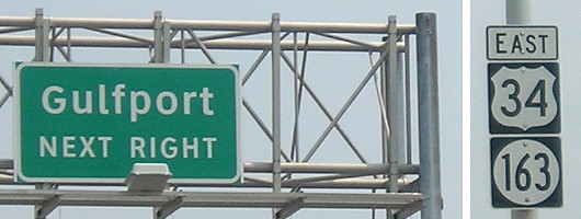
Gulfport interchange on Illinois side, last before bridge (6/16/06)
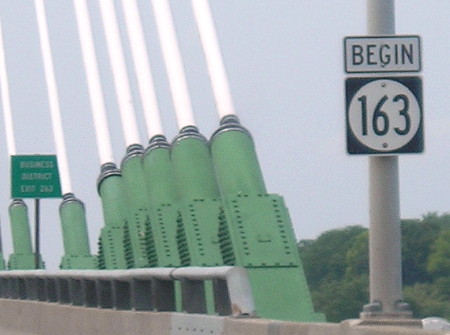
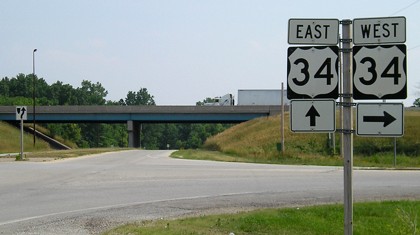
Facing west on 34 (5/26/12)
Facing west on 34/163 (5/26/12)
"One who knows the Mississippi will promptly aver - not aloud, but to himself - that ten thousand river commissions, with the mines of the world at their back, cannot tame that lawless stream, cannot curb it or confine it, cannot say to it, Go here, or Go there, and make it obey..." — Mark Twain, Life on the Mississippi
In 1993, the old bridge at Burlington was one of the few open Mississippi River crossings. In June 2008, a levee breach flooded Gulfport and caused the closure of the current bridge. I crossed the bridge about 36 hours before it closed, because at the time it was the first river crossing south of Dubuque that still had highway access to Des Moines.
Page created 8/10/06; last updated 4/7/20