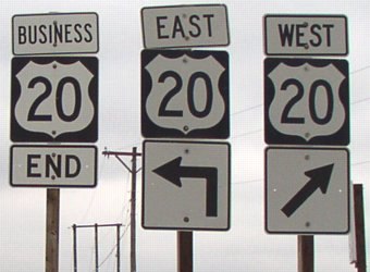
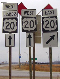
 BUSINESS
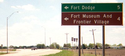
The evolution of highways in the immediate Fort Dodge area can be seen in this set of maps.
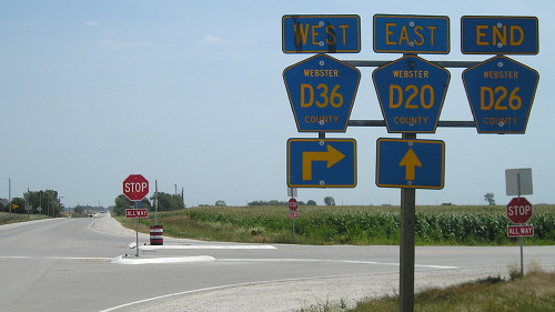
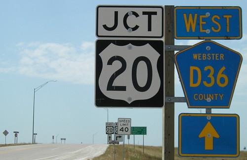
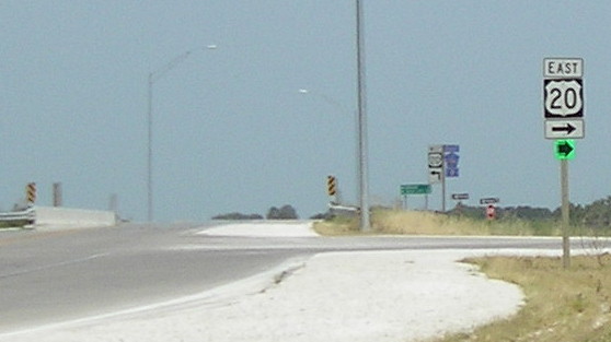
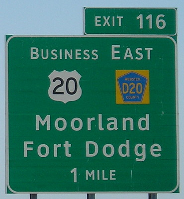
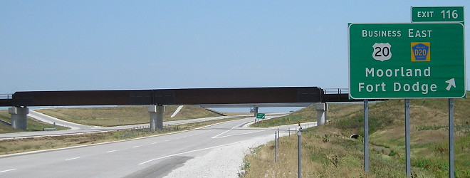
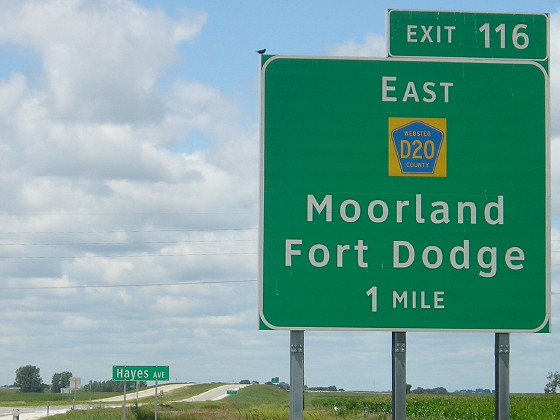
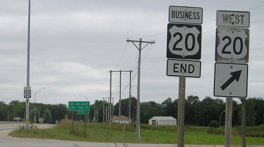
WEST End: Interchange, US 20, near Moorland, Webster County
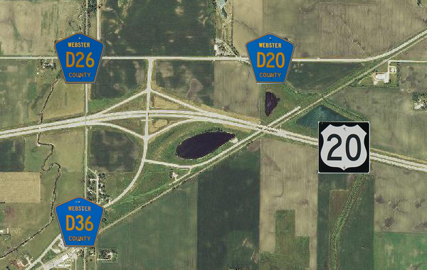
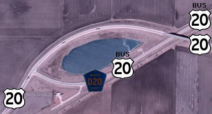
This map, with 2013 imagery, updates the information seen in the graphic down with the now-former west end. The pale green line northeast of the D36 marker is the scar for old old 20, which hasn't been there for decades. The removed pavement is northeast of the lake, where a now-dead-end stub goes under the expressway bridge.
All pictures at the new west end taken 7/25/12 unless noted.
Facing southwest, but heading west, on Business 20
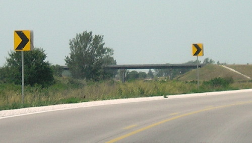
Here's about where the new concrete starts carrying a curve for Business 20. The road used to go straight ahead.
Facing west on Business 20
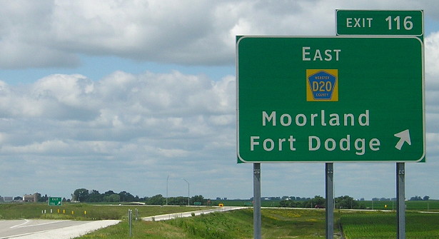
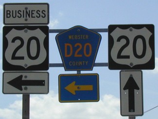
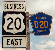
These are county-erected signs. The east-west portion of the road was D26 before the D20 designation was continued along the new business route.
I attended a public meeting about the US 20 relocation in Fort Dodge in December 2005. One thing I overheard a couple of people mention was the concern of everyone coming from Gowrie and Callender to work having to turn right at this T north of the interchange, and then having to turn left coming home.
Facing west on Business 20
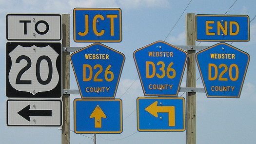
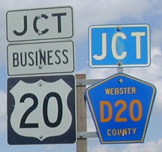
There are very few places in Iowa where three county road designations intersect. This one is very well-signed, although it uses a "To 20" rather than saying Business 20 turns left.
Facing east on D26
Business 20 is ahead and to the right. This is a rare appearance (outside of Lee County) of directions with county road signs - but notice the initial larger caps on the directions but NOT the "End" tag.
Facing north, but heading east, on Business 20/D36
There are no signs for Business 20 facing north. There is an "End D36" though - the designation for all of old 20 from here west that was bypassed in 2010 and 2012. We're close enough to the interchange that if you turn around and cross the road you see the signs below.
Facing south, but heading west, on Business 20
According to an article in the March 24, 2006, Fort Dodge Messenger, the DOT told the US 20 Corridor Association it would not proceed with plans until the counties involved agreed to take over old 20 between US 71 and Moorland.
Facing south on D36
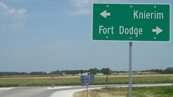
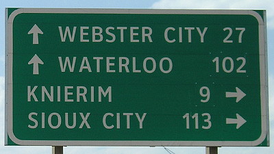
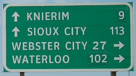
If you look closely (it's easier on the northbound sign), the mileages for Knierim and Waterloo are bolted-on numbers replacing incorrect distances on the original Clearview sign. There is no "End Business 20".
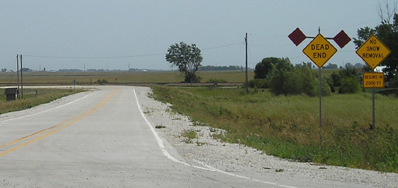
Facing east, south of the interchange
"No Snow Removal / Begins in 2000 Ft" says the sign on the right. I am only aware of one other "No Snow Removal" sign in Iowa, on old US 18 at the P64 intersection in Kossuth County. This intersection was slightly moved.
Facing north, but heading east, on D36
This interesting pair of shields is at the intersection with old Business 20, seen above, which now goes under the expressway and then dead-ends. The residuals of the old route explain that sign, and also the special one below at left.
Facing north, but heading east, on D36
The replaced mileage digits are very visible in this photo.
Facing north, but heading east, on D36
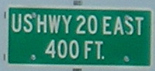
Facing east on 20 (7/22/12)
Before this, there is a "Fort Dodge Next 3 Exits" sign.
Facing east on 20 (7/22/12)
The addition of a yellow background to county road shields on BGSs is a new and somewhat confusing thing.
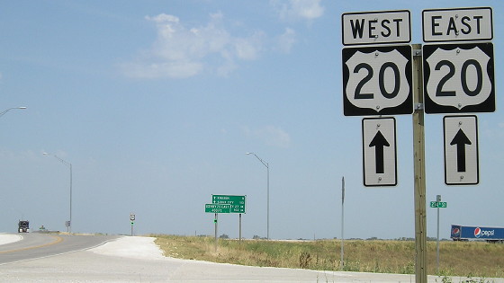
Facing west on 20 (7/15/14)
The slight rise in the land in the lower background is where the four-lane 20 goes over the old diagonal 20, which now dead-ends.
Facing west on 20
Facing west on 20 (7/15/14)
The westbound BGSs don't include US 20, but also don't include "West D36" for the recently bypassed old 20 west of here.
Old WEST End: Stop sign, US 20, Moorland, Webster County
USDA/NRCS via ortho.gis.iastate.edu (2002)
The area surrounding the Business 20 end is completely redesigned from its existence as US 20 in order to keep traffic on the main route. The lake in the middle is the fill lake created during construction. The original route here was a straight diagonal. A stub piece of the old diagonal serves one house (bottom left).
Facing northwest, but heading west, on Business 20 (5/7/03)
Facing northwest, but heading west, on Business 20 (5/7/03)
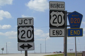
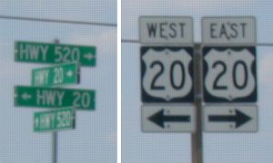
In Webster County, all of US 20 east of this intersection is actually in the rural system as "Hwy 520." The 5xx designation was used when constructing bypasses. However, the "Hwy 20" designation to the old route only applies between this intersection and Fort Dodge.
Facing northeast, but heading east, on 20 (5/7/03)
Facing northeast, but heading east, on 20 (5/7/03)
The fill lake is on the right, and 20 curves around behind it.
Facing southwest, but heading west, on 20 (5/7/03)
Facing southwest, but heading west, on 20 (5/7/03)
Unlike many other business routes, this one has the decency to be signed in both directions. (Notice this is a case where the later four-lane did NOT improve signage.)
Facing southeast, but heading east, on 20 (5/7/03)
For a short time the diagonal between here and Fort Dodge was a previous version of IA 934.
Facing northeast on stub (5/7/03)
From this perspective you can see the old piece of road run right into the business route.
Along the route
Plenty of pictures along Business US 20 as it joins with and then splits from US 169 in Fort Dodge can be seen on the Business US 169 (IA 926) and IA 7 pages.
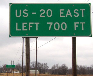
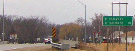
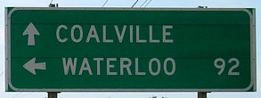
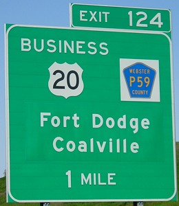
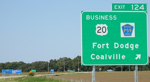
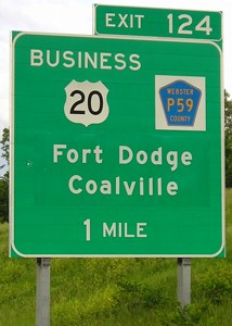
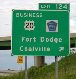
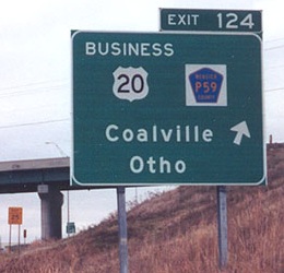
EAST End: Interchange, US 20, Coalville, Webster County
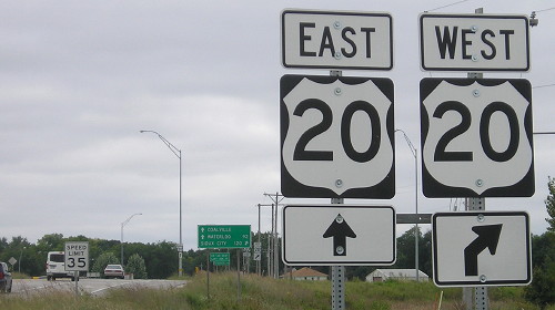
Facing south, but heading east, on Business 20 (9/11/14)
This assembly is of newer style signs and the 20's are painfully uncentered.
Facing south, but heading east, on Business 20 (9/11/14)
This entire assembly is of newer style signs and the 20's are painfully uncentered.
Facing south, but heading east, on Business 20 (3/20/03 and 9/11/14)
If the signs in each picture are the same, it's interesting how much of a beating one took.
Facing south, but heading east, on Business 20 (3/20/03)
Facing south, but heading east, on Business 20 (3/20/03 / 9/26/07)
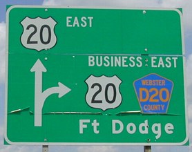
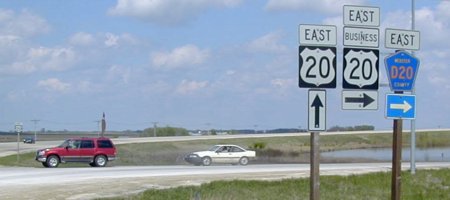
This LGS is one of the many that had mileage changed, right, after completion of the new 20 through the Iowa River Greenbelt.
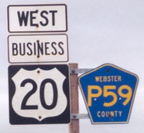
Facing north, but heading west, on Business 20 (3/20/03)
The road right behind the poles is P6D. The sign on the light pole is "North P59" as Business 20 is co-signed with two different county roads outside of Fort Dodge (D20 west, P59 east).
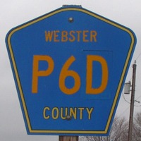
Running parallel to US 20 for 3.5 miles east of this interchange is P6D, a 'diagonal' that runs straight east-west and then turns north-south to Lehigh. It appears that this shield was originally for a P6[#] route and the D was pasted on. (3/20/03)
Facing west on 20 (9/16/07)
Fifteen years after the present route of 20 was opened, Fort Dodge apparently decided that it wasn't getting enough attention on the signs. While both directions have "Fort Dodge Next 2 Exits" approaching US 169 and P59 (and Business 20 appears in both directions at both ends), neither BGS included Fort Dodge itself. So Harcourt and Otho were moved to supplementary BGSs and new sheets with Fort Dodge were pasted on the signs.
Facing west on 20 (9/16/07)
Between 1987 and 1990 all traffic had to exit and take P59 north.
Facing east on 20 (6/12/05)
Compare the BGS at right to the one below left.
Facing east on 20 / Facing north, but heading west, on Business 20
Photos by Jason Hancock (11/10/02)
Page created 7/11/03; last updated 12/18/15