 BUSINESS
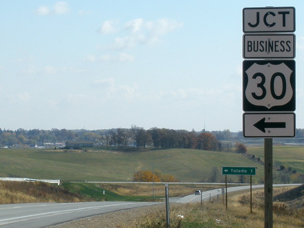
WEST End: US 30, Toledo, Tama County

Facing west on Business 30 (10/27/11)
The start-and-stop process for upgrading US 30 to four lanes in the eastern half of Iowa took a major step forward in 2010-11, when a new alignment opened through the Tama-Toledo area. (It's more a "bisection" of the two towns rather than a "bypass" but the meaning is clear enough.)
Facing east on 30 (10/27/11)
For a while in the planning process, there wasn't going to be a western connection of old 30 to the expressway to save money. In a compromise, a bridge was built for the westbound lanes over an at-grade SHARP left turn from the eastbound lanes. The bridge was the last part of the bypass to be completed; when it opened August 15, 2011 (ribbon cutting two days earlier), US 30 had 76 miles of uninterrupted four-lane road from the east side of Tama to the west side of Ogden.
Surrounding area information: US 63 exit
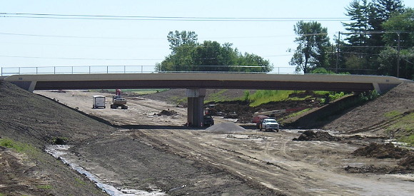
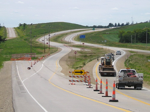
Facing east from 63, looking at the Broadway Street bridge, during construction (7/16/10)
Part of why it took so long to get 30 four-laned through Toledo is that there was very little room to put it. Hemmed in by South Tama schools on the south and Fareway on the north, the two directions are separated by a concrete barrier for a short distance.
Facing east on 30 (6/24/11)
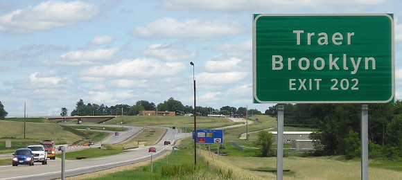
Traer finally got listed on a BGS! This photo is from the short period between partial and full opening of the bypass, hence the cars crossing over to the eastbound lanes. This is also before Brooklyn was replaced with Montezuma on this sign, since Brooklyn isn't on 63.
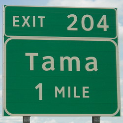
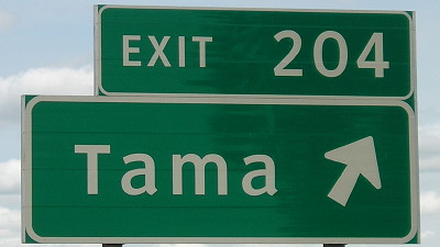
EAST End: Interchange, US 30, Tama, Tama County
What used to be...
Facing east on 30 (10/18/09)
There are earth-movers behind the pickup at the point where a new road would deviate from future old 30.
...and what is
Facing east on Business 30 (6/24/11) (location of the shield in the above photo)
Past the famous Lincoln Highway Bridge, the King Tower Cafe, and the Tama sale barn, old/Business 30 curves to end at an interchange north of the former straight-line road.
Facing east on 30 (6/24/11)
The bypass begins east of Tama by turning away from the straight line of the Lincoln Highway. The mile of old 30 going over the hill (upper left) bears the rare distinction of being paved AND a Class B road. The lane shift eliminated what, at its end, was one of the worst bridges in the state of Iowa.
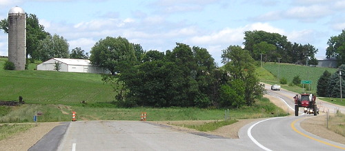
Facing west on 30 (6/24/11)
That shed and silo are doomed. When the four-lane is extended eastward, it will be built on an all-new roadbed through eastern Tama County, abandoning the true Lincoln Highway routing.
Facing east on 30 (7/7/13 and 6/24/11)
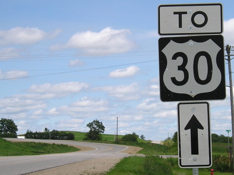
The first sign is up before the four-lane begins.
Facing west on 30 (6/24/11)
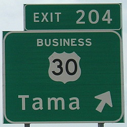
Facing northeast, but heading east, on Business 30 (6/24/11)
To follow the Lincoln Highway out of Tama now, you have to follow the curve and then the eastbound onramp. There is no "End Business 30" on this end.
Facing southwest, but heading west, on Business 30 (6/24/11)
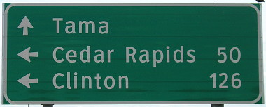
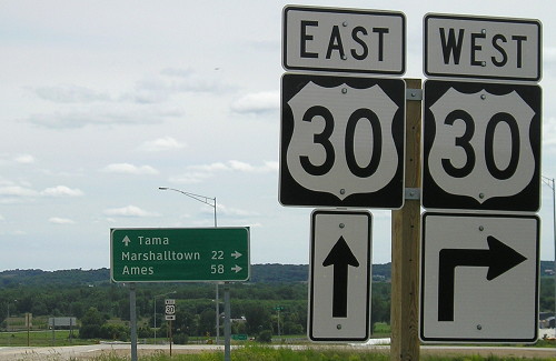
Facing southwest, but heading west, on Business 30 / Closeup (6/24/11)
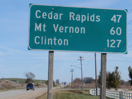
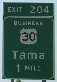
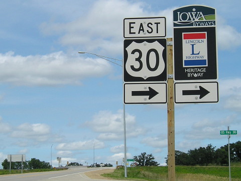
This is the first place Clinton is listed on mileage signs, because there are no towns on 30 between here and Cedar Rapids. It's weird that for such a major, long-existing road, this is probably the longest segment of Iowa highway east of I-35 without a gas station.
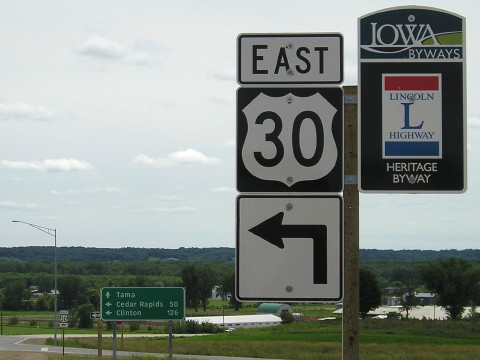
There should be an arrow sign under the Lincoln Highway sign pointing both left and ahead.
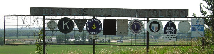
The old "Welcome to Tama-Toledo" civic organizations sign remains on the old part of 30 left behind. (7/7/13)
Page created 6/9/16