

NORTH End: Old US 16/MN 13/Main St., Albert Lea MN, Freeborn County MN
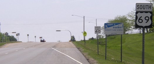
Facing north on 69
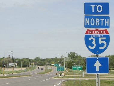
This highway, running much of the distance of the central United States, has a less-than-dignified end on the west side of Albert Lea. After US 16 was taken out of the state, Minnesota apparently didn't see it fit to extend 69 a few miles north to I-90. Today, there's a small "To 69" shield on I-90 right before the exit, but not on the main sign.
While it would be easier and probably shorter to take Main eastward to I-35, this sign directs you north to 90 and then east. An "End 69" would be more appropriate here.
Facing north on 69
The vehicles in the picture are on old 16.
Facing north on 69
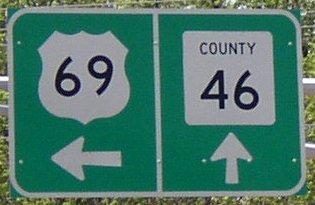
In Freeborn County, old 16 is marked as County Road 46, though CR 16 would have been appropriate.
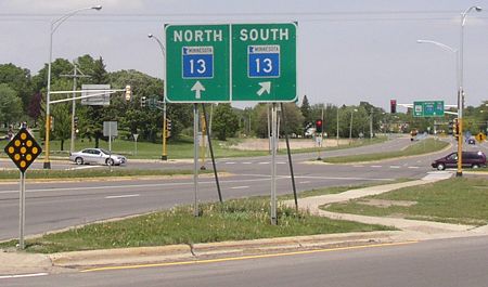
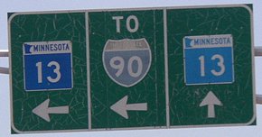
Facing west on 16, but heading north on MN 13
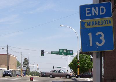
The signs on the stoplight poles are pretty clear in showing that 69 only goes south from here.
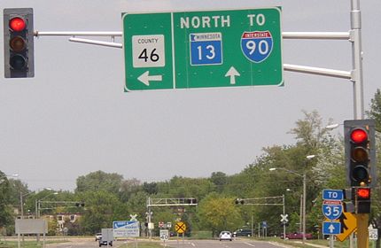
Facing east on 16
Even though all of the other signs looked relatively new, this one has some years on it. Perhaps it is because the road for this sign is a county road, and thus this sign isn't being maintained. That would also explain splitting MN 13 up, if the right spot was originally occupied by a 16 shield.
Facing south on 69 (first sign)
[Old] NORTH End: Stoplight, US 65 S/Broadway Ave. and US 65 N/Main St. (also US 16), Albert Lea MN, Freeborn County MN
Facing east on 16, but heading south on 13 and north on 69
This intersection is only about a mile east of the current end of 69, but Dale Sanderson learned that this had also been an end of 69. It makes some sense, since it would have met another north-south road (US 65) here, and it would certainly make sense to have 69 end here today. Clockwise from eastbound:
Facing east, closeup of signs in background
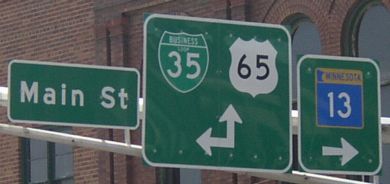
Facing south
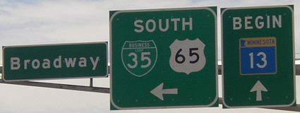
Facing west
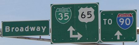
Minnesota must think that it's more important for MN 13 instead of US 69 to connect to US 65.
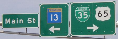
Facing north
Because 69 used to be routed in Minnesota a different way (all 12 miles of it), there's a slim chance that the original north end of 69 was to the south as 69, coming from the south on South Broadway Avenue, met 65 coming from the southeast on Southeast Broadway Avenue. (No, it doesn't sound like a smart street naming system to me, either.) But it more likely would have come up with 65 to meet US 16 in that case.
SOUTH End: TX 87/Gulfway Drive, Port Arthur TX, Jefferson County TX
US 69 ends a short distance from the Gulf of Mexico along with US 287 and, of all numbers, a US 96 that runs north-south. You can see pictures on this page.
All pictures by me: 5/19/04
Page created 10/23/06