Burlington highway chronology
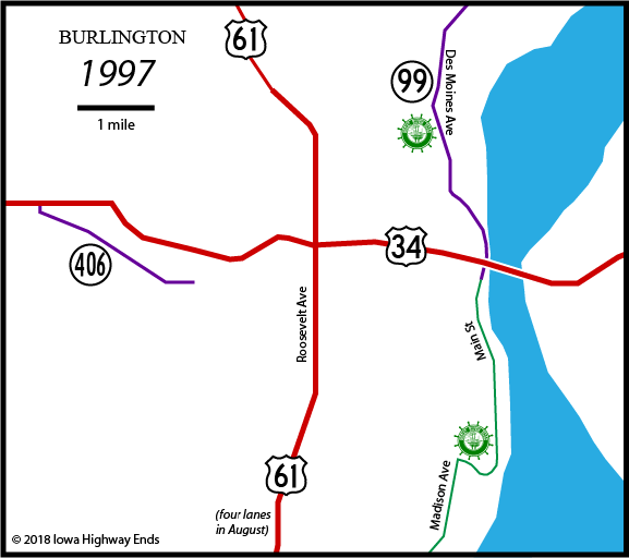
These maps show the highway evolution in the city of Burlington and the immediate area. US highways are in red, state highways in purple, the Great River Road in green, and four-lane highways in thicker lines. The blue splotch is the Mississippi River. Freeway opening dates come from Jason Hancock's Iowa Highways Page.
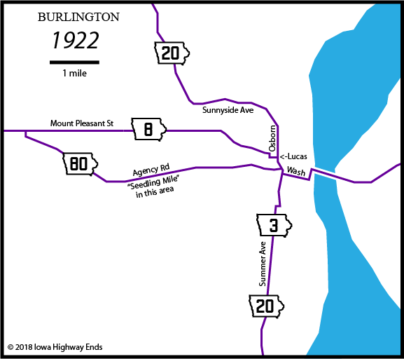
| Reflecting
the primacy of the railroads in the early 20th century, and the fact
there wasn't a car-only bridge until 1917, the Blue Grass Road auto trail
officially began at Burlington's train depot at the intersection of
Main and Division streets south of downtown. It then went north on
Main, west two blocks on Jefferson Street, and north a block on 4th,
where it picked up Washington Street and followed the IA 8 route seen
above. July 1, 1920: Iowa highway system created November 3, 1924: IA 3 truncated to Fort Madison October 16, 1926: US 61 replaces IA 20; US 34 replaces IA 8 August 7, 1929: IA 86 designated between Sunnyside Avenue and Mount Pleasant Street December 1, 1930: IA 16 designated July 8, 1931: IA 99 designated |
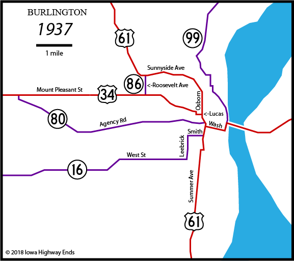
| End 80: Central Avenue at
Washington Street, according to DOT map book of era, one block south of
Agency Road. (The original Agency/Osborn connection right by Central dead-ends today.) Northbound US 61: Summer Avenue, Maple Street, Central Avenue, Osborn Street, Sunnyside Avenue Eastbound US 34: Mount Pleasant Street, Chalfant Street, Lucas Avenue, Central Avenue, Washington Street, Main Street, High Street, MacArthur Bridge 1938: Paving of IA 99 realigns from Mill Dam Road on north side 1941: IA 16 routed away from Burlington; it's possible that at this time IA 86 was extended south and east, along 16's route inside Burlington east of Roosevelt Avenue, to US 61. It was by 1944. 1942: US 34 widened between Middletown and IA 80 1943: Mount Pleasant Street bridge over CB&Q Railroad and Osborn Street (US 61) built; US 34 moved from Washington Street to Spring Street. A wartime project like this would be essential for the Iowa Ordnance Plant, eliminating an at-grade urban crossing. Spring Street becomes Mount Pleasant Street (or vice versa) at Central Avenue; US 34 then goes south four blocks on 3rd, east one block on Columbia, and north on Main. Later construction of the US 34 freeway (and then the Burlington Public Library) broke 3rd between Arch and Court streets. 1945: IA 86 decommissioned 1947: US 34 widened between IA 80 and West Burlington 1956: US 61 moved to Roosevelt Avenue; IA 80 truncated October 4, 1957: IA 80 renumbered IA 406 |
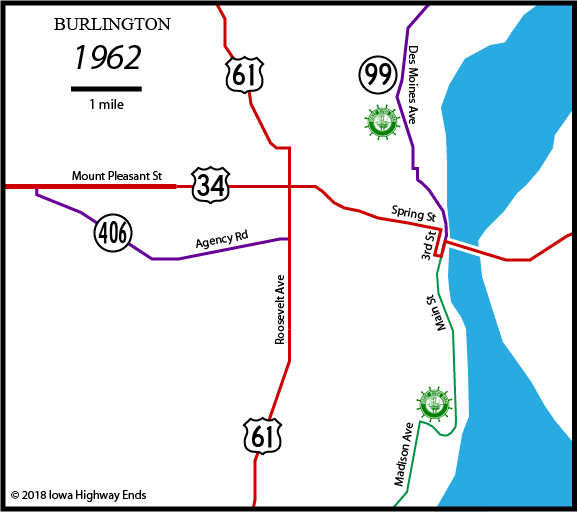
| February 2, 1974: US 34 freeway
segment between Central Avenue and Main
Street (IA 99) in Burlington completed June 13, 1975: US 34 freeway segment between Roosevelt Avenue (US 61) and Central Avenue in Burlington completed 1975: US 61 straightened north of Sunnyside and four-laned from there down Roosevelt Avenue November 10, 1976: US 34 freeway segment between Mount Pleasant Street in West Burlington and Roosevelt Avenue in Burlington completed December 31, 1976: IA 406's east end moved from Roosevelt Ave to Gear Ave |
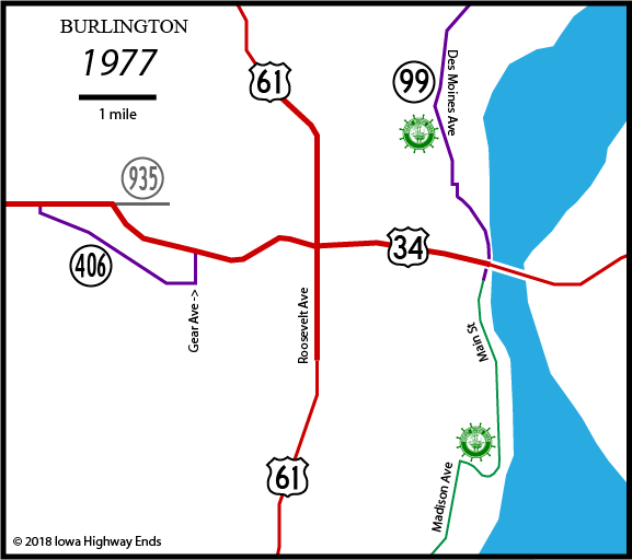
| February 1, 1981: IA 406
truncated, IA 935 decommissioned 1993 (project began December 18, 1986): IA 99 curved between 8th and Cash streets, taking it off a block of 9th Street October 4, 1993: Great River Bridge across the Mississippi River at Burlington opens, replacing the old two-lane MacArthur Bridge August 1997: 8-mile expressway segment from US 34 in Burlington to Wever opens |
| July 1, 2003: IA 99 and 406
decommissioned November 15, 2005: 9½-mile expressway/freeway segment opens from Danville to the previous end of the freeway at Mount Pleasant Street in West Burlington, bypassing the WWII-era four-lane November 18, 2008: Fairfield bypass opens, completing long-desired four-lane link between Des Moines and Burlington 2008: Cascade Bridge (Great River Road) closed 2009: IA 163 designation extended to state line |
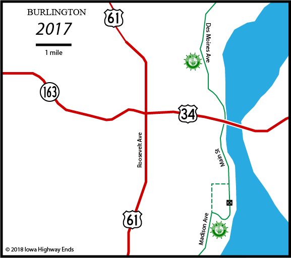
The US 61 four-lane is scheduled to be extended to Mediapolis in 2021.
Page created 1/14/18; last updated 1/13/19