
The State Data Center's website after 2011 didn't seem interested in making static files anymore, and so simple questions of "What's Iowa's 15th-largest city? Its 10th-largest county?" became difficult to answer. I took the files that were released and reordered them to put Iowa's 941 incorporated cities (as of the end of 2020) and 99 counties in descending order of population, with rankings right beside, in easy-to-read PDF files. The 2020 version includes previous populations and cities' move in the rankings.
2010 Census rankings of cities and counties
The previous version of the above, with Iowa's 947 incorporated cities and 99 counties in descending order of population.
Congressional district state maps, statehood to present
Color-coded maps divide Iowa counties by their representation in Congress, a representation that peaked at the turn of the 20th century and has been downhill since. Also included are maps of counties Iowa's four most senior congressmen have served. Updated for the 2020s!
Congressional districts by county, statehood to present
Tables list each county's district by color, with the same color code as the maps on the other page. Many counties in southeast Iowa stayed in District 1 from statehood to the 1992 redistricting, and others shuffled around nearly every time. Updated for the 2020s!
Tama County (and surrounding areas) in the Iowa Legislature
Why? I guess, because I can. Warning: Contains even more wonky redistricting stuff, large PNG maps, and the potential of being bored to death if you've never heard or cared about Bear Creek, Big Creek, Spring Creek, or Timber Creek townships. Note of actual potential interest: In April 2011, there were precisely three more registered Republicans in Tama County than Democrats. Not 300, not 30, THREE.
Iowa TV station guide
A project years in the making, this table lists every Iowa county's inclusion on network affiliates, and these maps show the data in a graphical manner. Just what TV stations do you get in Farmington, Atlantic, Lansing, Pocahontas, or Larchwood? The table page includes background and notes on the project; the maps page also lists the launch date or year of every station.
Iowa school district timeline
Did you know that as far as the state Board of Education is concerned, "Woden-Crystal Lake-Titonka" never existed? Because those two districts never entered (and, actually, never could enter) a complete consolidation, rather engaging in decades of whole-grade sharing, the state continued to view them as separate districts. This timeline of the past 25 years goes into the "facts on the ground," so to speak, tracking the actual school years that various districts began sharing classes before mergers, and also when old school buildings are last used or torn down.
The completely incomplete, noncanonical list of Iowa references
Captain Kirk, of course, grew up in Iowa. His line in Star Trek IV, though, is just one of many occasions in film, literature, and other parts of pop culture in which you can see a passing reference to the 29th state. As the long title suggests for this page, whenever I come across a name-drop I add it to a list organized by town, real or fictional.
Iowa's southern border
It's not straight. There was almost a war over it. And Van Buren County got the short end of the stick all the way around. Read about Sullivan's Line and the war that never (but could have) used the line "Forty-Thirty-five or Fight!" here.
Iowa's northern and western borders
Although it's straightforward today, the northern boundary was not settled until just before Iowa became a state. In addition, the sources I have found can't seem to agree on just WHERE the lines were supposed to be drawn. This page is a study of those various descriptions.
An easy thing to find, right? Depends on who you ask - and if you let Lee County drag it southward. It's in Story County either way, but more than 10 miles northeast or southeast of central Ames, and discussed here.
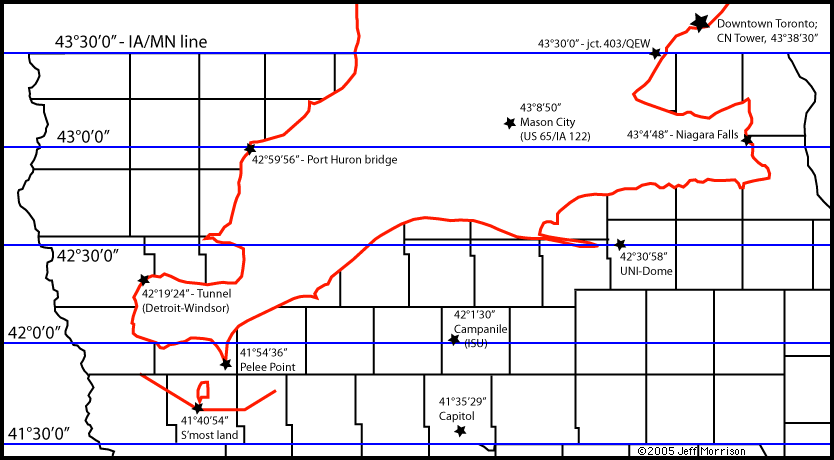
Ontario: Iowa's eastern neighbor
Canada's farther south than you think. In fact, the UNI-Dome is farther north than the Detroit-Windsor Tunnel and Niagara Falls is just south of Postville. This map superimposes the province over a county outline (that's somewhat close to scale).
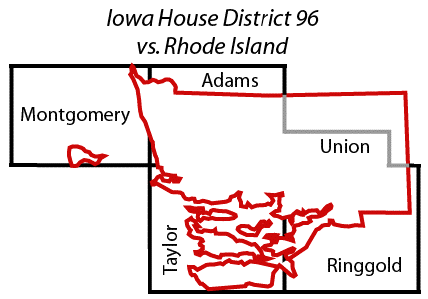
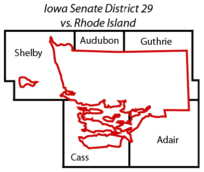
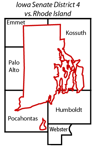
Iowa vs. southern New England
Pretend that an athletic rivalry between Independence and Clarinda consumes the nation (or, depending on your point of view, is forced down the nation's throats). The distance between those two towns is slightly larger than the distance between Boston and New York City. (In fact, the east end of US 20 is hundreds of yards away from Fenway Park.) This map moves Massachusetts, Connecticut, and Rhode Island 21 longitude degrees west to be on top of Iowa with corresponding latitude lines. Driving I-95 from Maine to New Jersey is the equivalent of going from Castalia to Villisca via Belle Plaine, and Hartford is only slightly north of Des Moines (Polk City, to be precise).
A few districts in the Iowa House and many in the Iowa Senate from the 2000s are larger than the state of Rhode Island. See, for example, House District 96, Senate District 29, and Senate District 4 (bonus: Compare Rhode Island to Kossuth County).
Iowa bridge timeline
A graphical timeline of the Missouri and Mississippi River bridges' histories, including openings, closings, significant closures, and toll eras.
History of four-lane roads in Iowa
Month-by-month openings of rural four-lane highways, from the 1940s to the present, with maps every five years.
Iowa's 1968 highway plan
The Iowa Highway Commission had grand plans for four-lane roads beyond the interstate system. It would take decades, however, for that vision to even come partially true. This page compares lines sketched out in 1968 with what has, or has not, happened since. Many of these corridors were eventually constructed as part of a commitment the state DOT made in 1996.
Highway Chronologies
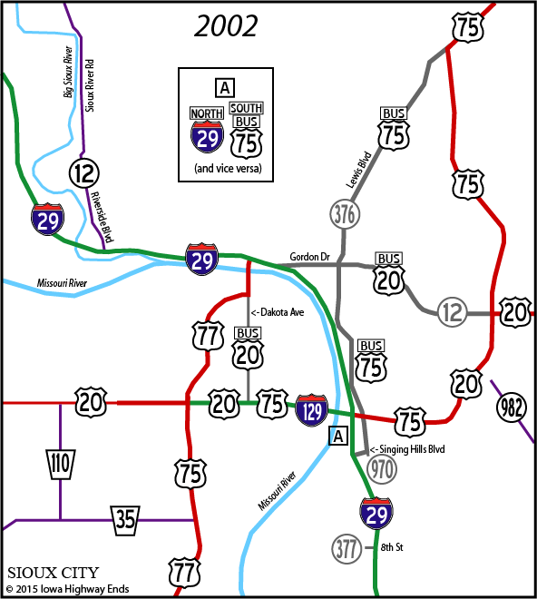
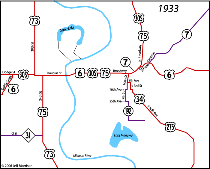
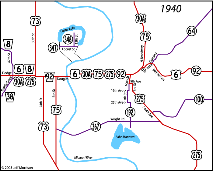
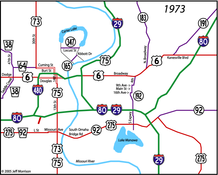
The "single-page" chronologies include every map, in order, with changes listed underneath. The Sioux City, Council Bluffs/Omaha, Waterloo-Cedar Falls, and Tama/Benton maps can be viewed separately or together, or in sequence if you type each of the years in order. Also available is a color-coded set of maps for IA 57 and 58 through the years.
| Waterloo-Cedar Falls (single page) | |||||||
| 1925 | 1933 | 1941 | 1963 | 1978 | 1988 | 1997 | 2006 |
| Sioux City (single page) | |||||||
| 1925 | 1932 | 1943 | 1956 | 1972 | 1990 | 2002 | 2002 |
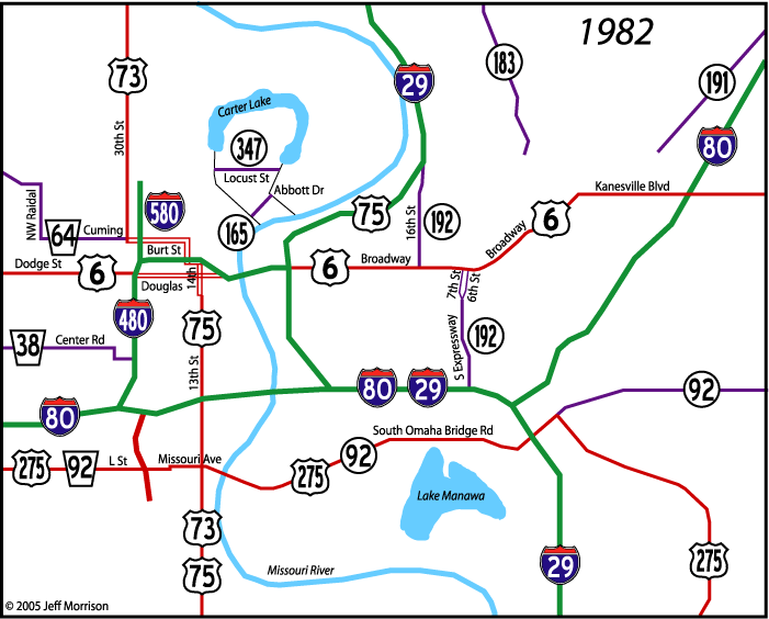
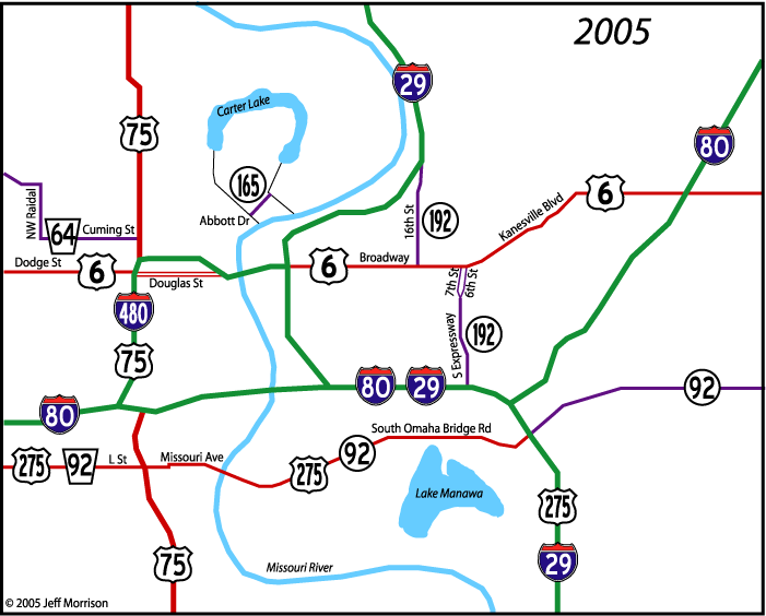
| Council Bluffs/Downtown Omaha (single page) | |||||||
| 1924 | 1933 | 1940 | 1963 | 1973 | 1982 | 2002 | 2005 |
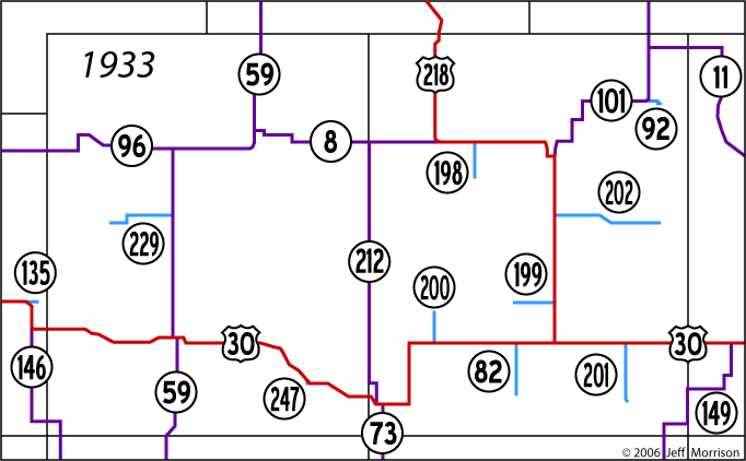
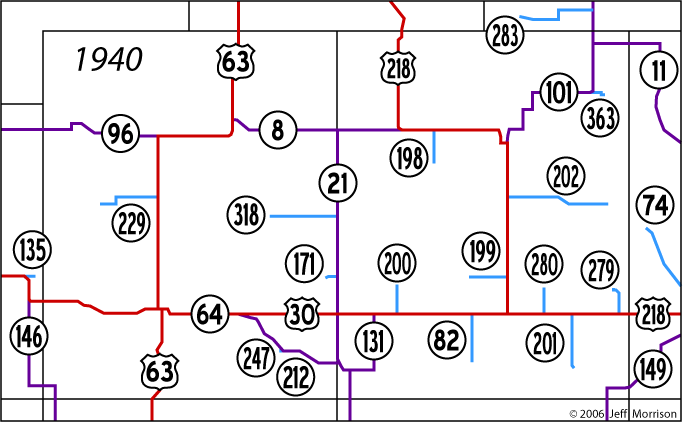
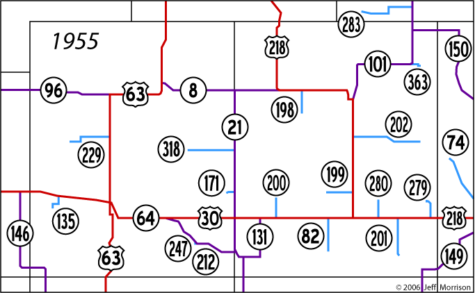
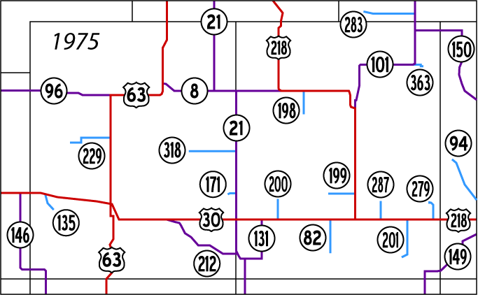
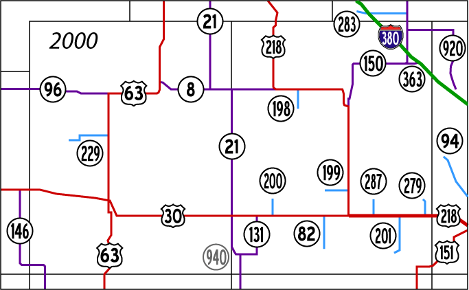
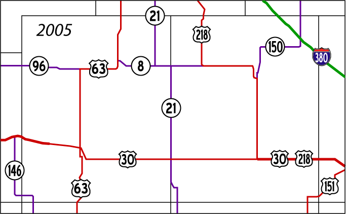
| Tama and Benton counties (single page) | |||||||
| 1925 | 1933 | 1940 | 1955 | 1975 | 2000 | 2005 | |
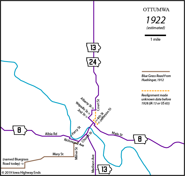
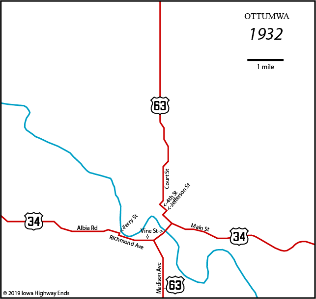
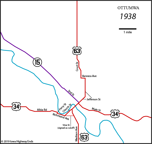
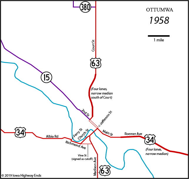
| Ottumwa (single page) | |||||||
| 1922 | 1932 | 1938 | 1958 | 1968 | 1998 | 2008 | |
| Fort Dodge (single page) | |||||||
| 1923 | 1928 | 1933 | 1943 | 1958 | 1973 | 1988 | 2008 |
| Muscatine (single page) | |||||||
| 1920 | 1928 | 1938 | 1948 | 1974 | 1985 | 2001 | 2009 |
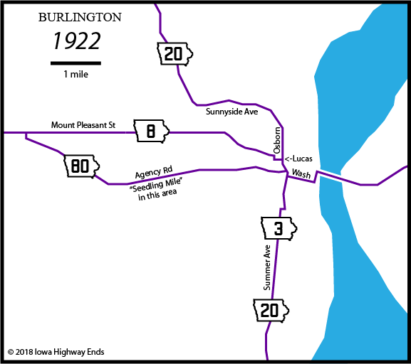
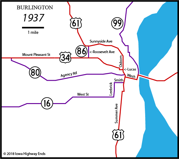
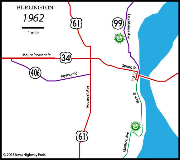
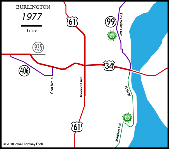
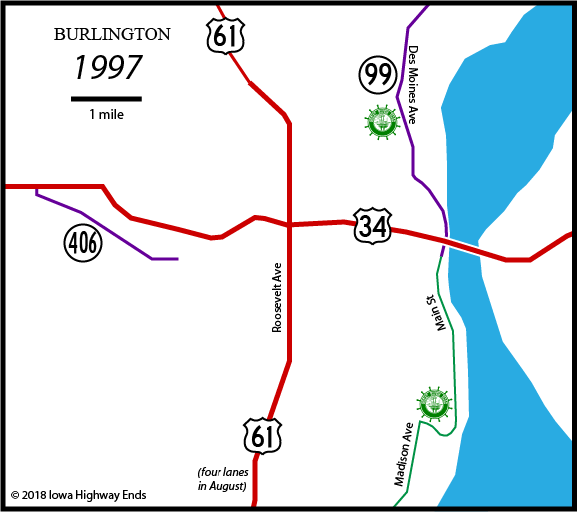
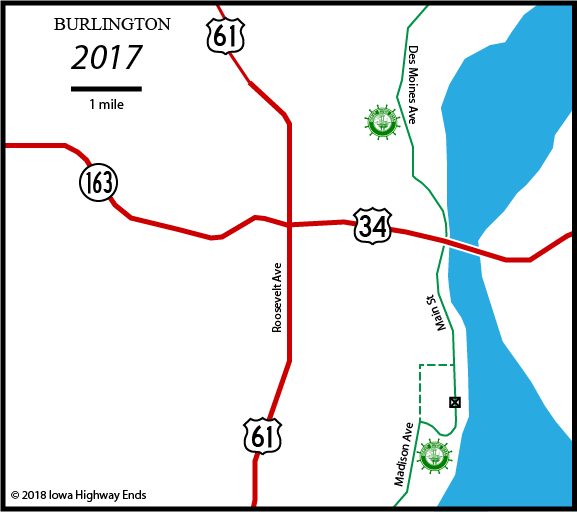
| Burlington (single page) | |||||||
| 1922 | 1937 | 1962 | 1977 | 1997 | 2017 | ||
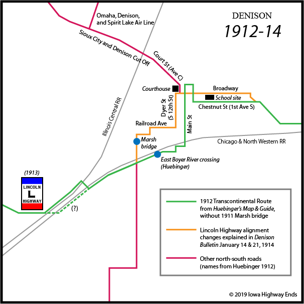
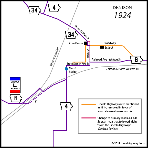
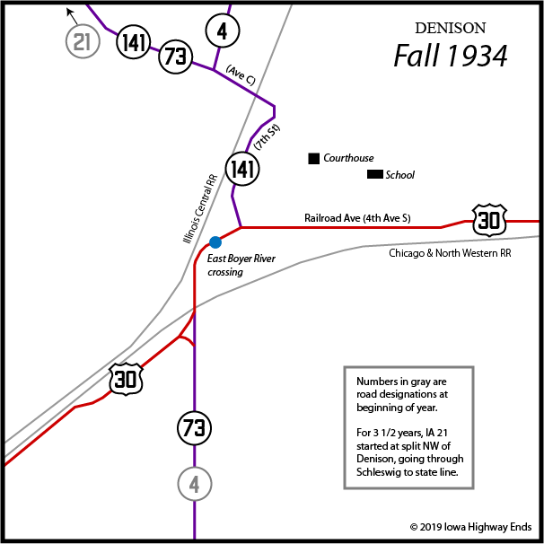
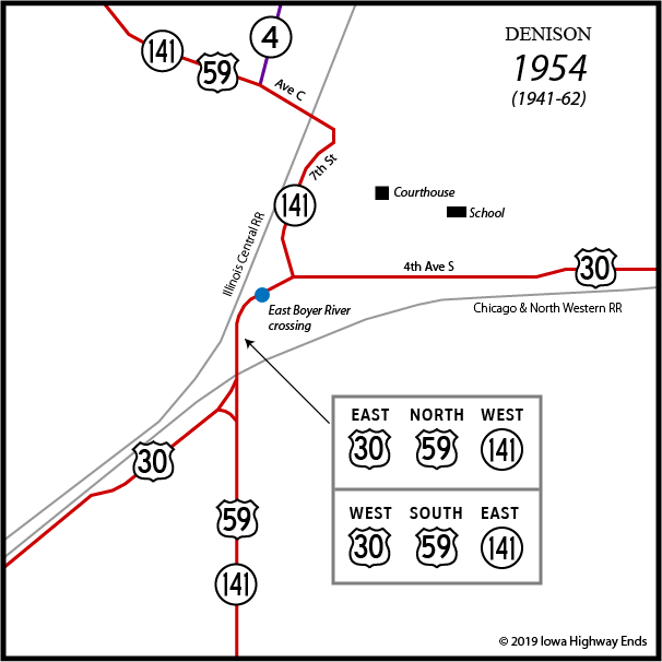
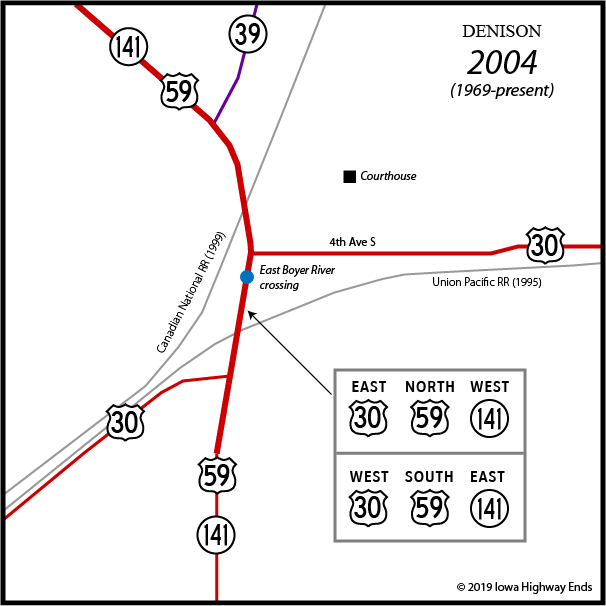
| Denison (single page) | |||||||
| 1912-14 | 1924 | Fall 1934 | 1954 | 2004 | |||
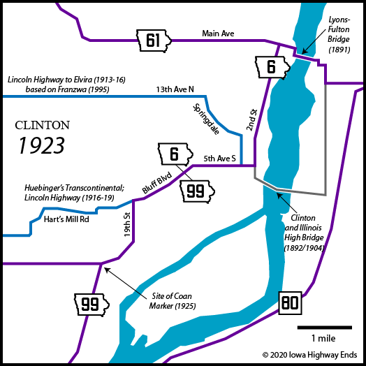
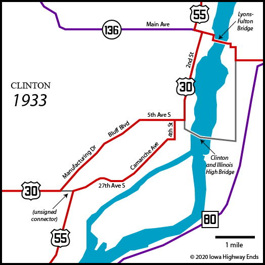
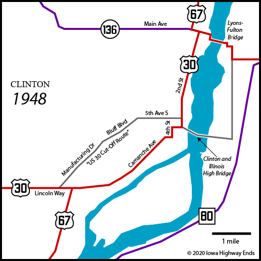
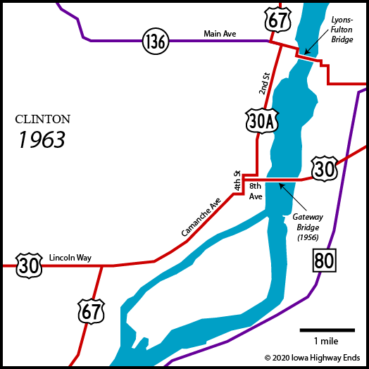
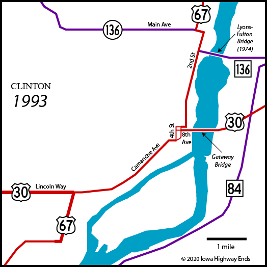
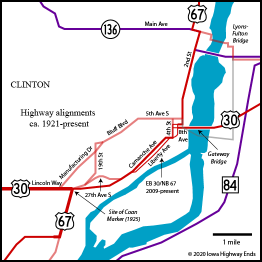
| Clinton (single page) | |||||||
| 1923 | 1933 | 1948 | 1963 | 1993 | Composite | ||
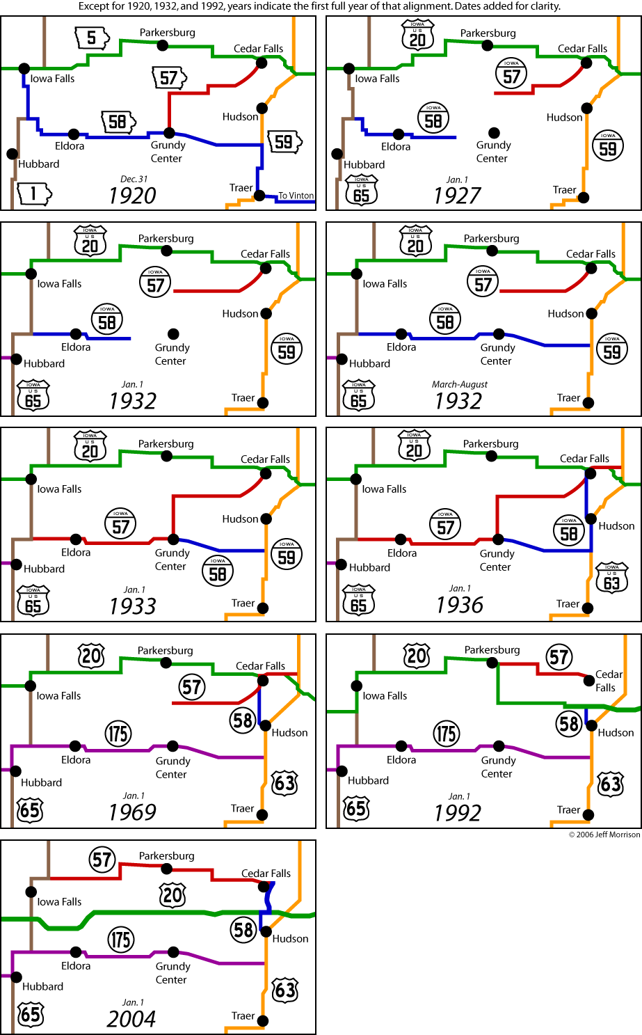
| Iowa highways 57 and 58 (maps only) | |||||||
| 1920, 1927, 1932 (2), 1933, 1936, 1969, 1991, 2004 | |||||||
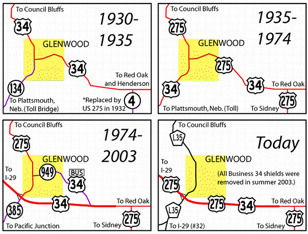
| Oskaloosa | Glenwood | ||||||
Page created 6/1/05 (as the Iowa Geography Page); last updated 7/3/11 10/10/22