April 18:
Clinching US 151 and US 67 in Iowa
May 7:
Clinching IA 44 and IA 37
May 28:
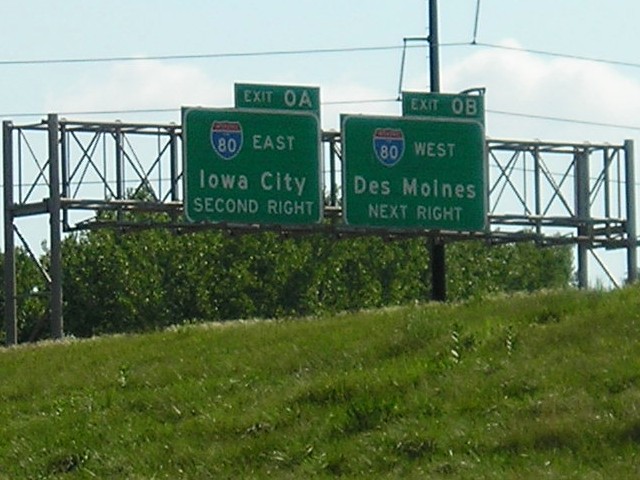
Clinching US 218
July 15 and August 21: Eastern Iowa, St. Joseph MO

2006 Road Trips/Pictures
Click on each thumbnail to see a larger 640x480 image.
In the gallery below, I tried to include pictures that aren't on the highway-end pages. Links to other pictures from the same area on those pages will appear periodically.
|
April 18:
Clinching US 151 and US 67 in Iowa
|
|
|
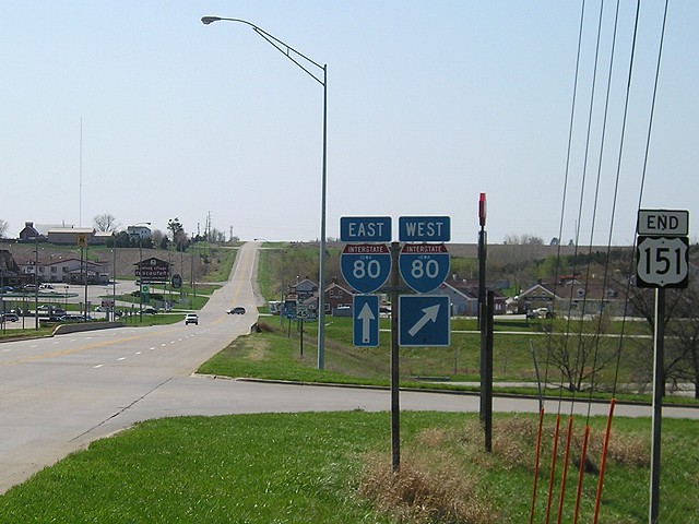
Let's start at the very beginning - or very end - of US 151 at I-80 near the Amana Colonies. After recent upgrads in Iowa and Wisconsin, the southernmost 25 miles of 151 is the only two-lane segment in Iowa and the only non-controlled-access segment south of Madison. |
|
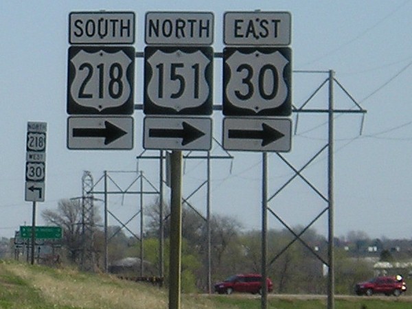
On the southwest side of Cedar Rapids, Iowa's longest wrong-way multiplex begins with 30, 151, and 218 all going in separate directions on the same road. Business 151 is straight ahead. |
|
Signs are placed on either side of 151 instead of overheads at the south US 61 interchange. This four-lane segment has been around since the early 1970s, but much of the 45 miles behind me weren't built until the 2000s. |
|
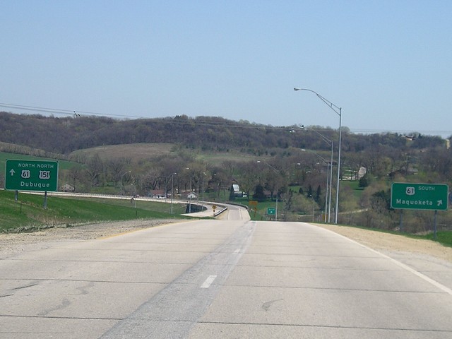
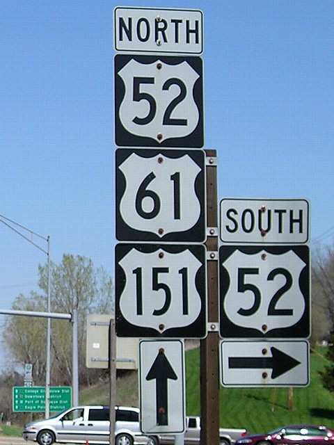
US 151 joins another triplex in Iowa, this one all running the same direction through Dubuque. It's pretty short, though. Dubuque is the only city in Iowa with four US highways - 20 is the other. |
|
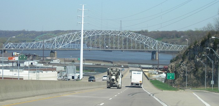
View from US 61 of the US 20 Julien Dubuque Bridge, gray, and the US 61/151 Iowa-Wisconsin bridge, background. The exit here is to Locust Street and the connection to US 20. |
|
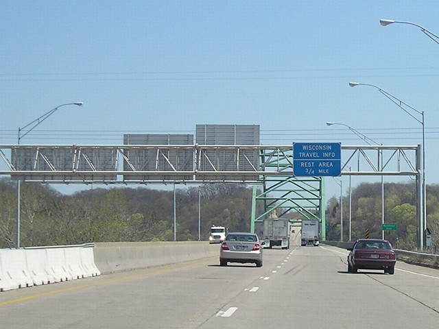
The advance sign for Wisconsin's welcome center is up before leaving Iowa. It's a quick turn from the first exit in the state. |
|
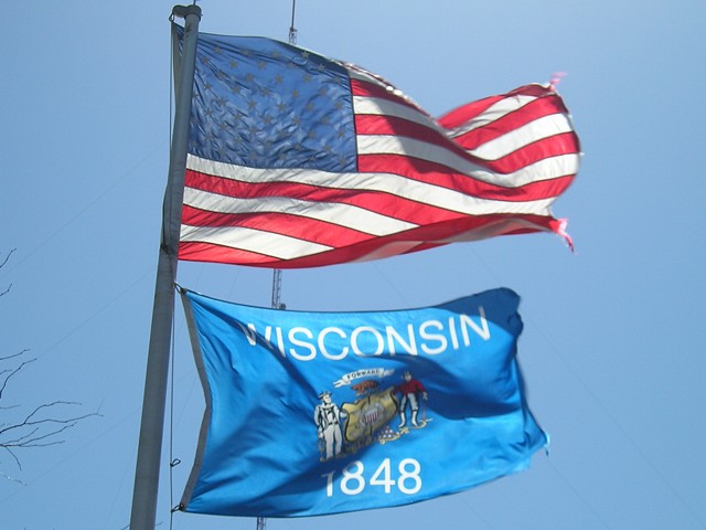
I stopped in Wisconsin just long enough to get a map and some pictures. |
|
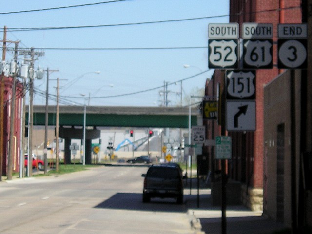
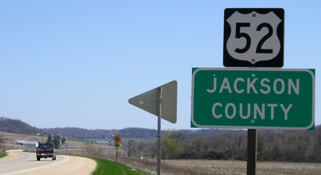
The cross-state IA 3 has its end signed just after turning onto 11th Street with US 52. |
|
Ninety-nine! At 2:32 PM on April 18, I entered Jackson County and checked off my last unvisited county in the state. |
|
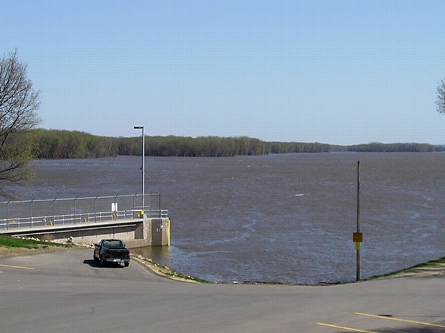
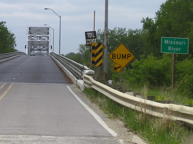
Dam No. 12 makes the Mississippi River pretty wide at Bellevue. |
|
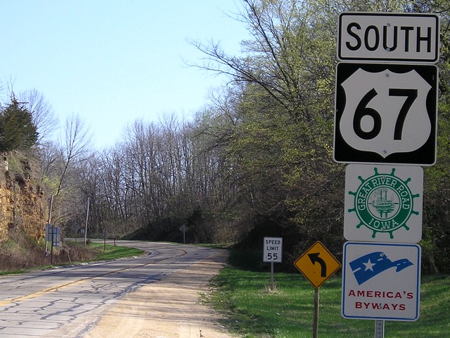
From its north end, 67 runs about a mile with IA 64, and then turns south on its own on a long, winding way southwestward toward Presidio, Texas. |
|
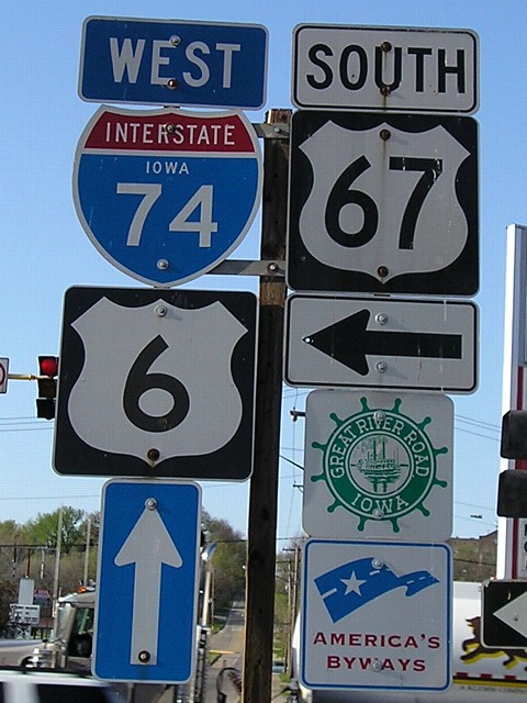
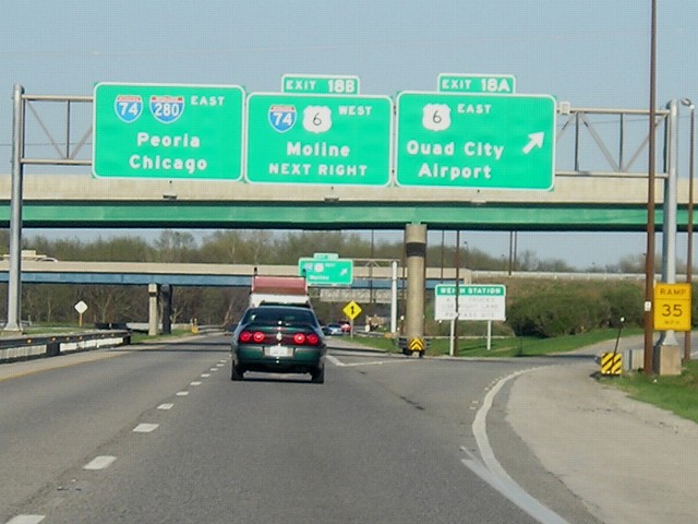
Two routes that barely make a dent in Iowa, US 67 and I-74, cross each other in Davenport in directions perpendicular to their signed alignments. I'm facing north, but ahead is westbound 74, and to the left is southbound 67. Northbound 67 is a block behind. The I-74 bridge proposal includes bringing the one-ways that 67 has in Davenport back together just long enough to have an interchange, and then separate. It makes the short one-way setup even more ridiculous. |
|
Facing east on 280, the interstate joins 74 in a redundant multiplex. US 6 runs south of this cloverleaf interchange for a VERY short distance before turning east and passing the west end of US 150. |
|
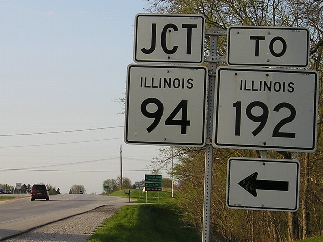
I took 67 down to the town of Preemption to get to X County, one of the last bordering Iowa I hadn't been to. For most of the way down, 67 is four lanes, but that stops after the intersection with IL 94. If you go west, following 94 then 192 then 92, it can be a shortcut to Muscatine. |
|
May 7:
Clinching IA 44 and IA 37
|
|
|
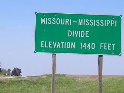
Though it may not look like much, at this point on IA 44 the waters part between the Mississippi and Missouri watersheds. |
|
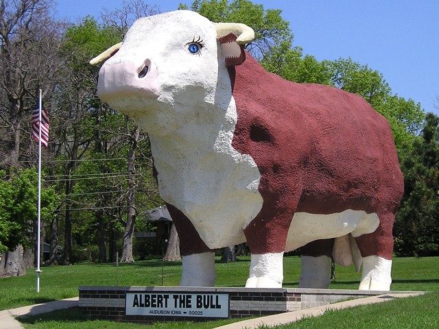
Albert the Bull. The World's Largest Anatomically Correct Hereford. Need I say more? |
|
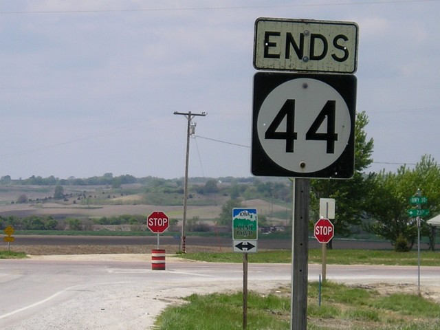
The unique "Ends" marker at the west end of IA 44. |
|
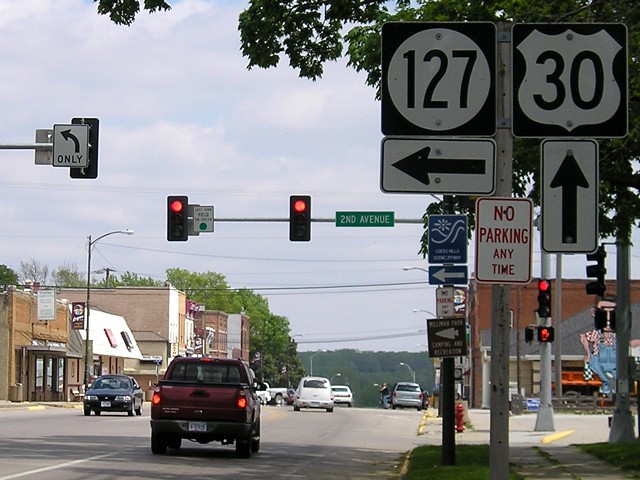
The only stoplight in Logan, by the courthouse, was put up earlier in the decade at the east end of IA 127. |
|
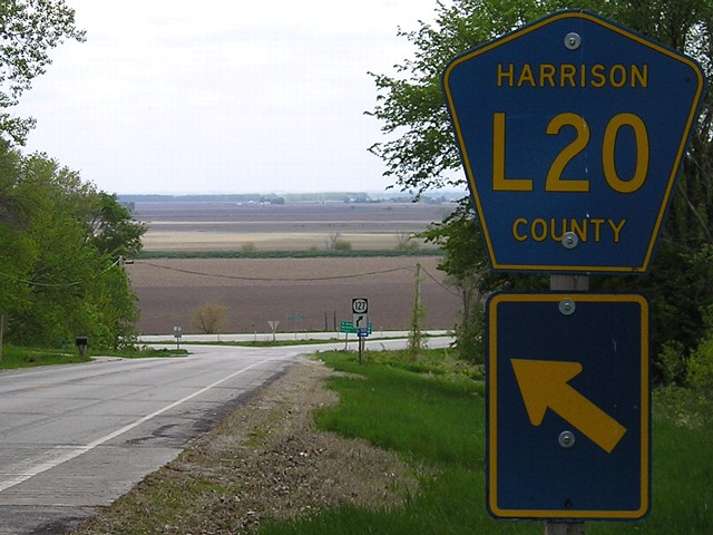
IA 127 meets Old US 75/Old IA 183/County Road L20 where the Loess Hills meet the Missouri floodplain. This used to be a "Jct 183 <->" sign. The intersection itself is still a split-T. |
|
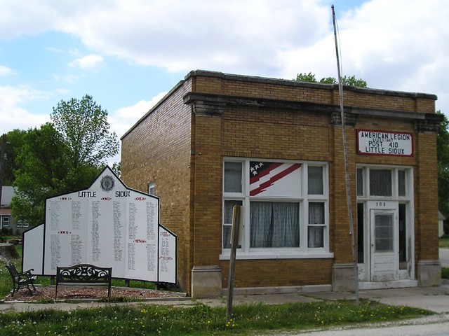
American Legion post in Little Sioux with a wall-of-names memorial beside it. |
|
West end of IA 175, bridge into Nebraska. |
|
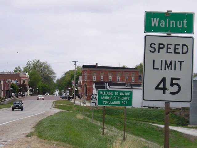
IA 83 enters Walnut and has a few blocks of bricks in downtown. This is facing north; 83 turns west right away. |
|
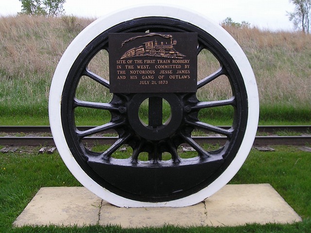
Marker along old US 6/old IA 83/County Road G30 between Anita and Adair. On July 21, 1873, Jesse James and his gang committed the first train robbery west of the Mississippi River at this point. |
|
May 28:
Clinching US 218
|
|
|
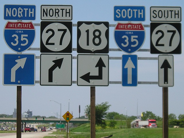
On westbound IA 122/Business 18 at Clear Lake, this assembly puts US 18 as an ahead-and-left, BUT eastbound 18 is actually following southbound I-35/IA 27, which are represented here with straight arrows. Because the first left turn is actually the northbound 35 offramp, this should really be an "18 ^" with separation into east and west after the intersection with the northbound ramps. |
|
A unique marker on US 65 at the Iowa-Minnesota line
commemorates "the completion of the Jefferson Highway" through both
states. The original route was completely paved by October 28, 1930,
the date of the marker. The Jefferson Highway, an auto trail, followed
what is now US 65, US 30, and US 69 through Iowa. |
|
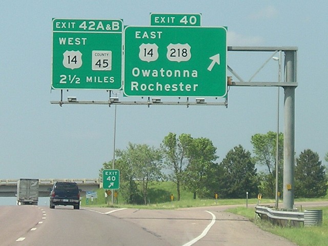
US 218 meets I-35 in a redundant multiplex with US 14. There are plans to have a four-lane US 14 from this point westward to Mankato, which would require rebuilding the interchange here, by the end of 2011. |
|
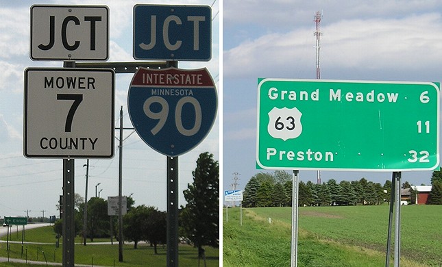
A pair of signs on MN 16 as it ends at I-90: Left, the westbound assembly approaching the interstate without an "End" sign, and a mileage sign with the west junction of US 63 as a destination instead of Spring Valley. West of this point to Rapid City, I-90 adheres very closely to US 16's old route. |
|
Pay close attention: The mile marker in the foreground uses US 18's mileage, but the exit uses US 63's. This is a good compromise for those places where a lower-numbered highway (one whose mileage "should" be used) is duplexed with another that is really the "dominant" route for the alignment. |
|
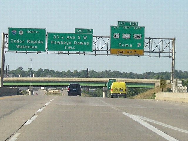
July 15 and August 21: Eastern Iowa, St. Joseph MO
|
|
|
View of I-380 "Exit Zero" approaching I-80 as seen from US 6, which does not have a direct interchange with either interstate. |
|
I-380 and US 30/151/218 meet in a modified cloverleaf interchange. The southbound-to-eastbound exit is north of the interchange instead of a loop and then includes a ramp for the Kirkwood Boulevard/Bowling Street interchange just to the east. Tama is the first city west on 30. |
|
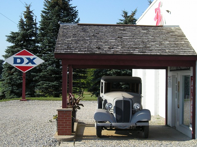
An old gas station near Walker has gas-station signs and an old car in front. |
|
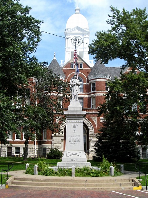
The Taylor County Courthouse in Bedford is offset on the street grid (this photo looks directly north from a street) and has a Civil War monument on the grounds. In addition, the streets surrounding the courthouse and in much of downtown are brick except for Pearl Street running on the courthouse's north side, which carried IA 3 (now 2) until 1980. |
|
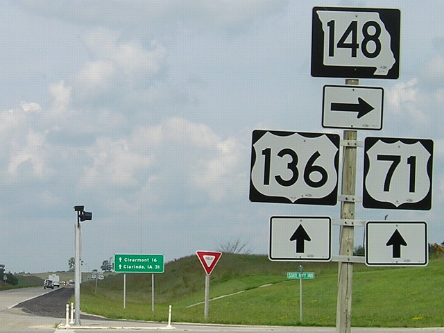
In August 2006, MO 148 was very freshly ashphalted for its
entire length from the Iowa line to the US 71/136 Maryville bypass. To
the south, after 71 and 136 split, 71 is now four lanes down to St.
Joseph. |
|
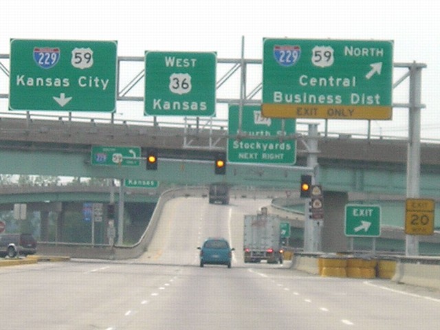
A stoplight pops up on US 36 where one may not expect it, at the interchange with I-229. This is probably related to space constraints. It's the only one on the route in western Missouri. The four-lane continues a short distance into Kansas. |
|
K-238 is maintained by the Kansas Department of Transportation but serves the St. Joseph airport, ending at the original Missouri state line but which is now a dry riverbed. A couple of miles west, the four-lane ends but US 36 has many interchanges between here and US 75 as part of what I presume to be a plan to extend the four-lane to there. |
|
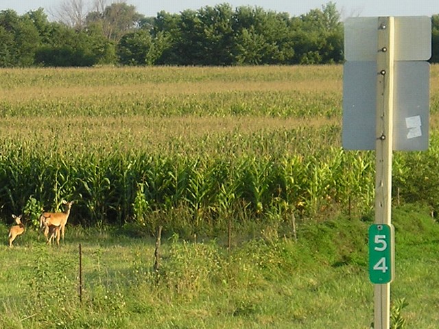
Deer run through a cornfield on US 169 near Tingley. |
Page created 3/11/08