2005 Houston Bowl
The Iowa State football team went 7-4 in 2005 to qualify for its fifth bowl game in six years*. The site: Houston, Texas. The opponent: TCU of the Mountain West Conference. The trip: One new state capital, two Big 12 universities, one major interstate clinched, the 65% threshold on I-35, and a good chunk of counties in Texas.
*Two good sites in Phoenix and Houston and three booby prizes in Shreveport, Boise, and Shreveport again. Get five consecutive bowl games in places that don't require winter coats and we'll re-evaluate that asterisk.
Click on each thumbnail to see a larger 640x480 image.
|
December
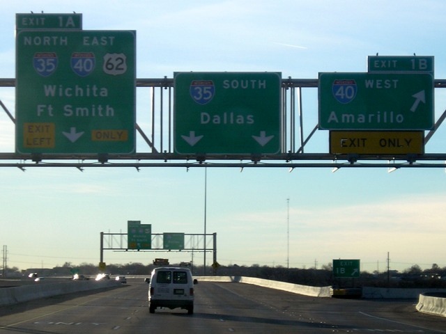
27-28: Des Moines to Austin (I-35, Kansas Turnpike, I-44, I-235, I-35W)
|
|
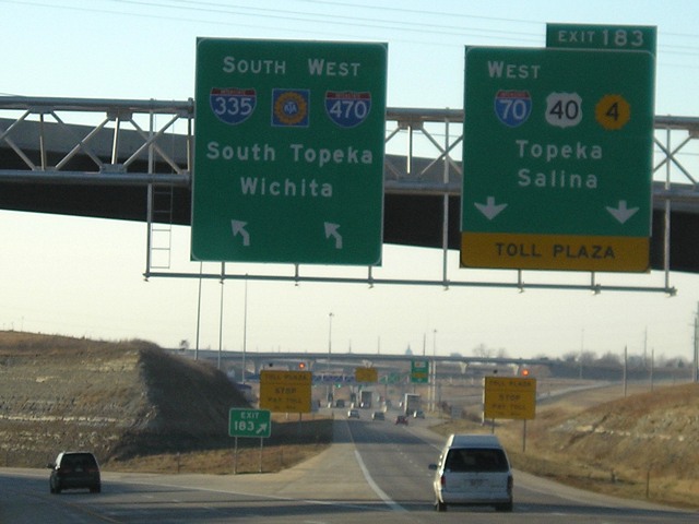 |
The Kansas Turnpike switches from I-70 to I-470 east of Topeka. Because exit numbering follows the Turnpike instead of the various interstate numbers, I-70 is marked as the exit. This interchange was reconfigured earlier in the decade. Notice that I-335 is marked here as if it followed I-470 in a redundant multiplex. December of 2005 was, once again, a mostly snowless one. It rained in Iowa on the way down and was foggy on the way back up. |
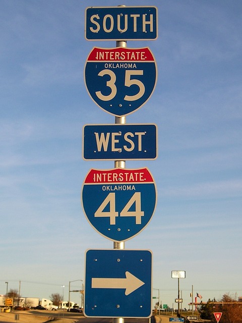 |
The I-35/I-44 duplex to the north of Oklahoma City at the beginning of Day 2. Not signed here is OK 66, the designation for old US 66 throughout much of central and eastern Oklahoma. |
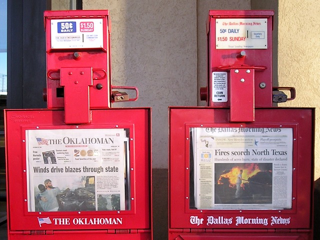 |
The big regional story at the end of December 2005 was wildfires in Oklahoma and Texas. Later in the day we would see smoke along I-35. Since this picture was taken, the Dallas Morning News has eliminated same-day delivery to Oklahoma City. |
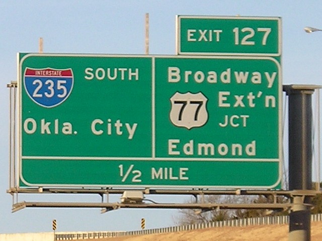 |
Oklahoma's I-235 is about a third of the length of Iowa's. US 77 follows it. |
 |
The song "Route 66" ends with the line "And I'll meet you on Route 62." If we take Route 62 to mean US 62, Oklahoma City is where you would probably meet the singer. However, based on old Oklahoma maps, 62 and 66 both served the city but didn't really intersect. They met for a while in the 1930s, long before the song, north of here on 23rd Street, but after that it was only Business 66 that met 62 until the business route died. |
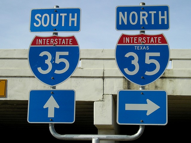 |
Neutered and non-neutered shields for I-35 in northern Texas on a Y-shaped sign bracket of the type used throughout the state. |
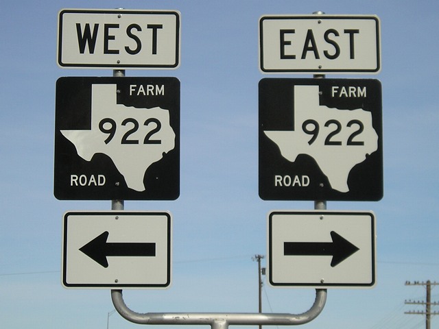 |
Farm/Ranch Roads are somewhat the equivalent of Iowa's county roads, except that there are a lot more of them and their status is laid out in law. They are marked with a number in a state outline, which is kind of neat. |
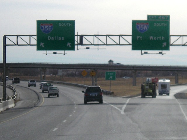 |
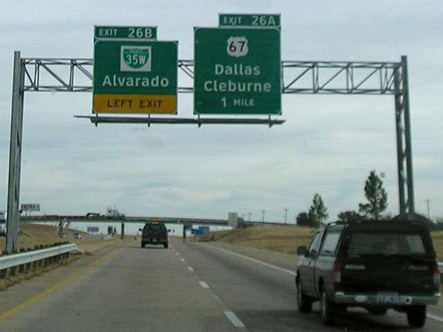
I-35 splits in two north of Dallas/Fort Worth. Notice that the prevailing traffic, and the continuous exit numbers, go to I-35E through Dallas. |
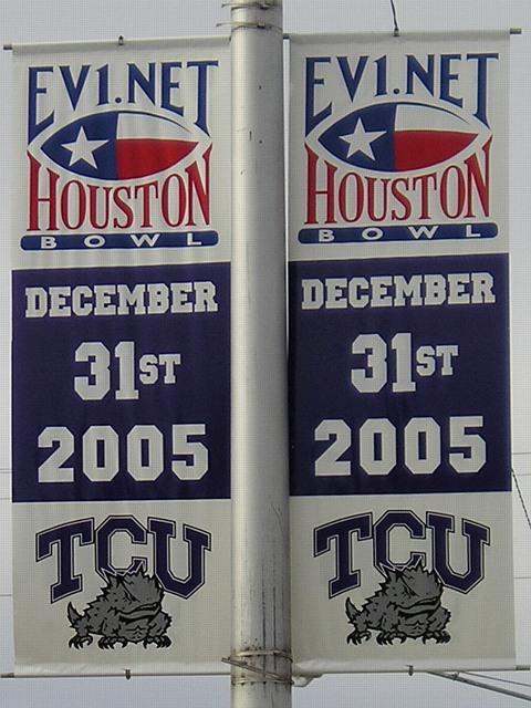 |
Along the way, we stopped at the campus of Texas Christian University in Fort Worth; TCU was Iowa State's opponent in the upcoming bowl game. Banners like these were on light poles in the area. |
 |
South of Interstate 30, a lot of signs along I-35W were in Clearview. The Texas Department of Transportation was one of the major forces (or, ahem, culprits) in development of the Clearview font, so it's no fluke that this was the first state I really encountered it. The Business Loop 35W is interesting too. |
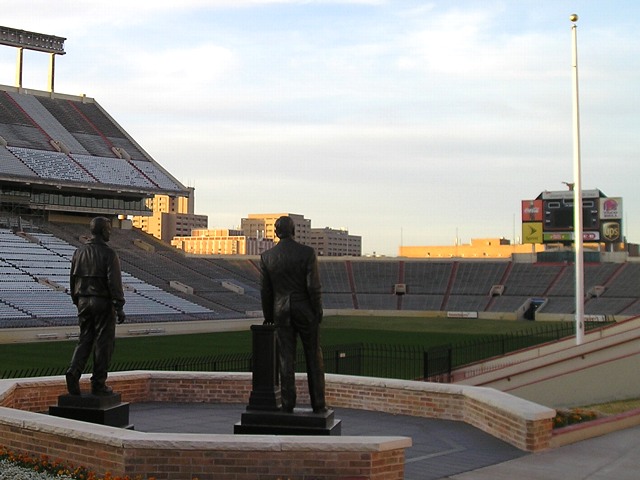 |
An evening view of Darrell K. Royal-Texas Memorial Stadium in Austin. Eight days after this picture was taken, Texas beat USC to claim the BCS championship in the Game of the Century So Far (arguably, Boise State-Oklahoma a year later may own that title now, but I think Texas-USC was better overall). |
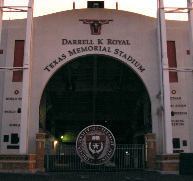 |
North (I think) gate to the stadium |
|
December 29: Austin to Houston
|
|
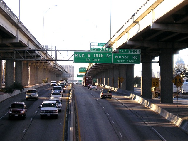 |
Traffic on I-35 in Austin has so exceeded available ground space that the route through the city is on two levels. Also, consider the following: There are 235 miles of I-35 in both Oklahoma and Kansas, and less than that in Iowa, but in Austin we're not even halfway from Mexico to the Oklahoma state line. There are 504 miles of I-35 in Texas alone; the next 504 miles will get you northeast of Kansas City. Put another way, nearly a third of the entire route from Laredo to Duluth is inside Texas. |
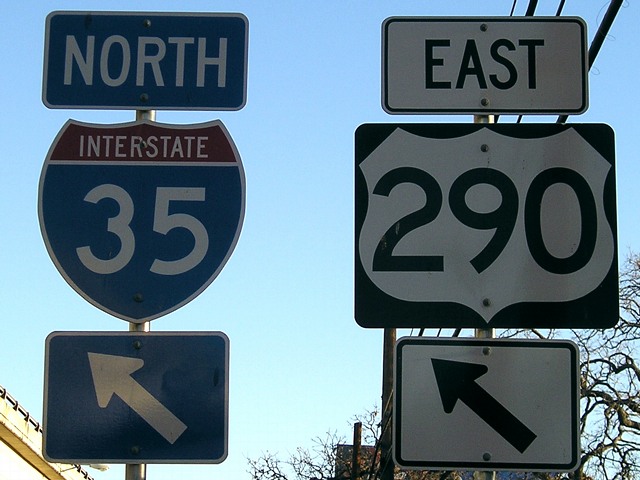 |
US 290 is a "child" of US 90, the southernmost major east-west US highway. |
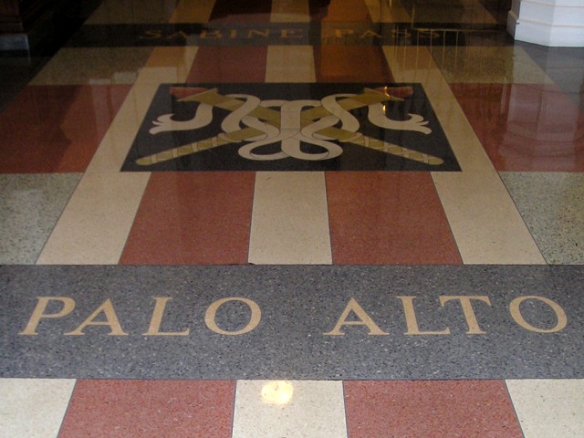 |
The Texas State Capitol has a lot of features related to the Mexican War. Palo Alto was the first major battle of the war. Because it was fought nearly eight months before Iowa became a state, the name was used for a county. Two other Iowa counties, Buena Vista and Cerro Gordo, are also named after battles, and other counties are named for soldiers in the war (Ringgold, Taylor, Fremont). |
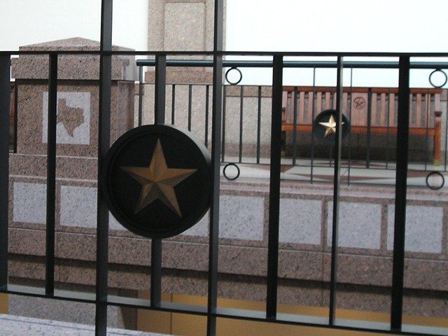 |
Decorative work in the two-story underground addition to the capitol building. |
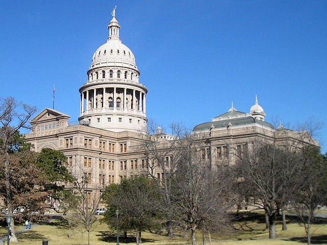 |
View of the Texas State Capitol |
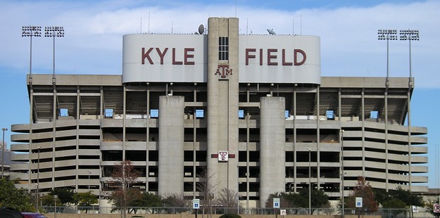 |
From Austin to College Station and Longhorns to Aggies, Texas A&M was the last Big 12 school we had yet to visit over the past 11 years. Kyle Field is "Home of the 12th Man," and A&M won't let you forget it (just ask the Seattle Seahawks). Yout might be able to make out the 75 degrees on the thermometer - my second warm-weather December in a decade. |
|
December
30-31: Surf and Turf (Gulf of Mexico, NASA, bowl game)
|
|
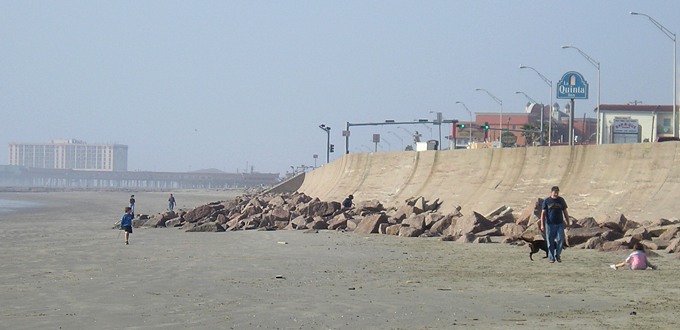 |
The beach and seawall at Galveston, 105 years after the famous deadly hurricane. Interstate 45 ends at this island city. |
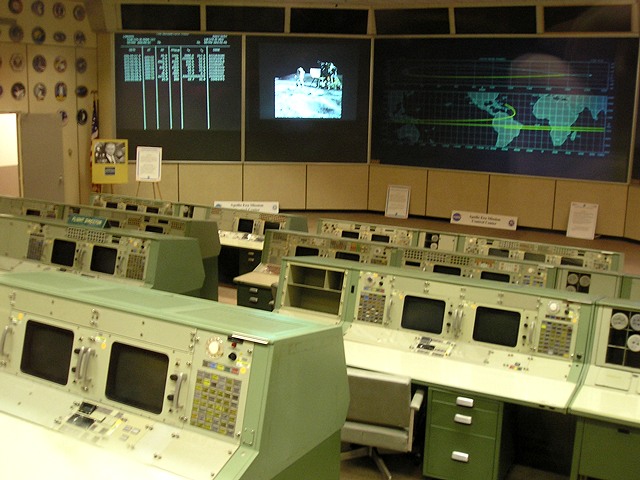 |
"Houston, Tranquility Base here. The Eagle has landed." A small room served as Mission Control for America's space missions. To look at it today, with its 1960s equipment, is to be in awe and wonder at how exactly they did it. |
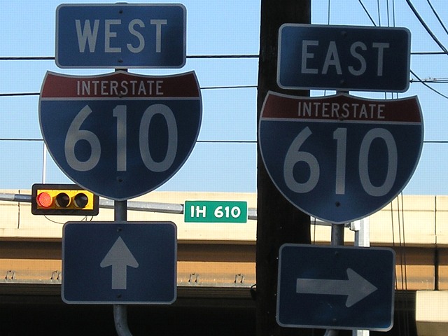 |
I-610 is Houston's (original) beltway. This is the only branch of I-10 I've been on, and I-10 itself is my least traveled major interstate. |
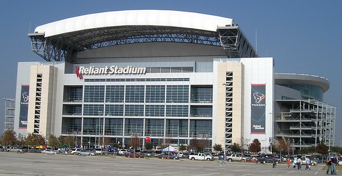 |
Reliant Stadium, home of the Houston Texans, in its fourth year. This is the second pro football stadium I've been to a college football game in, the other being Arrowhead Stadium in Kansas City. |
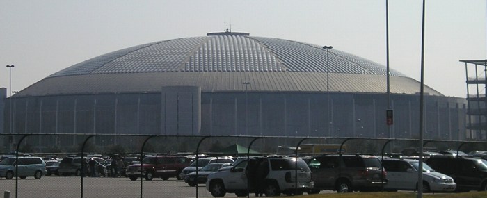 |
The Astrodome is right beside the stadium, and looks tiny because of it. Or, I guess, by modern standards it IS tiny. |
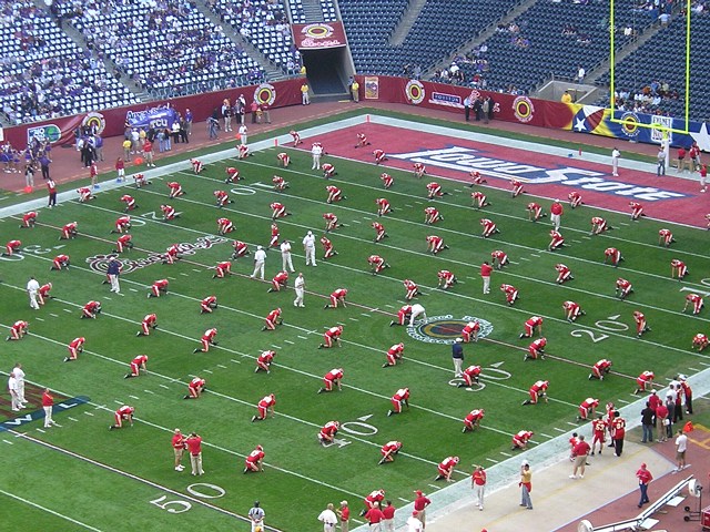 |
Iowa State warms up before the game. I took this picture while gawking at the sheer seating capacity of the stadium. It's a long way up. Iowa State would lose 27-24, giving Dan McCarney a 3-2 bowl record. |
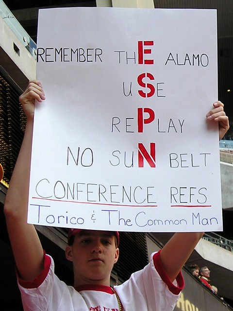 |
Three days before the Houston Bowl, Nebraska beat Michigan after one of the weirdest postseason game endings in college football history. During the last play, as Michigan madly lateraled the ball to keep alive, players and coaches from both sides rushed the field presuming the game was over. No flags were thrown. A point of controversy that later arose was that the game officials were from the non-BCS Sun Belt Conference while both teams were BCS-conference schools. Bonus: In the background appears to be ISU President Gregory Geoffroy. |
|
January
1-2: Houston to Des Moines (I-45, US 75, US 69, I-44, US 71, I-35) and
US 66 in Kansas
|
|
 |
I clinched Interstate 45 on two days, the 30th and 1st. (So what if it's the shortest x0 or x5; I'll take what I can get.) This is at Madisonville. |
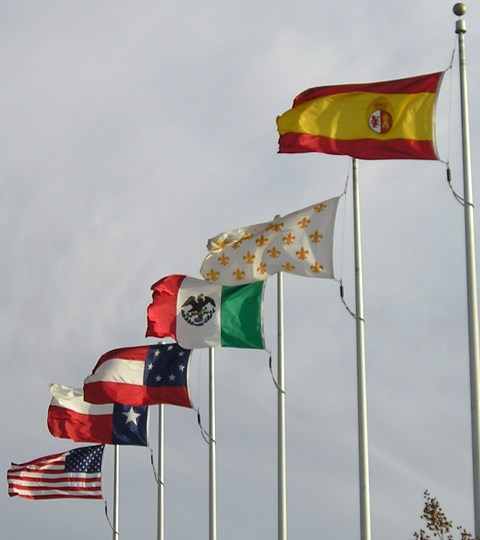 |
"Six Flags Over Texas" at the welcome center on US 69/75 at the Oklahoma line. Right to left: Spanish Empire, French Empire, Mexico, Confederate States of America, Republic of Texas, United States of America. This site puts the French period at five years, 1685-90 - longer than the Confederate era of 1861-65. |
 |
Possibly the last northbound shields for US 69 and 75 in Texas, as the frontage road ends and merges before the Red River bridge. They are definitely the last on the frontage road. With this trip, I traveled all of US 75 in Texas, 19 months before doing the same in Iowa, and added Texas and Oklahoma segments of US 69, giving me segments from each state that that route is in. (To be fair, the Missouri and Kansas segments at the time were only the short pieces duplexed with I-35 in the Kansas City area.) |
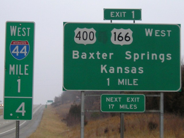 |
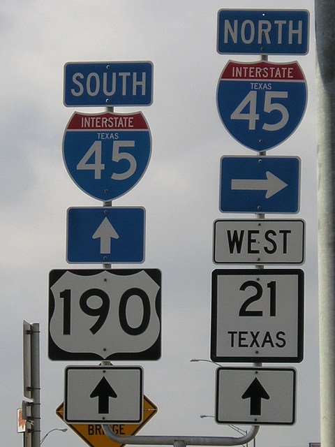
The last exit in Missouri is right by the Oklahoma line, for US 166 and that abomination of a number, US 400. |
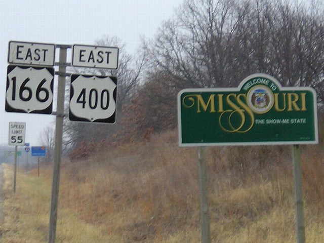 |
Even as 166 and 400 enter Missouri from Kansas, you can see their end ahead; "Jct 44" can be made out to the right of the speed limit sign. |
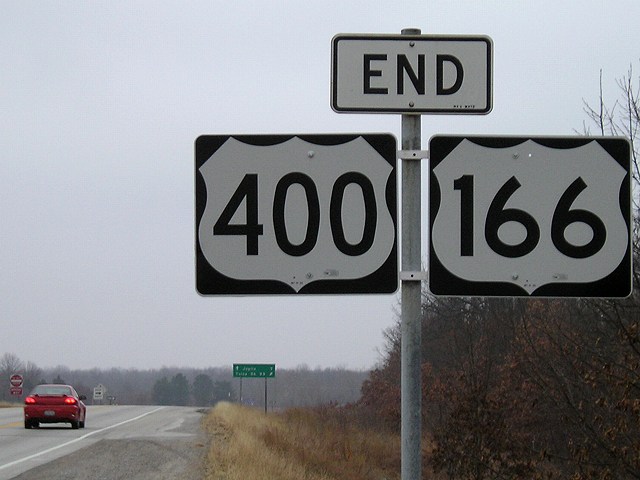 |
Relatively new wide 3-digit shields at the end of 166 and 400. Tulsa is 99 miles away according to the sign. |
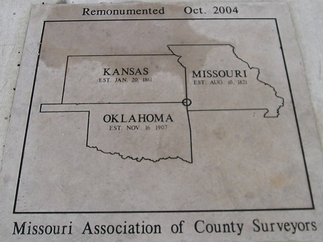 |
This ground-mounted marker is at the triple point of the three states, near a large rock monument. While I-44 does not go through Kansas, this secluded area at the state's southeasternmost point is close enough to it that you can hear the traffic. |
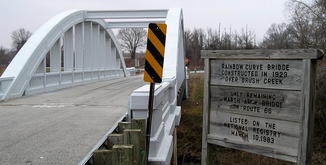 |
This historic bridge northeast of Baxter Springs was part of 66. The sign explains its history and significance. |
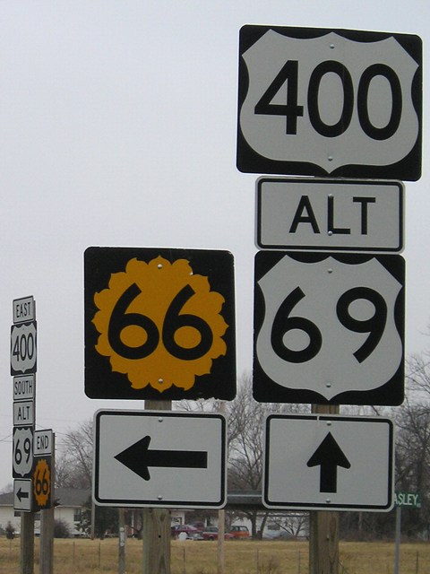 |
Only the part of old US 66 that isn't Alternate US 69 today carries the KS 66 designation, about half of it. At left you can see the end signage. |
|
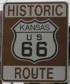
A very rare marker for Kansas' 66 because of its short length in the state. This is at the north end of KS 26 in Galena, marking where an older alignment rejoins modern KS 66. East of here, 66 expands to four lanes when it enters Missouri and goes through downtown Joplin. |
|
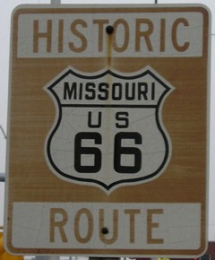
Older Missouri counterpart to the Kansas marker above. Similar signs are up in each state to mark historic alignments. MO 66 follows a straight line from Kansas to I-44, even though the old route went northeast and then east along what is now MO 96. |
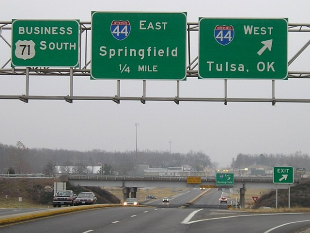 |
Business 71 meets I-44 on the south side of Joplin. The business route continues southward a ways to meet a new alignment of 71; Missouri has steadily created a new four-lane alignment between I-44 and the Arkansas state line over the past 10 years. |
Page created 1/20/08