(1962-July 1, 2003)
NORTH End: Stop sign, US 6/IA 21, Iowa/Poweshiek county line

Facing north on 419 (January 2002)
Photo by Jason Hancock
Highway 419 was the second-highest active number prior to 2003 (outside secret routes and the 900s), but the highest number to end in a town and highest odd number in sequence. For some reason, odd numbers in the 420s were never used.


Facing north on 419 (5/25/03 and 5/25/03 and 11/22/06)
By May 2003, the brackets had been removed.

Facing west on 6, but heading south on 21 (January 2002)
Photo by Jason Hancock

Facing west on 6, but heading south on 21 (5/25/03)
At all signs at this intersection, US 6 was below IA 21. I'm not sure why; it may even date back to tacking 21 on top when it was rerouted.

Facing west on 6, but heading south on 21 (6/3/15)

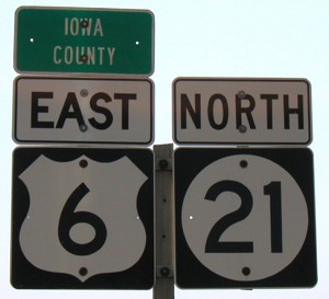
Facing east on 6, but heading north on 21 (5/25/03)
Prior to 1956, 6 and 21 were duplexed a mile south of here, using F29 a mile west of Victor, and then they split at what became the south end of 419; 6 continued east, 21 went up. In 1956 a realignment of 6 removed the duplex. In 1962, 21 was still a gravel road between Deep River and Victor, following a stairstep of gravel roads northeast of Guernsey that had been set that way since the beginning of the road system. (Today's Iowa County maps still show slight curves on these roads at the intersections, and the old parts of 21 north of Guernsey are gravel F46 and V30.) This was the last major simultaneous pave-and-realign project in Iowa, which explains why 419 is the highest consecutive spur number assigned.

Facing east on 6/21 (11/22/06)


Facing east on 6/21 (5/25/03 and 5/25/03 and 11/22/06)
In both directions, there is not a "Jct 419", but a shield with an up-and-south arrow.

Facing east on 6, but heading north on 21 (6/3/15)

Facing east on 6/21 (5/25/03)
A little out of sequence here (this is after the intersection), but this shows both how 419 lies on a county line, and a thicker "East" that has popped up a few times, notably at the new South Dakota Avenue interchange on US 30. (At least it's not Butt-Ugly Kansas-Style Signage.)
Gone, but not forgotten

Facing west (11/22/06)
There is one road that intersects 419 on the Poweshiek side of the road. Because 385th Avenue is a dirt road, this simply may have escaped the county's attention. Iowa County's only nearby sign, at the north intersection, calls it Poweshiek-Iowa Road.
SOUTH End: Stop sign, 3rd St./F29, Victor, Iowa/Poweshiek county line

Facing south on 419 (January 2002)
Photo by Jason Hancock
Jason didn't know why both signs are on brackets. They were gone by 2003 (see below).

Facing south on 419 (5/25/03)
Third Street is old US 6 (now F29). About 85% of Victor is in Iowa County, with the rest in Poweshiek County; the center line of 419 is the county line, so I'm not sure who got the road. As for the "To I-80" sign, V38 is 0.6 mile east, which goes down to the interchange. The first sign northbound is visible on the right.
Last seen: 2003

Page created 5/13/02; last updated 4/9/16